Will Thunderstorms Force Another Postponement of Launch America?
Hello everyone!
Many of us were disappointed on Wednesday when NASA and SpaceX were forced to postepone the launch of the Crew Dragon spacecraft which was set to be the first human spaceflight from American soil since 2011. The launch was postponed because the electric field surrounding the launch site was too strong, and there were thunderstorms downrange along the launch trajectory. You can’t safely send a rocket to space if there are thunderstorms near the launch site because even if lightning isn’t striking the pad or rocket directly, the presence of a strong electric field means that the rocket could trigger a strike if launched. If lightning hits the rocket while on the launch pad, there are lightning rods present to safely handle the current of the strike. If lightning strikes the rocket while it’s moving through the atmosphere, I’m not sure what would happen to be honest (I try to predict the weather as best I can, but when it comes to rocket science I’m no good) but given how much volatile fuel and sensitive electronics are present on rockets, I couldn’t imagine it would go well. Either way, the engineers at NASA and SpaceX who do know what would happen if lightning struck the rocket in-flight decided that it was bad enough to scrub the launch.
The launch has since been rescheduled to 3:22 PM EDT May 30th (tomorrow). The launch must either occur then, or be postponed for another few days. Why such precise timing? The astronauts are headed for the International Space Station which is a very small satellite orbiting at a very high velocity. If the launch vehicle has any hope of linking up with the ISS, their two trajectories need to cross at some point in the future. This can only happen if the rocket is launched at very specific times. Unfortunately, the mid-afternoon hours are prime time for thunderstorms along the Florida coast.
Why?
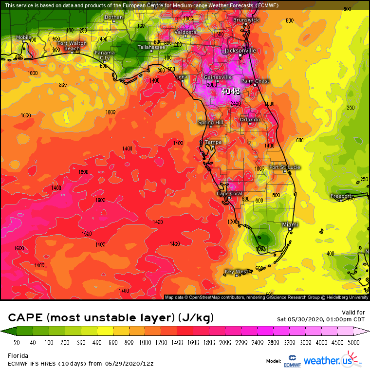
It’s no secret that Florida afternoons this time of year are very hot and very humid. As you might recall, hot and humid air is uniquely positioned to be convectively unstable which means that if given a small bump upwards, it will continue accelerating upwards until it’s moving extremely fast. Click here for a refresher on convective instability (often quantified as CAPE). As we would expect, there will be abundant instability over Florida tomorrow afternoon. But, we won’t be able to get a thunderstorm unless some external force comes along to deliver that initial small bump upwards.
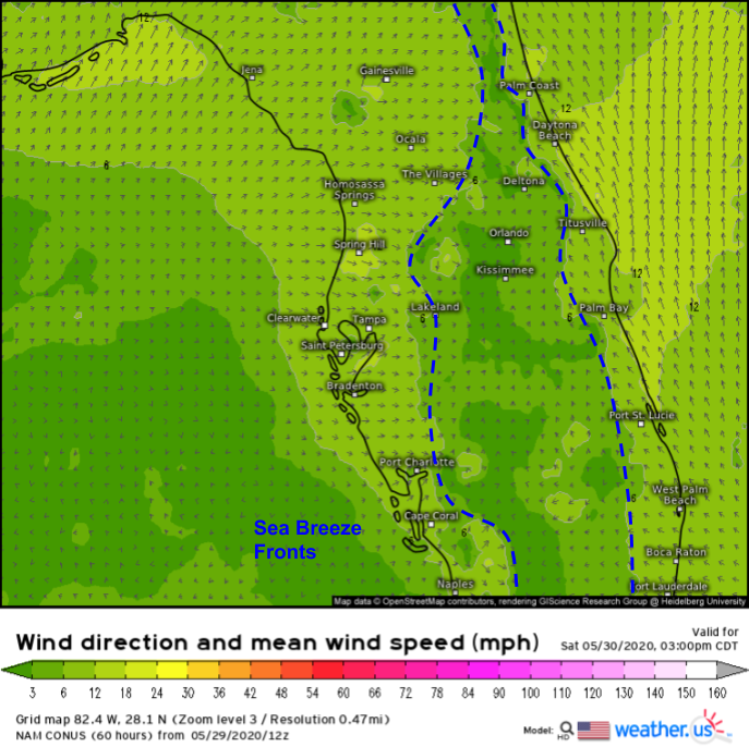
Unfortunately, Florida is also really good at generating precisely the type of lift needed to trigger thunderstorm development. Each afternoon, the Florida Peninsula warms rapidly as it absorbs radiation from the sun. The surrounding waters of the Atlantic and Gulf of Mexico also absorb this radiation, but because water has a much higher specific heat capacity, these regions do not experience rapid heating. The (relatively) cooler maritime air then rushes inland, forcing the hot air over land to rise. This rising motion is responsible for thunderstorm development. You can read more about sea breezes and how they work here.
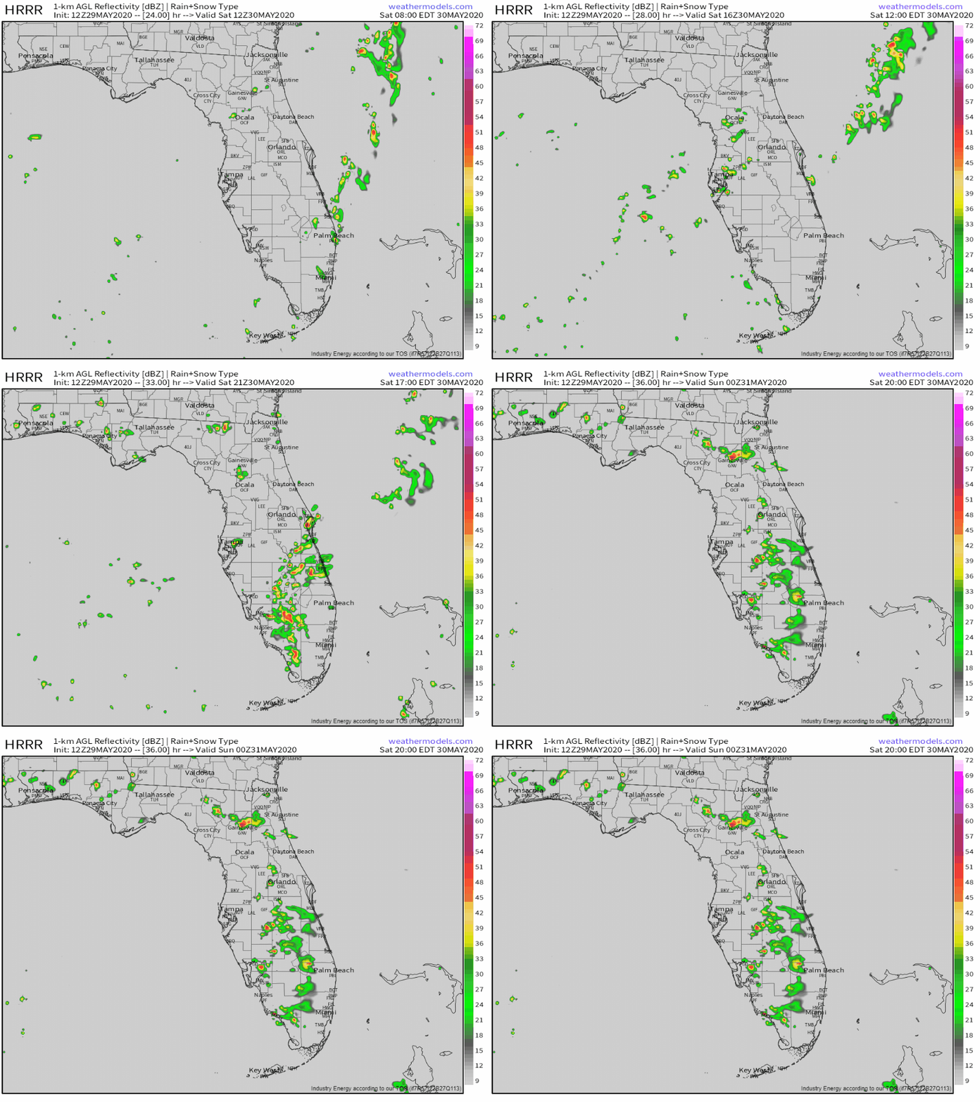
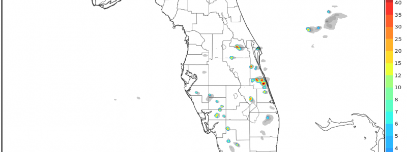
Because we have a source of rising motion and air that is very unstable, it’s no surprise that the HRRR is expecting storms to pop up again tomorrow afternoon, as shown in the radar image above. You can see storms form along each sea breeze front near the coasts during the early afternoon before drifting towards the center of the state later in the day.
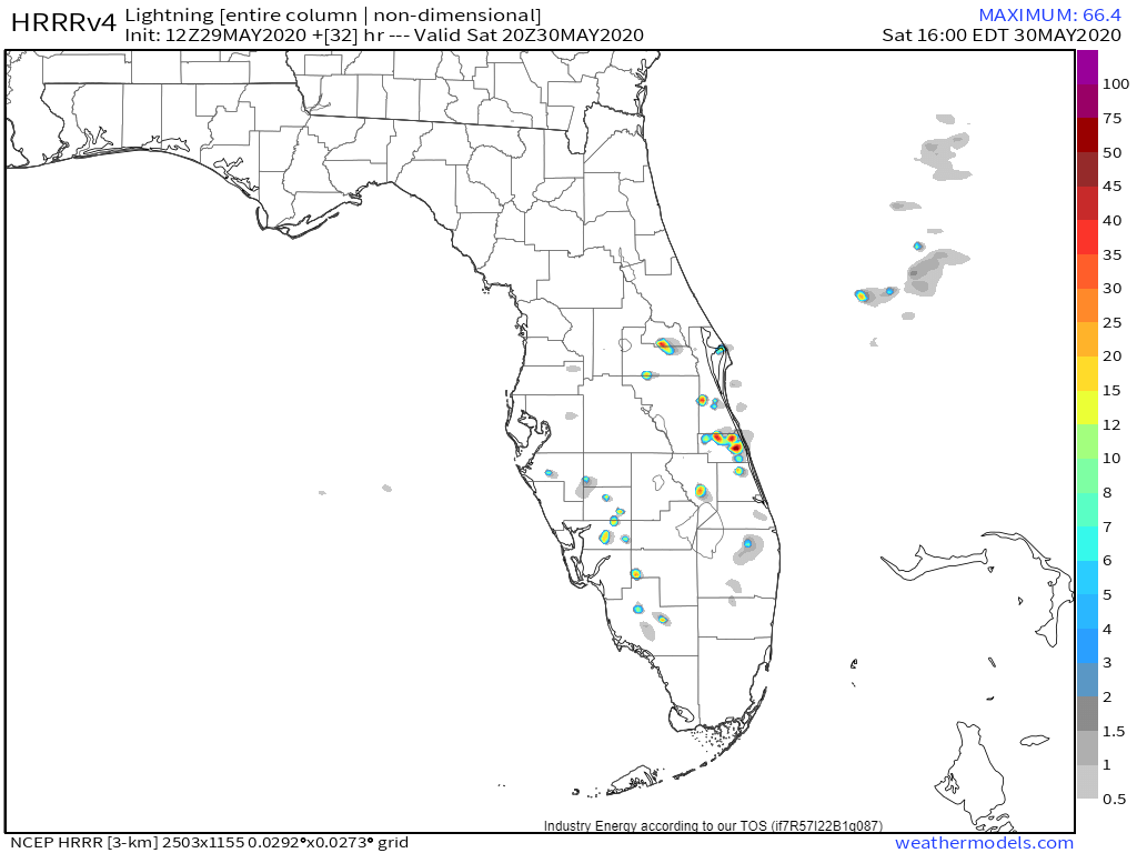
The HRRR actually attempts to compute how much lightning will occur over an area during any given hour. I’m not well-versed in exactly how the model attempts to compute this, but it’s safe to say that lightning will likely be present in thunderstorms developing near or just southwest of Cape Canaveral. The Crew Dragon rocket will be headed east from the launch site, and thunderstorm activity over the western Atlantic looks much more subdued compared to Wednesday when we had Tropical Storm Bertha developing offshore. Thus I think we have a better shot of seeing a successful launch tomorrow than we did on Wednesday. That said, it wouldn’t take much for one of those thunderstorms developing along the sea breeze boundary to produce an electric field too strong for a GO.
While it might be tempting to look at the model forecasts shown above and compute the exact odds of lightning striking within a given radius of the launch pad, remember that even our best high-resolution models specializing in thunderstorm prediction cannot predict the precise location of thunderstorm development. Read more about high-resolution models and some of their limitations in the Weather Encyclopedia section of the site.
As we get closer to T-0, be sure to keep an eye on radar imagery and our lightning analysis product to see if thunderstorms might force another launch postponement.
-Jack
