Did It Really Snow In Southern Florida This Afternoon?
Hello everyone!
Photos and videos have been circulating on social media this afternoon that appear to show a remarkable sight: snow falling during the heat of the day in southern Florida. If snow did indeed fall, it would be a record-setting event, even more remarkable than this morning’s cold snap. However, it’s incredibly important to be skeptical of such remarkable claims, even when they seem to be backed up by photos/videos.
First and foremost, we need to establish that there was some precipitation falling at the time the videos were taken, around 1:45 PM. If there wasn’t any precipitation, it would be pretty easy to dismiss the videos as fake/edited.
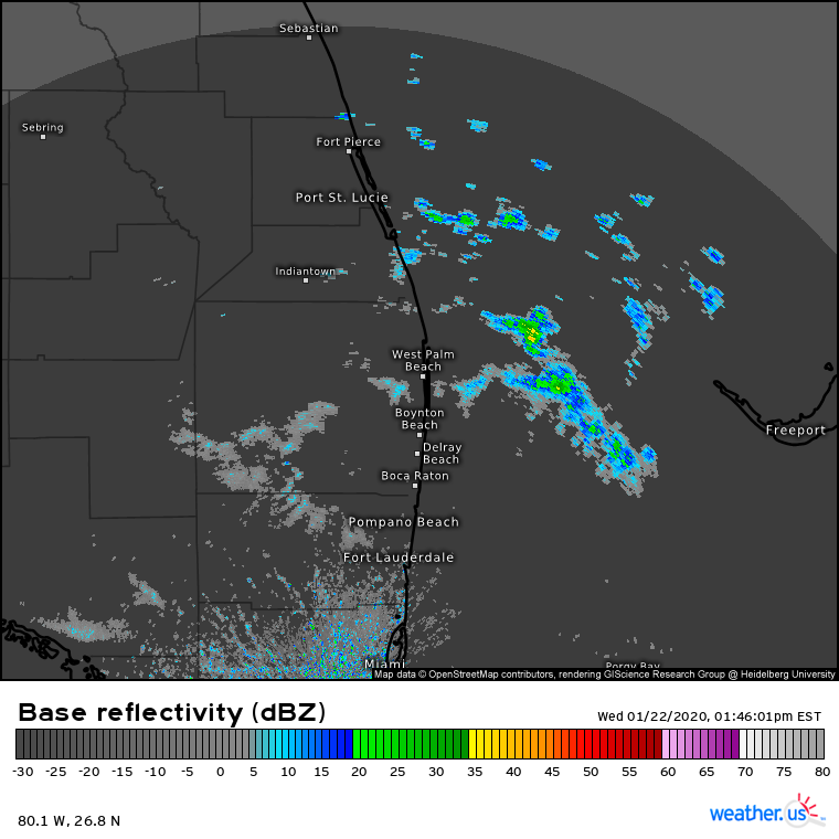
The videos were allegedly taken in West Palm Beach around 1:45 PM eastern time, and radar imagery does indeed show some light precipitation in that area at the time. That precipitation formed as a result of instability generated when a pocket of cold air aloft moved over the warm waters of the southwestern Atlantic. 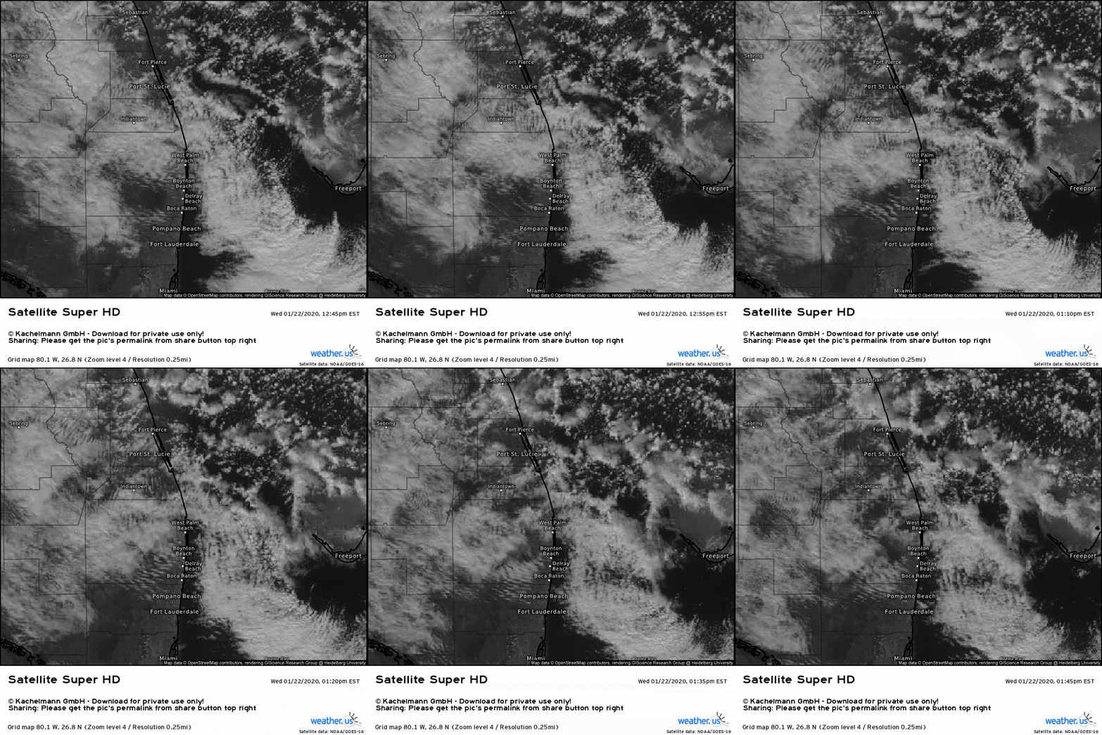
Satellite loops from the hour preceding the report of snow confirms the presence of shallow convection moving into the WPB area from the northeast. These cells would be deep enough to extend above the freezing level, so it’s possible there were some snowflakes being produced in the skies above WPB this afternoon. But could they possibly have made it all the way to the ground intact?
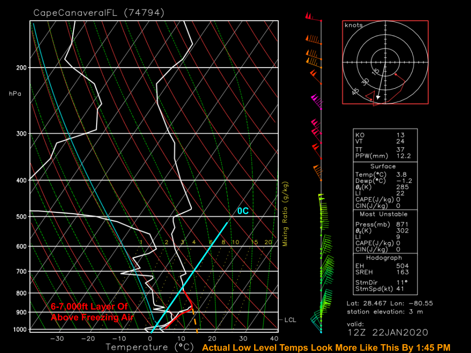
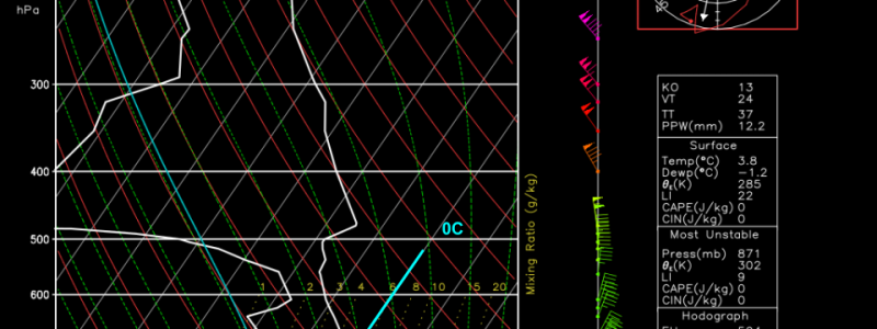
Here’s a look at the temperature profile of the atmosphere from the surface all the way to the top of the troposphere at Cape Canaveral FL as measured by a weather balloon at 7 this morning. A deep (6-7,000ft) layer of above-freezing air is noted, despite temperatures very near the surface being a bit closer to freezing. Remember though that this sounding was taken when surface temps were at their daily minimum. By 2 PM, actual low level temperatures would be much better approximated by the orange dashed line connecting the top of the boundary layer (inferred via moisture/temp profiles) to the observed temperature at the WPB airport (58F/14C) at 2 PM.
Simply put, snowflakes surviving a trip through this layer of warm air would be a thermodynamic impossibility. It did not snow in southern Florida this afternoon.
What was likely falling in the videos circulated on social media was most likely graupel, a form of precipitation that’s somewhere in between a snowflake and a sleet pellet. Graupel forms in shallow convection, like that which was observed off the Florida coast this afternoon, when supercooled water droplets freeze onto a snowflake. Once these droplets freeze, they form a dense layer of ice that surrounds the flake. This dense layer of ice is much harder to melt than a typical snowflake which means it can survive a trip through even a fairly deep layer of warm air.
Any residual graupel-producing showers will dissipate in the next couple hours as the loss of sunlight shuts off the instability these showers are fueled by.
-Jack
