Rare Fujiwhara Interaction Forecast Over The Eastern Pacific
Hello everyone!
A rare and beautiful phenomenon is forecast to play out across the remote waters of the Eastern Pacific this weekend and into early next week as two tropical cyclones, one a hurricane and one now a tropical storm (formerly a hurricane) dance around each other before crashing together. By this time next week, the storms will have traveled nearly a thousand miles and the two swirls will have become one. This is a fascinating and rare event. Here’s how it’s forecast to unfold, according to the ECMWF model.
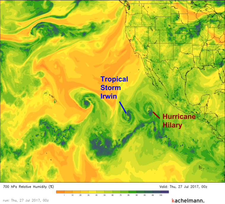
Currently, Hurricane Hilary and Tropical Storm Irwin are moving westward across the Eastern Pacific. The swirl NW of Irwin is TS Greg, but he’s not a part of this story. He’ll die a quick death in the dry air NE of Hawaii. Notice how Hilary and Irwin are located close together. This is important, soon they’ll begin to interact.
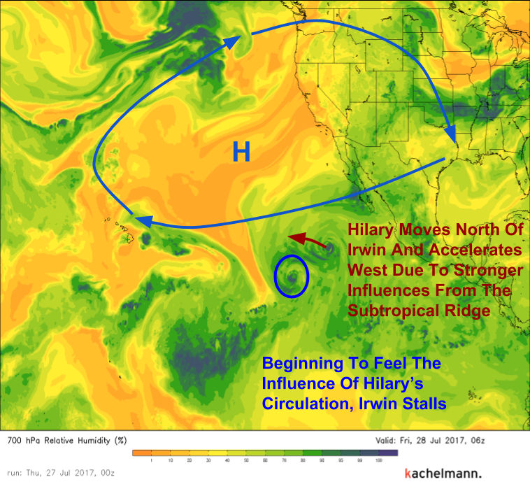
Hilary is farther north than Irwin, and as a result, will be moving more quickly to the west. This is because of a large area of high pressure located about half way between California and Hawaii. Notice how Hilary’s track (red arrow) has it getting even closer to Irwin. They’re on a collision course.
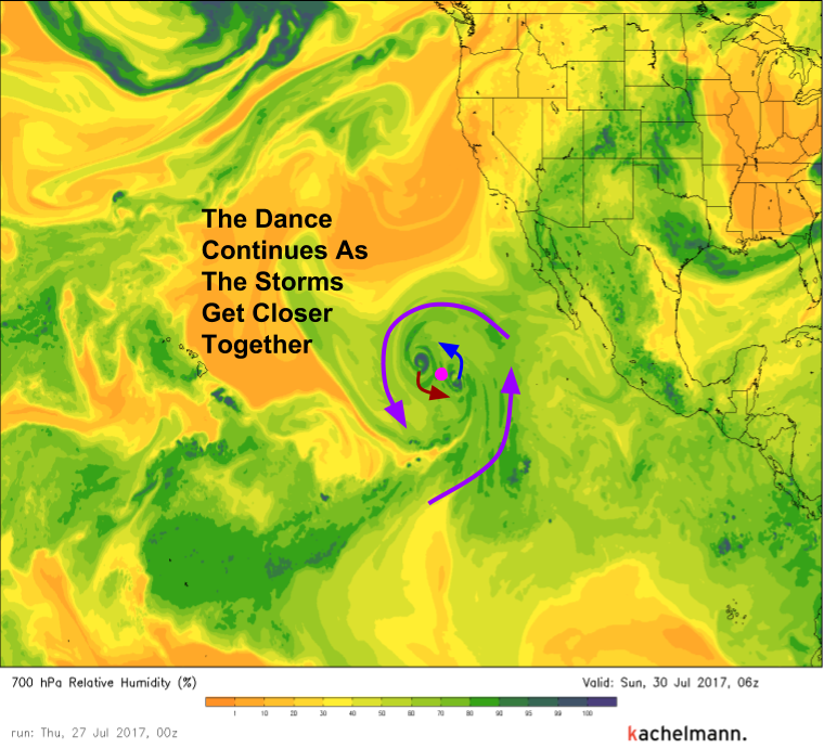
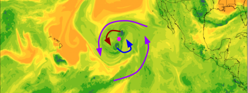
The Fujiwhara interaction is set to kick off late Friday night as the two storms approach one another. Hilary will slow down and begin to move southwest while Irwin will accelerate to the northeast. They’re both rotating around a common center. Their outer bands will begin to organize around this central point, even though the cores of both storms will continue to remain separate.
The storms will make multiple revolutions around this common center, much like two stars in a binary system. The whole system will begin to consolidate into a single entity and will move west-northwest under the ridge of high pressure. Meanwhile, the inner cores of both storms will continue to dance around one another.
The dance will continue for several days. Remember, it started on Friday night. The image below is valid Sunday night. The dance continues.
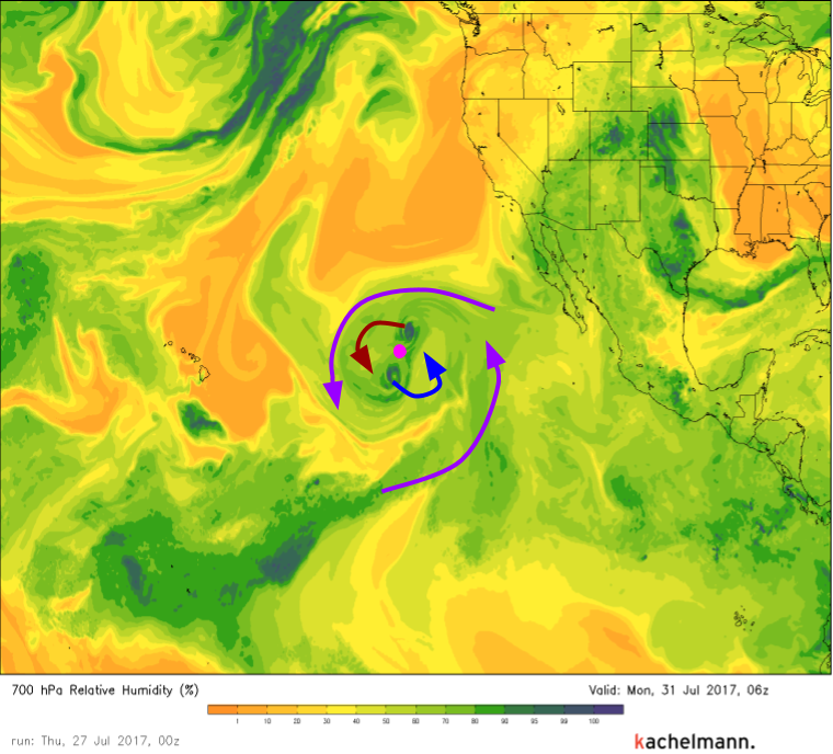
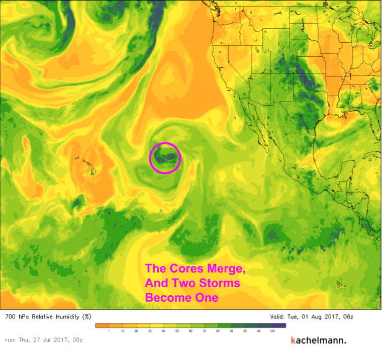
All good things must come to an end and by the time Monday afternoon arrives, the end will be beginning for this rare phenomenon. The two cores will begin heading towards one another.
By Tuesday morning, the process is complete and two storms will have become one.
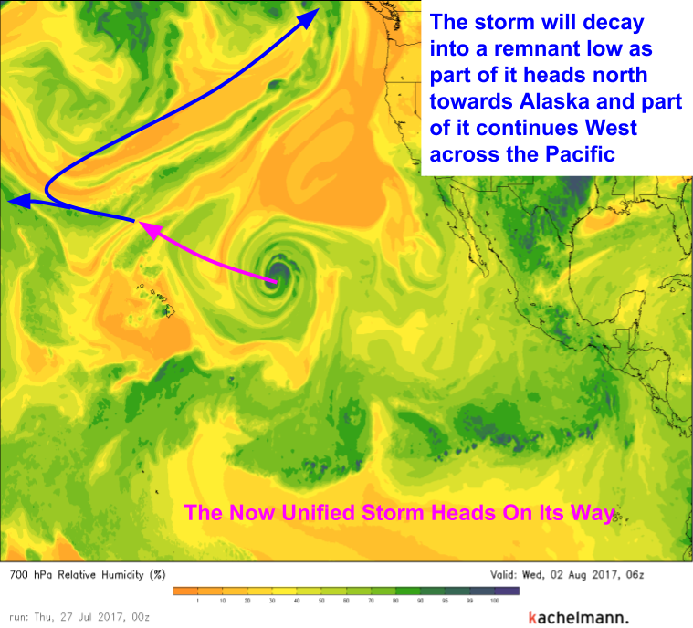
The new storm won’t have long to live, however. As it passes over cooler waters and through drier air, its energy will be sapped and eventually an extratropical storm will shred it apart into two pieces. One will march on towards the Western Pacific, and the other will become absorbed in to low pressure near Alaska.
So what causes the Fujiwhara effect, and why is it so rare?
For the Fujiwhara effect to work, two storms need to pass within close proximity to each other. Close enough that both storms absorb the other into their circulations, simultaneously. Once this happens, each storm carries the other around itself, along with all the other air that rushes in circles around a hurricane. Seems easy enough right, there are so many tropical storms and hurricanes out there, why don’t more enter into this interaction?
Typically, when two tropical systems approach one another, one is much stronger than the other. The outflow winds from the stronger storm rips the thunderstorms from the weaker system to shreds, and it dies off. The larger storm marches on. While it’s true that Hilary is slightly stronger than Irwin, the difference isn’t much. They’re closely matched enough so that when they meet, neither can claim victory too early. It’s only after the beautiful and complex dance of the Fujiwara effect that Hilary’s circulation will finally absorb Irwin’s.
Ready to watch it all unfold? This link will let you see the whole process, from start to finish, day and night. Enjoy the show!
-Jack Sillin
