Widespread Heavy Rain Expected In The Mid Atlantic This Week As An Upper-Level Low Meanders Slowly Over The Ohio and Tennessee Valleys
Hello everyone!
While the threat from tropical storm Arthur is relatively minimal (click here for the latest forecast), the risk of widespread flash flooding from an upper level low unrelated to Arthur is quickly increasing. This upper level low is already producing heavy rain in the Midwest and Great Lakes as it drifts slowly southeast. This low will stall out somewhere in the southern Ohio Valley or northern Tennessee Valley on Tuesday and Wednesday, leading to a prolonged period of heavy rain on the system’s eastern flank from the Northern Ohio Valley through the southern Appalachians into southern parts of the Mid Atlantic. This post will take a closer look at the flooding threat from this feature.
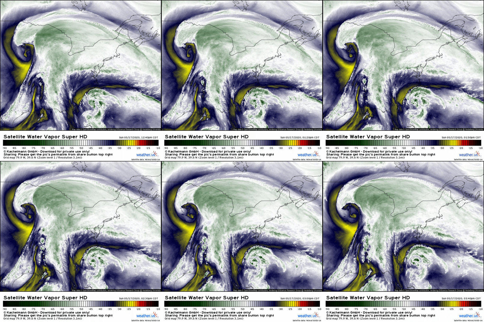
Water vapor satellite imagery shows the upper level low in question over the Upper Midwest this afternoon. This feature is drifting slowly southeast, where it will meet up with an upper level disturbance noted over the southern Mississippi Valley. It turns out that after the recent shifts to Arthur’s track forecast, this disturbance will be responsible for most of the moisture transport rather than Arthur itself.
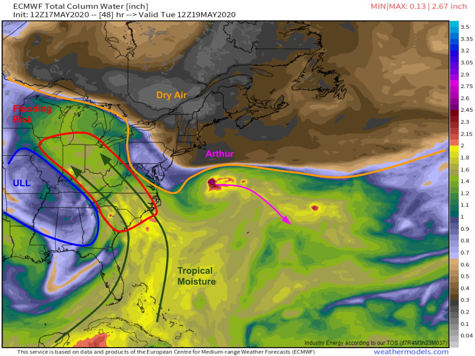
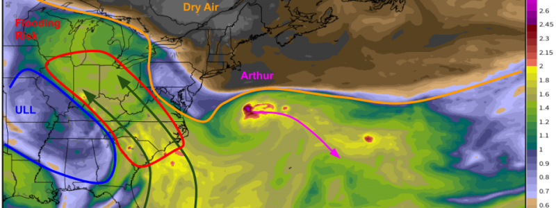
ECMWF precipitable water forecasts highlight this subtle shift to the forecast setup for Tuesday morning. The upper level low will be located near Memphis TN at this point, and moisture will be streaming north and northwest along its eastern flank from the Caribbean Sea through the Carolinas into the Ohio Valley. Arthur will be drifting slowly east/southeast as a very dry airmass surges south from Canada. That dry airmass will drive a wedge between Arthur and the upper-level low, thankfully preventing much entrainment of Arthur’s moisture. However, with such a robust moisture tap from the Caribbean, this feature will still be capable of producing prolific rainfall totals even without Arthur’s assistance.
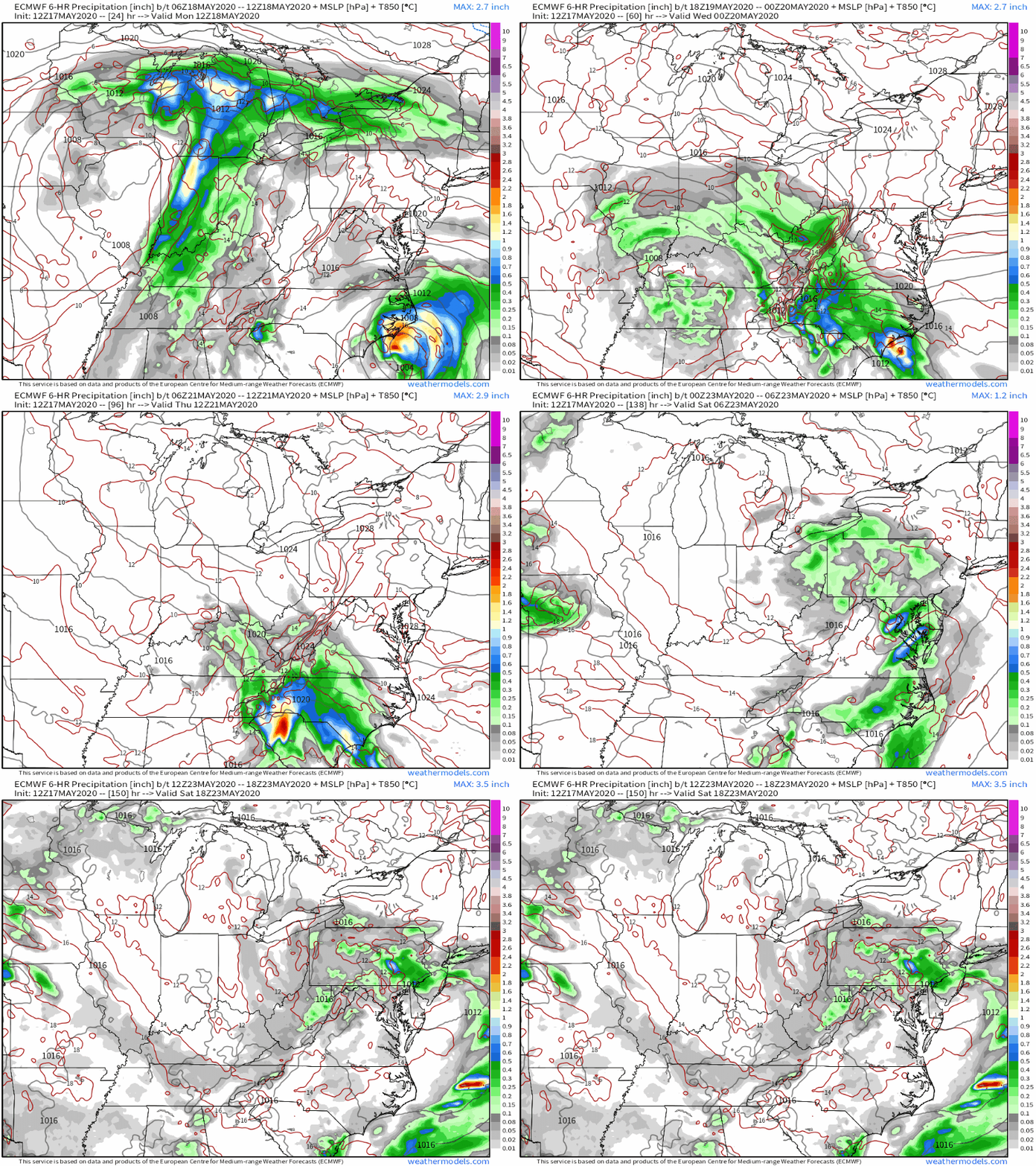
Here’s a loop of ECMWF 6-hourly precipitation totals and 850mb temperatures showing just how persistent rounds of heavy rain are expected to be across eastern parts of the Ohio Valley, southern parts of the Appalachians, and southern parts of the Mid-Atlantic including VA, NC, and SC.
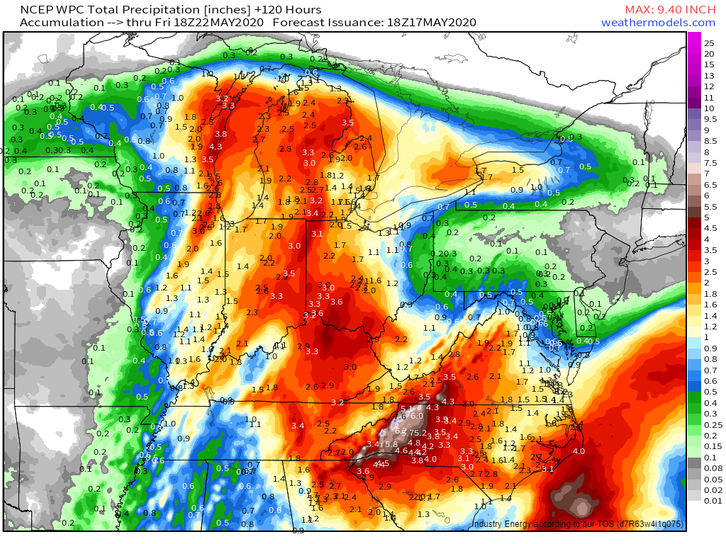
Here’s the WPC’s best guess as to how much rain we’ll end up with by the time all is said and done next weekend. The jackpot is clearly expected to be southeast-facing slopes of the Appalachians in North Carolina and Virginia where totals of 5-8″+ are expected. That’s a recipe for major flash flooding and some substantial flooding along larger rivers as well. Outside of some lighter totals in WV/TN where downsloping will make it harder for heavy rain to persist over an extended period of time, most of of our area of interest is looking at 2-4″ of rain though exact town-by-town totals will, as always, depend on the behavior of individual rain bands/convective cells.
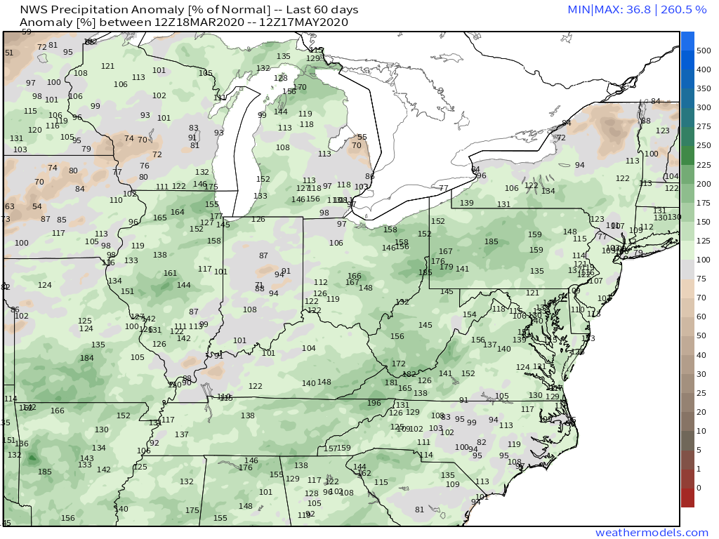
Here’s a look at observed precipitation anomalies over the last 60 days showing above-normal precip across the entire area of interest (except perhaps for central Indiana). This means that rivers, streams, and soils are primed to flood with less rain than might be required under “normal” circumstances. While 2-4″ usually isn’t enough to cause problems on the major rivers, it will definitely push the smaller rivers and streams out of their banks. If your area is susceptible to flooding in minor/moderate flood events, be prepared for high water this week.
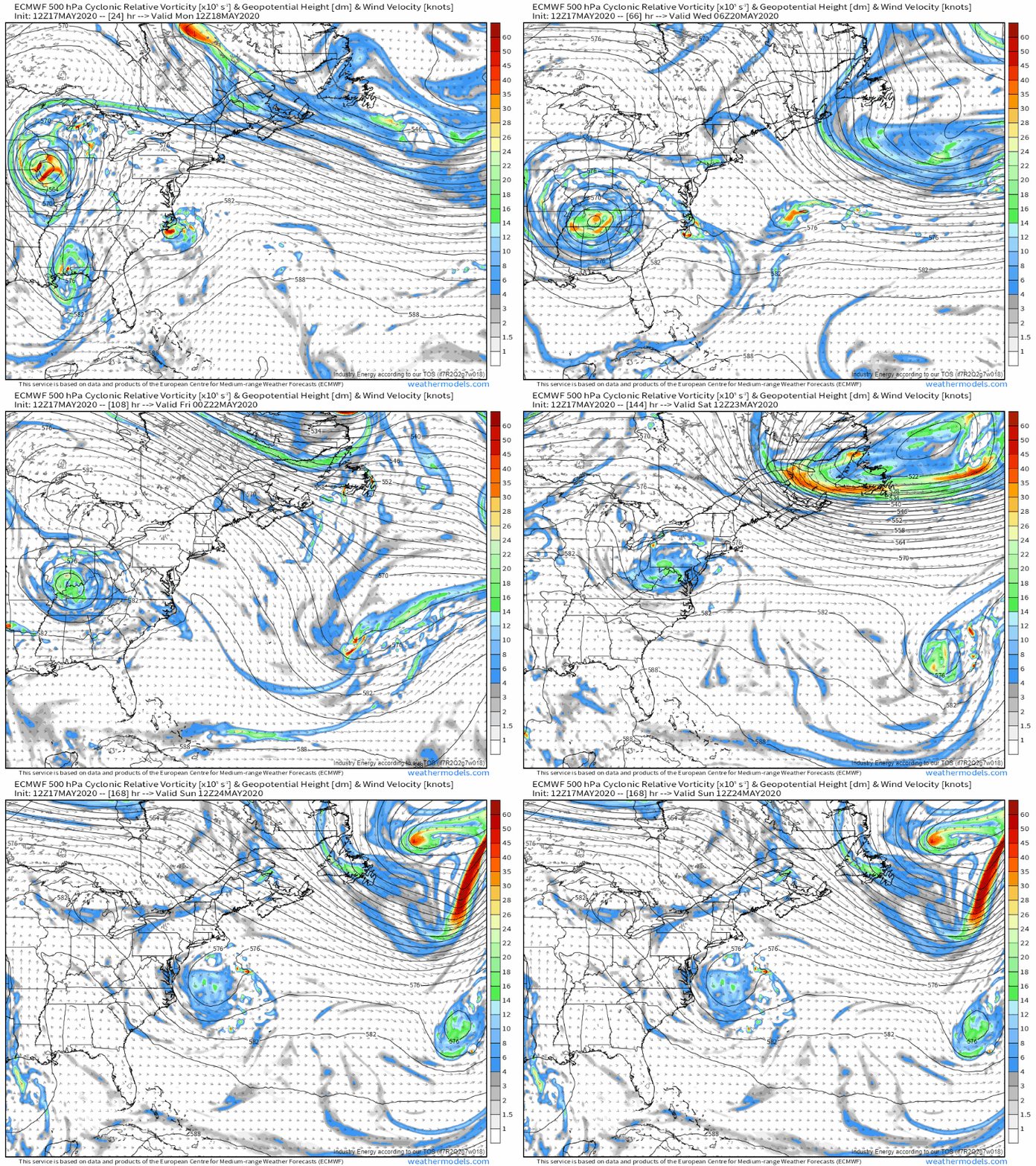
Rain will taper off later in the week as the upper level low slowly weakens and eventually drifts east into the Atlantic.
-Jack
