Widespread Freezing Rain To Cause Problems As Arctic Air Retreats
Hello everyone!
Arctic air that has been in full control of the Eastern third of the country since Christmas is finally retreating this week. While this will lift the spirits of many who are tired of the bitter cold, the transition between weather patterns is often a timeframe ripe for storms, and this will be no exception.
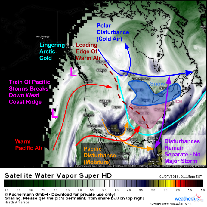
Water Vapor satellite imagery (what’s that?) shows several important changes to our pattern. Off the West Coast, a series of Pacific storms are breaking down the persistent ridge of high pressure that has been sitting over the Western part of the country for the past few weeks. This will result in an eastward expansion of warm Pacific air that will be chasing out the Arctic cold in the East. This process will occur faster aloft than it will at the surface, and freezing rain is expected as a result due to warm air aloft melting snowflakes into raindrops, which then promptly freeze onto cold surfaces at ground level.
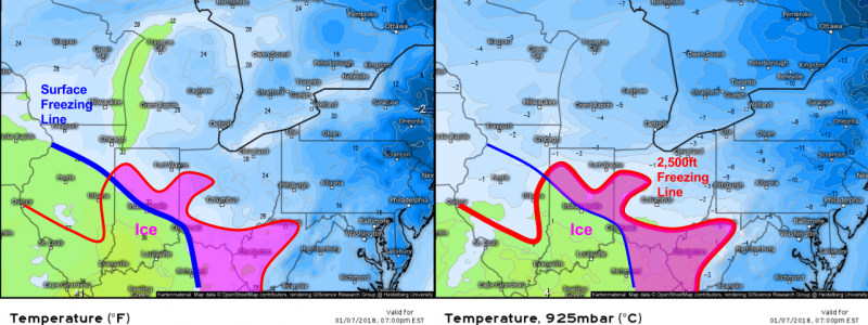
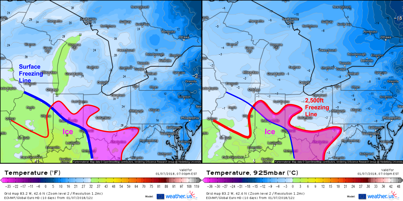
Here’s a map showing surface temps and 2500ft temps this evening. I’ve marked the location of the surface freezing line and the 2500ft freezing line, according to the ECMWF model (which I suspect may be a little too quick to warm surface temps in Southern Indiana). I’ve also marked the area where the surface freezing line is farther south than the 2500ft freezing line. It’s in this area that we’d look for freezing rain due to the shallow cold layer near the surface. Temps will be warming through the rest of this afternoon and through tonight, so areas that are above freezing in the image above valid at 7 PM may see ice earlier in the day, and areas below freezing may see temps rise above 32 later in the night.
Here’s an animation from weathermodels.com that shows freezing rain spreading east from where it’s ongoing now (in Missouri) through the Ohio Valley tonight and eventually down into parts of the Deep South by tomorrow morning. For most areas, ice accretion will be light enough to avoid issues beyond very slick travel, though some parts of Southern Indiana, Northern Kentucky, and Southern Ohio may see just enough ice (.25-.35″) to start worrying about scattered power outage issues. Areas farther north will see all snow due to the deeper cold airmass, while parts of the Gulf Coast will see all rain with the chance for some thunderstorms.
The whole system will clear out to the east tomorrow afternoon leaving a day of dry and cool weather on Wednesday before our next storm develops in the Plains towards the end of the week. More on that system later.
Jack


