Why Do Upper Level Ridges Result In Warm Weather?
Hello everyone!
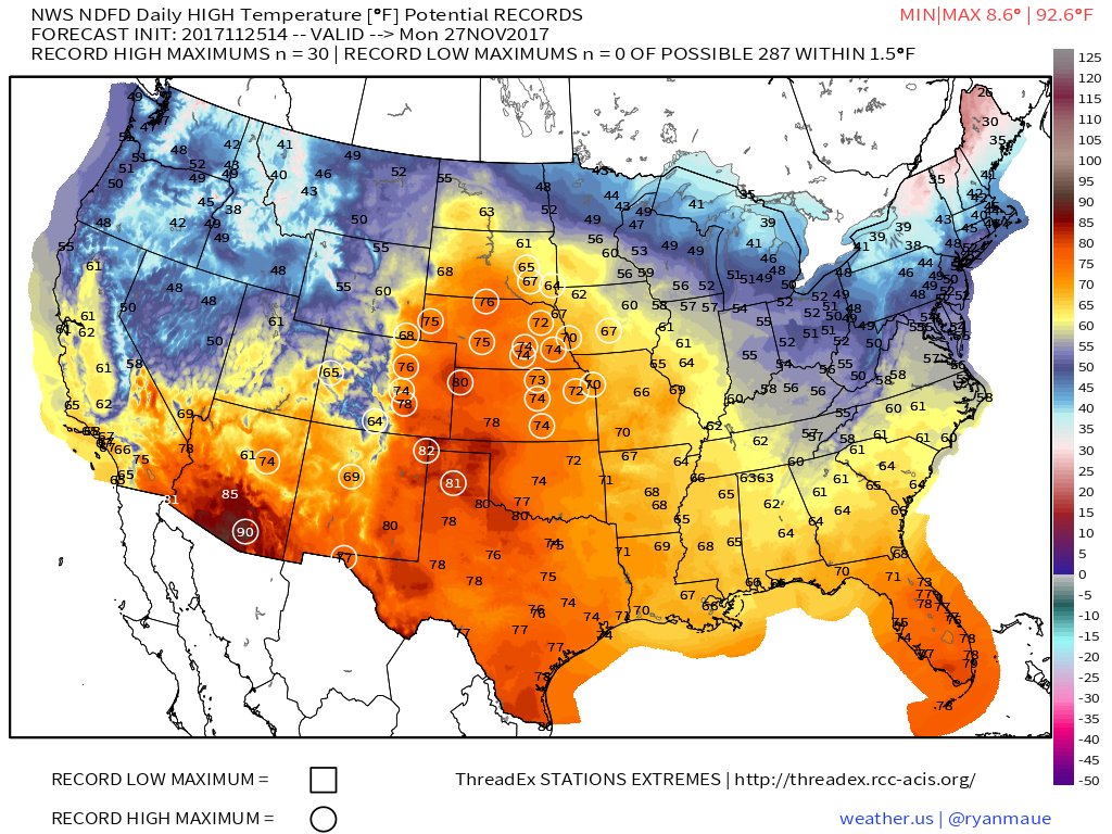
Despite the fact that we’re rapidly approaching the month of December, temperatures are forecast to soar into the 70’s as far north as the Dakotas on Monday. A number of record high temperatures are forecast to fall due to the warm airmass.
Here’s a map of the National Weather Service’s high temperature forecast for Monday, with potential record highs circled. A whopping 30 record highs are forecast, ranging from South Dakota to Arizona. So what’s causing the spring-like weather in late November?
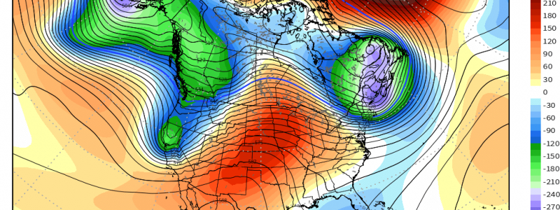
ECMWF ensemble forecasts are showing a large ridge located over the Plains on Monday. As a Pacific storm moves into California, downstream ridging will develop over the Plains. At the surface, we know high pressure means clear skies and quiet weather. Ridging can be thought of as the upper level equivalent of high pressure. Under ridging, air sinks, resulting in quiet weather. The one difference with watching ridges aloft, is that ridges are tied not just to dry/clear weather, but also to warm weather. Why is this? The answer has to do with what defines a ridge. A ridge is an area of higher than normal geopotential heights. The geopotential height of a given pressure level (for the map above, 500mb) is how far above sea level you’d have to go to achieve that pressure.
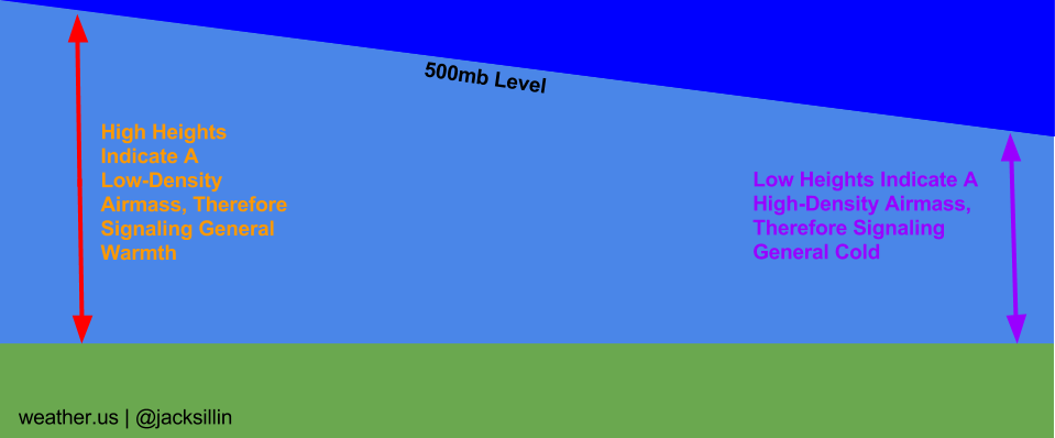
That’s helpful for temperatures due to the fact that the volume of a gas and its temperature are inversely correlated. The colder a gas, the denser it is and the less volume it takes up (this is due to the ideal gas law PV = nRT where V (volume) and T (temperature) are on opposite sides of the equation, thus demanding they be inversely correlated assuming all other variables are constant). The opposite is true for warm air. As you can see in the graphic above, a low-density airmass will expand, pushing the height of a given pressure level higher. The opposite is true for a dense, cold airmass that will show up as an area of lower heights. The much higher than normal heights forecast across the Plains on Monday, will naturally lead to much warmer than normal temperatures, hence the record highs being forecast.
It’s important to note that high heights don’t correlate perfectly with warm temperatures. Local features and weather systems can override the height patterns. Most commonly, this is seen when shallow cold air undercuts warmth from a ridge. This can happen a few different ways, but most often it has to do with sea and lake breezes that form on warm spring/summer days. While the synoptic setup (i.e. ridging aloft) might favor warmth, it doesn’t take much of a breeze off a 40 or 50 degree body of water to result in cool temperatures. Terrain can also help with this, as cold air is oftentimes hard to scour out of mountain valleys, even as warmth streams in aloft due to ridging.
Now that you know what ridging is and how it can result in warm weather, be sure to watch the geopotential height maps both on weather.us and weathermodels.com to see if any higher than normal heights are forecast to move into your area.
-Jack
