What Is Lake Effect?
Hello everyone!
With lake effect snow in the forecast today across the Great Lakes, it’s a perfect time to discuss what lake effect snow is, how it forms, and how to predict/track it with the tools at weather.us.
This simulated radar image shows lake effect in action. Notice the bands of moderate to heavy snow extending southeast of the Great Lakes. These snow bands are being directly caused by the lakes, there’s little to no snow outside of these areas. In this case, the wind is blowing from the WNW, and the snow bands extend to the ESE of the lakes. Coincidence? Certainly not. So how do the lakes cause snow?
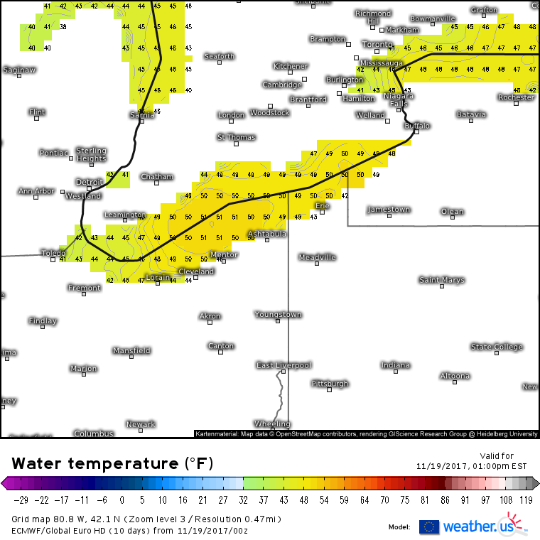
Water retains heat for a much longer time than air, due to its much higher specific heat capacity. This basically means that 50 degree water has much more energy stored within it than 50 degree air. As more energy leaves the Northern Hemisphere than enters it during the fall, both the air and the water lose energy. The water has much more energy to lose than the air, so therefore it cools more slowly. As a result, water temperatures across the Great Lakes, especially lakes Erie and Ontario, are still quite warm this time of year. Notice the large area of water temperatures above 50 degrees on the model analysis above.
The air this time of year is cooling much faster. Behind strong cold fronts, cold airmasses move southeast over the lakes. This map shows the temperature at 5,000 feet. Notice that temperatures just aloft are much colder than the 50 degree lake temperatures. This contrast sets up a very steep vertical temperature gradient in the lower part of the atmosphere. If you remember my discussion on CAPE, you’ll know that steep vertical temperature gradients can help fuel convection. In the summertime, these gradients often arise from very hot temperatures near the surface, which can lead to thunderstorms. In the wintertime, these lake-induced gradients drive bands of snow that are fueled by the same energy as summertime thunderstorms.
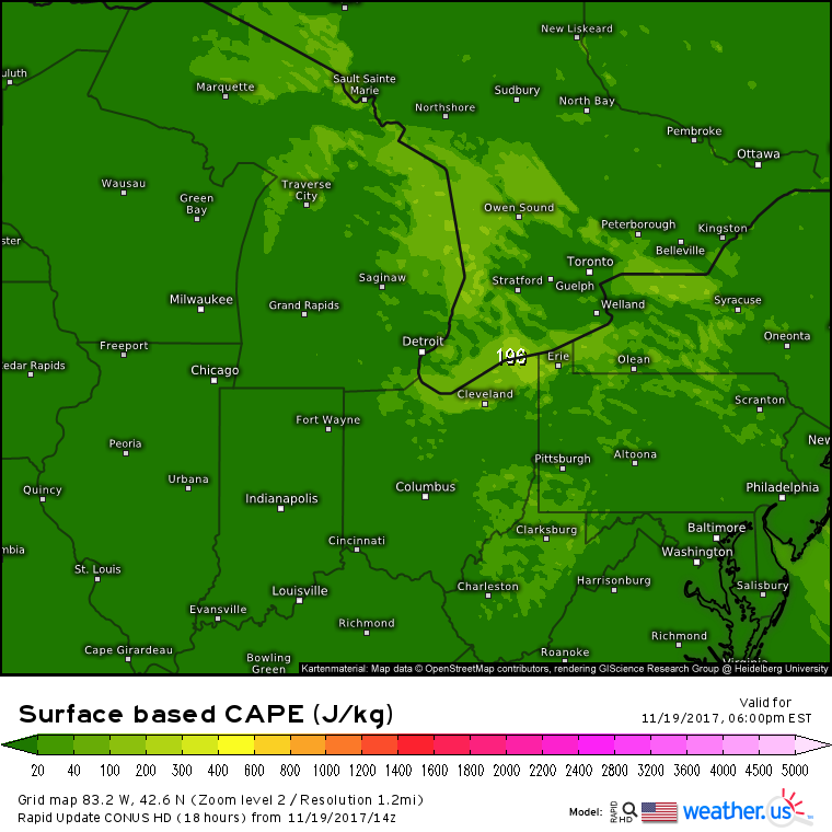
Sure enough, there’s some CAPE on the map during this Lake Effect snow event! Notice how the CAPE values are located over and directly downwind of each of the lakes. This is due to the loacalized nature of the steep vertical temperature gradients. The warmer the lakes, and the colder the air aloft, the steeper the temperature gradient will be, resulting in higher CAPE values, and therefore stronger snow bands.
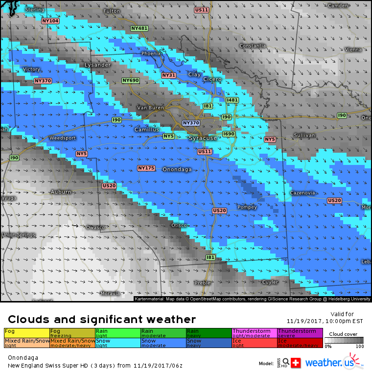
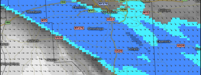
One of the hallmarks of lake effect snow is how narrow the bands of heavy snow are. This county level Swiss Super HD model map shows an extremely narrow band of intense snowfall just south of Syracuse. This is one of those cases where towns 5 miles south of Syracuse could see 6″ or more of snow, while the downtown area sees less than an inch. In some of the more intense cases, where heavy snow bands don’t budge for days, the gradients can be even stronger.
This radar image, pulled from our archive of HD radar data that extends back to 1991, shows an extreme example of lake effect snow gradients. This storm brought over 70″ of snow to towns just southeast of Buffalo, under the band in this image. Buffalo itself, shown just a couple of miles north of the band, got a mere 6″. Lake effect bands are notorious for producing insane snowfall gradients such as this one. If you see lake effect in your forecast, be prepared for heavy snow, but don’t be shocked if it’s your friend on the other side of town that has to break out the shovels.
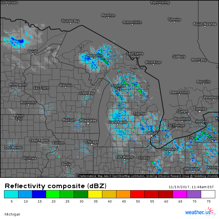
Lake effect snow isn’t always oriented in single, intense bands. Sometimes the snow is lighter and distributed across a wider area, like in the image above. Notice the large areas of light to moderate snow across Michigan, Ohio, and Western New York. What accounts for the difference? When the wind blows directly parallel to the length of the lake, a single band of very intense snow is likely. In the Buffalo example, winds were blowing out of the West-Southwest, down the entire length of Lake Erie. In the lighter example above, Northwest winds are blowing across the width of the lake, resulting in a smaller but wider fetch. As a result, snowfall is lighter, but spread out over a wider area.
Now that you know what lake effect is and how it forms, be sure to watch our model maps for signs that a cold airmass might be moving over warm lakewater. You might just see some lake effect snow!
-Jack

