Weak System Could Bring Snow To Parts Of The Northeast
Hello everyone!
With quiet weather generally expected across the country today, this update will discuss a potential light snow event that could take place across interior parts of the Northeast today.
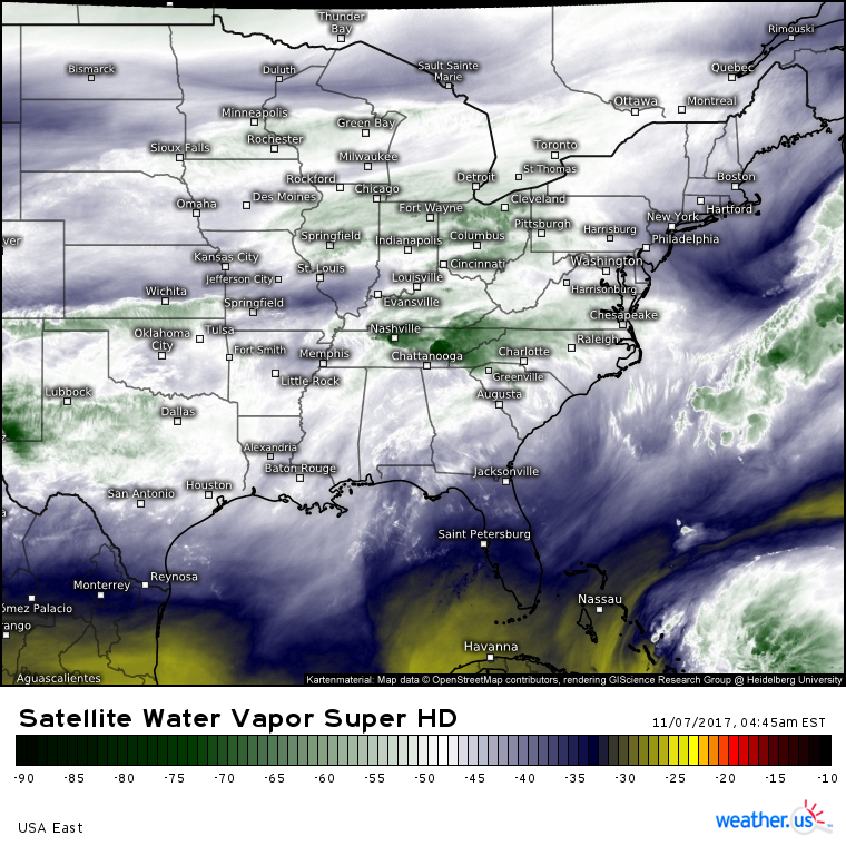
GOES-16 water vapor satellite imagery (What’s that?) shows a weak disturbance moving through the Ohio Valley this morning. This disturbance will be responsible for periods of rain in the Mid Atlantic this evening, with snow flurries possible farther north.
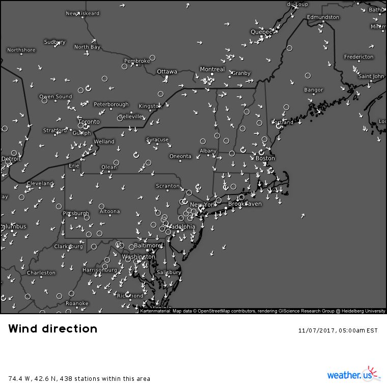
The chance for snow will be made possible in part by what you’re seeing on the map above, which is observed wind directions this morning. Notice the N/NW winds ongoing across the entire Northeast region. These winds are bringing in cold air from Canada that will be just barely cold enough to support some snow flakes.
The big question is if the moisture from the Ohio Valley disturbance can make it far enough north to find the air cold enough for snow.
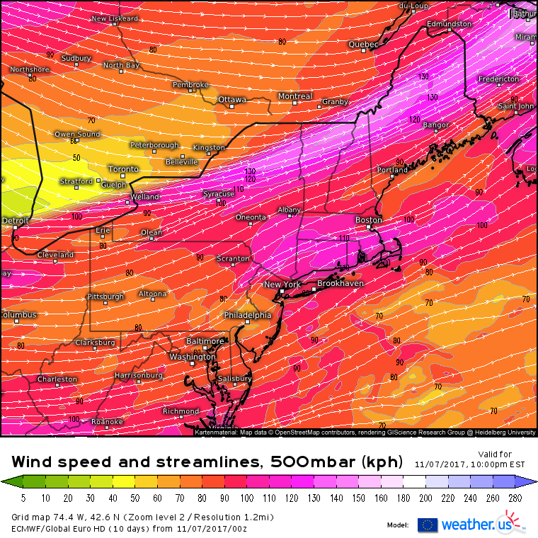
This map of mid/upper level winds shows who has the best shot at some flakes tonight. In the mountains and interior parts of the Northeast, we’ll have enough cold air for flakes (barely). The question will be getting precipitation to fall in these areas. The disturbance that will have the moisture is forecast to be located over Philadelphia this evening, as shown by the ripple in the wind flow in that area on the map above. WNW winds are shown aloft over Canada, this is the leading edge of drier air, and the cutoff point for any chance of snow. Notice the SW winds from Scranton up to Albany and over towards Portland. This wind flow will have just enough moisture to let us consider the idea of snow. The best chance for precipitation will be in the Mid Atlantic, under and ahead of the disturbance, but it’s those SW winds that could transport some of that northward.
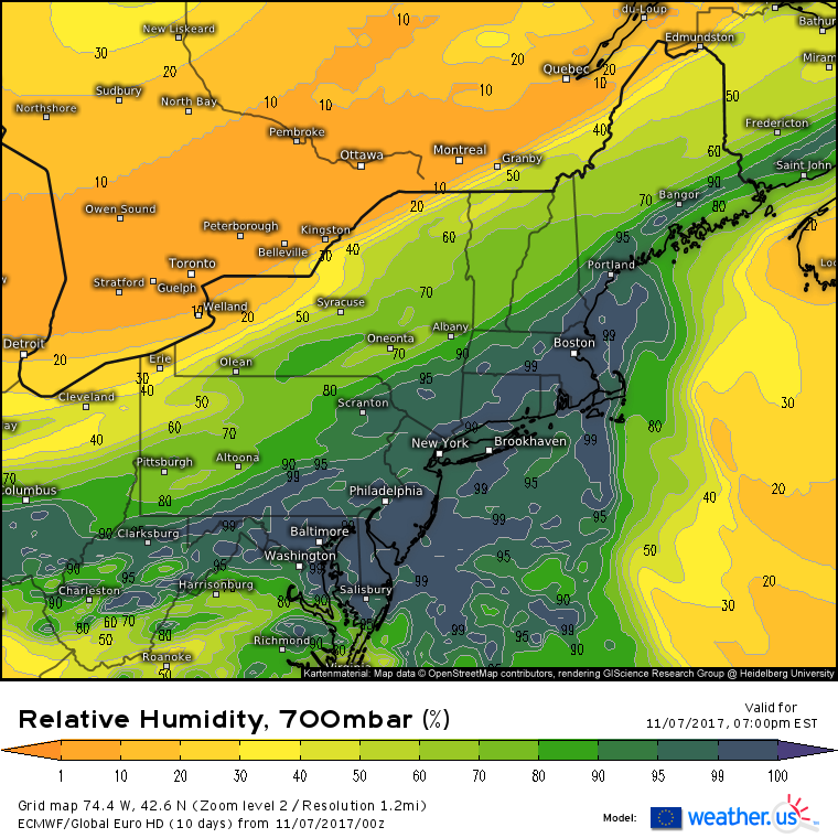
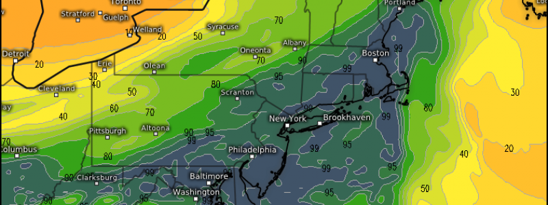
This map helps to visualize the moisture situation I was discussing above. Notice the very dry air in Canada, brought in by those WNW winds. Also notice the moisture over the Mid Atlantic associated with the disturbance. This map shows how the SW winds aloft could lift some of that moisture northward into places like Albany NY and Portland ME.
So how does this all play out in a practical sense?
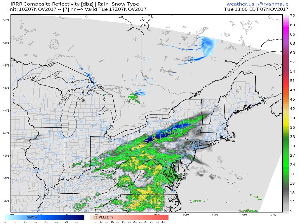
Rain currently in Ohio will expand and move ENE this morning, where it will encounter below freezing temperatures in the hills of Northern Pennsylvania. Moderate snow will fall there with perhaps an inch of accumulation. This is a pretty high confidence forecast given that these areas are much closer to the disturbance and moisture than places farther northeast.
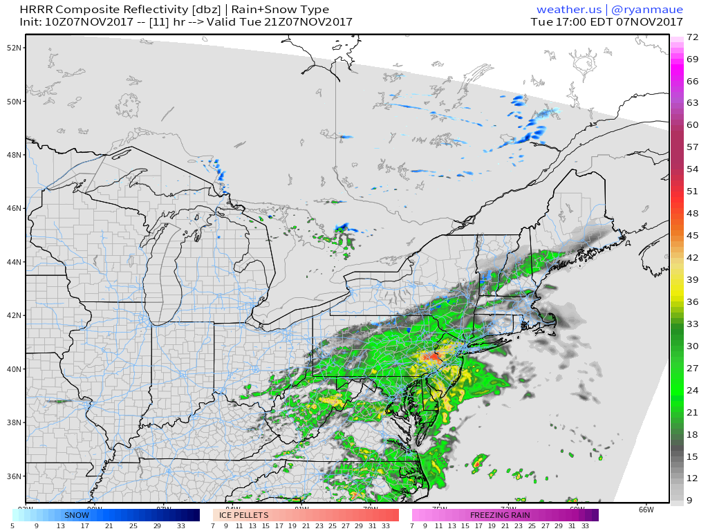
As we head into the evening, rains will continue across the Mid Atlantic under and ahead of the disturbance. The northern edge of the precipitation shield will be fraying a bit as it runs into drier air over New England. Still, light showers and flurries are possible, especially as temperatures cool heading later into the evening.
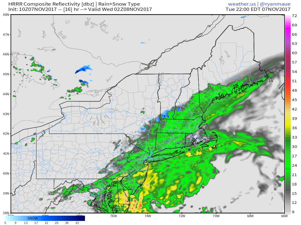
Heading into later this evening, the moisture transport due to the southwesterly winds discussed above will help to rebuild the northern edge of the precipitation, which will be mixing with and changing over to snow in the mountains of NY, VT, NH, and ME. Whether enough cold air will be present for snow in the lower elevations has yet to be determined, but N/NW winds will be working hard today to make it happen.
Elsewhere across the country today, quiet weather is expected today.
For more details on your local forecast: https://weather.us/
For more details on the local forecast for ME/NH: https://forecasterjack.com/2017/11/07/much-cooler-today-flurries-possible-tonight/
-Jack
