Weak System Brings Heavy Snow To Parts Of The Great Lakes Today
Hello everyone!
Today’s most active weather will once again be heavy snowfall, but instead of the Northeast, this time the focus will be over parts of the Great Lakes. The system behind the snow will remain quite weak, but just enough dynamics will be packed into a small area ahead of it to result in some impressive snow banding.
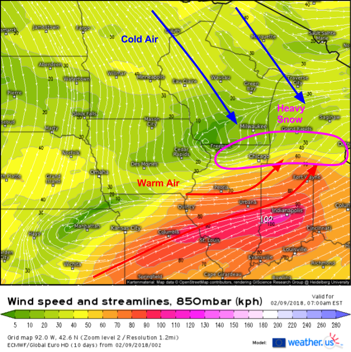
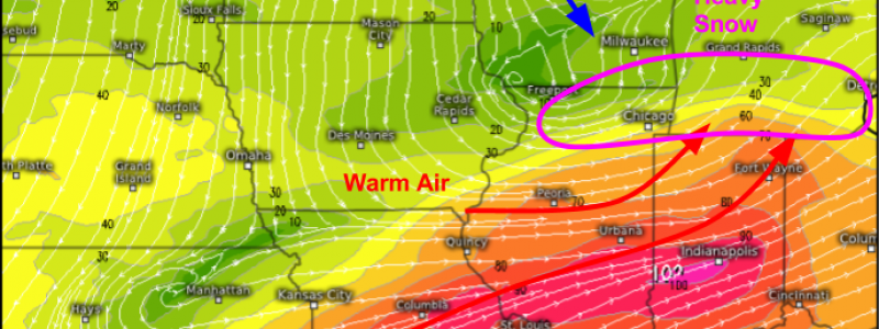
Here’s a look at the most important dynamic at play with this system: frontogenesis. Frontogenesis is the term given to the process that creates a front. We know that a front is a boundary between two airmasses, so to create a front we need two different airmasses to get pushed towards one another to sharpen up the boundary between them. If we look at the 5,000 foot wind map from the ECMWF above valid this morning, we can see that this is exactly what’s happening. Warm air is surging northeast through Illinois and Indiana, moving towards Chicago and Southern Michigan. Farther north, cold air is surging southeast from Wisconsin, also heading towards the Chicago area. This airmass rendezvous is what will drive a nearly stationary band of heavy snow in Chicago this morning, and in Michigan midday/this afternoon.
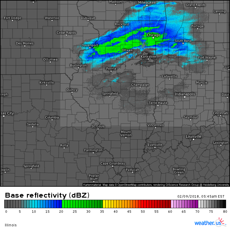
HD radar imagery shows this process already well underway, with a band of heavy snow already impacting Chicago. Notice the sharp cutoff to the south of this band, with only a few miles separating heavy snow from mere flurries. This is a trend that is expected to continue throughout the day, with one town seeing nearly a foot of snow while the next town to the south may only see an inch or two. With a setup like this, it’s nice to have county level data to see what’s going on from one town to another. Remember you can click any one of our maps to zoom into county level and take a look at what’s going on right in your local area!
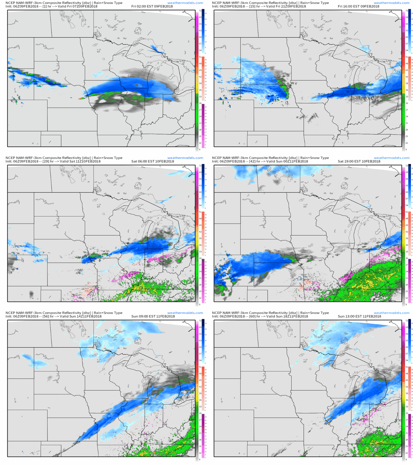
This simulated radar animation from weathermodels.com shows several rounds of precipitation passing through the Chicago-Detroit corridor in the next couple days as various waves of low pressure ride along the front created by today’s frontogenesis. While each round of snow may only last a few hours and drop a few inches of snow, totals over the next two days will be quite impressive, likely reaching over a foot in some places.
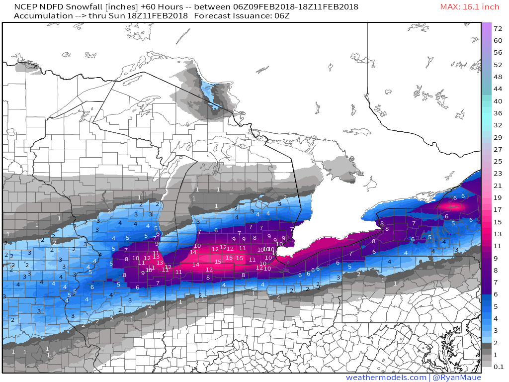
Speaking of snow accumulations, here’s the National Weather Service’s prediction for how much snow will fall through Sunday afternoon when the last round of snow departs. You can clearly see the results of the frontogenesis today, which will be maximized from Chicago to Detroit resulting in the highest snow totals being found in this area. Also notice the quick dropoff of totals to the south, where only a couple inches is expected in Central Illinois/Indiana.
Map from weathermodels.com
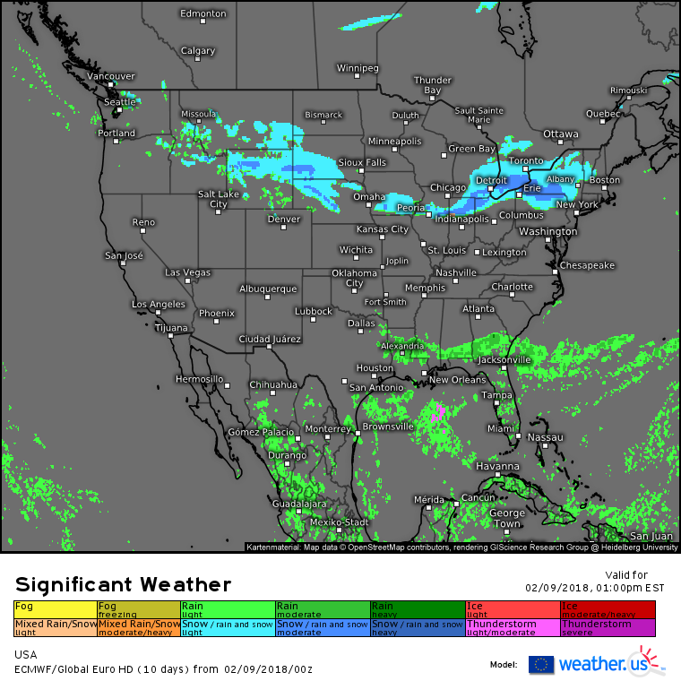
The ECMWF’s overview map for this afternoon shows a couple areas of active weather outside of the main heavy snow setup we’ve been discussing. Snow will also impact areas along the same front farther west, including parts of Iowa, Nebraska, South Dakota, and Wyoming. This snow should remain light to moderate, though a couple inches of accumulation through the day will result in some areas of slick travel. Rain showers and possibly a few thunderstorms will impact parts of the Gulf Coast though with no severe weather expected, impacts will remain on the minimal side.
For more information on your local forecast: https://weather.us/
For more information on the local forecast for ME/NH: https://forecasterjack.com/2018/02/09/increasing-clouds-today-9/
-Jack
