Weak Storm To Bring Light Snow To Parts Of The Coastal Northeast Tonight
Hello everyone!
Today’s weather will be generally quiet across the US as a large ridge builds into the West Coast, and dry NW flow rules the middle of the country. Active weather will be confined to coastal parts of the East as a weak low pressure system moves northeast today. This system is bringing some steady rains to parts of the Mid Atlantic this morning, and will bring snow to coastal parts of New England and the Mid Atlantic tonight into tomorrow morning.
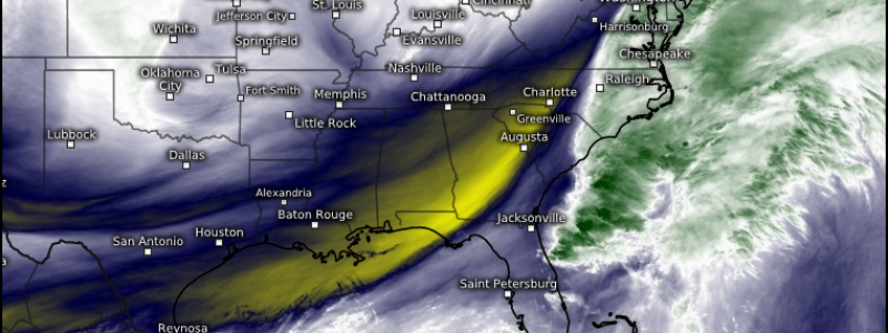
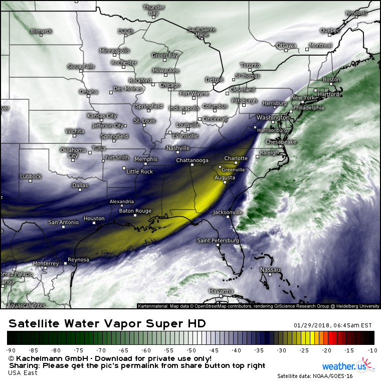
Here’s a look at Water Vapor satellite imagery (what’s that?) this morning, showing a plume of moisture hugging the East Coast from North Carolina up to Maine. An upper level disturbance can be seen to the west over the Ohio Valley, and this disturbance will help to tug just enough moisture just far enough northwest for some snow. Another important feature to note is the thunderstorm activity east of Jacksonville Florida. Heat released from these thunderstorms into the upper atmosphere will play a part in building up the downstream ridge enough to guide the storm a little farther west than originally forecast. Read more about that process here.
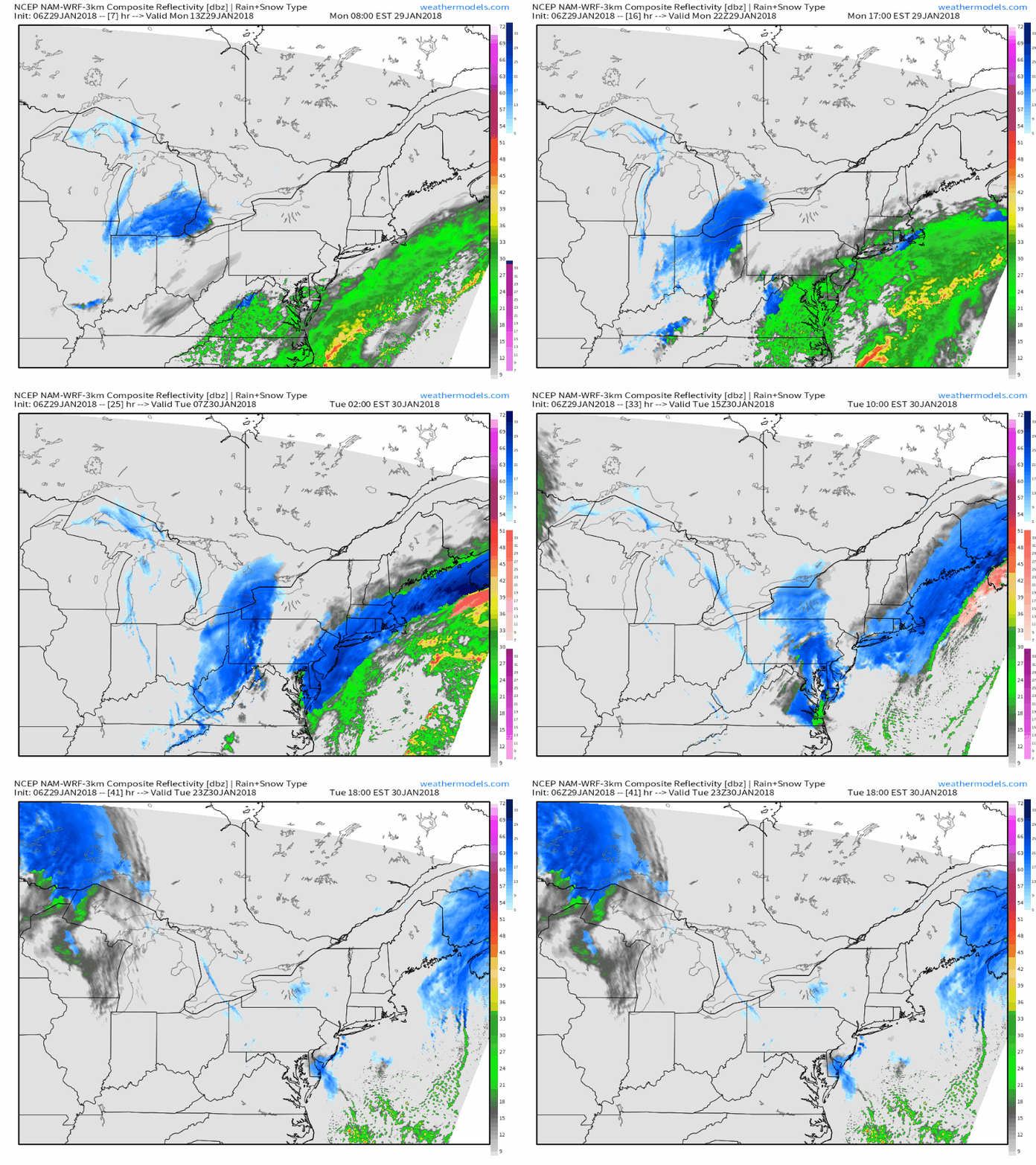
Here’s a simulated radar GIF from weathermodels.com that gives a pretty good idea of how this storm is expected to play out. Light to occasionally moderate snow will develop tonight across coastal parts of the Mid Atlantic and southeast parts of New England. The highest totals will be found on Cape Cod, closest to the low’s center. Snow will rapidly wind down during the day tomorrow.
One feature to watch tomorrow morning as light-moderate snow is ongoing in New England will be this band of heavy snow forecast to move through the DC area just before rush hour. This band will be driven by strong forcing in advance of that Ohio Valley disturbance discussed above. Current forecasts, including the Swiss Super HD map displayed above, indicate that this band will move through before rush hour, and marginal temperatures near the surface will probably preclude any accumulation of significance especially on roadways, but if the timing gets pushed back even by an hour or two, watch for some potential impacts to the morning commute. This band will be a fast mover, and isn’t expected to linger in any particular location for more than 30-45 minutes, though during that window visibility will be dramatically reduced in heavy snow and a quick coating-1″ is possible especially on grassy/cold surfaces.
Track this storm with Super HD satellite imagery https://weather.us/satellite/usa-east/satellite-water-vapor-superhd-5min.html#play (click to zoom in, other satellite options such as IR/visible available via menus, click here for satellite imagery tutorial), HD radar imagery https://weather.us/radar-us/usa-east/#play (click to zoom in to state/county level for HD imagery), and current observations https://weather.us/observations/744-w-426-n/weather-observation/20180129-1200z.html (click refresh button at the top left of the map for latest data, click to zoom in or click near edge of map to pan (custom zoom mode) other parameters such as temps and wind via menu).
For more information on your local forecast: https://weather.us/
For more information on the local forecast for ME/NH: https://forecasterjack.com/2018/01/29/colder-with-plenty-of-clouds-today/
-Jack


