Warm, Muddy, and Unsettled Across The Northeast
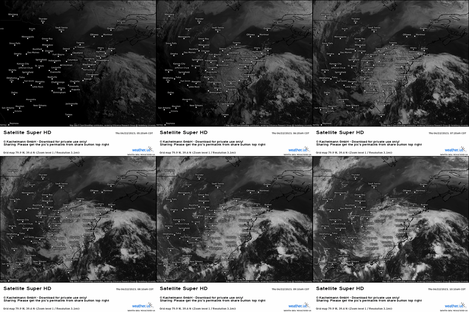
We begin off by observing water vapor satellite imagery to garner a sense of what is happening across the regions we’re interested in, and how that may play a role in the imminent future. We see a large, broad cyclonic upper low located in the Southeast. This has plagued the region since the start of the week, which has kept temperatures below normal along with repeated rounds of showers and localized storms. We’ll now compare that to the 500mb height pattern below, to see what transpires heading into the weekend in the Northeast.
We see the broad area of below average heights, which is what we’re looking at now in current observational analysis via water vapor imagery, modeled to slowly shift into the Appalachian mountains across the Mid-Atlantic before propagating into the Northeast. We know that troughs in general, are associated with cloudy, cool, and typically wet conditions. This’ll be the case all weekend across the Northeast and Mid-Atlantic, which is even then followed by yet another upper low early next week.
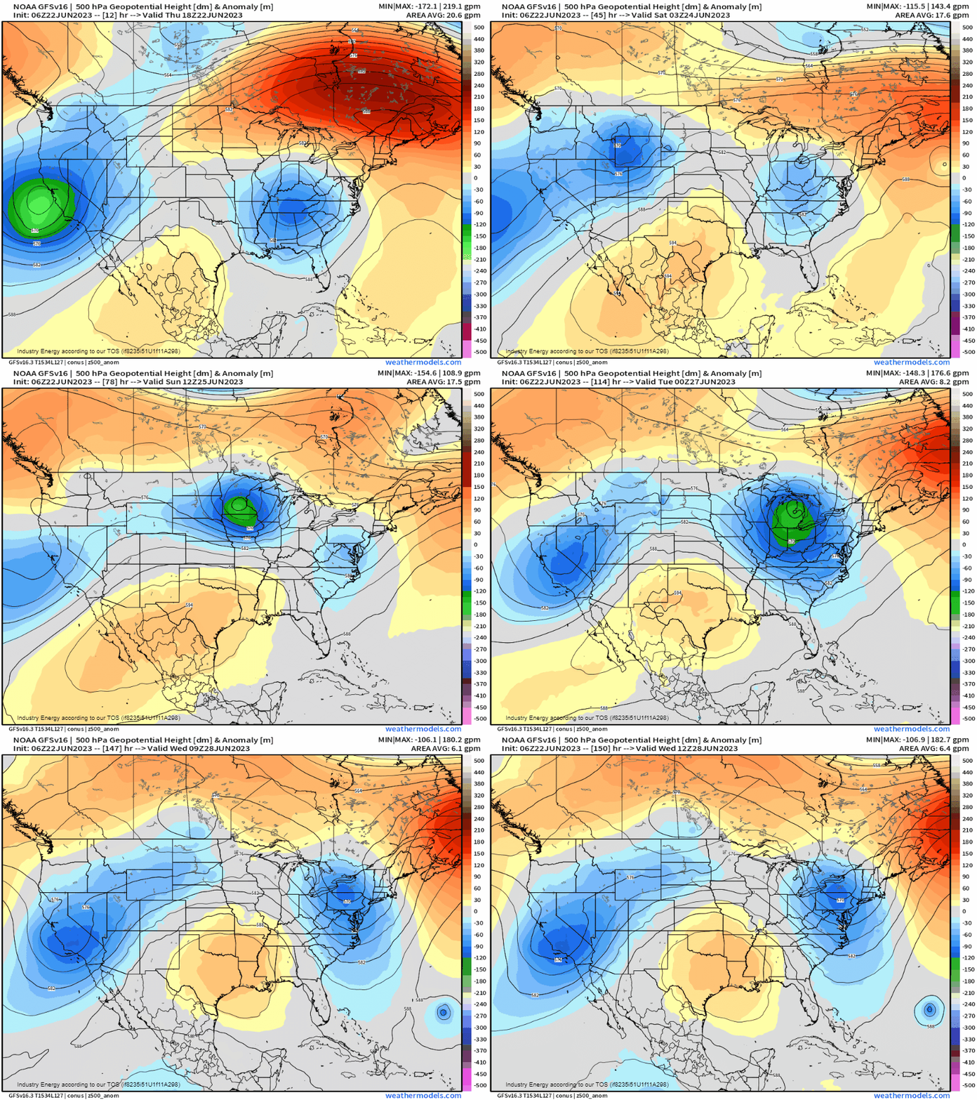
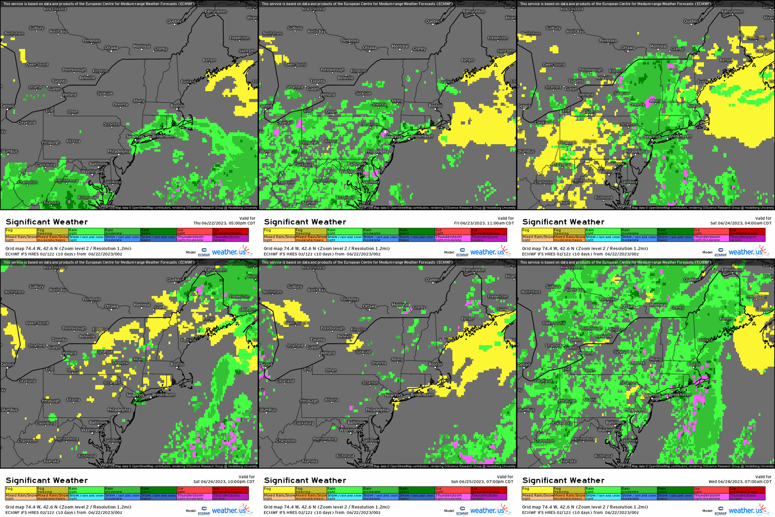
This pattern will result in several occurrences across these aforementioned regions:
- As mentioned, an unsettled pattern. Daily chances for showers and storms, albeit mostly sub-severe, will cover a large swath today through this weekend and into next week. The one caveat is that severe weather could be more of an issue via next trough next Monday/Tuesday. Nonetheless, the main concern will be localized flash flooding due to the nature of weak shear, high PWAT’s, and persistent rounds of showers from the upper low that is the main forcing mechanism.
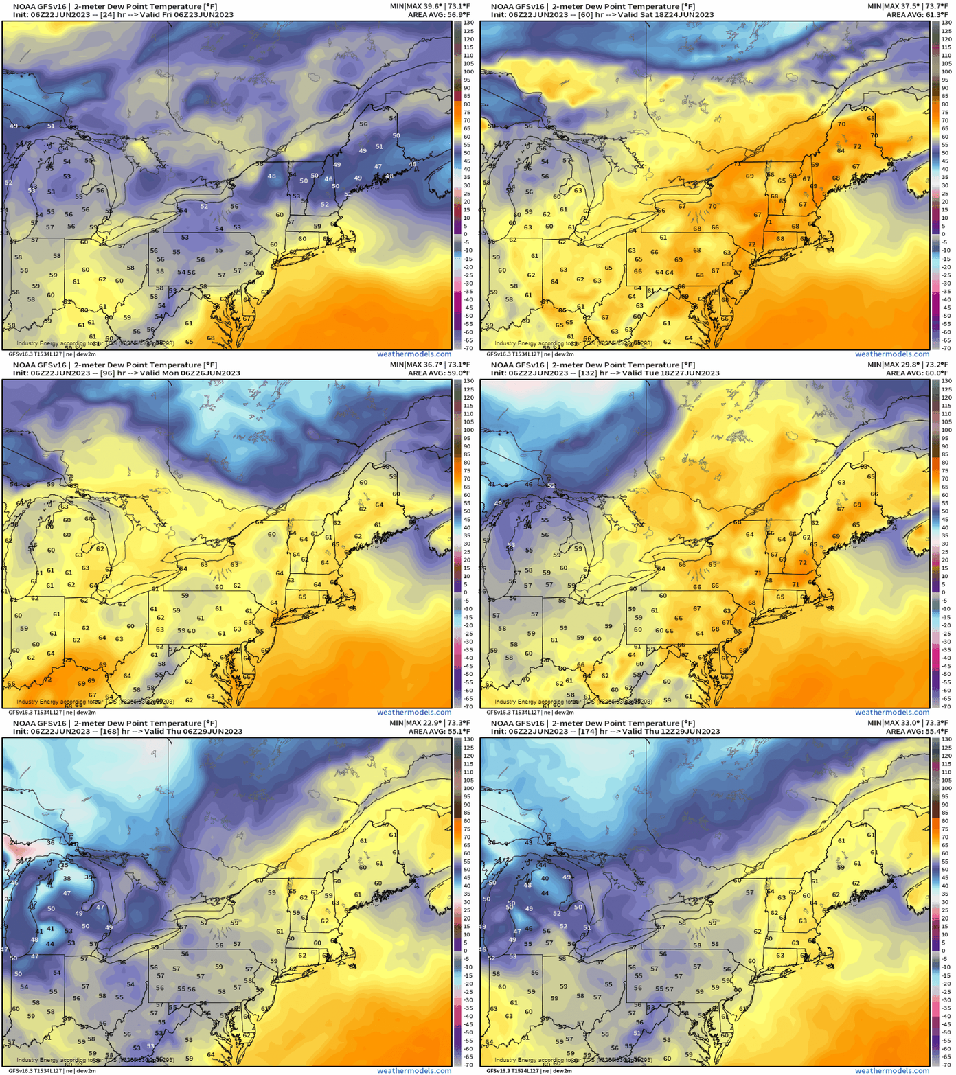
2. The mugginess. One big result of both the orientation of the trough axis and where the air is coming from, is that the dewpoints will persistently stay elevated into the 60’s and 70’s until a cold front finally pushes southeast by the middle of next week. It’ll basically be the “air you can wear”, with the moisture being pulled directly from the Gulf, with tropical moisture characteristics. I mentioned higher PWAT’s just above, and this is what I meant because of the anomalous moisture carried in the parcels of air that’ll stick around these regions for quite a bit.
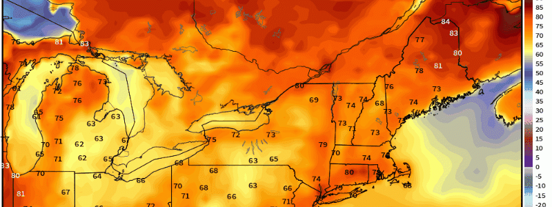
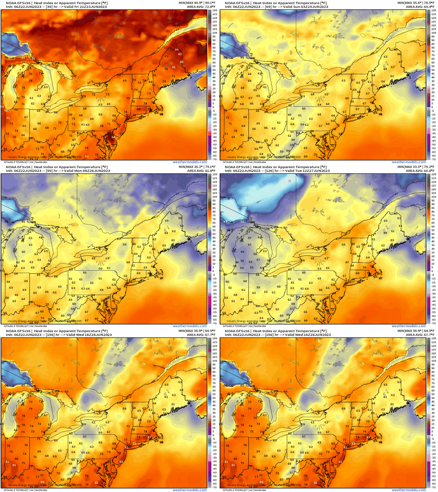
Analyzing now both temperature and moisture combined into an index – the heat index, we see that up the I-95 corridor, heat indices exceed the upper 70’s and gets into the 80’s through the entire weekend and into next week. Not only this area, but again in the general Mid-Atlantic and across the entire Northeast.
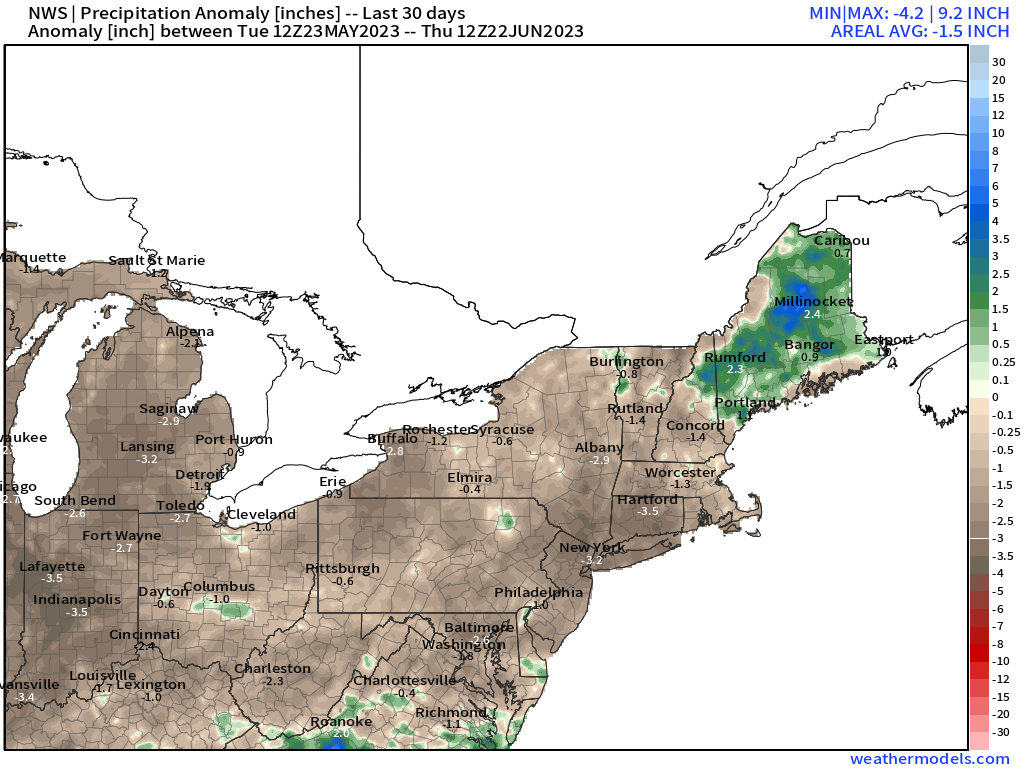
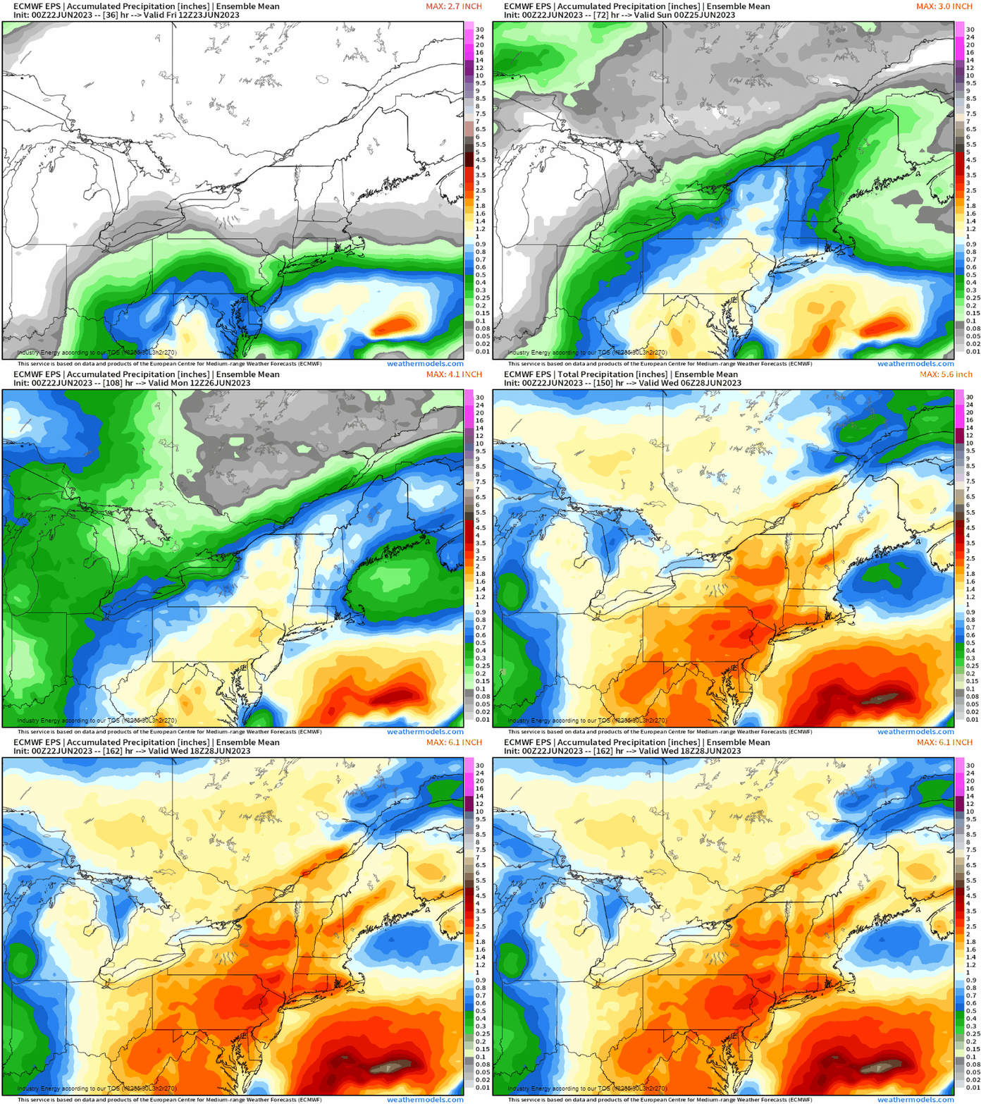
If there’s any “silver lining”, it’s the fact that across the Ohio Valley into the Northeast, we have an ongoing deficit in precipitation. This is over the last 30 days, and doesn’t even take into account since the beginning of the year so it’s even more glaring. Below is the EPS displaying a surge of precipitation, a much needed amount verbatim, falling this weekend and next week where a mean of over an 1” looks to occur for a large population. While it may damper weekend plans, it’s at least beneficial to look at it through this perspective since we’ll have plenty of nice weekends ahead since it’s technically now the official summer season!
