Two Part Storm System To Bring Rain And Mountain Snow To The West Coast This Weekend
Hello everyone!
A storm system with two parts will approach the West Coast this weekend bringing widespread valley rain and mountain snow. Because there are two parts to this system, everyone will get in on the precipitation from Southern California to Northern Washington. This doesn’t appear to be a particularly powerful system, but it will be another important step towards establishing bountiful water supplies for the summer to come.
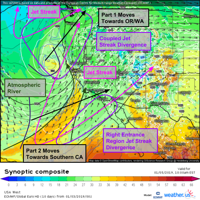
Here’s a look at the overall setup visualized by the ECMWF’s synoptic composite map. The first part of the storm is most visible NW of San Francisco, as its circulation is nicely wrapped up into the structure of a mature low. The second part of the storm is a little more subtle and visible only in the upper level parameters (300mb wind shift and kink in the 500mb height lines) SW of LA. A strong jet streak sits to the east of the two, and like all jet streaks has two areas to watch for divergence aloft (which fosters upward motion). The first area in the left exit region of the jet overlaps with divergence from the right entrance region of another jet, located to the west of Seattle. This coupled jet structure will help to produce plenty of upward motion, and thus precipitation, as the system moves northeast. The second area of divergence will be located in the right entrance region of the first jet streak, south of LA. As the jet lifts north, this divergence will follow, setting up lifting for precipitation in Southern CA out ahead of the second system. Additionally, the storm has a deep tropical moisture feed to tap
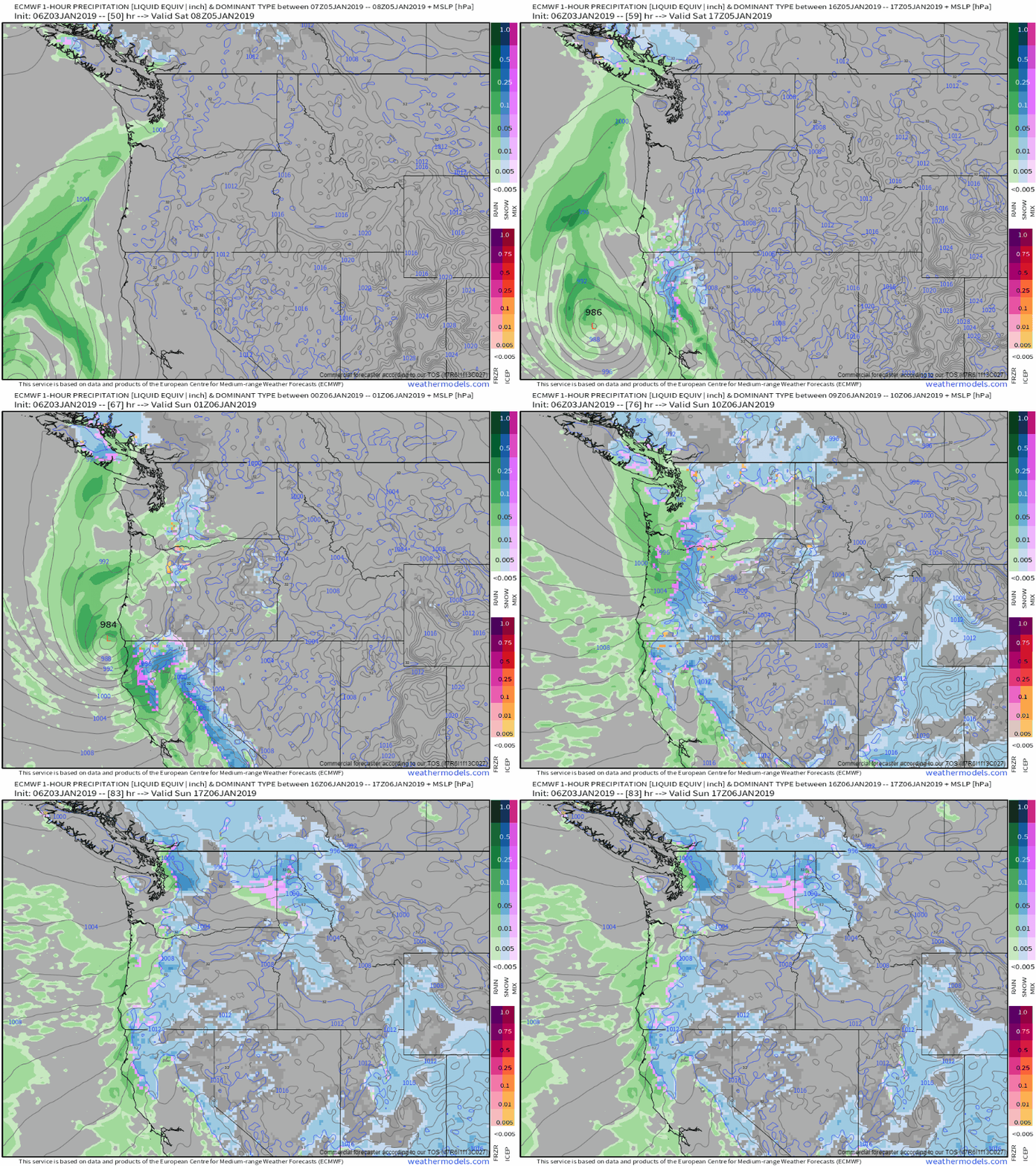
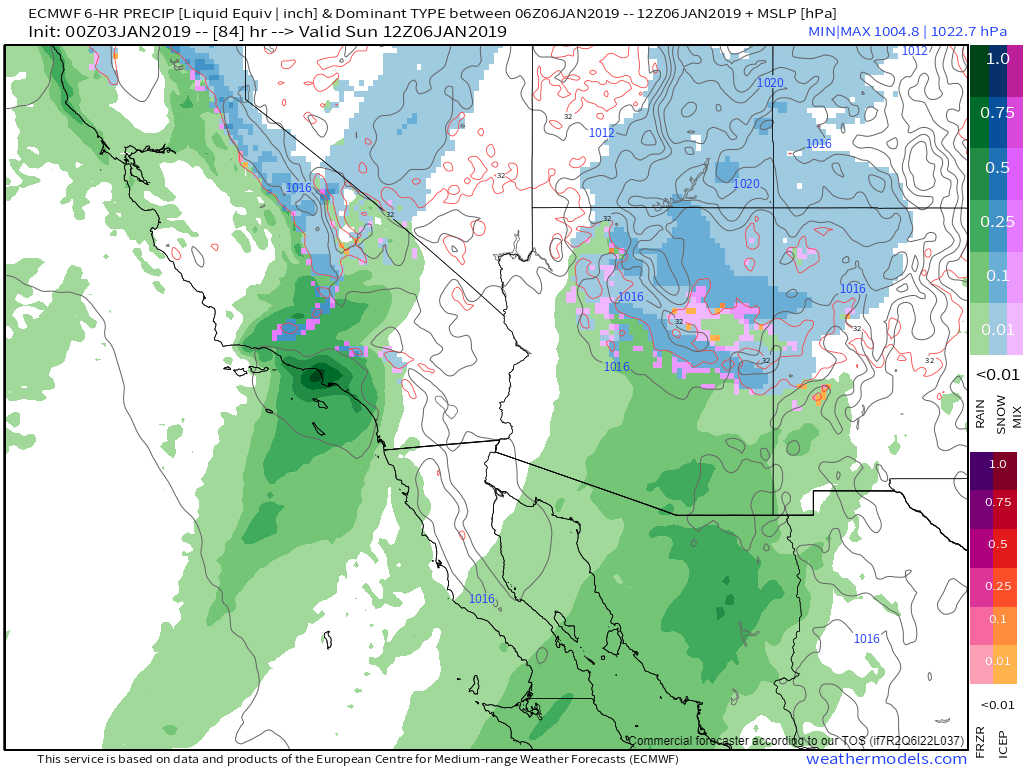
The first part of the storm will be the strongest and best organized, so I’ll start by discussing it first. Here’s an animation from the ECMWF model showing precip types for each hour between Friday night and Sunday afternoon. Notice the track of the low from the Pacific west of San Francisco all the way up into Washington state. This track, along with the second element, will ensure widespread impacts as opposed to the more typical systems which move directly onshore, usually resulting in much narrower impacts. Additionally, as the storm tracks through Oregon and Washington, moist SW flow will keep rain and snow going across California, though the heaviest precip will be limited to when the storm is closest to any given spot. Via weathermodels.com.
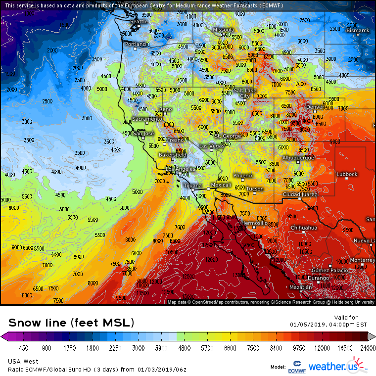
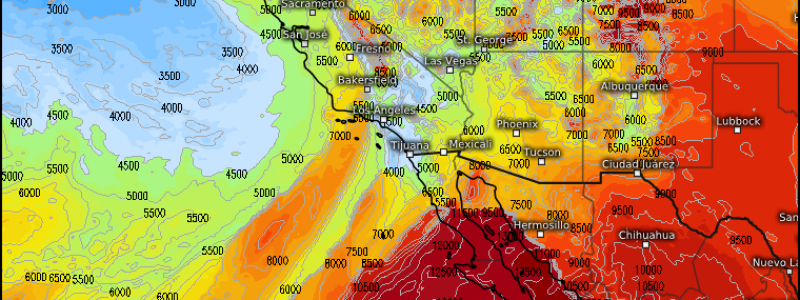
Snow level forecasts indicate that you’ll have to get to around 4-5,000 feet before you see flakes in most of OR/CA. Snow levels will be a bit lower up in WA where a colder airmass resides. Note that this map shows either the elevation of the ground (in mountainous areas where snow will reach the ground) *or* the height you’d have to go up to in order to see snow (in areas not expecting snow). This means that places like the Sierras show up as having snow lines of 6-10,000 feet, but because the mountains themselves are that tall, snow will fall.
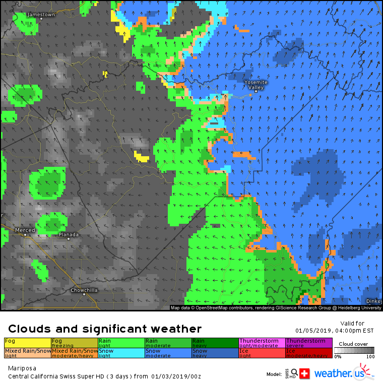
For more precise rain/snow line forecasts, be sure to check out the Swiss Super HD model for Central CA. Its 1km resolution lets it pick up on small scale terrain features that will be critical in determining the exact rain/snow line. These terrain features are also important for temperature and wind forecasts, where the Swiss model is also a step ahead of the game!
The second part of the storm will arrive in Southern CA on Sunday with lower elevation rain and higher elevation snow. The mountains near Los Angeles should do fairly well with this storm, as heavy snow likely amounts to more than 6″ for some of the ski resorts. This system won’t be quite as powerful as the primary low that heads towards WA, but LA and surrounding areas could see over an inch of rain by the time all is said and done. Moisture moving into the Desert Southwest will also lead to more snow across parts of AZ and and NM that have already seen several feet over the past few days. Via weathermodels.com.
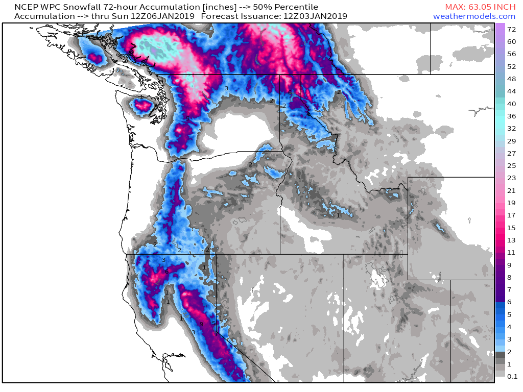
Here’s a look at the forecast snow totals from the Sierras on north. The highest totals over the next three days will be found in the Cascades, but all the higher peaks should see at least a foot of snow over the coming days. Snow will expand into the Central Rockies early next week as the storm moves east. Via weathermodels.com.
-Jack
