TS Nate Moving Through The Caribbean En Route To The Gulf Coast
Hello everyone!
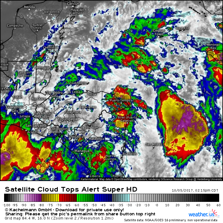
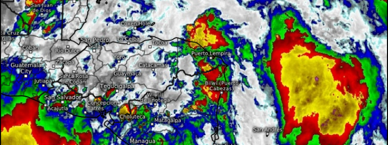
TD-16 strengthened into TS Nate this morning, and is now moving NNW near the NE corner of Honduras.
The satellite presentation of Nate continues to leave a lot to be desired. The center of the system is located within an area of shower activity near the NE part of Honduras. Most of the strong thunderstorms are well removed from the center. Large, loosely organized bands of showers and storms extend hundreds of miles from Nate’s center. These showers and storms are associated with a much larger system known as the Central American Gyre. This is basically a large area of broad low pressure that is dominating the weather in Central America right now, including the Atlantic and Pacific oceans on either side. Nate is just one disturbance of many that are associated with this gyre.
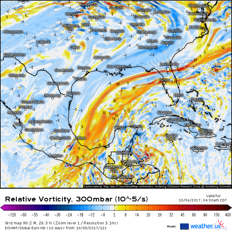
This map shows the amount of spin in the mid levels of the atmosphere. Nate is the bright red spot N of Honduras tomorrow morning. Notice the large area of spin extending from Florida to the Bay of Campeche down into the East Pacific. This is the Central American Gyre. Nate will move north/northwest around the east side of this system, before turning N and NE due to an approaching mid latitude trough on Saturday night.
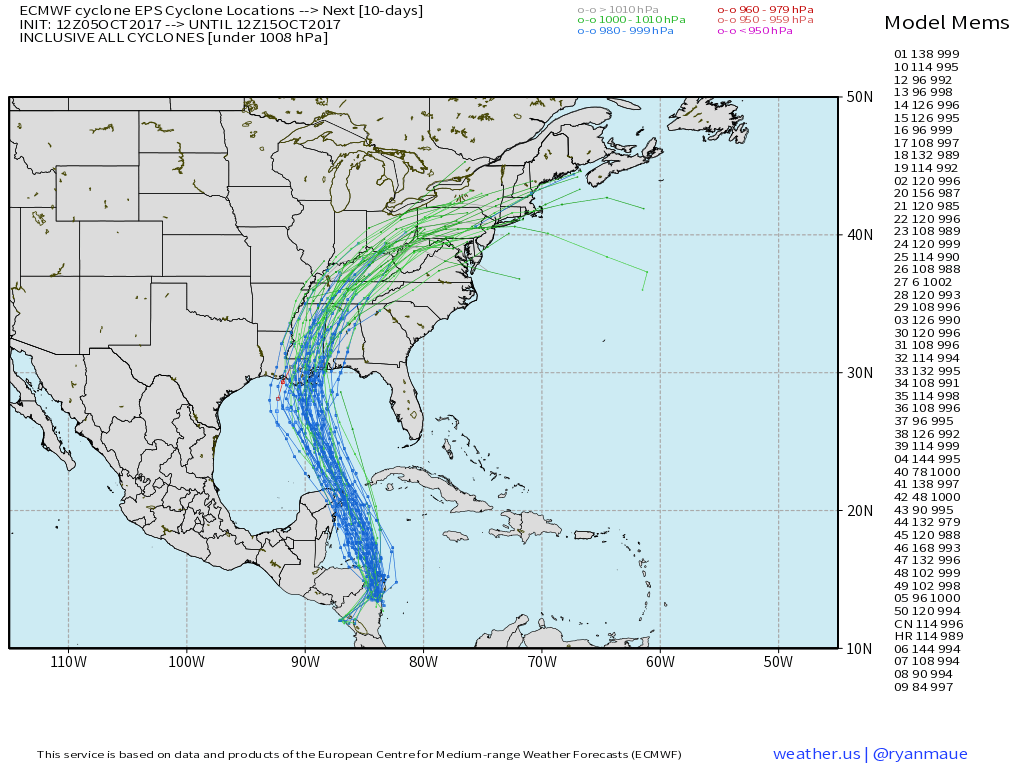
Nate’s track has become a little clearer over the past 24 hours. A general NNW track will continue through Saturday night, at which point the storm will be near the Louisiana coast. Notice how there’s still some uncertainty with regards to exactly where the system will make landfall. What’s the forecast for intensity? That’s a much harder question to answer.
Remember that we usually look for four things when trying to forecast tropical cyclone intensity: water temperature, wind shear, dry air, and inner core organization. Let’s briefly run through each of those to see if we can get a sense for how strong Nate will be when approaching the Gulf Coast.
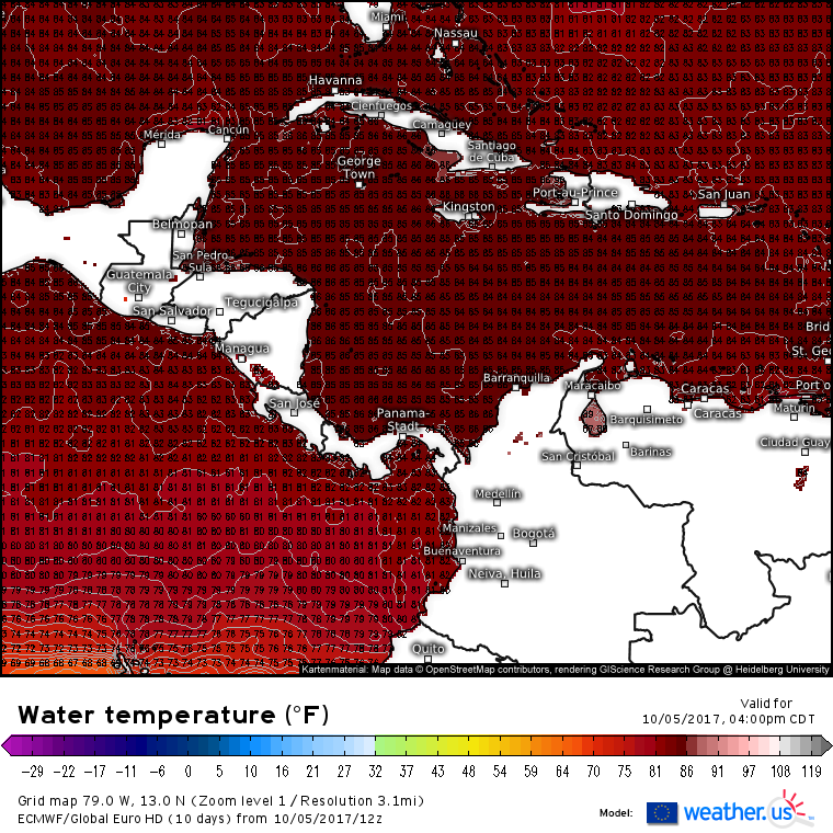
Water temperatures are quite favorable for intensification. You typically need waters above 80 degrees to support a tropical system, and the coolest waters in Nate’s path are in the mid 80’s. Cold water will not be an issue between now and landfall.
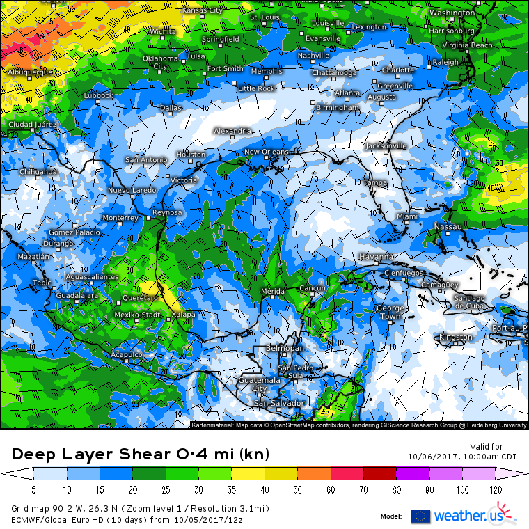
Wind shear will be light as an upper level trough to the west of the system helps to vent air away from the center of the storm. When a storm’s intensity depends on air rapidly rising through the atmosphere, it’s critical to have an exhaust system in place to prevent air from building up at the top of the storm which would prevent further upward motion. Nate won’t have a textbook exhaust system, but it is unlikely to be hampered by strong winds aloft which can disrupt thunderstorm organization in tropical systems.
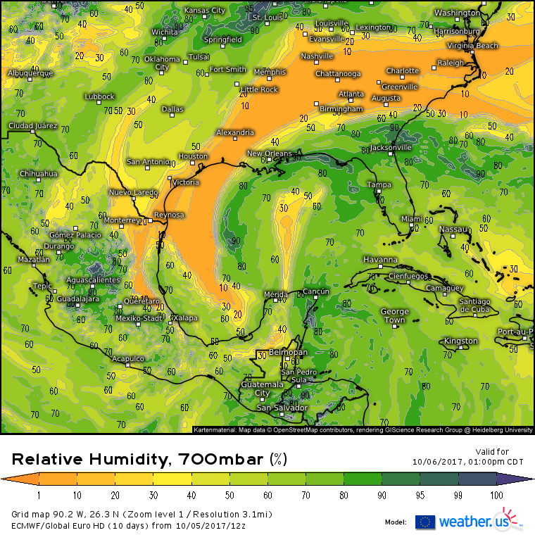
Dry air is likely to be an inhibiting factor for Nate. Both water vapor imagery and ECMWF forecasts show two taps of dry air available for causing problems in Nate’s circulation. When dry air gets entrained into a thunderstorm’s updraft, it cools the air, making it heavier. The heavier air then sinks, killing the storm. The potential for dry air entrainment is high with Nate, though sometimes tropical systems can mix some of the dry air out of their circulations before too much damage is done. How resistant Nate is to dry air remains to be seen.
Current forecasts indicate that the center of Nate will pass either over or very close to the Yucatan Peninsula. Interaction with the Yucatan, as well as interaction with Honduras tonight, will disrupt the storm’s developing inner core. The extent of this disruption remains to be seen. If Nate can build up an inner core while over the warm waters of the Western Caribbean, and happens to miss the Yucatan, it could rapidly intensify into a hurricane. If the storm moves over the Yucatan, or for some other reason fails to develop an inner ring of organized thunderstorms, it is likely to remain fairly weak.
As far as impacts go, there is very high confidence in direct US impacts from this system. There’s simply nowhere for Nate to go except into the Gulf Coast. In terms of impacts, rain and wind will be in progress Saturday through Sunday along the Gulf Coast, and Sunday into Monday farther up the East Coast as the storm’s remnants race NE.
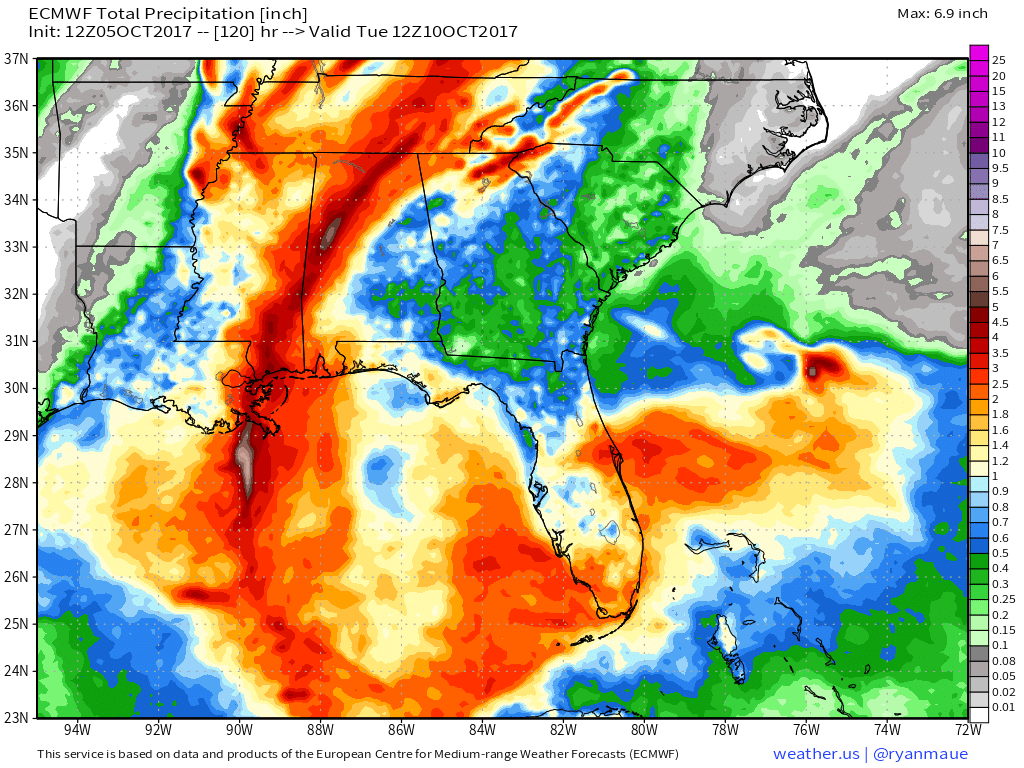
Heavy rains will cause flooding, especially near the point of landfall where the heaviest thunderstorms will move onshore. However, the swift forward motion of the system will prevent any devastating flooding impacts. Heavy rains will extend well away from the center as thunderstorm activity in the storm’s outer regions is enhanced by the larger scale gyre mentioned earlier.
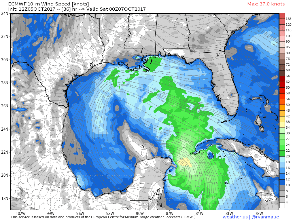
Gusty winds will also impact the coastline, though the extent of the winds, and the potential for any wind damage, will depend on how the storm’s intensity evolves over the coming days.
I’ll have more updates as the storm makes its way closer to the coast this weekend!
-Jack
