TS Karen Approaching Puerto Rico, Long Term Future Still Uncertain
Hello everyone!
There’s plenty of tropical activity in the Atlantic basin this morning as three named storms move slowly to the north or northwest. Two of these systems, TS Jerry currently located near Bermuda and TS Lorenzo near the Cabo Verde Islands, pose no threat to the US and will move out to sea over the coming days. The third storm, TS Karen, is the one that we’ll need to watch a little more closely this week as it moves north of Puerto Rico.
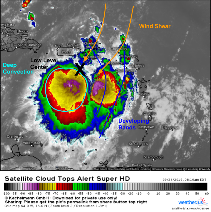
Karen’s satellite appearance has improved significantly over the past 12 hours due to a persistent burst of deep convection near the storm’s center. This activity is still being displaced SW of the low level center due to strong NE wind shear, but the system is overall healthier than it was yesterday. There are even some signs of a few banding features towards the edge of the storm which would be another sign of improved organization if they’re able to persist.
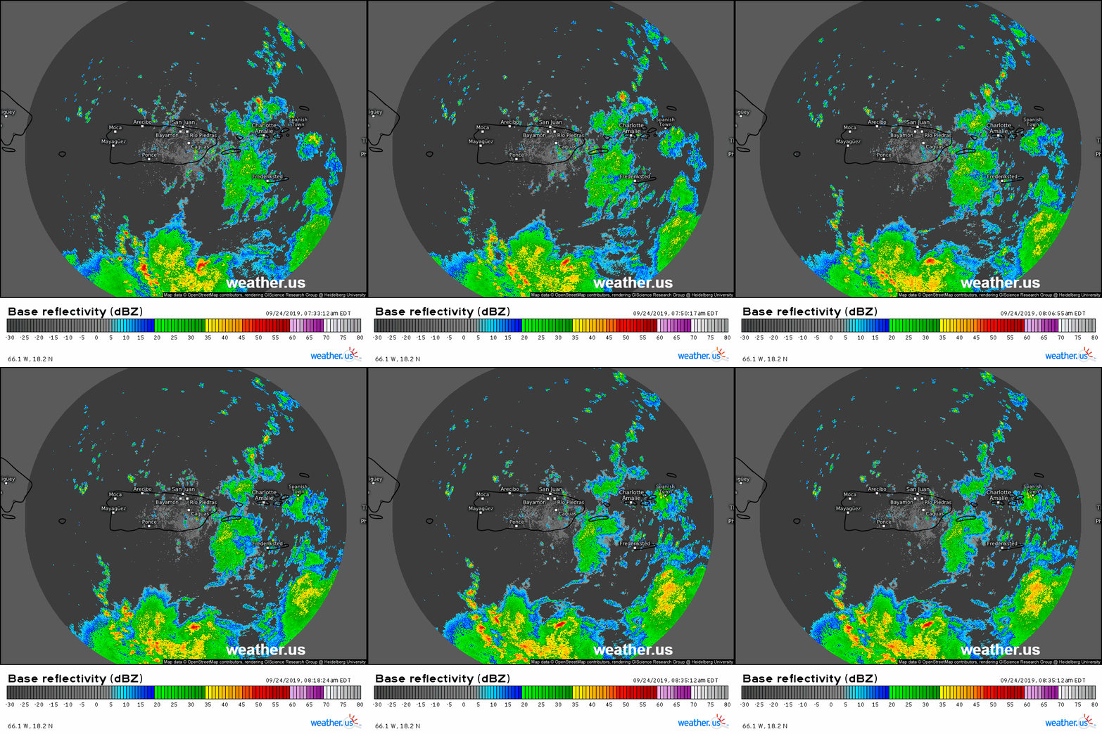
Radar imagery from San Juan shows the northern edge of Karen’s strong thunderstorm activity moving slowly towards Puerto Rico this morning. As these storms arrive today, expect heavy rain and gusty winds. Flash flooding will be a major threat in Puerto Rico as over 6″ of rain is expected to fall in a very short period of time. The worst rains will occur later today into tonight before slowly clearing tomorrow as Karen moves north.
After Karen moves north of Puerto Rico, its future is more uncertain.
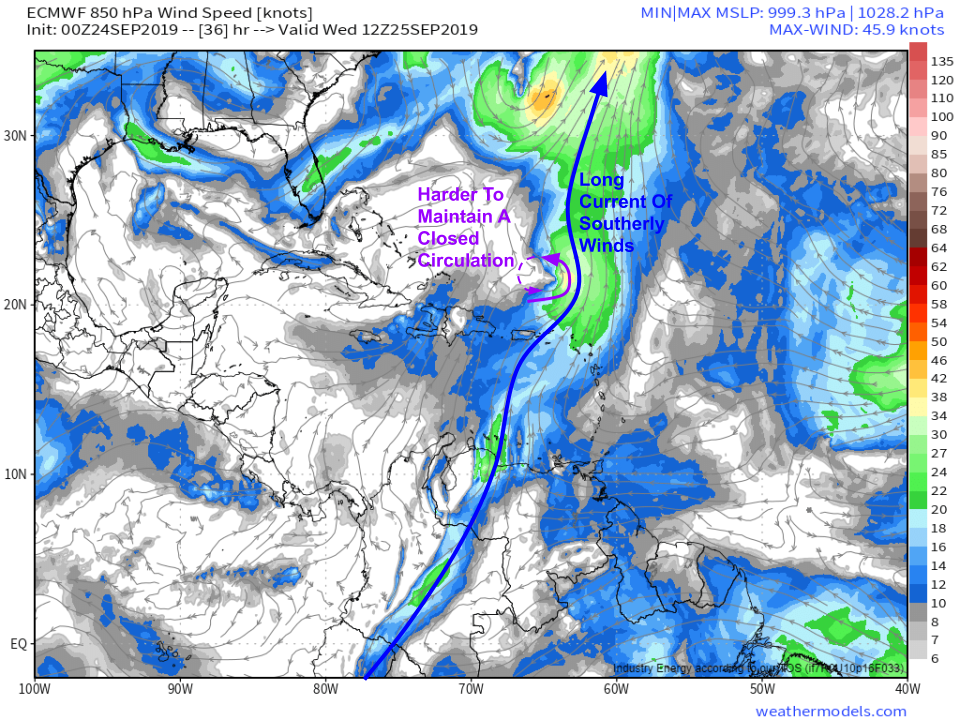
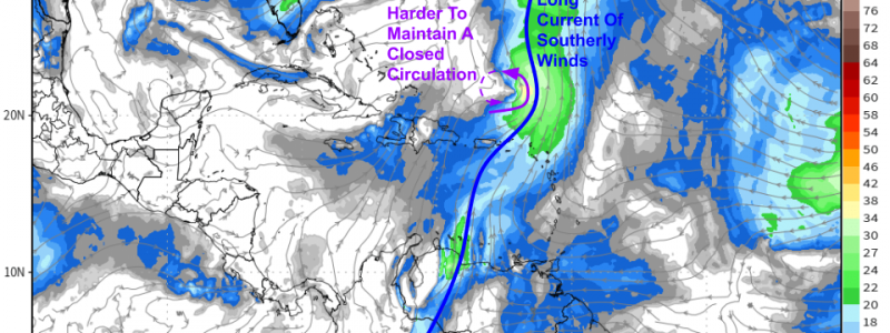
The storm’s circulation will be disrupted as it passes over the island, and this may be enough for the storm to degenerate into an open wave. If Karen remains a tropical cyclone north of Puerto Rico, it will face an uphill battle to maintain a closed circulation as it becomes embedded in a long current of southerly winds beginning in South America and stretching north into TS Jerry’s circulation. As the storm moves north, it will struggle to maintain northerly winds on its western side. All that to say that there’s a very real chance Karen doesn’t survive until the weekend. Map via weathermodels.com.
That being said, if it is able to maintain a center of circulation and some deep convection, the environment over the SW Atlantic will be relatively favorable for intensification.
The wind shear currently plaguing Karen will lessen over the next couple days and upper level winds will begin venting the system tomorrow afternoon/evening. This will attempt to counteract the negative influence of the low level southerly winds mentioned above. It’s hard to figure out exactly how strong each influence will be on Karen’s intensity, but we should know much more tomorrow once the storm has passed over Puerto Rico and gets acquainted with its new environment. Map via weathermodels.com.
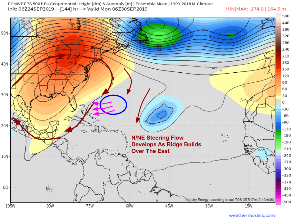
Karen, or whatever is left of Karen, will be located south of Bermuda by this weekend. Its arrival in this area will coincide with the development of a large ridge of high pressure over the Eastern US. This building ridge will turn the large-scale winds steering the storm towards the north/northeast, meaning that Karen is likely to turn towards the W/SW. This turn will be sharper if the storm ends up being stronger. If Karen is a remnant low by this point, it’s possible that it could get caught up in a shallow frontal boundary and move NE into the open Atlantic. Map via weathermodels.com.
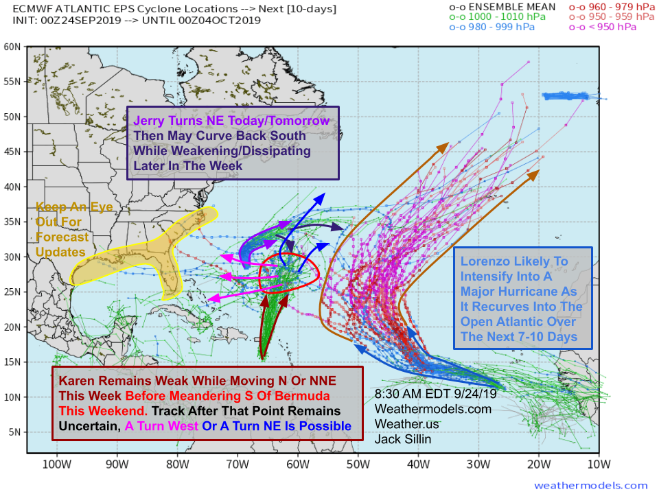
Here’s a look at overnight EPS guidance for the Atlantic basin. The map includes forecast tracks for each of the three active storms Karen, Jerry, and Lorenzo. Jerry is falling apart near Bermuda this morning and won’t bring any impacts to the US. We’ve discussed Karen’s forecast in some detail here, but its long term forecast remains quite uncertain and is quite sensitive to short-term intensity fluctuations. Finally, Lorenzo is gearing up to become a very powerful hurricane which will recurve through the Central Atlantic. Map via weathermodels.com.
I’ll have more updates on Karen as its long term forecast becomes a little clearer over the next few days.
-Jack
