TS Chris To Intensify Off The East Coast This Week, No Direct US Impacts Expected
Hello everyone!
Tropical Storm Chris is spinning just a couple hundred miles southeast of the Outer Banks of North Carolina this morning, and is expected to intensify into a hurricane as it accelerates northeastward over the coming days. An upper level trough will kick the storm out to sea, and no direct impacts are expected for the US East Coast, though high surf will pose a threat indirectly via rip currents. The storm will either make landfall on or pass very close to the east coast of Nova Scotia this coming weekend, bringing rain and wind impacts there.
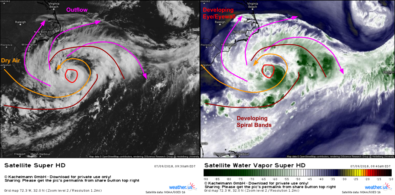
GOES-East satellite imagery this morning shows Chris struggling with some dry air that is getting caught up in the system’s western side. After it enters the circulation, the dry air is getting wrapped around the center, resulting in diminished shower and thunderstorm activity, especially on the storm’s northern side. This dry air also shows up well on WV imagery (right image). Despite the dry air, the storm does have a few things going for it. Outflow has been well established to the north of the storm, and a ring of thunderstorms is trying to build around the storm’s center, forming the beginnings of an eye/eyewall. However, despite these improvements in organization, the storm has a bit more work to do before becoming a hurricane either tonight or tomorrow.
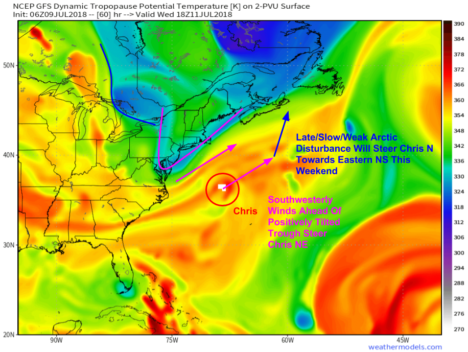
As Chris strengthens, it will cease meandering and begin accelerating off to the northeast. This increase in forward motion will occur in the next couple days as an upper level trough approaches the Northeastern US coastline (purple feature). This trough will be positively tilted, i.e. oriented along a NE-SW axis. Southwesterly winds ahead of this trough will steer Chris off to the Northeast, away from the US coastline. As we move towards the end of the week, a weak Polar/Arctic disturbance will dive into the back side of the trough discussed previously, tipping it a bit more upright (N-S axis). This will result in winds backing to the south ahead of the trough, steering Chris more to the north in the direction of eastern Nova Scotia. Map via weathermodels.com.
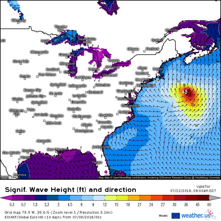
As Chris will move too far offshore to bring direct wind/rain impacts to the US coast, the system’s threat to the US will come in the form of large swells. This map shows the ECMWF’s significant wave forecast for Thursday morning. Note the large swells moving towards the coastline from Florida all the way up to Maine. If you’re headed to the beach in these areas this week, watch for larger than normal waves and stronger than normal rip currents. Be sure you know how to break the grip of the rip if you do venture into the water. If you’re caught in a rip current, always swim parallel to the beach until you’re out of the rip current’s relatively narrow channel, then swim back to shore. Swells will subside this weekend as the storm moves into the Canadian Maritimes.
Elsewhere across the country, coast to coast high pressure is ensuring generally quiet weather with only scattered thunderstorm activity expected each afternoon.
-Jack


