Tropical Storm Hanna Intensifying En Route To Texas, May Become A Hurricane By Tomorrow
Hello everyone!
In my forecast update yesterday, I discussed a few reasons why Tropical Storm Hanna (then Tropical Depression Eight) might end up stronger than originally anticipated. Factors contributing to that forecast included the large upper-level anticyclone located above the storm and very warm waters in the western Gulf of Mexico, over which Hanna is travelling. So far, this forecast has worked out pretty well. The latest advisory from the NHC (as of 4 PM CDT) shows Hanna with maximum sustained winds of 50 mph. This is considerably higher than forecasts by myself and others back on Tuesday/Wednesday were calling for. So what can residents along the Texas coastline expect given Hanna’s newfound strength? This post will outline the forecast for Hanna as it approaches the coastline in the next 18-24 hours.
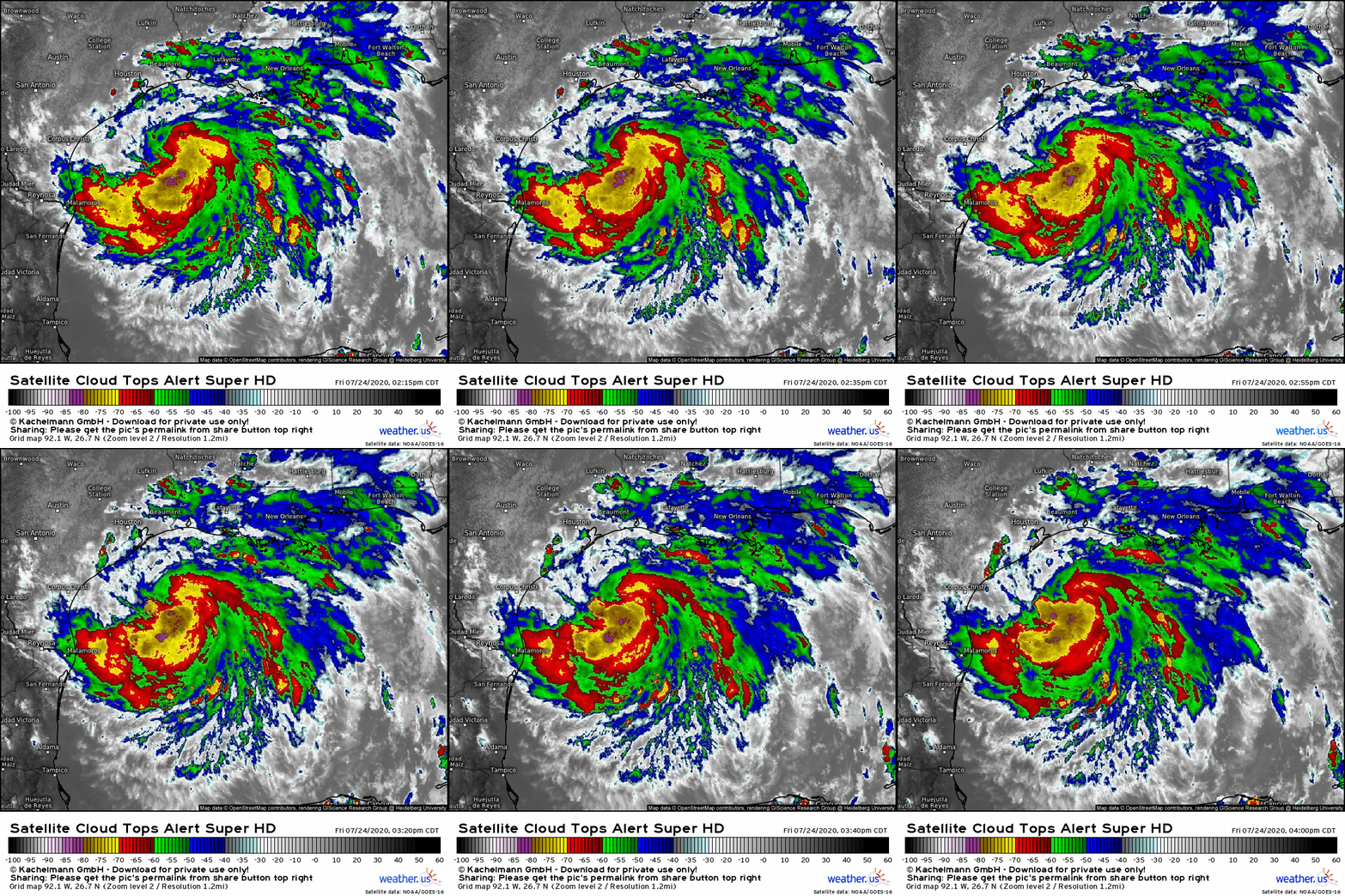
Satellite imagery shows a very healthy Hanna this afternoon as the system drifts slowly west towards Corpus Christi. Much like the past few days, the system is enjoying excellent ventilation in the upper-levels from an area of high pressure located atop the system’s center. This feature is largely responsible for Hanna’s steady development over the past few days despite starting out with a broad center of circulation and relatively meager thunderstorm activity. Hanna has now amassed a consistent and healthy heap of thunderstorms near its center. Cloud tops in these storms are dipping below -80C which is a sign that upward motion in this region is extremely intense. If these thunderstorms are able to organize into an eyewall (seems likely by tonight), Hanna will be able to rapidly intensify.
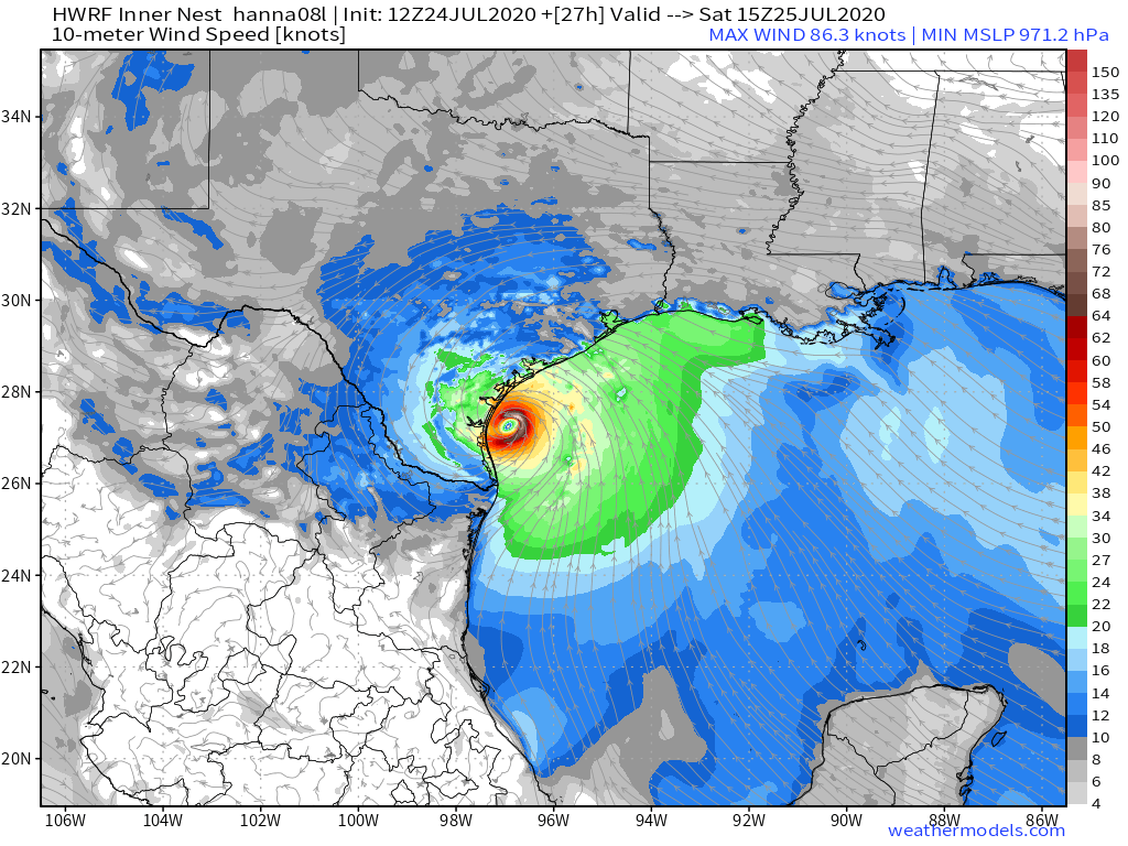
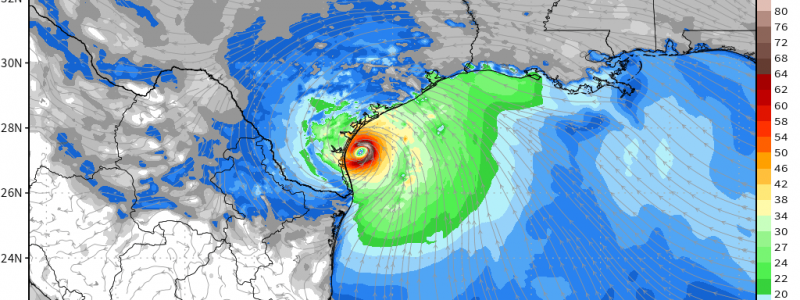
This evolution is forecast by the HWRF (Hurricane-specific version of the Weather Research and Forecasting model) which depicts rapid intensification into a strong category one or weak category two hurricane by the time Hanna nears landfall on the Texas coastline early tomorrow afternoon. I think this represents the higher end of the range of possible outcomes for Hanna, but it certainly can’t be counted out given the system’s structure this afternoon and the environment in which it’s located.
The HWRF usually does a decent job with anticipating tropical cyclone intensities, but it has a bit of a high bias (meaning it often overforecasts how strong a storm will be). While the model output shown here depicts winds of 85 kts, the NHC interpreted that as a forecast supportive of 70 kts. I don’t have the data in front of me to investigate whether that’s a good correction factor, but the scientists at the NHC do have that data somewhere, so I’ll assume it’s a decently accurate estimate.
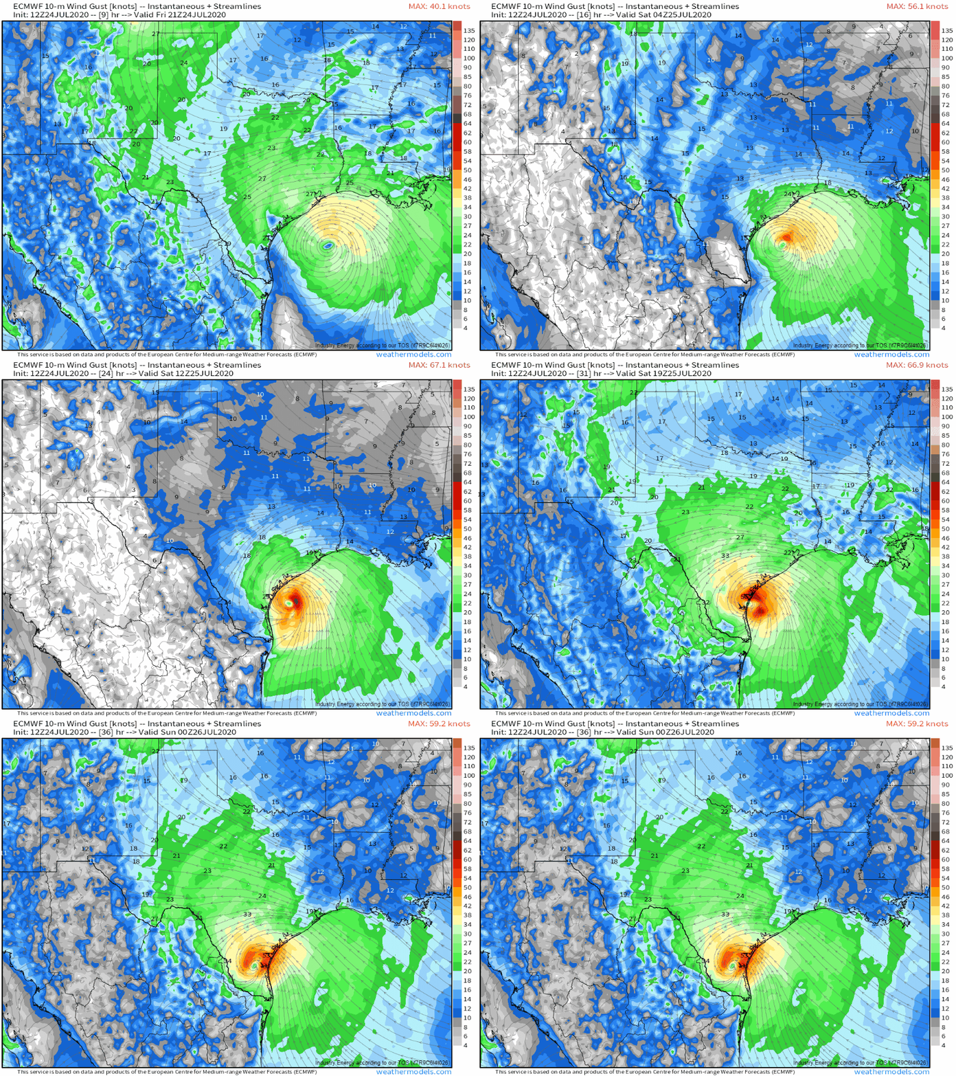
That said, the ECMWF model (shown here) depicts a similar evolution though with slightly lower numbers. At this point, I think there is solid environmental, observational, and model support to say that Hanna will likely be a category one hurricane at landfall on the Texas coastline. If the storm struggles unexpectedly tonight for some reason (dry air blowing into the system’s northwest side for example), I’d set the lower bound of “reasonably possible” outcomes at a strong tropical storm (max winds 55-70 mph). If Hanna can close off an eyewall earlier rather than later tonight and is able to cling to the Gulf of Mexico for a few extra hours tomorrow afternoon, I’d set the upper bound of “reasonably possible” outcomes as a low-end category two hurricane (max winds roughly 100 mph).
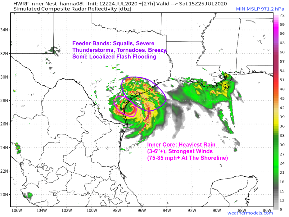
Without offering too much additional commentary on the HWRF’s forecast for Hanna’s landfall intensity, its simulated radar product does a good job highlighting who will see what types of impacts from Hanna as it moves ashore tomorrow. Areas north and east of the center (between Corpus Christi and Houston) will experience Hanna’s outer bands (also known as feeder bands or spiral bands- all equivalent terms). In these bands, expect showery weather along with breezy winds (briefly strong in any severe thunderstorms), localized flash flooding (where individual cells train), and tornadoes. Areas near and just south of Corpus Christi will see Hanna’s inner core. This is where the heaviest rain and strongest winds will be found. Hurricane warnings have been posted for this area, and substantial damage is likely from a combination of storm surge, strong winds, and heavy rain. If you live in this area, you should be heeding the advice of local officials and executing your hurricane preparedness plan.
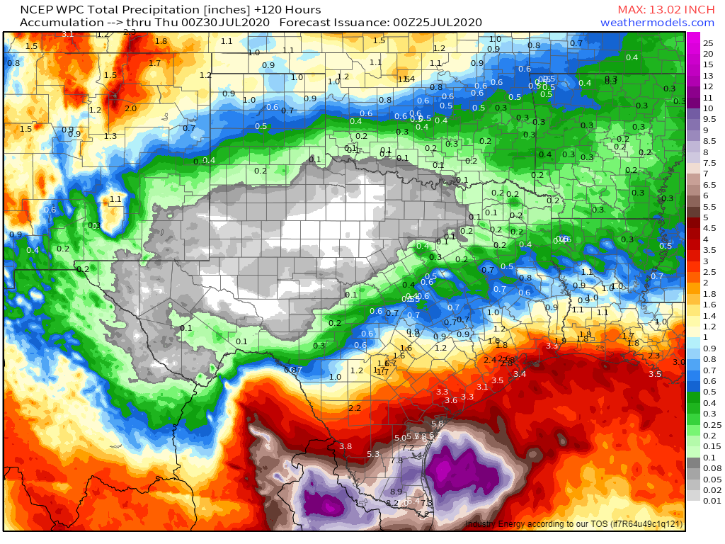
As you head farther inland, heavy rain will become far and away the biggest threat from Hanna. Parts of far southern Texas will exceed a foot of rain as Hanna passes through. This will cause serious flooding issues not just in the usual small streams/poor drainage areas but also along some of the larger rivers. Some areas that don’t usually flood in smaller heavy events will see high water this weekend. Even if you live far from the coastline and are not expecting strong winds or storm surge flooding, you need to be preparing now for flood-related impacts.
Impacts from Hanna will abate by Monday as the system dissipates over the mountains of northern Mexico.
-Jack
