Tropical Disturbance 92L Likely To Impact The Gulf Coast This Week
Hello everyone!
We’re monitoring a potential threat in the tropics this morning that could cause some headaches for the northern Gulf Coast. While the system is little more than an upper level disturbance currently, most forecast model guidance points to the development of some sort of tropical cyclone once the disturbance emerges over the warm waters of the Gulf of Mexico. While it’s too early to say exactly where the eventual system might make landfall, or how strong it might be, it’s worth digging into 92L and what its future might bring to the coastal parts of Texas, Louisiana, Mississippi, Alabama, and Florida over the next few days.
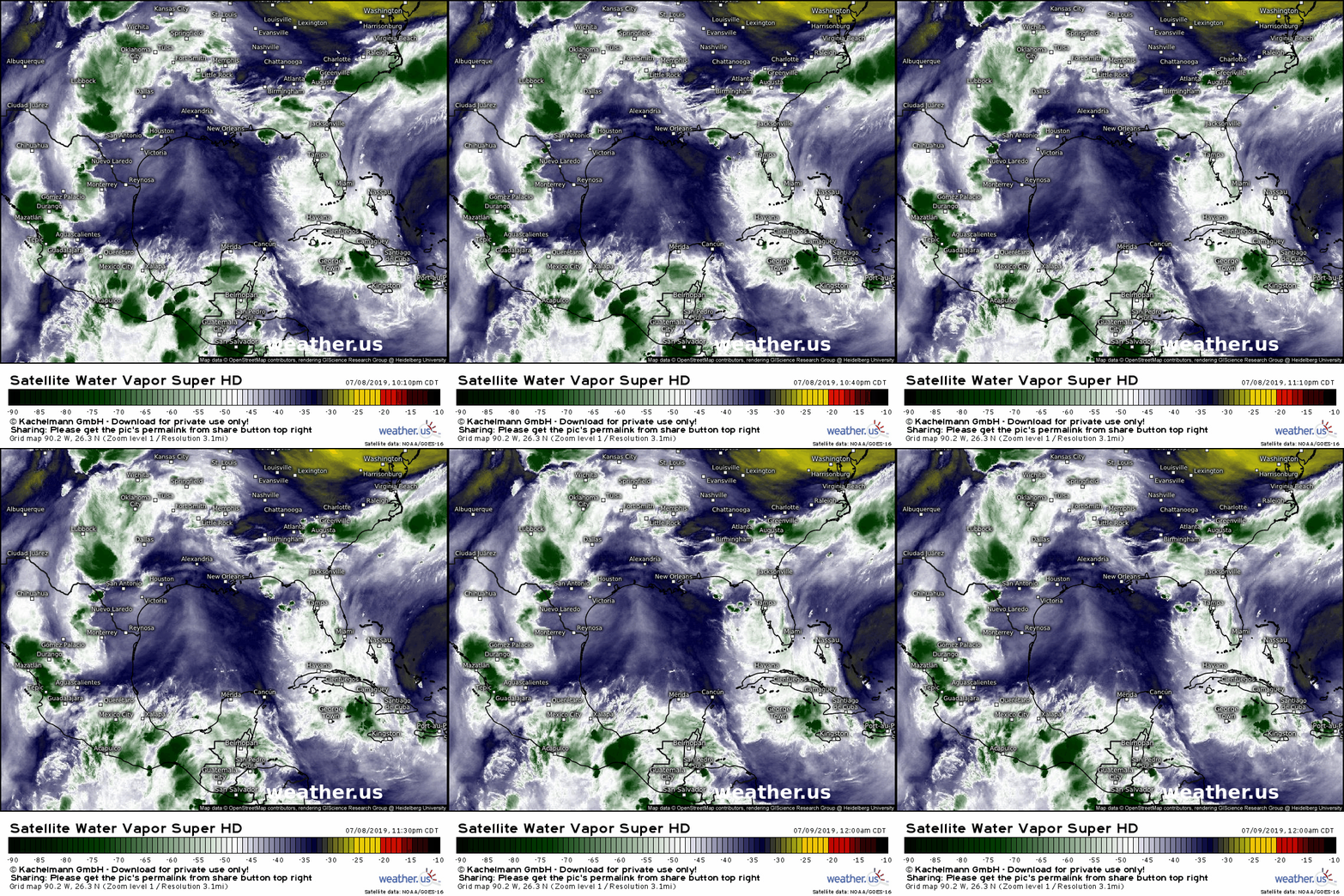
The system right now is anything but impressive. In fact, it takes a bit of time watching this satellite animation to see where it’s located currently. If you focus on the area south of Birmingham Alabama, you’ll see two clusters of thunderstorms. The first is just SE of the city, and the other is in the Gulf of Mexico ESE of New Orleans. In between these storms, you’ll see an area of slight counterclockwise spin if you look closely enough. That’s the upper level disturbance that we’re watching. Given how disorganized the system is now, it will need several days of development before it becomes something impactful.
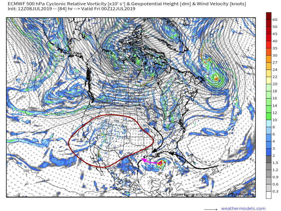
Over the next 2-3 days, a large ridge of high pressure building over the eastern Rockies and western Plains will force the storm south into the Gulf of Mexico. The strength of that high and how solid its eastern periphery is will determine how far south the storm gets pushed. The farther south it goes, the more time it will have over water, and thus the more time it will have to intensify given the presence of other favorable environmental factors such as wind shear and dry air. Map via weathermodels.com.
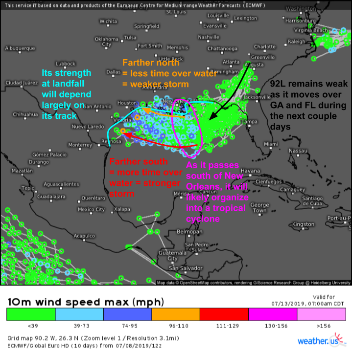
The ECMWF ensemble storm tracks product highlights the general range of possible futures for 92L pretty well. It stays very weak over the next day or two, becoming more organized as it passes south of New Orleans. If it clings to the coastline, we can expect little in the way of wind or storm surge, but lots and lots of rain. If the system gets punted farther south into the Gulf, strong winds and storm surge may become threats in addition to the very heavy rain threat.
If the system does indeed get pushed farther out into the Gulf, what does the environment look like? The short answer is: very favorable for intensification.
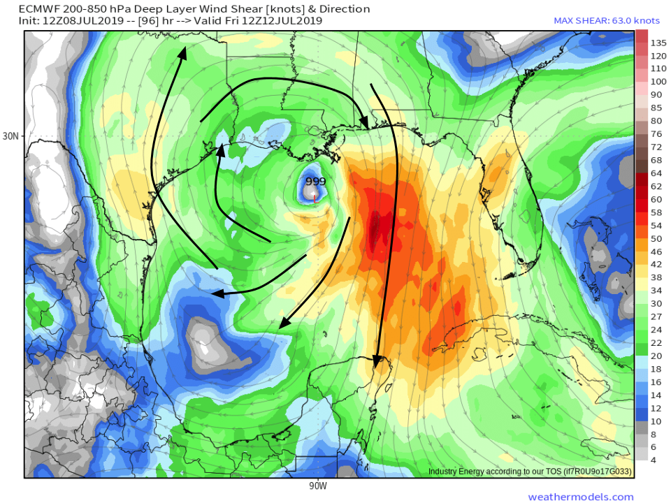
This map shows a parameter known as wind shear, which represents the change of wind speed and direction with height. If shear is high, the thunderstorms in a tropical cyclone’s core will be ripped apart, with the top half zipping off in a completely different direction than the bottom half. Fortunately for 92L, shear is expected to be very light over the storm as it passes south of New Orleans. Additionally, there are hints that an upper level anticyclone (area of high pressure) will develop atop the storm. This feature can be seen in the streamlines around the storm that are moving clockwise (I’ve highlighted the general pattern in black). An upper level anticyclone is very helpful to a developing tropical system, because it acts as a ventilator. All the air that the storm lifts in its thunderstorms’ updrafts needs to go somewhere. The first option is to go back down where it came from. But that would squash the updrafts and kill off the storm. The second option is to move horizontally for a while before sinking back down towards the ground. With the anticyclone pushing winds outwards in all directions from the center of the storm, this process can happen quite easily, and the storm can continue to grow. Map via weathermodels.com.
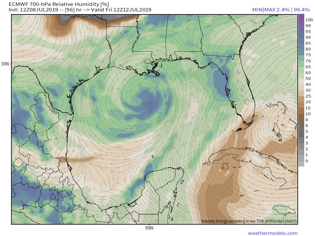
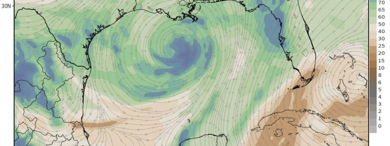
Another possible problem for a tropical cyclone is dry air in the mid levels. Mid level dry air is bad for a storm because it can get entrained into the thunderstorm updrafts. When this happens, some of the water droplets in those updrafts start to evaporate. This evaporation requires some extra energy from the surrounding air to turn the liquid water into the higher-energy gaseous state. The surrounding air is then left at an energy deficit, and its temperature goes down. This cooler air is much heavier than the surrounding warm air, so it begins to sink. When that sinking happens inside a thunderstorm’s updraft, the storm dies off. Do we need to worry about this with 92L? The answer appears to be no. The map above, showing 700mb relative humidity, shows barely any dry air over the Gulf of Mexico when 92L would be strengthening. Map via weathermodels.com.
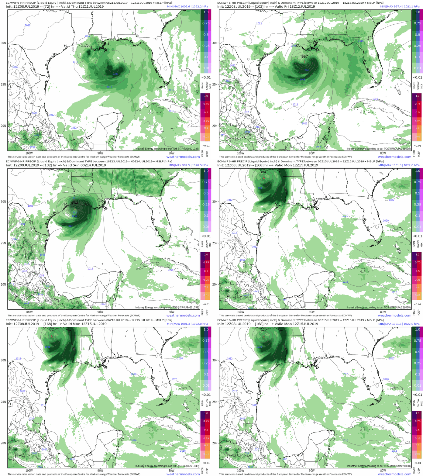
The ECMWF model, shown above, represents what I think is a ‘reasonable worst case scenario’ for 92L. The storm gets pushed well south into the Gulf of Mexico, is able to build an organized structure to take advantage of the favorable environment, and steadily strengthens on approach to the Texas coast. As we’ve seen above, it is certainly possible to get a stronger system out of this setup, but it would require a lot of things to line up just right (or wrong, depending on your perspective). The biggest hurdle I think 92L will face is a lack of organization. Right now this is just a little area of spin in the upper levels. It will need to develop consistent thunderstorm activity then organize those thunderstorms around a center before it can turn into the strong system the ECMWF is predicting. This is an outcome folks in TX/LA need to be prepared for, but shouldn’t be too worried about just yet. GIF via weathermodels.com.
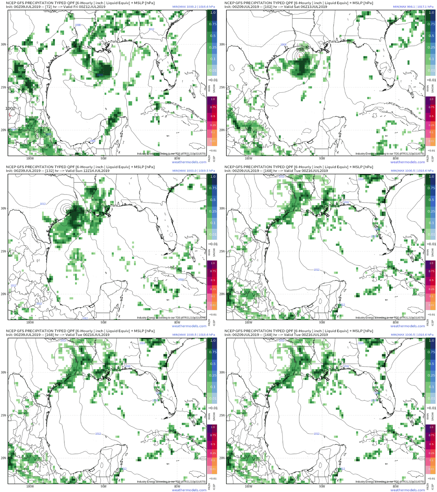
The American GFS model shown here offers a reasonable ‘best case scenario’ for the Gulf Coast. The system stays much farther north, and it struggles to get very organized. Heavy rain would cause flooding problems, but winds would be limited to unusually strong breezes right at the coastline. This is the outcome you’re hoping for if you’re living along the Gulf Coast between roughly Corpus Christi TX and Mobile AL. GIF via weathermodels.com.
As 92L gets closer to development and eventual landfall, you can follow its progress with GOES-East satellite imagery at weather.us. For a tutorial on using the satellite imagery tools we have, please check out this video.
I also recommend looking at our Forecast XL and Forecast Ensemble tools to get a sense of the range of possible outcomes in your town. Each model will have widely varying solutions, as we saw above, but these tools let you compare many models on one graph so that you can see what a reasonable best case and reasonable worst case scenario might be for your location. Tutorials on Forecast XL and Forecast Ensemble are also available if you’re looking for more information.
Follow us on twitter @WeatherdotUS for more updates in the coming days.
-Jack
