Tropical Depression Likely To Form In The Caribbean This Weekend, Could Move North Next Week
Hello everyone!
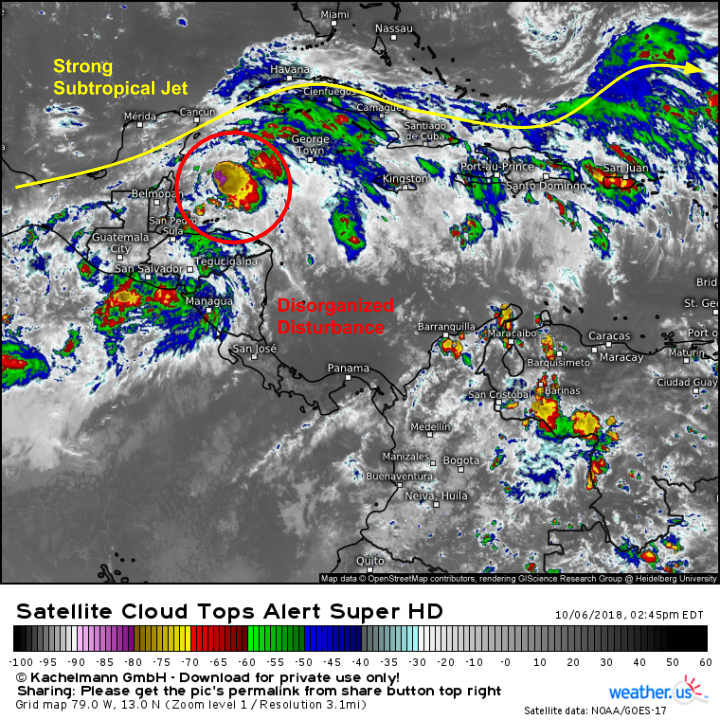
A tropical disturbance in the northwestern Caribbean is producing an area of disorganized showers and thunderstorms this afternoon. This disturbance is likely to organize into a tropical depression later tonight or tomorrow, and will begin drifting slowly north. As the system moves north into the Gulf of Mexico, it is likely to strengthen into a tropical storm. However, a strong subtropical jet will keep the storm’s intensity in check, at least during the first part of its life. This jet will mean that while a tropical cyclone of some sort is likely to landfall somewhere on the Northern Gulf Coast next week, it’s very very unlikely to be a major hurricane.
Here’s a look at the disturbance as seen by satellite imagery this afternoon. The area of thunderstorms near the center, while momentarily impressive, has yet to sustain itself, which is part of why development of the system as a whole thus far has been fairly slow. Looped satellite imagery shows very fast cloud movement on the northern edge of the system, which indicates the presence of that strong upper level jet. Keep watching satellite loops in the days to come to monitor the development of the system, and the evolution of that jet.
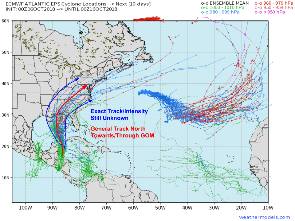
EPS ensemble data show this disturbance moving north into the Gulf of Mexico this week, with high confidence in the overall track/intensity idea. However there’s low confidence regarding the specifics of the forecast for track and intensity. It’s possible that the system is able to carve out a relatively-shearless pocket in the upper level flow, and might strengthen a little bit more. Or the jet could be a little on the stronger side, in which case the system might strengthen a little bit less. Small changes in the upper level pattern could also result in slight changes to the track, though the ensemble data points fairly clearly to impacts somewhere on the Northern Gulf Coast. Map via weathermodels.com.
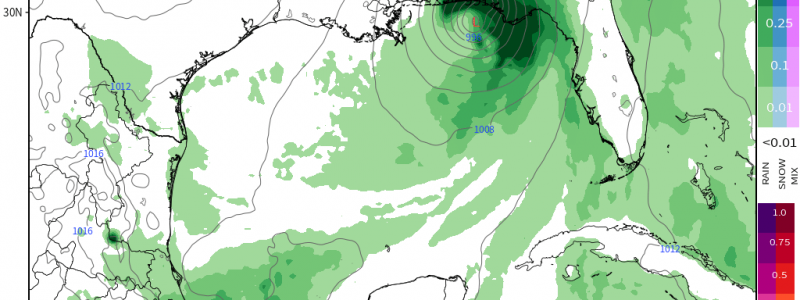
In terms of impacts, those from this system don’t appear to be all that intense. Heavy rain will accompany the system, as will some gusty winds. With shear expected to keep a lid on the storm’s maximum intensity, and forward motion expected to be steady, both rain and wind look to be off “nuisance” level impacts. Of course, that could change, with either a burst of intensification or a localized “training” setup in the storm’s outer bands, which would result in locally higher wind and rain respectively. The training of storm cells in the outer bands leading to locally impactful flash flooding is definitely the most likely impact, though we’ll be watching to see how the shear setup pans out, and if the potential does exist for some stronger winds. Map via weathermodels.com.
I’ll have more updates in the coming days, both here and on twitter (@WeatherdotUS/@JackSillin)
-Jack


