Tropical Cyclones 101: What Is The Saharan Air Layer (SAL) And What Impact Does It Have On Tropical Cyclone Activity?
Hello everyone!
The 2020 Atlantic Hurricane Season is now officially underway (as of June 1st) which means that it’s a great time to brush up on your knowledge of tropical cyclones. The more familiar you are with these systems and how they work, the better prepared you’ll be to follow along with forecast discussions when a tropical cyclone approaches the coastline. This is the fifth in a several-part series (“Tropical Cyclones 101”) aimed at bringing everyone up to speed on what tropical cyclones are, how they work, and how you should prepare for their impacts. This post will discuss the Saharan Air Layer and why it’s important to tropical cyclone forecasting.
The Saharan Air Layer (often abbreviated as SAL) is an airmass (layer of air) that originates over the Sahara Desert in Africa and moves west across the Atlantic. Because this airmass begins its life over the Sahara Desert, it is extremely hot and extremely dry.
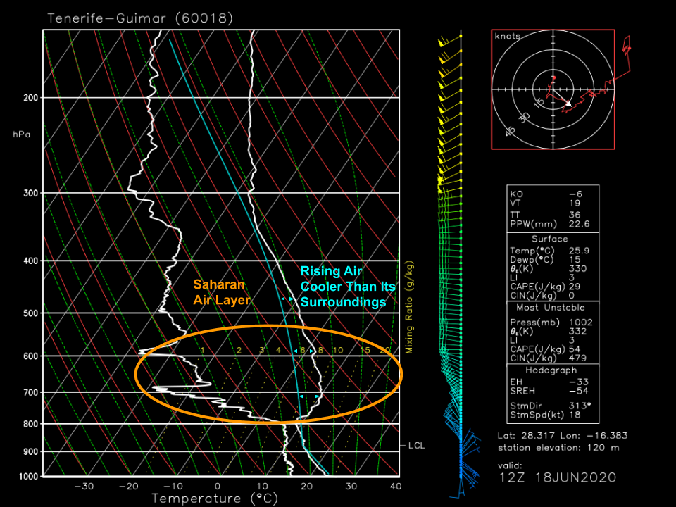 We can get a sense of this by looking at a sounding from the Canary Islands during a major SAL outbreak. Note the layer of very warm and very dry air beginning around 800mb and extending at least to 300mb. This is air that moved off the Sahara in the days prior to when this sounding was taken. Because the Saharan airmass has been “modified” near the surface by the relatively cooler (but still quite warm!) waters of the Atlantic, the core of the SAL is located in the mid-levels of the atmosphere starting around 800mb.
The primary reason we care about the SAL is that it is excellent at preventing the development of tropical cyclones. This is because it’s nearly impossible for thunderstorms to develop within the SAL, and when SAL air is ingested by existing thunderstorms, they have a tendency to rapidly collapse. Thunderstorms can’t form in the SAL because the mid-level warmth associated with this airmass means that rising air parcels will be cooler than their environment as they rise past 800mb (approximately). As a result, this airmass is very stable.
The SAL doesn’t just prevent the development of new thunderstorms, it can easily cause well-established thunderstorms or even entire tropical cyclones to collapse. How does that work? Remember the SAL is not just hot (that contributes to the stability) but also very dry. When dry air gets entrained into thunderstorms, water droplets in the storms begin to evaporate. That evaporation pulls energy out of the air and into the water (for the phase change to occur) which then leaves the air cooler than it was before. This newly cold air is now quite dense, and will begin to sink. This process shuts down thunderstorm updrafts and turns them into downdrafts, often quite rapidly. If the SAL gets ingested into the circulation of a tropical cyclone, the dry air can quickly infiltrate the entire system, shutting down the updrafts in just a couple hours. What was once a powerful hurricane can then easily be reduced to nothing more than a “naked” swirl of low-level clouds.
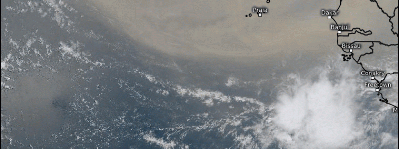
So how do we track the SAL? Without a network of upper air stations scattered throughout the Atlantic, we can’t easily pinpoint regions of warm/dry air in the mid-levels (WV satellite imagery helps, but is too focused higher in the atmosphere). Thankfully, the origin of this airmass over a desert means that we have a helpful indicator to see where the SAL is and where it’s headed: dust. The same winds that blow this hot air from the Sahara Desert out into the Atlantic also pick up plenty of dust and sand from the desert. That dust and sand is lofted into the atmosphere where it can remain for over a week as the dry air moves west.
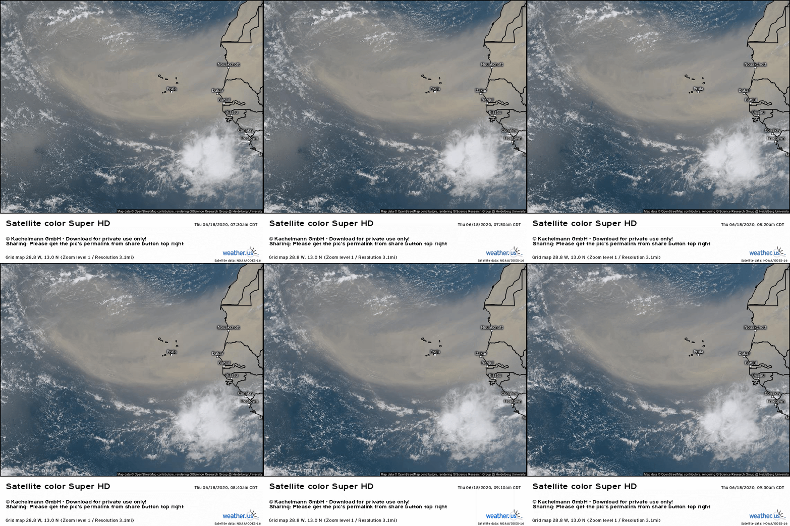
This cloud of dust is clearly evident on visible satellite imagery which is the best tool we have to track the current location of the SAL. 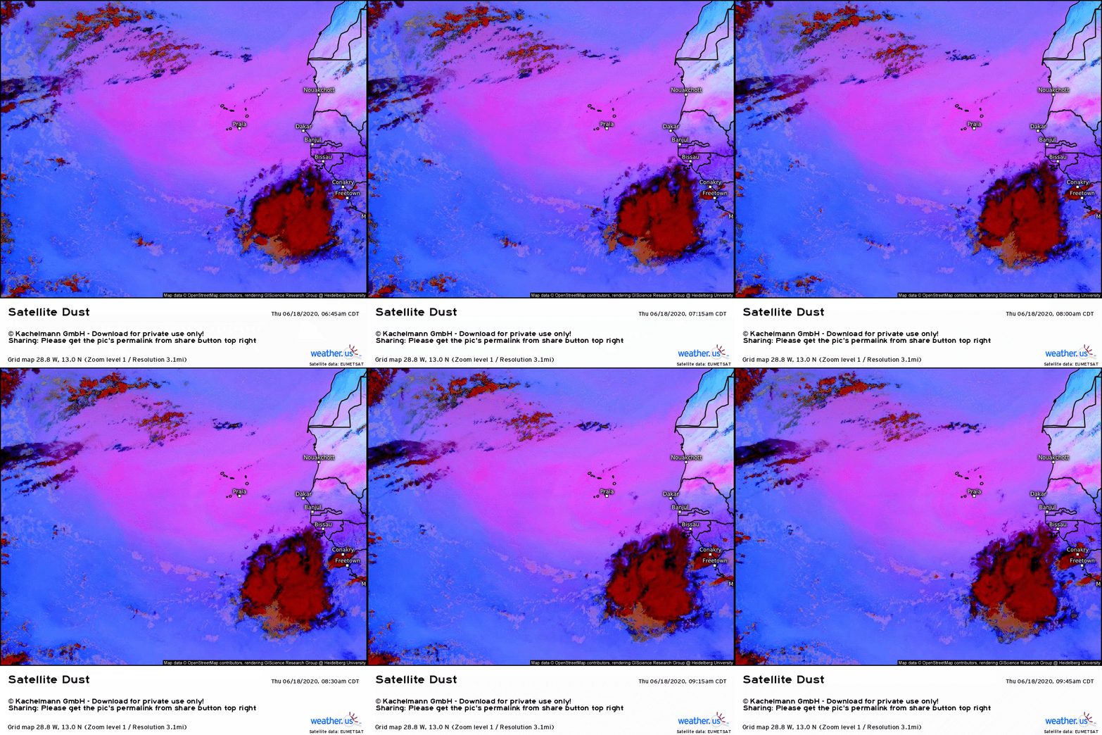
The EUMETSAT satellites also have a “dust detection” product that lets you follow along with the SAL at night when visible imagery isn’t available. Dust appears as various shades of pink depending on its concentration (brighter pink = more dust).
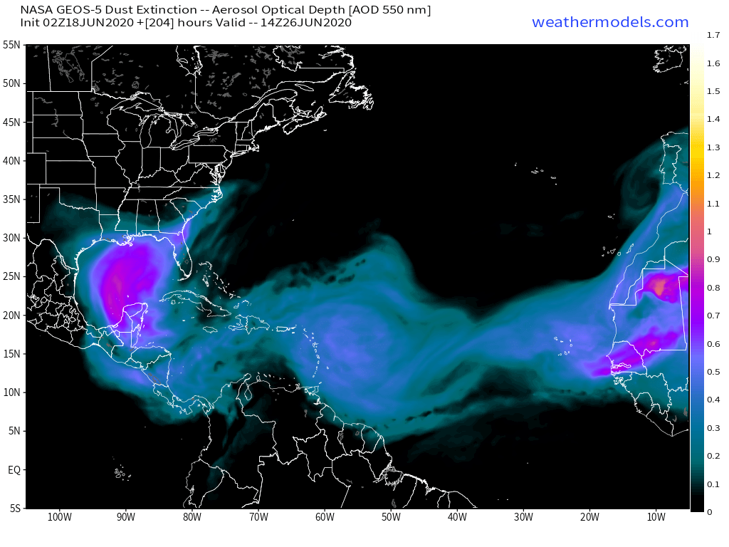
Because dust is also a parameter forecast by model guidance, we can also track the movement of the SAL into the future.
This forecast, for example, shows three plumes of dust (known as SAL outbreaks) in the Atlantic. The first has made it all the way to the Gulf of Mexico and is quite intense. The second is a bit weaker as it approaches the Lesser Antilles. The third is smaller but a bit stronger near the Cabo Verde islands. You can find dust forecasts either at weathermodels.com or at weather.us.
SAL outbreaks are fairly common early in the Atlantic hurricane season but typically begin tapering off in August.
-Jack
