Tropical Atlantic Begins To Heat Up: TD 7 Becomes TS Gonzalo, Next Wave Emerging Off Africa May Pose Longer-Term Threat
Hello everyone!
The 2020 Atlantic Hurricane season has gotten off to an extremely active start if you count by number of named storms, but certainly not if you count by the total amount of energy produced by those storms. In other words, up until this point in the season, we’ve seen many tropical/subtropical storms that are weak and short-lived. Alberto and Fay brought heavy rain and breezy conditions to parts of the East Coast and Cristobal caused some moderate flooding as it moved ashore in Louisiana, but so far our tropical systems haven’t been particularly impactful. Unfortunately, we’re just now starting to move into the part of the season where conditions become more favorable for stronger and more impactful storms.
As I write this on July 22nd, there are three systems to keep an eye on in the tropical Atlantic. In order from west to east, these are 91L (a tropical wave in the Gulf of Mexico), TS Gonzalo (located east of the Lesser Antilles), and a yet-un-designated tropical wave over Africa. This post will discuss the forecast for Gonzalo and the next African wave which will emerge into the Atlantic this weekend. For details on 91L and its impacts on Texas, please click here.
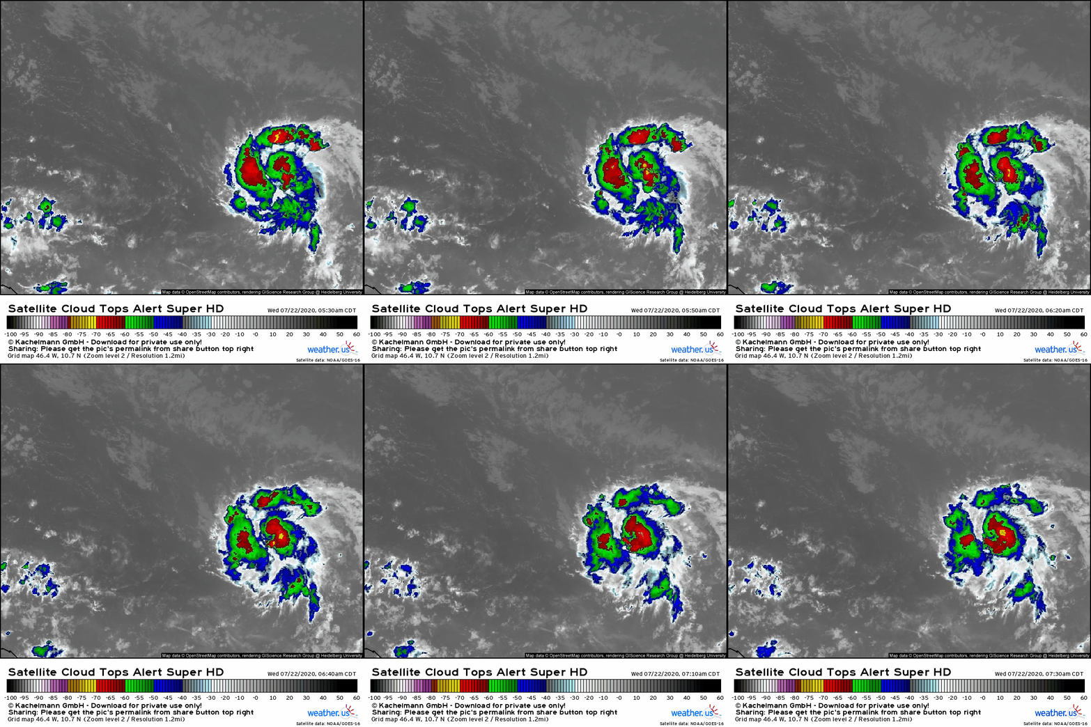
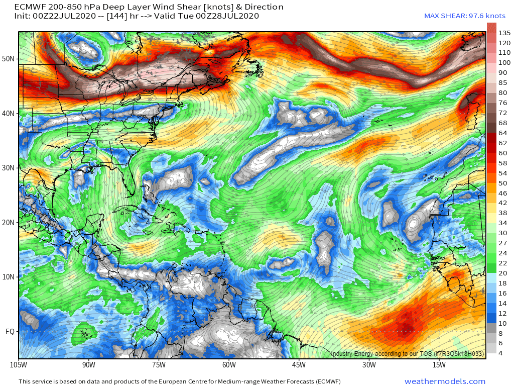
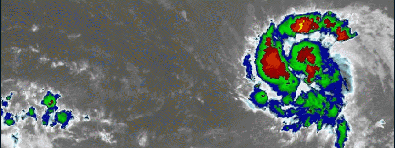
Gonzalo is looking quite healthy on satellite imagery this morning. The system has a persistent Central Dense Overcast (CDO) and a nascent spiral band along its northern/western flank. Looking at the system’s upper-level cirrus outflow, it is unimpeded and curving clockwise which indicates that an upper-level anticyclone is present over the system. That will keep Gonzalo insulated from the detrimental effects of wind shear.
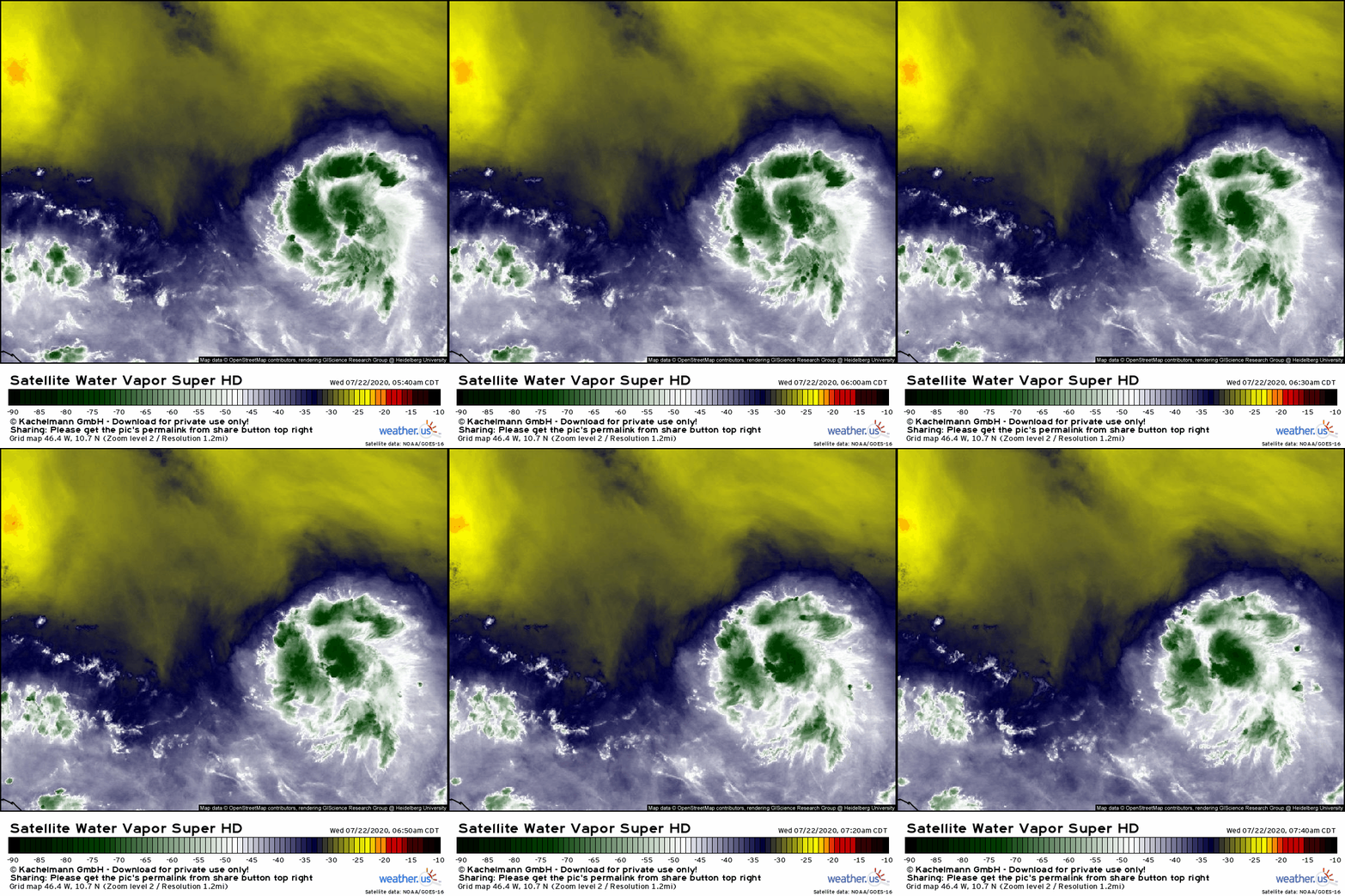
By far Gonzalo’s biggest challenge will be overcoming the large dry airmass to its north, seen here on WV satellite imagery. The system has been carving out a small envelope of favorable moisture on the southern edge of this dry airmass, but if that dry air can work its way into the system’s circulation, it will be hard for such a small system to survive.
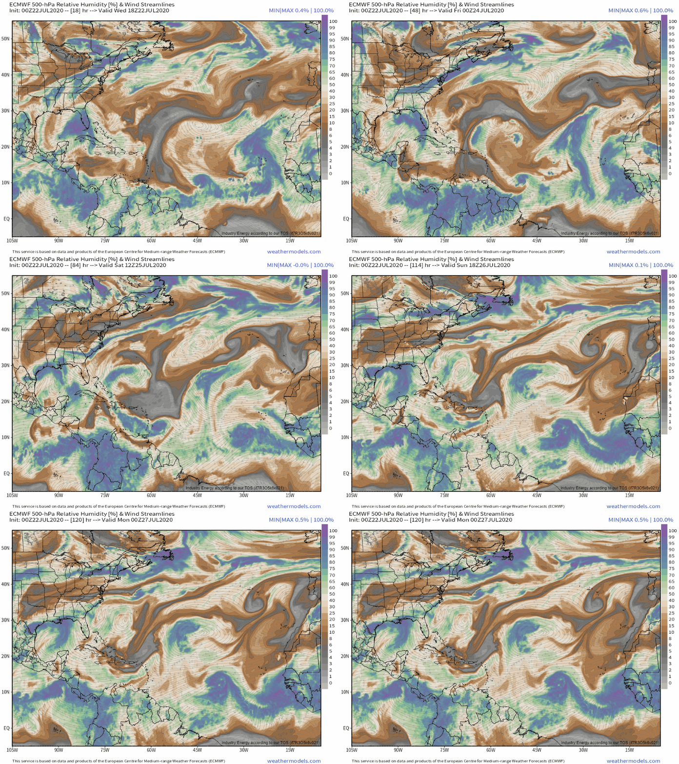
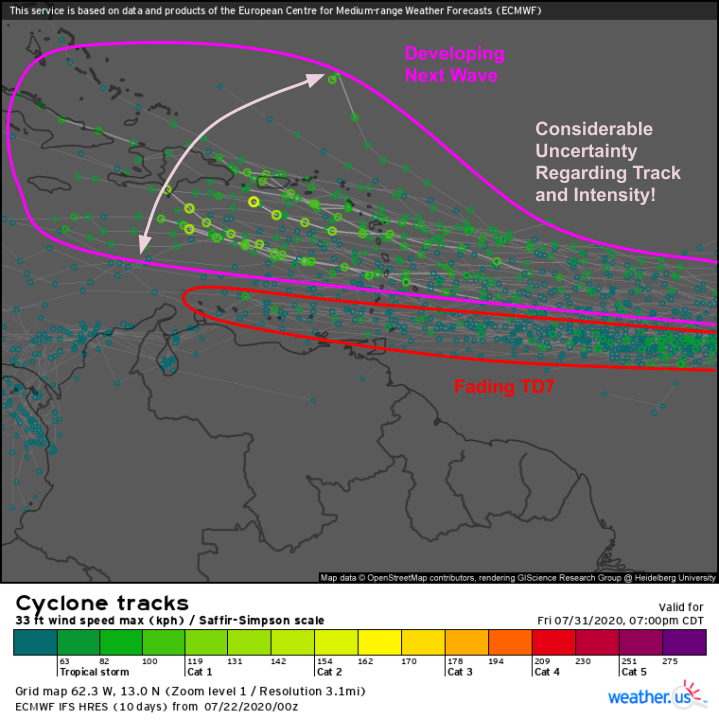
While Gonzalo may be able to hold the dry air at bay in the short term (next 48-72 hours), a surge of dry air dropping south from the Central Atlantic will pose a much bigger challenge to the storm by this weekend. Most global model guidance suggests that as Gonzalo interacts with that plume of dry air, it will dissipate while crossing the Lesser Antilles. That said, Gonzalo appears poised to undergo a period of rapid intensification over the next 24-36 hours based on its environmental conditions. A stronger storm is more resilient to hostile environmental conditions. So if Gonzalo ends up becoming a strong TS or hurricane before it arrives in the islands, it could hold its own against the surge of dry air, and remain a coherent entity as it enters the Caribbean. Given that such long-term forecasts are so sensitive to the near-term intensity forecast (which is quite uncertain), I’m not sure there’s much else to say about Gonzalo’s long-term future at the moment. If Gonzalo were to remain a coherent entity as it moves through the Caribbean, it would arrive near the Yucatan in about 10 days. What happens after that is anyone’s guess, but at the moment, the plausible scenarios with US impacts from Gonzalo are far outnumbered by those where this is nothing to worry about outside the Caribbean islands.
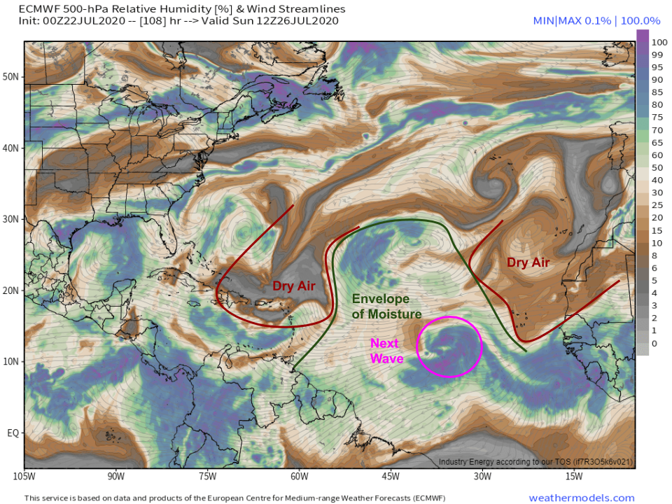
The next wave to watch will emerge off the African coastline on Friday and will be moving through the middle of the Atlantic by Sunday. Personally, this is the tropical system I’m most interested in over the next two weeks. The biggest impediment to tropical systems developing in the main development region (MDR, located between the Lesser Antilles and Africa) this time of year is dry air streaming off of Africa. This wave seems likely to be timed perfectly between surges of dry air. If it’s able to remain within this envelope of moisture, it will have a much easier time developing than Gonzalo.
By Monday, this system will be about three quarters of the way across the Atlantic, located within an envelope of favorable moisture and directly under an upper-level anticyclone (pictured here east of Barbados). Water temperatures in this region are plenty warm enough to support tropical cyclone development. With that in mind, I think this wave should have little trouble becoming our next named storm by the time it approaches the Antilles in the middle of next week.
This is consistent with EPS guidance which is fairly bullish on development chances for the next wave. I think at this point, we can say with fairly high confidence that we’ll be looking at Hanna or Isaias (depending on if 91L is named) by the end of next week. What happens after that is quite uncertain, both with regards to track and intensity.
I’ll be watching both Gonzalo and this next wave carefully over the next week(s) and will let you know if at any point either system becomes a threat to the US.
-Jack
