Tropical Atlantic Begins To Heat Up: Invest 91L Likely To Bring Heavy Rain To Texas This Week
Hello everyone!
The 2020 Atlantic Hurricane season has gotten off to an extremely active start if you count by number of named storms, but certainly not if you count by the total amount of energy produced by those storms. In other words, up until this point in the season, we’ve seen many tropical/subtropical storms that are weak and short-lived. Alberto and Fay brought heavy rain and breezy conditions to parts of the East Coast and Cristobal caused some moderate flooding as it moved ashore in Louisiana, but so far our tropical systems haven’t been particularly impactful. Unfortunately, we’re just now starting to move into the part of the season where conditions become more favorable for stronger and more impactful storms.
As I write this on July 22nd, there are three systems to keep an eye on in the tropical Atlantic. In order from west to east, these are 91L (a tropical wave in the Gulf of Mexico), TS Gonzalo (located east of the Lesser Antilles), and a yet-un-designated tropical wave over Africa. This post will discuss the forecast for 91L as it approaches the Texas coastline later this week. For an update on Gonzalo and the next African wave, please click here.
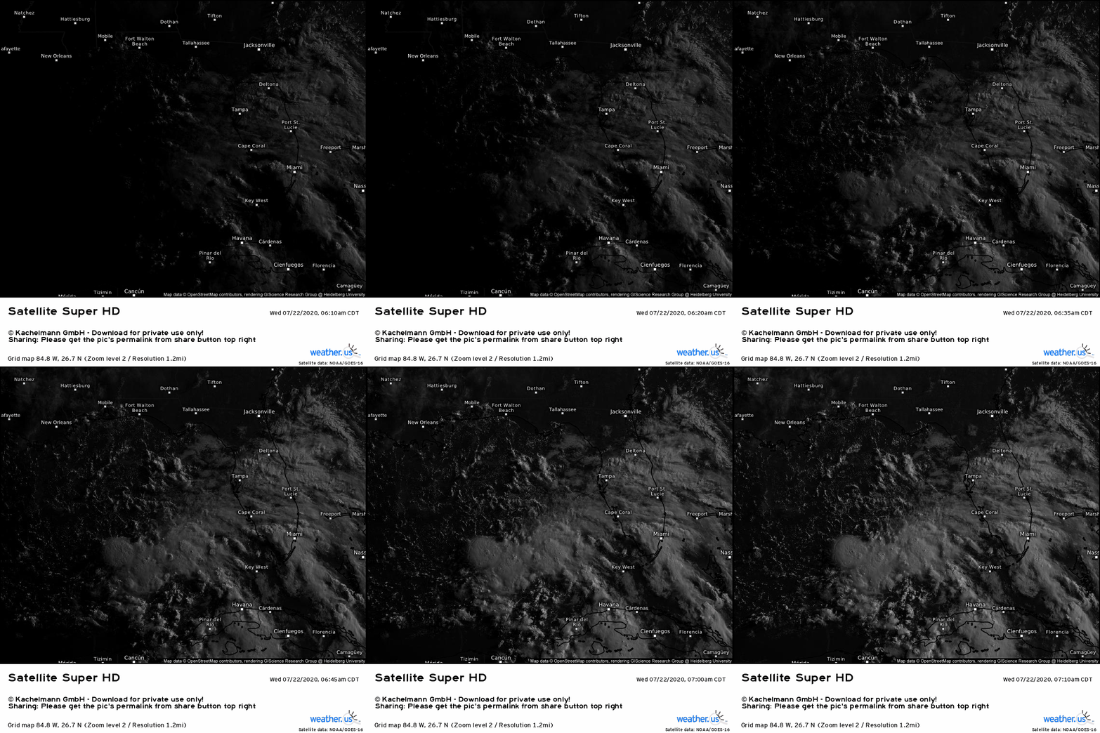
91L is seen here on GOES-East visible satellite imagery SW of Florida. The system has no well-defined center of circulation, but its thunderstorm activity appears concentrated several hundred miles SW of Tampa. If you look closely, you’ll see cirrus clouds blowing off the top of these thunderstorms moving in a subtle clockwise pattern. On the western side of the system, these clouds are drifting west/northwest. Over Florida, these clouds are drifting east/southeast. This upper-level anticyclone will help 91L continue to organize as it drifts NW over the next couple days by keeping shear low and helping “vent” the system in the upper levels of the atmosphere.
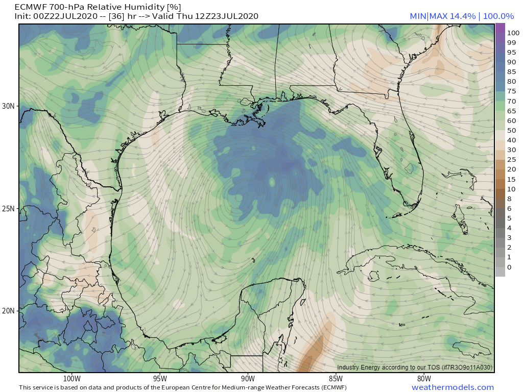
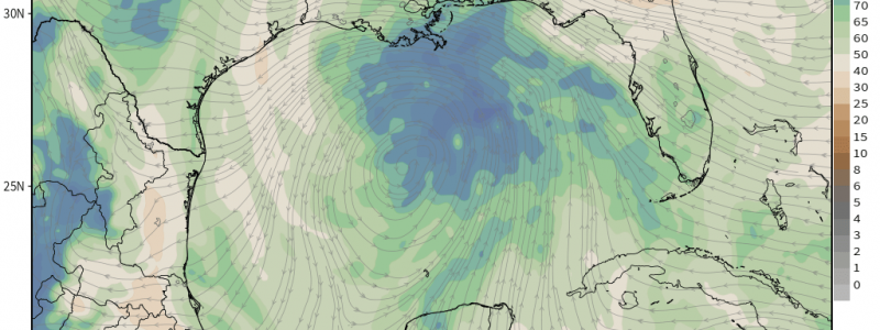
There’s virtually no dry air to speak of in the vicinity of 91L as it moves through the Gulf over the next few days as shown by this 700mb RH plot. With a nearly-unlimited supply of warm water, 91L will be limited primarily by its own disorganization and lack of time over water. The system has about 72 more hours over the Gulf before it moves onshore late Friday night or early Saturday morning. Given that it will take most of today (and perhaps tonight) to develop a coherent center of circulation (if that even occurs at all), I don’t see 91L becoming very strong before landfall.
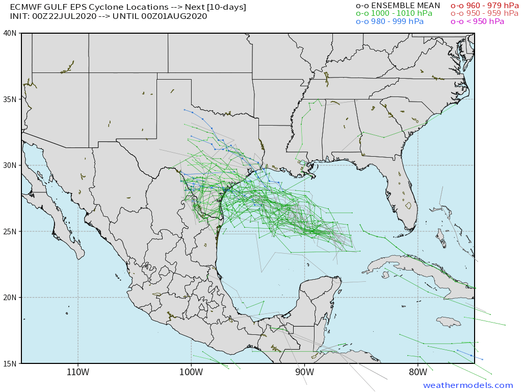
This is consistent with EPS guidance shown here which suggests that while 91L could develop into a weak or moderately strong TS, that’s pretty much the upper limit on its potential intensity even if it is able to develop into a tropical cyclone with a consolidated center of circulation. Residents along the TX coastline shouldn’t be too worried about strong winds from 91L. The main threat will be heavy rain.
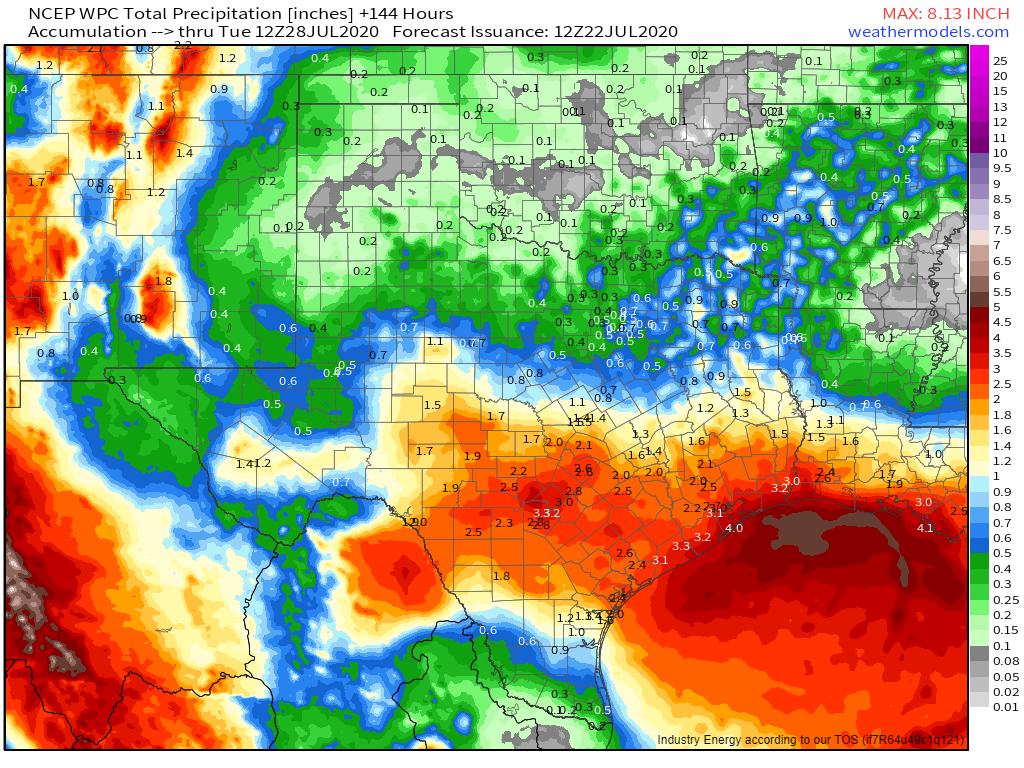
WPC guidance (a mix of computer models and human forecaster input) suggests widespread 2-4″ rainfall totals from coastal Louisiana into interior southern Texas. Some towns will higher totals (6″+) where individual thunderstorm cells linger for a prolonged time. Unfortunately, there’s no way of predicting which towns those might be ahead of time. If you live in coastal TX or interior southern TX (San Antonio/Austin included) and your area is susceptible to flooding, you should start making preparations for high water. The usual low-lying/poor-drainage spots will be most at-risk. At the moment. major river flooding is not expected though smaller streams will likely approach or burst their banks.
Curious how much rain might fall in your town? Check out our Forecast Ensemble tool which is designed to let you see the full range of possible outcomes (most likely, worst-case and best-case scenarios).
The heavy rain threat is present regardless of if this system eventually gets named. Remember that tropical cyclones are classified and named based on a set of criteria that do not include rainfall. Thus this system’s classification (tropical wave/depression/storm) won’t give you much if any information about the level of threat posed because the primary threat from a system like this is rain not wind. Focus on the impacts not the classification! Curious to read more about how tropical cyclones are classified/named? Check out the installment of our Tropical Cyclones 101 series that explains just that.
-Jack
