Thunderstorms To Bring Flash Flooding Concerns To Parts Of The Gulf Coast Today
Hello everyone!
Today’s most active weather will be found across parts of the Gulf Coast as showers and thunderstorms bring heavy rain and the threat for some flash flooding.
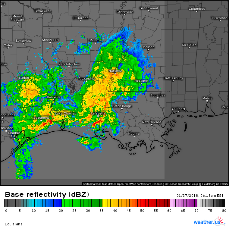
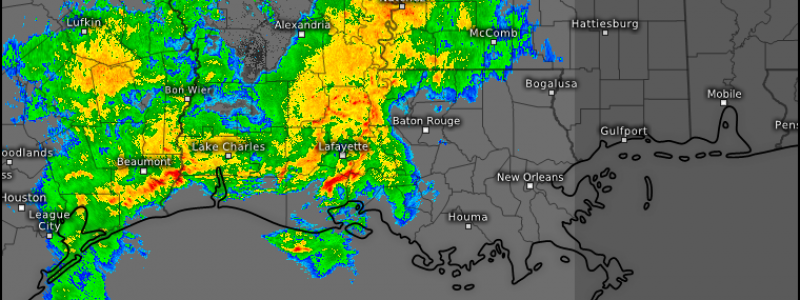
HD radar imagery from Louisiana shows strong thunderstorm activity already ongoing, with several cores of extremely intense rain surrounded by a broader swath of moderate rain. In an environment of weak steering currents, there won’t be much to move these storms along, and storms with that much heavy rain lingering for too long is a recipe for flooding concerns. Remember that you can click the map to zoom our HD radar products into county level for an even more detailed look at individual storm cells.
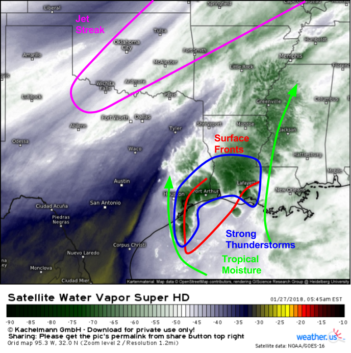
Water Vapor satellite imagery (what’s that?) shows some of the key components behind the storms. We have deep tropical moisture returning north around the western side of strong high pressure near Bermuda. This moisture laden flow is running into a jumbled mess of weak surface features in the SE TX-SW LA area, resulting in rising motion. This rising motion is accentuated by the presence of a jet streak to the NW of the frontal structures. The area is in the right entrance region of that jet streak, an area favored for rising motion. It’s no surprise then with fuel, and plenty of rising motion, that thunderstorms are developing. There’s very little in the way of shear, so severe weather isn’t expected, but the lack of shear is what will drive the flash flood threat with storms training and lingering over the same areas for extended periods of time.
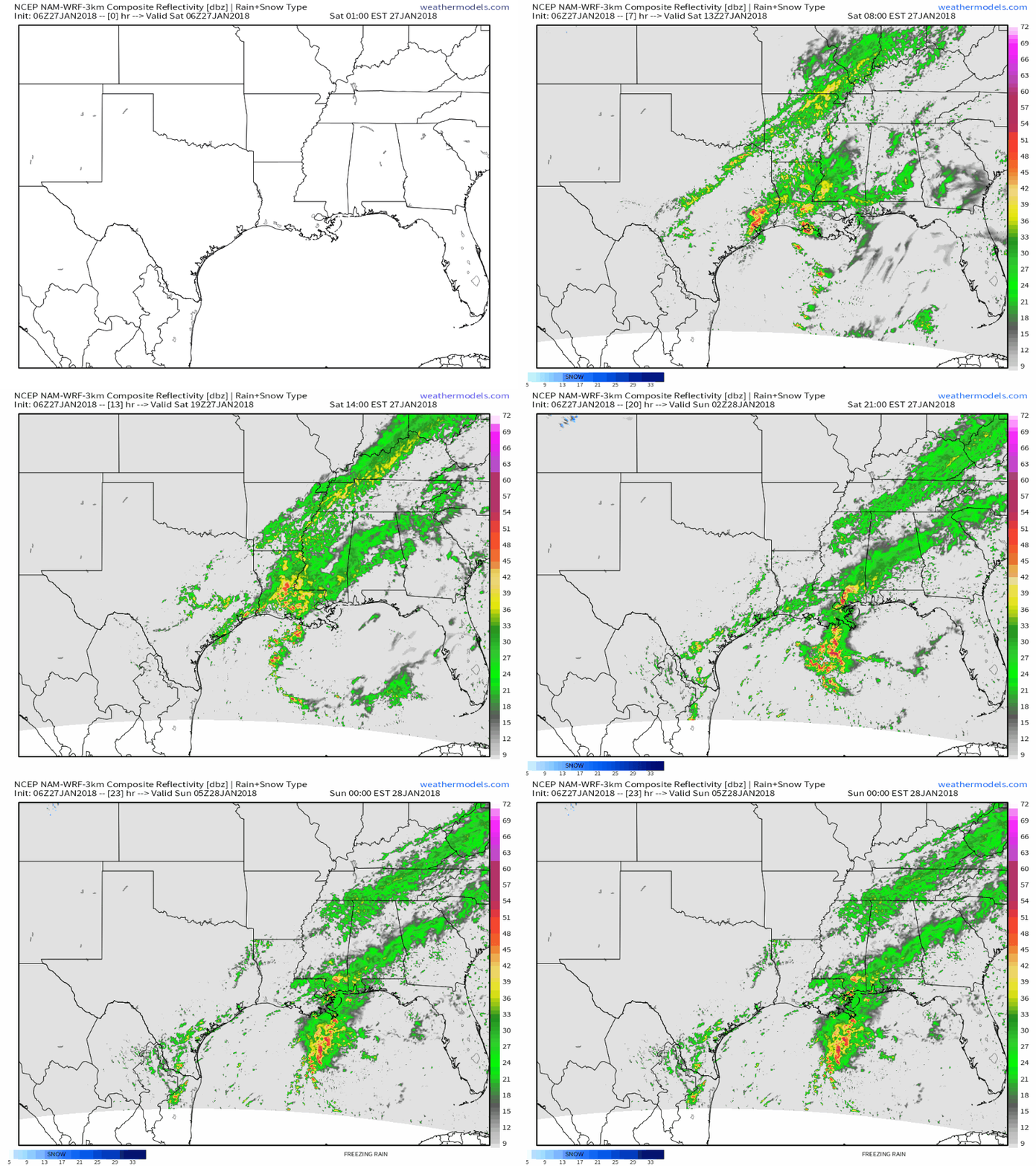
This simulated radar animation from weathermodels.com is a great way to show how storms are expected to evolve today. Storms will continue to develop in the SE TX-LA area through this afternoon, when a cold front approaching from the west pushes tropical moisture east and thus ends the heavy rain threat.
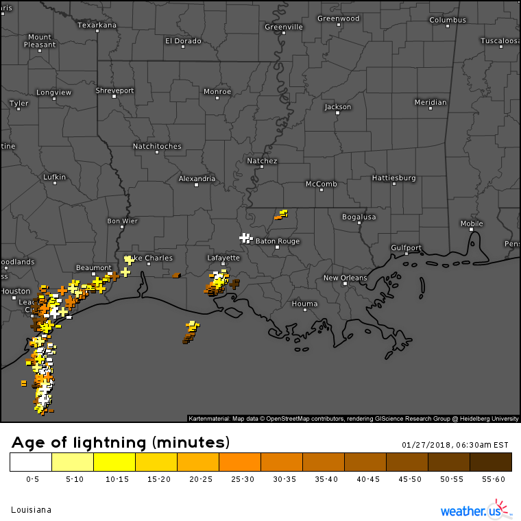
These storms have plenty of lightning associated with them, a sign of healthy updraft and downdraft circulations. Our lightning analysis product lets you look at strike-specific details, information you can access by zooming into county level then clicking a specific strike icon. You’ll be able to see detailed information about that strike, including its exact time, its location accurate to within a couple hundred yards, and its power.
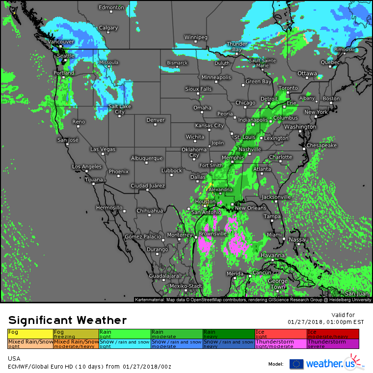
Elsewhere across the country today, the ECMWF’s overview map highlights a couple other areas of precipitation. Farther north along the cold front set to sweep through SE TX-LA this afternoon, lighter rains are expected with little in the way of impacts. Rain and mountain snow will continue to impact parts of the Pacific Northwest as well as parts of Idaho as Pacific moisture and energy continues to drift east. No significant impacts are expected from this system, but high elevation travel will be slippery.
For more information on your local forecast: https://weather.us/
For more information on the local forecast for ME/NH: https://forecasterjack.com/2018/01/27/much-warmer-today-5/
-Jack
