The Tropics are Beginning to Stir
Hello everyone!
Yesterday, we looked at the large scale pattern behind recent, current, and future severe weather threats. Today, we’re going to look at the large scale pattern(s) behind some potential tropical trouble. As you may have heard elsewhere, there are some disturbances in the tropical Atlantic that are being monitored for potential development. I’ll talk about both of those disturbances (Ex-TD4 and an African tropical wave) as well as go into why our current Atlantic-wide setup is one to watch closely.
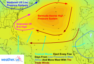
The Atlantic basin is currently being dominated by a semi-permanent high pressure system known as the Bermuda-Azores high. This high pressure system shifts in size, strength, and position throughout the year but is nearly always present between Bermuda and the Azores. Because winds blow clockwise around high pressure systems, winds across the tropical Atlantic are out of the east. These winds are permanent features of the tropics and are known as the trade winds. As with any stream of air (or water), there are little disturbances embedded within the trade winds. These disturbances are known as tropical waves. They form in the mountains of East Africa as thunderstorm complexes and emerge off the West coast of Africa every few days. Tropical waves range in strength but are typically fairly weak when they first emerge off the coast. At the moment, there are three well defined tropical waves in the Atlantic and two of them have the potential to develop into tropical cyclones. I’ll get to those later.
The feature I want to draw your attention towards is highlighted in pink on the map above. It’s the westward extension of the Bermuda-Azores high. The high acts as a lid of sorts on the tropical waves and any tropical storms that may develop from them. The waves want to move north but are blocked by the high. Think of a balloon trying to escape into the atmosphere but being blocked by a ceiling, the tropical waves (or storms) are the balloon trying to move north, and the high is the ceiling, blocking its path. As the waves travel west, they either grow into tropical storms that develop enough to catch a ride north and east with the jet stream, or, if they remain weak, will continue on their slow march west into the Pacific. Typically, a dip in the jet stream over the eastern US will whisk any tropical storms or hurricanes well out to sea before they can hit land.
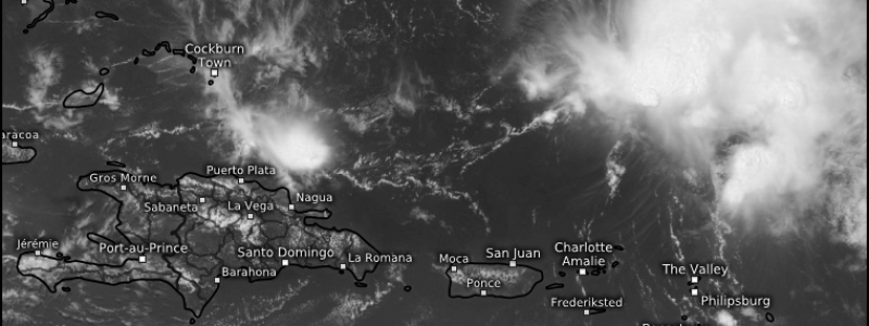
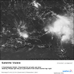
Now the question becomes, will there be a tropical storm or hurricane to move towards the US? Currently there are two disturbances in the Atlantic that could develop into a tropical storm. The first disturbance to watch is the remnants of Tropical Depression 4. TD4 developed from a tropical wave last week and quickly succumbed to dry air and wind shear, both detrimental to tropical cyclone formation. Dry air and wind shear continue to plague the storm but both are expected to let up in the coming days and a TD or weak TS could form as the system moves into the Gulf of Mexico in 5-7 days. A hurricane hunter mission is planned for tomorrow to investigate the storm if it continues to pose a threat for regeneration. Regardless of any potential development, this system is likely to bring heavy rains to parts of southern Florida this coming weekend. Just because a tropical system doesn’t have a name doesn’t mean it can’t cause problems!
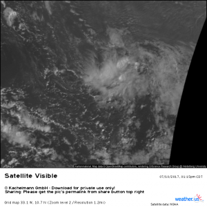
The other system that could develop in the next week is currently located roughly half way between Barbados and Cape Verde. It is a disorganized cluster of showers and thunderstorms that’s slowly but steadily moving west across the deep tropics. Model guidance has been inconsistent as to whether this wave develops or not but it will definitely be something to keep an eye on this week. If it does develop, it will likely move into the Caribbean and then towards Florida due to the pattern described above. This system looks much healthier than the remnants of TD4 and it already has a decent amount of thunderstorm activity associated with it. It will be one to watch for sure in the coming days!
Note that despite the pattern and its currently healthy appearance, this system still has plenty of hurdles to overcome before it becomes a legitimate threat. Any dire predictions of major hurricane strikes are not based in reality for now. Just know that we’re in a pattern generally favorable for tropical cyclone development and that any tropical cyclones that do form will likely track in the direction of the US. If any storm does become a threat to the US, I’ll be sure to let you know about it. For now, though, there’s little to worry about. Keep watching the model data over at weather.us to get a feel for how likely tropical cyclone development is. Note that the GFS is notoriously overeager to develop tropical cyclones, especially in the long range. Its output should be used with great caution!
I’ll continue to provide updates on these tropical systems should they become a threat to the US.
-Jack Sillin


