Strong Upper Level Low To Bring Rain And Snow To New England Thursday
Hello everyone!
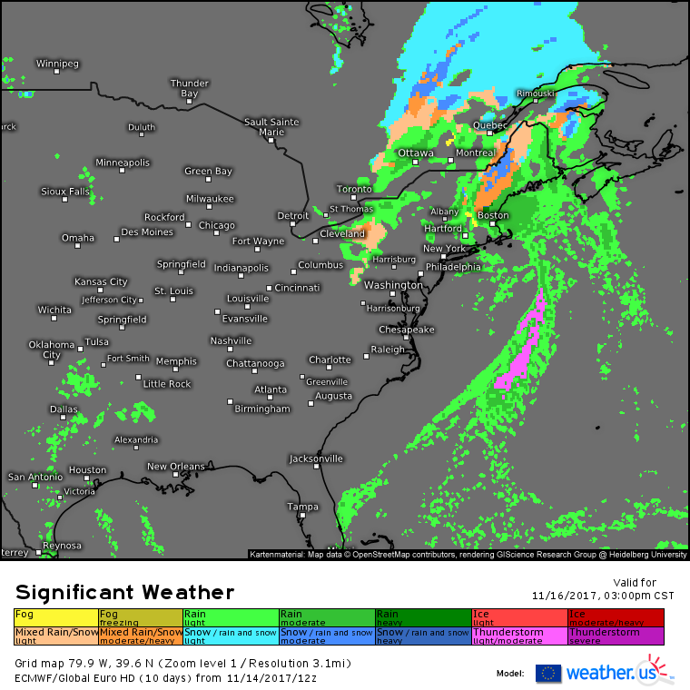
The end of our quiet weather stretch is in sight for New England as a strong upper level disturbance is likely to bring rain and snow to the area Thursday.
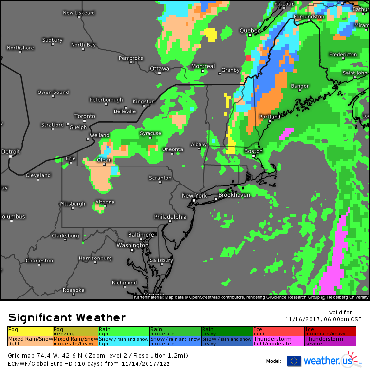
The ECMWF’s forecast shows an area of rain and snow, some of it moderate to heavy, developing across New England on Thursday. This precipitation will be driven by a strong upper level low which will force the development of a coastal storm in the Gulf of Maine. How quickly this storm develops will be the key to determining how much rain and snow will fall. So how quickly will the storm develop? To answer that question, we need to look aloft at the upper level dynamics.
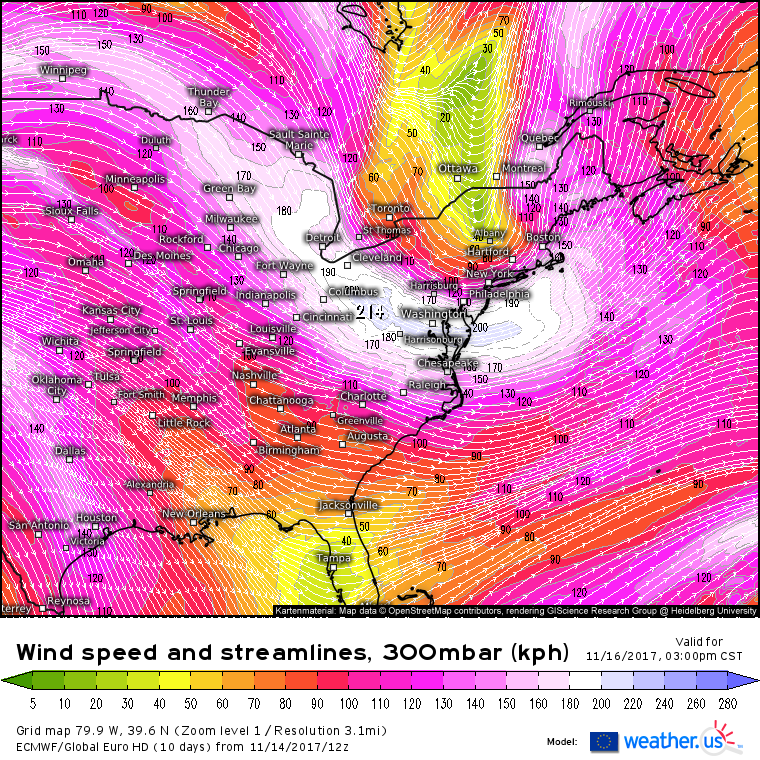
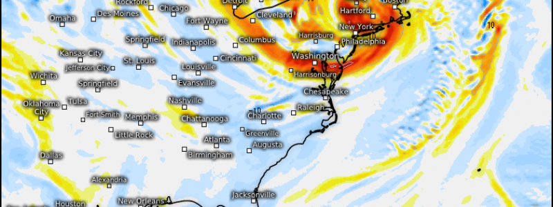
This map shows the wind patterns in the upper part of the atmosphere on Thursday afternoon. The major feature of note here is the jet streak that extends from Michigan to Washington DC before curving up towards Cape Cod. Jet streaks can greatly increase the amount of air rising through the atmosphere, and this effect is maximized in the left exit region of jet streaks that are cyclonically curved like the one above (if the streak is curved anticyclonically, lifting is maximized in the right entrance region). The left exit region will be located over New England on Thursday afternoon, suggesting that there will be enough large scale rising air to support the development of a coastal storm.
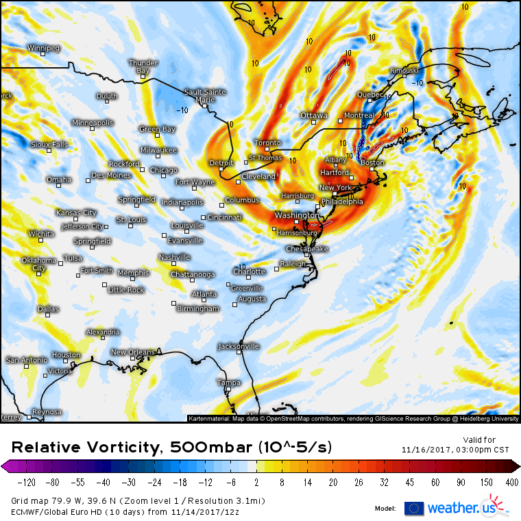
Another ingredient that’s important for coastal storm development is upper level energy. This map shows plenty of upper level energy available across the Northeast to help fuel storm development. Not only is the presence of red shadings that indicate strong energy important, the orientation of the energy is just as crucial to predicting storm development. Notice the spindles of energy that extend from a coherent center located between NYC and Albany. One of these spindles reaches east towards Cape Cod, another reaches west towards the Finger Lakes of New York, and several extend up into New England. The presence of a consolidated energy center, with spindles rotating around it is another indication that conditions are favorable for coastal storm development. All too often this fall, we’ve seen upper level energy maps that show systems lacking a coherent center, and with energy that is sheared out over a large area. Those systems hardly ever produce notable impacts, this one likely will.
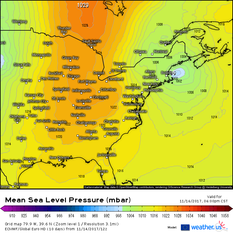
As predicted by the upper air features, a coastal low is forecast to develop Thursday afternoon. It won’t be an especially powerful storm, but with pressures dropping into the 990’s, it will be a bit stronger than recent events. Strong polar high pressure will be moving south behind the system, bringing in cooler air. However, the cold air and the precipitation won’t overlap all that much, and as a result, widespread accumulating snow is not expected.
Here’s a general look at the impacts that can be expected from this system. The steady moderate to occasionally heavy precipitation will be confined to eastern New England as the coastal low gets going offshore. To the west, lighter showers are forecast in parts of Pennsylvania and upstate New York as a cold front moves through. Within the area of steadier precipitation, rain is expected along the coastal plain of Maine and down into Massachusetts. A mid of rain and snow is expected in the foothills of Maine and New Hampshire, while the mountains of the two states will see accumulating snow.
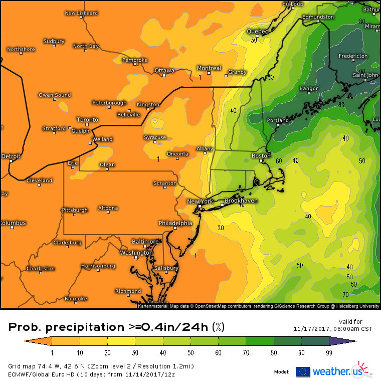
One good way to visualize who is at the greatest risk for seeing noticeable precipitation is the newly added EPS probabilistic forecasts. This map shows the chance that any given area sees more than .4″ of rain or liquid equivalent snow. It takes a steady rain to bring more than .4″ to a widespread area, and you can see on the map that the greatest risk for these steadier rains are located in Eastern New England, especially along the Maine coast which will see the coastal storm in a more developed state compared to Southern New England. Due to the lack of cold air, much of that precipitation will fall as rain. Farther northwest, closer to the cold air, notice the diminished probability of >.4″ of precipitation, which would come out to about 4″ of snow. Due to the disconnect between the moisture and the cold air, even the mountain locations cold enough to see all snow will likely only get a couple inches of accumulation.
The system will move east on Friday with cooler air moving in to kick off the weekend. Our next storm will feature more widespread impacts, and will get going across the Midwest on Saturday. More on that storm from me in the coming days, though you can always check the forecast over at weather.us!
-Jack
