Strong Storms Expected Across the Upper Midwest Today and Into Tonight
Hello everyone!
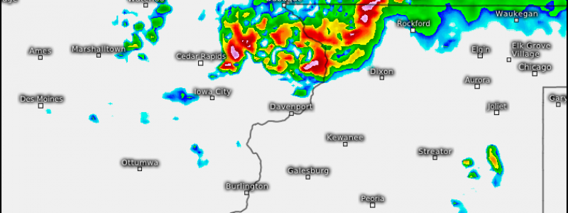
Another day, another severe weather threat from the northern plains down towards Chicagoland. The NW flow pattern I highlighted a couple of weeks ago continues to crank away and it shows few signs of letting up. This severe weather threat will develop in two areas. The first already has ongoing showers and weak storms and is moving into NE Iowa as well as portions of NW Wisconsin.
These showers and storms are associated with an upper level disturbance that will continue to move south and east through this evening. Those storms over the western part of the state will merge into a strong line of storms by this evening and a Mesoscale Convective System (MCS) is likely to be in progress by the time the sun goes down this evening.
This line of storms will be capable of some extremely strong winds as well as large hail. A few brief tornadoes could spin up right along the leading edge of the line but the main tornado threat will be with any storms that develop off the southwest end of the line. These storms are likely to take on a supercellular structure, as shown by the model above. Noticed the curved shape of the storm just north or Davenport. The model can’t tell that a storm like that will form exactly there, but the model’s simulation is a good tool to use to get a feel for what storms could potentially look like given the setup.
The tornado threat will diminish as the evening progresses due to waning instability. The damaging wind threat, however, will continue well into the night as the system drives SE towards and through Chicago.
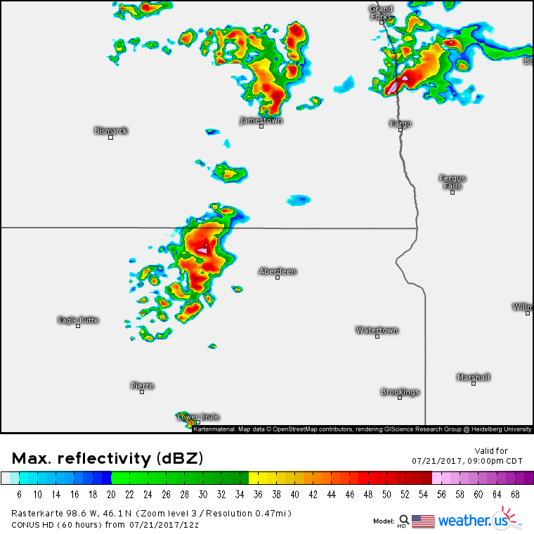
The second area of severe weather will develop this evening across the Dakotas. The environment is favorable for supercells with backed winds (helpful for rotation), high dew points (helpful for low cloud bases as well as instability), and plenty of upper level winds. Supercells in this area will be capable of all severe weather hazards with damaging winds, large hail, and tornadoes all possible. As the evening wears on, some of the storms may merge into small clusters that will be more supportive of damaging winds than hail or tornadoes.
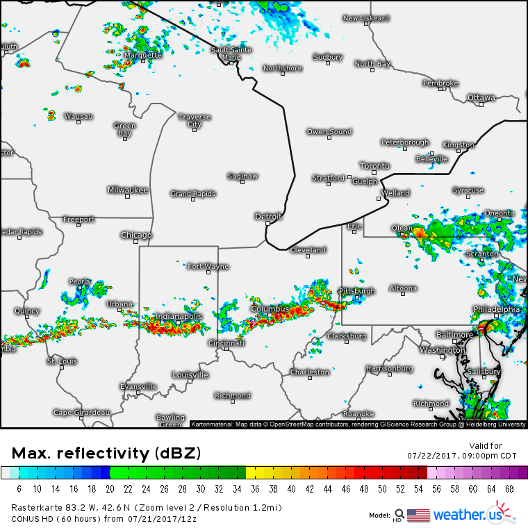
So what’s behind all the storms? This map from the ECMWF model gives the answer. It shows the amount of spin/energy in the atmosphere at about 25,000 feet. The yellows and reds are high energy areas while the blues and purples are low energy areas. Notice the cluster of energy in Iowa as well as across North Dakota. These two upper level disturbances are causing the air ahead of them to rise, and thus allowing thunderstorms to form. These disturbances will move southeast tomorrow and more severe weather is expected across the Mid Atlantic as well as the Ohio Valley.
Damaging winds appears to be the main threat with tomorrow’s Ohio Valley/Mid Atlantic storms as the atmosphere won’t be quite as conducive to tornadoes. However, that doesn’t mean a few quick spinups can be totally ruled out.
For more information on the forecast for your location as well as even more model maps and data, head on over to weather.us!
-Jack Sillin


