Strong Storm To Impact California This Weekend
Hello everyone!
A storm is developing in the Eastern Pacific this morning, and it will bring heavy rain, mountain snow, and strong winds to California this weekend. In this post I’ll do a quick overview of some of the dynamics driving this system and what to expect from each aspect of the storm over the next few days.
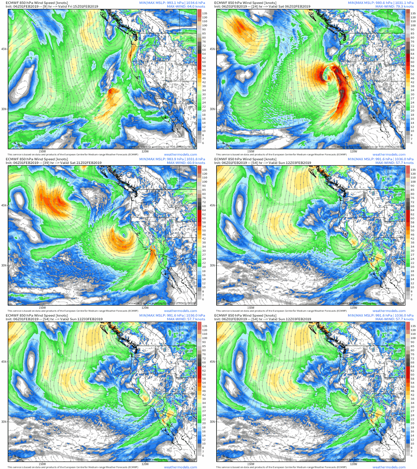
Here’s an animation highlighting the storm’s general evolution over the next few days. The parameter shown is the wind speed and direction at about 5,000 feet. The storm is clearly visible off California undergoing a full life cycle from intensification to maturity to dissipation. The band of strong winds aloft will mix down to the surface tomorrow morning, with gusts to 50 mph possible for coastal and mountainous areas. Those winds will also be carrying plenty of moisture responsible for heavy precipitation, both in the form of rain for the valleys and snow for the mountains. GIF via weathermodels.com.
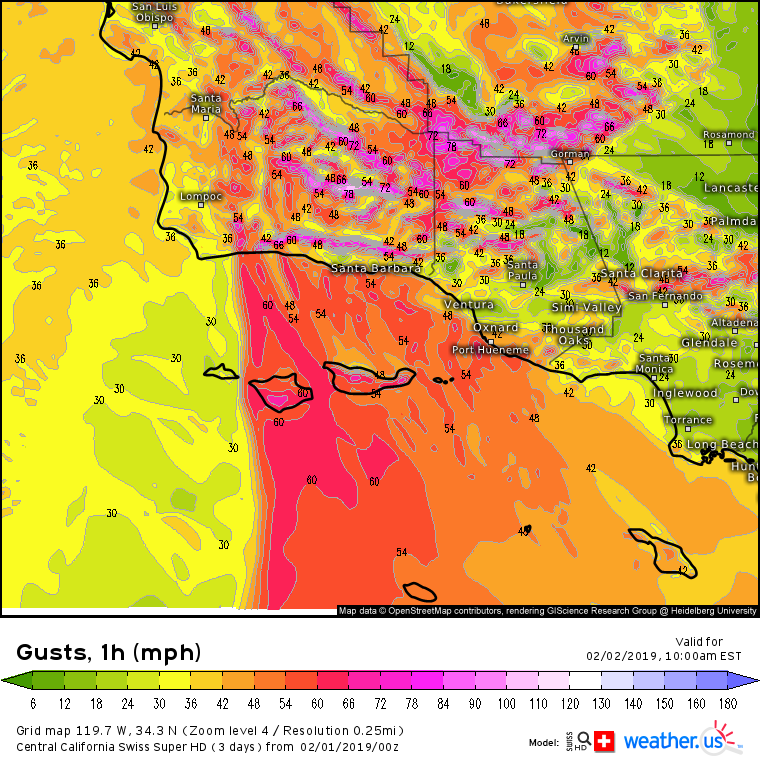
Starting with the winds, this event is likely to be fairly impactful from a wind perspective for parts of Southern California. Our Swiss Super HD model shown above brings gusts over 50 mph into the Santa Barbara area. Even windier conditions will be found at higher elevations, but this event will be notable in that even the lower elevations could see power outages from high winds. Other coastal and mountainous parts of the state will also see strong gusts above 40 mph, but the strongest low elevation winds look to be found in the Southern part of the state.
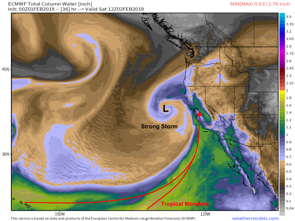
As I mentioned above, those southerly winds will be bringing plenty of moisture up from the tropics. Here’s a look at the moisture forecast for tomorrow morning which shows a deep moisture plume pointed right at California. Also visible here is the classic swirl pattern of a mature cyclone west of San Francisco. While not a “bomb cyclone”, this will be a respectable system! Map via weathermodels.com.
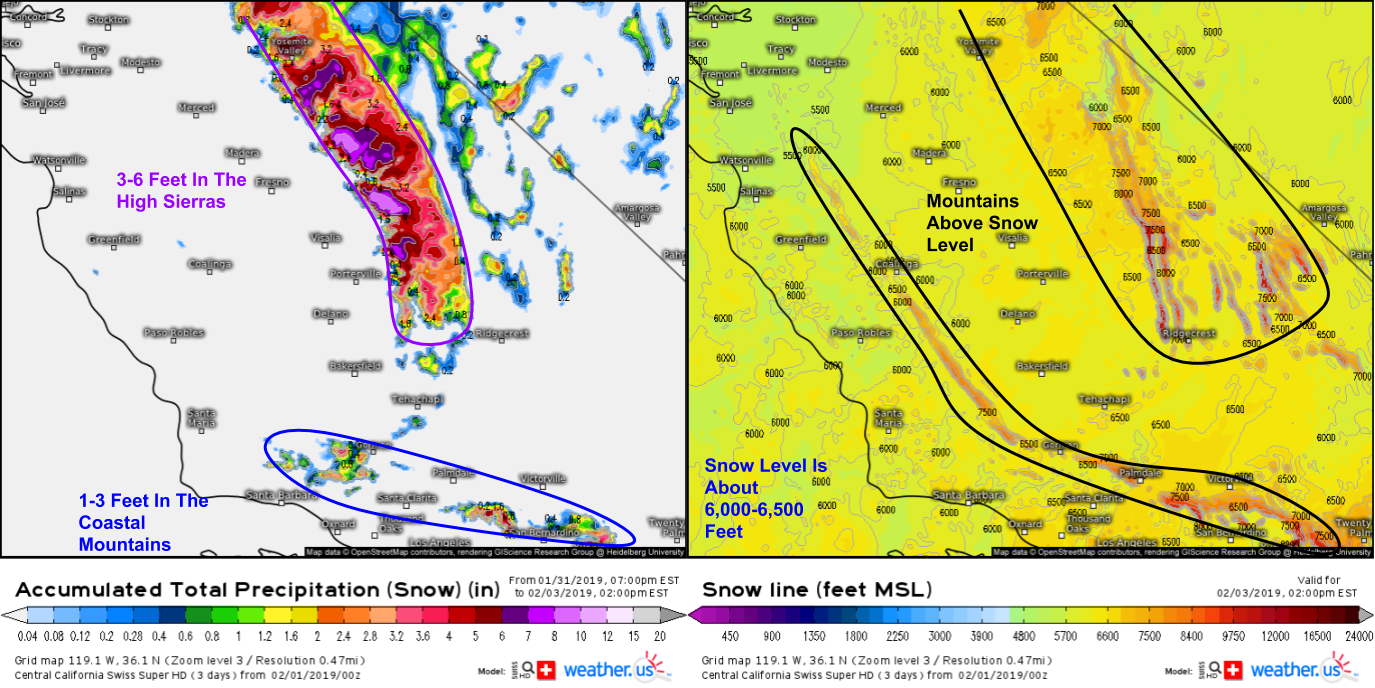
Much of the moisture will fall as rain for the lower elevations, but above around 6,000 feet, there will be plenty of snow. The map on the right shows how far above sea level you have to go to see snow. Note the stripes of higher values that represent mountains sticking up above that snow level (i.e. you’d have to go 9,000 feet up to see snow because the mountain is 9,000 feet tall). The map on the left shows how much liquid equivalent precipitation will fall as snow through Sunday morning. Multiply these values by about 12-15 to get actual snow totals. This translates to about 3-6 feet for the Sierras and 1-3 feet for the coastal mountains NE of the LA area. Great news for the water supply!
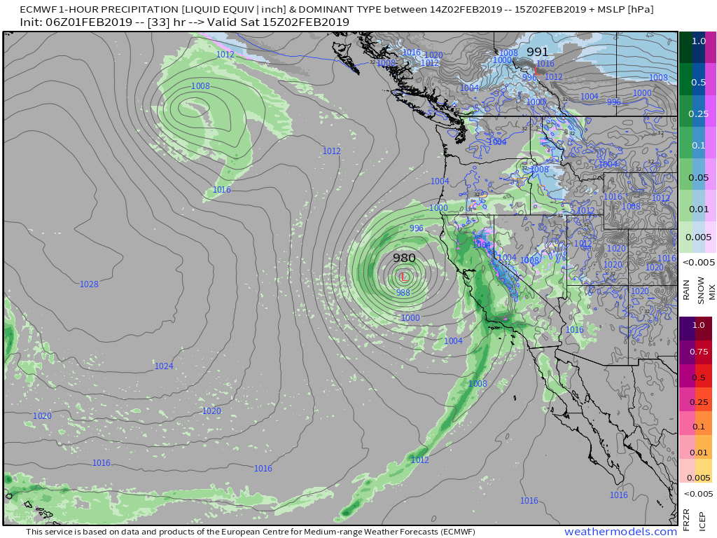
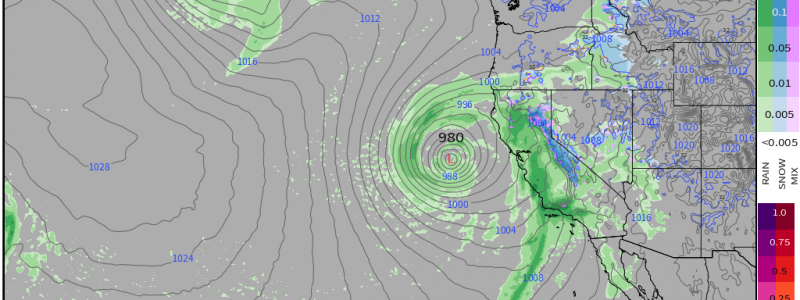
Here’s a shot of the storm in “peak form” tomorrow morning, as forecast by the ECMWF model. Note the heavy rain for coastal/valley areas with heavy snow up in the Sierras. You might also notice the lack of snow in the coastal mountains I just said should expect 1-3 feet of snow. That’s because those areas will start as rain before a change to snow occurs after the passage of the cold front you can see extending from San Francisco down into the tropical Pacific. The core of the storm moves ashore tomorrow night with another round of precip before a short break ahead of the next system set to arrive Monday. Map via weathermodels.com.
-Jack
