Strong Storm To Bring Severe Weather, Flooding, And Some Snow This Weekend
Hello everyone!
A strong upper level disturbance is moving through Southern California this morning, and will emerge onto the Plains tonight. A variety of inclement weather is expected to occur as a result of this system, ranging from heavy snow in the Northern Plains to our first major severe weather threat in the Lower MS Valley. More flooding is also expected in saturated parts of MS/AR/AL/TN.
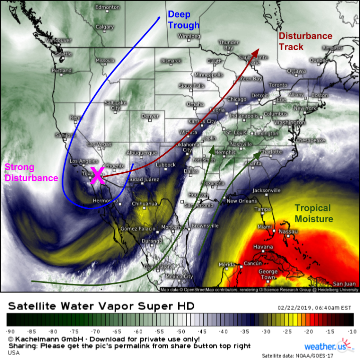
Here’s a look at this morning’s WV satellite imagery showing the strong disturbance in the Desert Southwest about to lift up through the Plains. The tap of tropical moisture is open both from the Eastern Pacific and from the Gulf of Mexico, and some cold air is present especially at the surface farther north. The main thing to note though is just how strong that western disturbance is. It will spur the development of a very strong cyclone out in the Plains over the next 24-48 hours, which in turn will drive some fairly high impact weather.
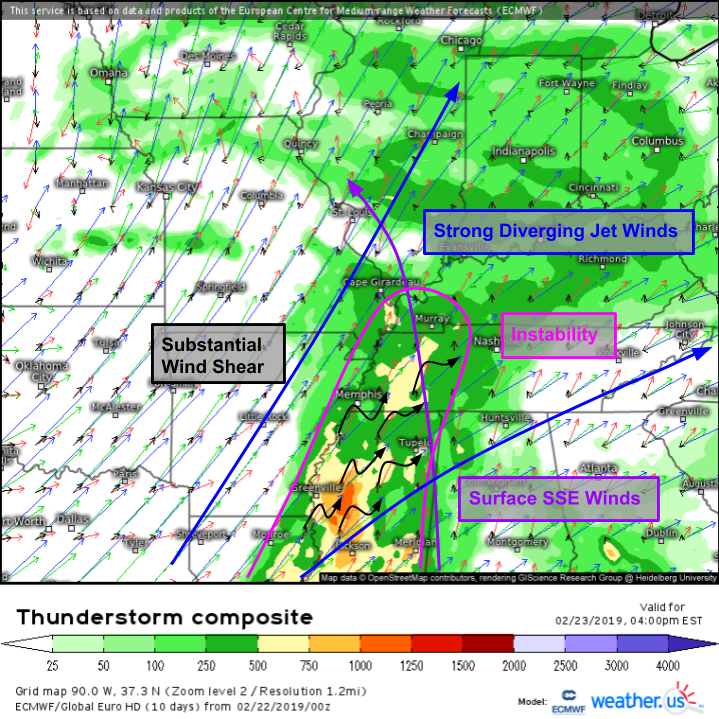
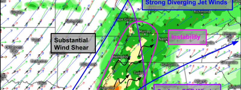
The most impactful part of this system is likely to be the severe weather across the MS Valley. The ECMWF’s thunderstorm composite shows strong wind shear to the SE of the main storm system as SE surface winds sit under strong SW winds aloft. The environment will have strong forcing (lifting) from an approaching cold front, so we won’t have to worry about that. The element that is most uncertain is the instability. It remains to be seen just how much cloud cover might exist ahead of the cold front, and how fast the warm front will advance northward. Most forecasts as of now indicate the potential for modest instability (500-1,000 J/kg of CAPE) which will be enough to support a strongly forced squall line, but may or may not enable the development of discrete cells out ahead of the main line. Damaging winds, large hail, and tornadoes are all possible with storms tomorrow afternoon so be aware if you’re headed out and about in the favored area (generally from Cape Girardeau to Memphis to Greenville and points just east (within 100 miles or so).
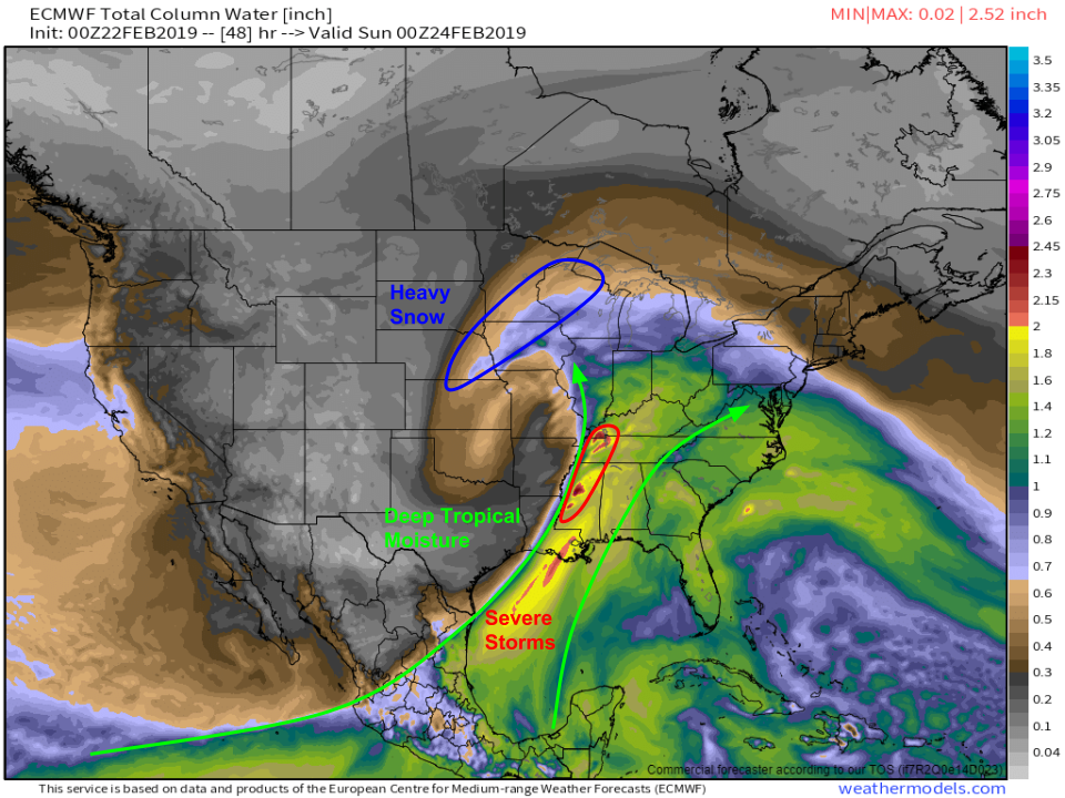
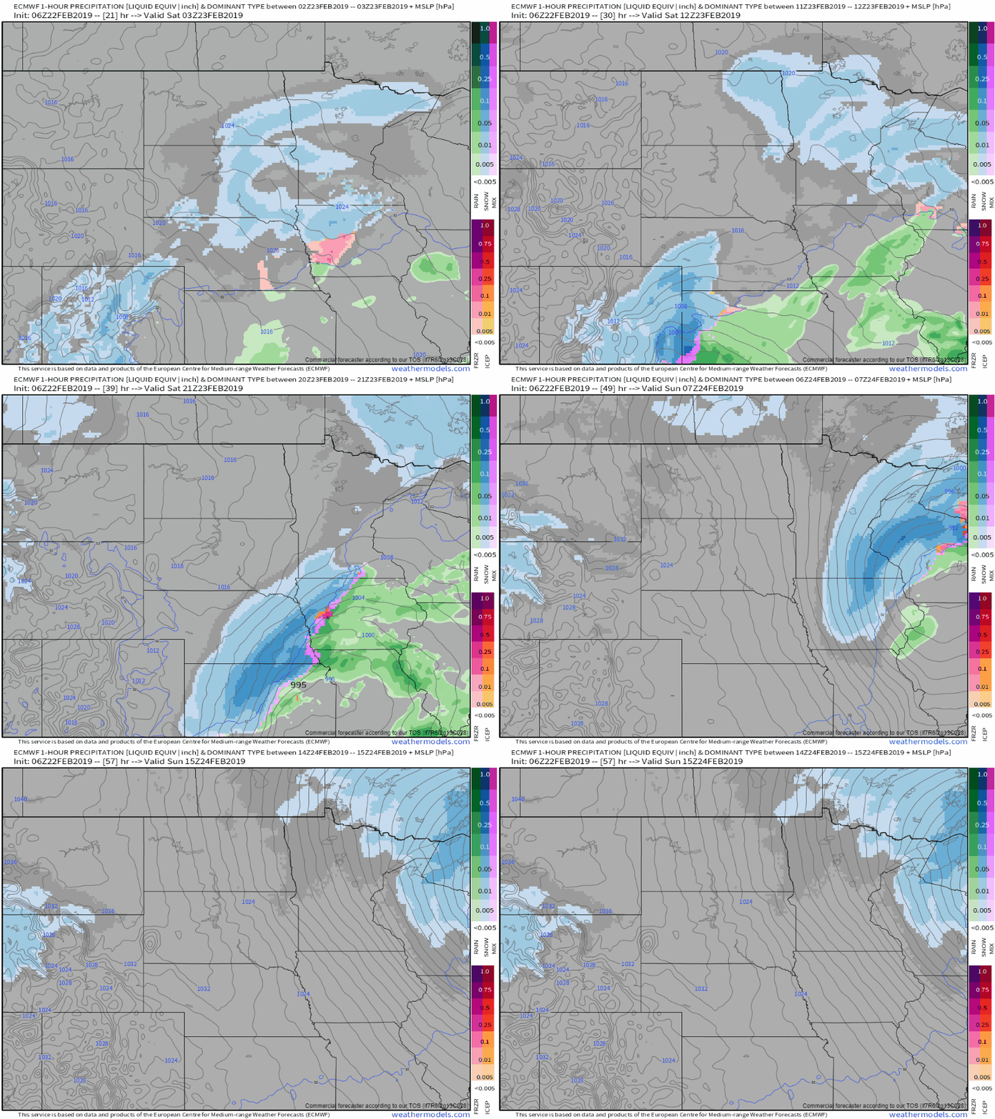
Here’s a look at the system on a large scale tomorrow evening. The storm center is clearly visible in Missouri, with deep tropical moisture flowing north on the system’s southeastern flank. That moisture will be squeezed out by those severe storms mentioned above, leading to even more heavy rainfall over saturated parts of N MS/TN. Map via weathermodels.com.
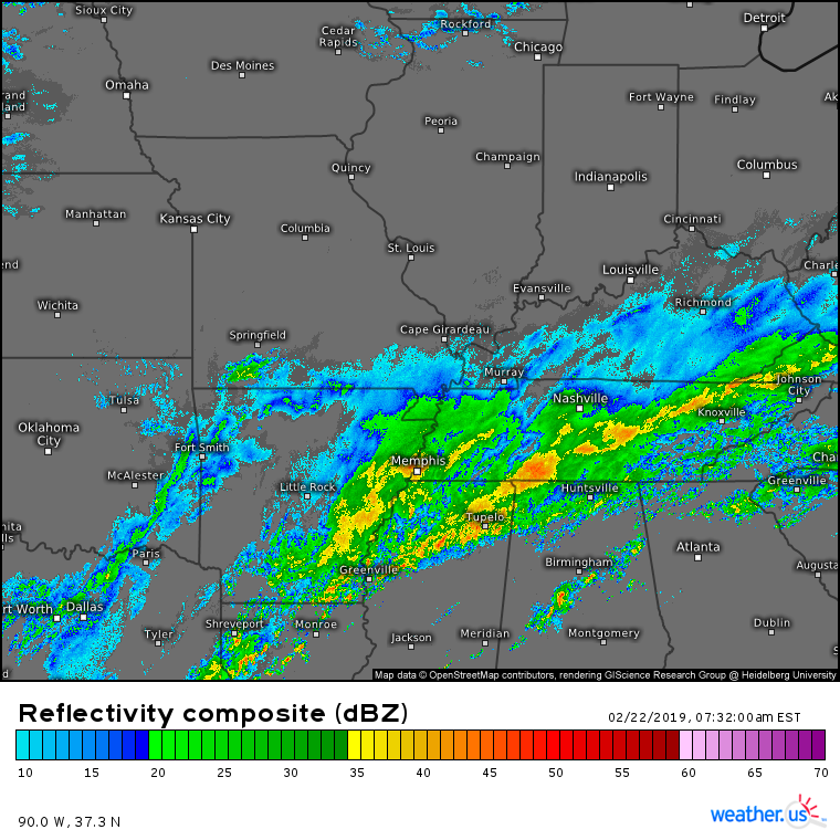
It’s pouring out there already this morning across the N MS -> N AL -> TN area as the cold front from the last storm system lingers over the region. Major flash flooding problems will continue for the next couple days before drier weather finally develops early next week. Be sure to heed the advice of local officials if you are in this area and being impacted by the flooding! An additional 2-4″ of rain is likely on the large scale with locally higher amounts in areas that see persistent training of storm cells.
The wintry side of this system won’t be quite as intense as the severe/flooding impacts, but a heavy band or two of snow will form in Southern Colorado tomorrow morning before cruising northeast. The bands won’t stick around long enough to drop more than several inches, but those several inches will fall in the matter of just a couple hours making for brief windows of extremely low visibility and poor road conditions. Winds will kick up as the storm intensifies, which will lead to blowing and drifting of snow even after the flakes stop falling. GIF via weathermodels.com.
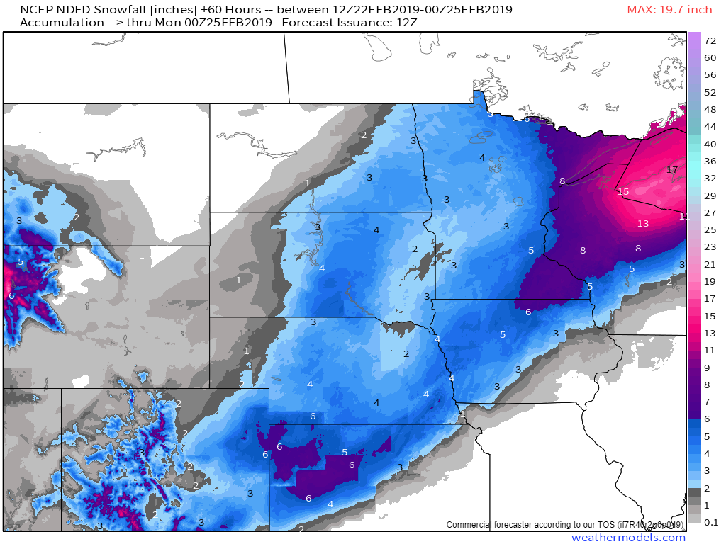
Here’s how much snow the NWS expects over the next few days. Note that amounts aren’t all that high, generally in the 3-6″ range, but it’s the snowfall rates not the snowfall totals to watch with this system. Much higher totals are forecast up in WI/MI as the system stalls out once it gets up there, resulting in a much longer duration event. Map via weathermodels.com.
-Jack
