Strong Low Pressure System To Drive Severe Weather Today And Tomorrow
Hello everyone!
An active couple days is in store for the northeast as an unusually strong storm drives a cold front through the region. Severe weather is expected along the front both today and tomorrow, and things are already well underway with today’s threat.
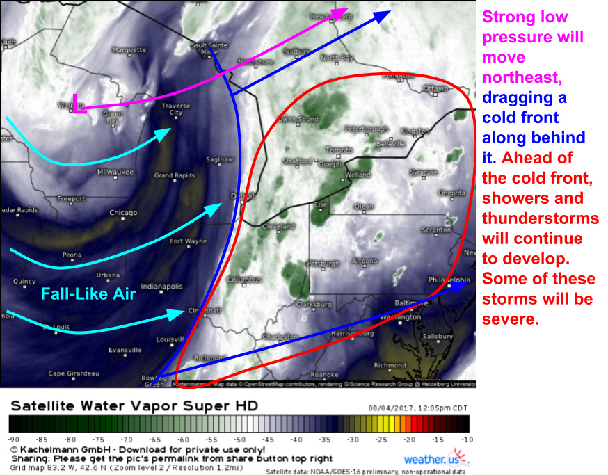
Here’s a general look at the situation today. GOES-16 WV satellite is one of my favorite tools to spot storm systems, and today’s shows up extremely well.
Our cold front is marching east and air is being forced to rise out ahead of it. Given that this air is unstable, thunderstorms are developing. For more information about how cold fronts generate thunderstorms and what makes air unstable, check out the weather encyclopedia entries on those respective topics.
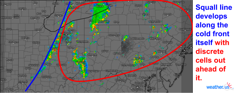
Storms along the cold front itself are organizing into a nearly solid line known as a “squall line”. This line marks the back edge of the severe threat as cooler and more stable air moves in behind the front. Ahead of the cold front, more widely scattered storms are forming and congealing into small clusters. The main threat with the squall line will be gusty winds while the storms out ahead of the line could produce gusty winds, hail, and even a brief tornado or two. Heavy rain and lightning are threats with any and all storms.
Storms will wane overnight as we lose the energy provided by daytime heating, but will restrengthen as the system moves into New England tomorrow morning.
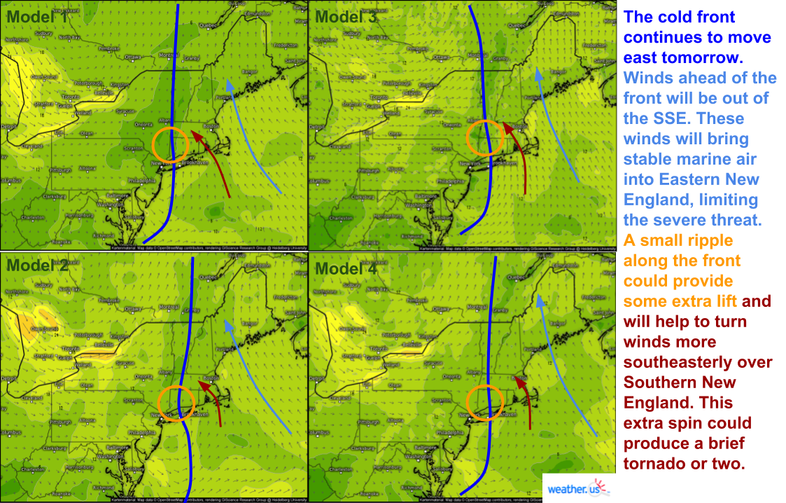
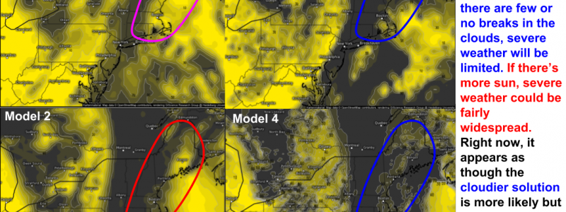
As the front begins to orient itself more north-south as opposed to northeast-southwest, winds ahead of it will turn southeasterly across eastern New England. These SE winds will drive stable marine air onshore which will help limit severe weather potential. However, the forecast will likely end up coming down to a different variable- cloud cover.
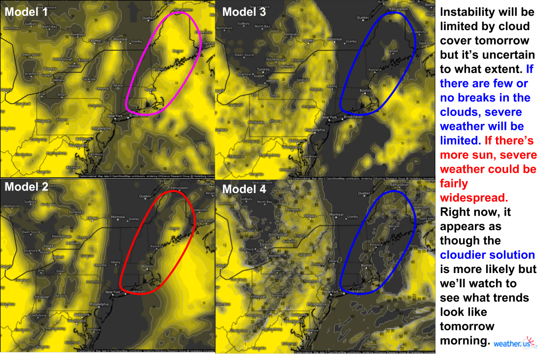
This image shows the cloud cover forecast by four models at the same time, 2 PM tomorrow. You can see that there’s quite a bit of disagreement among the models as to how much cloud cover is forecast. The more clouds there are, the less solar energy can get through, and thus the cooler temps at the ground will be. The cooler it is at the ground, the more stable the atmosphere is and the more stable the atmosphere is, the less energy there is for severe thunderstorms. We’ll have to watch satellite data closely tomorrow morning to see if any breaks in the clouds can develop and where those pockets of higher instability may reside.
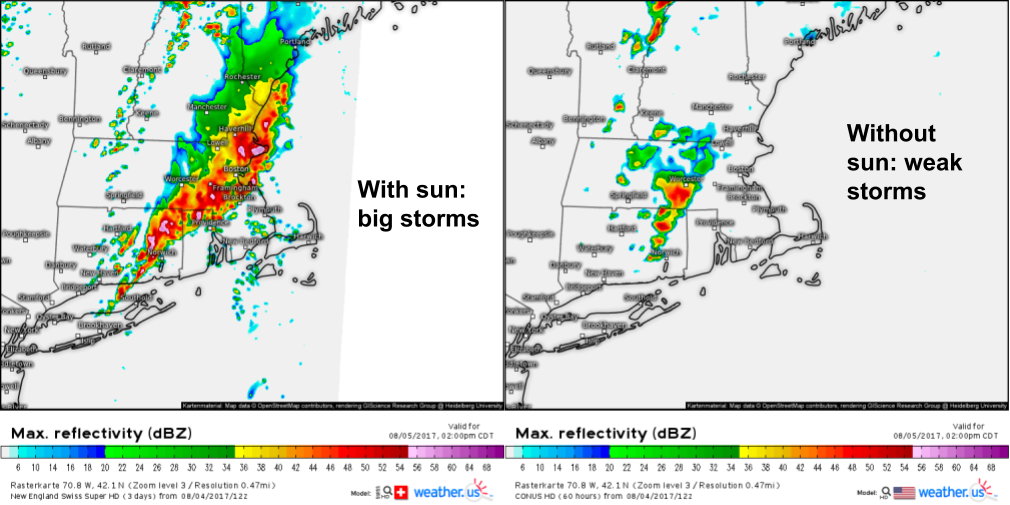
Here’s what the potential outcomes look like on simulated radar. Either scenario is possible though I’d note the lower energy outcome is favored by climatology and most model guidance. The main threat, no matter which setup occurs will be gusty winds. A weak tornado or two can’t be ruled out in southern New England where a weak low pressure system will help to enhance rotation in the atmosphere.
The system will move east into Canada tomorrow evening leaving the region with cool and dry conditions heading into next week.
-Jack Sillin
