Strong Jet Streak Set To Drive Severe Weather Across New York Today
Hello everyone!
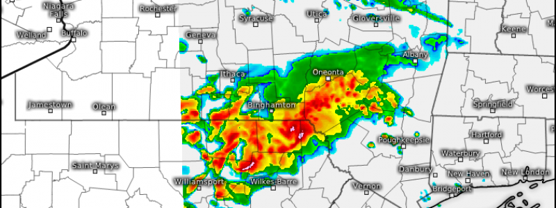
In last night’s update, I discussed an area of severe weather moving across the Great Lakes and how it might impact the weather in the NYC area by tonight. Well, the forecast is progressing more or less as planned so I’ll just provide a quick update here as to what to expect as this area of severe weather moves east-southeast.
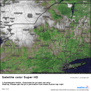
Noontime GOES-16 satellite imagery shows clear skies across much of New York and Pennsylvania as an area of thunderstorms approaches.
GOES-16 visible satellite imagery shows clear skies across much of New York and Pennsylvania as of noontime and current observations indicate a very warm and unstable airmass is awaiting the arrival of our disturbance aloft.
The warm and unstable air will continue to become even warmer, and even more unstable as the sun beats down relentlessly this afternoon. Temperatures are likely to reach the mid 90’s in the NYC area in the next couple of hours and they will be slow to drop this evening. By 9 PM, the NYC area could very well still be in the upper 80’s to low 90’s as the storms begin to approach.
Why is the heat and humidity so favorable for thunderstorms? To answer that question, check out my article on instability that discusses how oppressive heat translates into thunderstorm jet fuel.
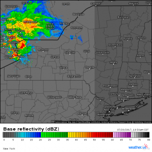
Storms are already underway across far western New York state. The strongest core, just north of Buffalo, was severe warned as of 12:30 PM. These storms are moving ESE into the very unstable environment described above. As all the energy aloft plows into this airmass, the sparks will fly and widespread severe thunderstorms are likely from Western New York through NE PA and towards New York City by this evening.
The line will likely begin to weaken as the sun goes down, but, as described above, temperatures will still be quite warm, and the air still quite unstable, even as the line approaches the coast well after dark. The vigorous upper level energy will also help to keep storms going even when, under normal circumstances, they would long be dead.
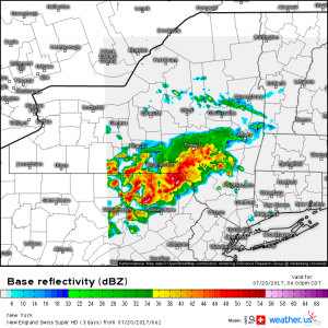
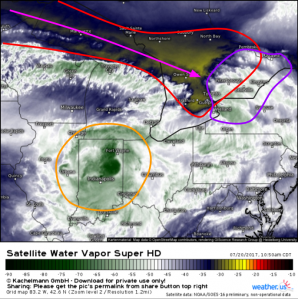
The two images above tell the story. On the right, we have GOES-16 water vapor imagery from this morning at around noon eastern time. The dry air punch (ligher yellow colors on the map, circled in red) indicate the upper level energy. The striations in the clouds over Michigan and Wisconsin indicate a pocket of upper level moisture (clouds) is being pulled apart by fierce winds. An animated version of this image confirms this. This intense band of winds, known as a jet streak, is pointed right at the developing cluster of thunderstorms (circled in purple). Farther southwest, another cluster of thunderstorms is not getting this boost from the upper levels, instead it is slowly dying out over Indiana. The cluster headed through NY and towards PA is getting the boost, and as such it is expected to intensify as it moves SE. The Swiss HD model forecast on the left shows this well.
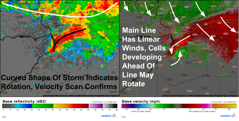
While the main threat from this cluster will be damaging winds, any cells that can jump out ahead of the line could take advantage of favorable wind shear to begin rotating, perhaps enough for a tornado or two. This cell south of Buffalo did have a tornado warning associated with it as of 12:45 PM. The southern end of the cluster will be the place to watch for any additional tornado warnings as the afternoon progresses.
Elsewhere across the country, more thunderstorms are possible in New England and across parts of Illinois and Iowa though those storms are not expected to be quite as intense as those moving through the Mid Atlantic. Farther west across the high plains of W ND, W SD, E WY, and far E MT, more intense storms are possible as another disturbance drops in from the northern Rockies. For more details on your local forecast, check out all the tools we have over at weather.us.
-Jack Sillin
