Strong Cold Front Will Bring Heavy Rain, Gusty Winds, And Thunderstorms To The Northeast Today
Hello everyone!
Today’s weather will once again be dominated by the same strong cold front marching slowly east. As cold air pours into the Central US behind the front, warm air will continue to stream north ahead of the front. This moisture will fuel heavy rain and thunderstorms this afternoon and evening.
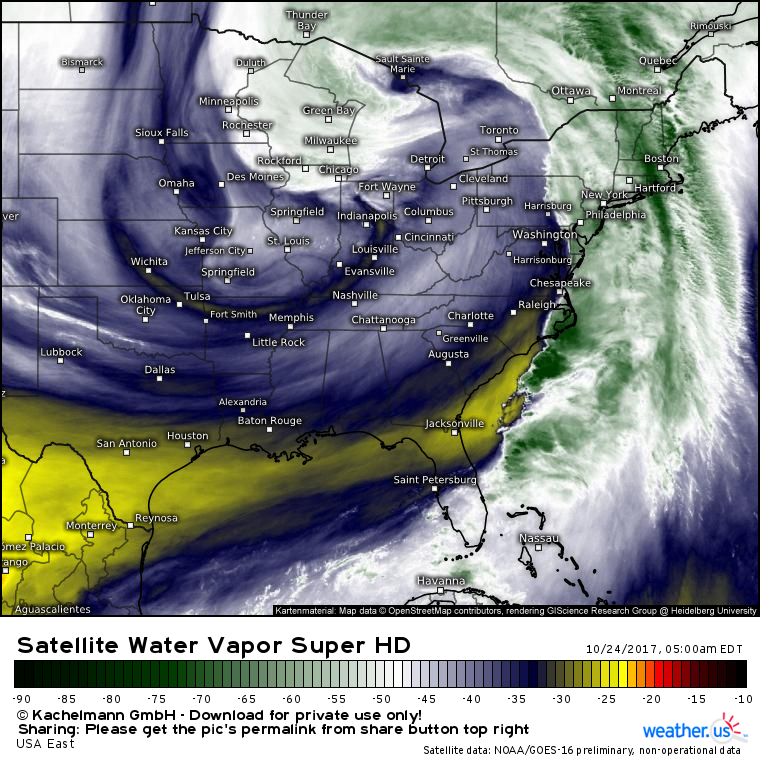
As always, water vapor imagery from GOES-16 (what’s that?) is an excellent tool for spotting the major features that drive our weather. The large swirl over the Great Lakes is an upper level low, with the smaller swirls surrounding it indicating smaller upper level disturbances. You can see the plume of moisture extending from Florida up into New England out ahead of the front. This moisture plume will be an important part of the forecast for the Mid Atlantic and Northeast today.
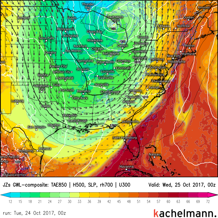
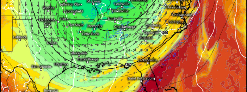
This is another way to visualize the moisture plume this evening. The shading is a parameter known as theta-e, a measure of heat/moisture. Notice the plume of high theta-e extending from the deep tropics up into the Northeast. This map also shows surface pressure contours (isobars) in white. The kinks in the isobars over the Mid Atlantic indicate the cold front. The vectors on the image show winds in the upper levels. Notice the area of strong winds extending from Pittsburgh up into Canada. This is a jet streak, and air likes to rise rapidly in the right side of the entrance to jet streaks. The right entrance region will be located over the Mid Atlantic this afternoon, shifting into New England tonight.
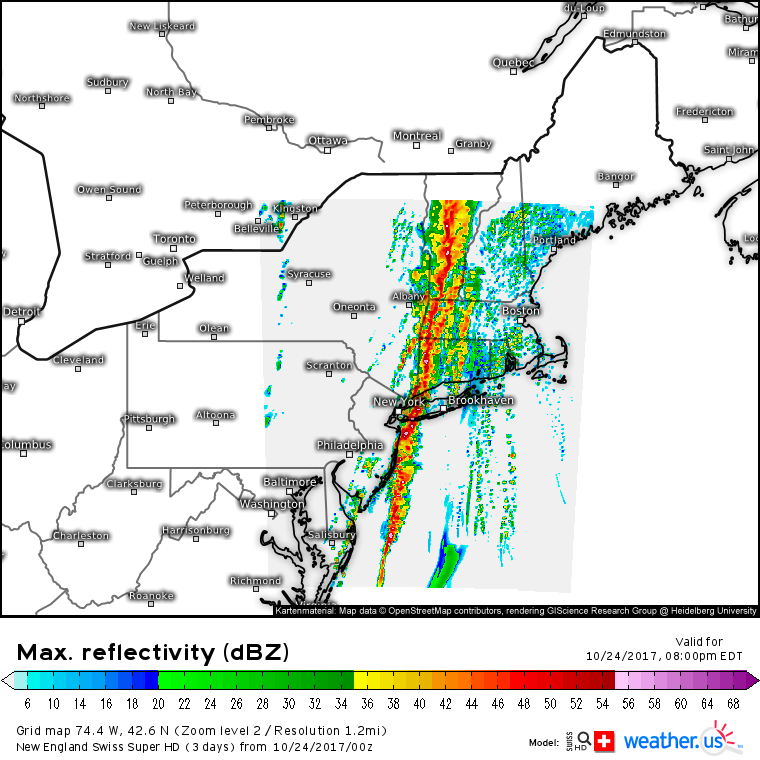
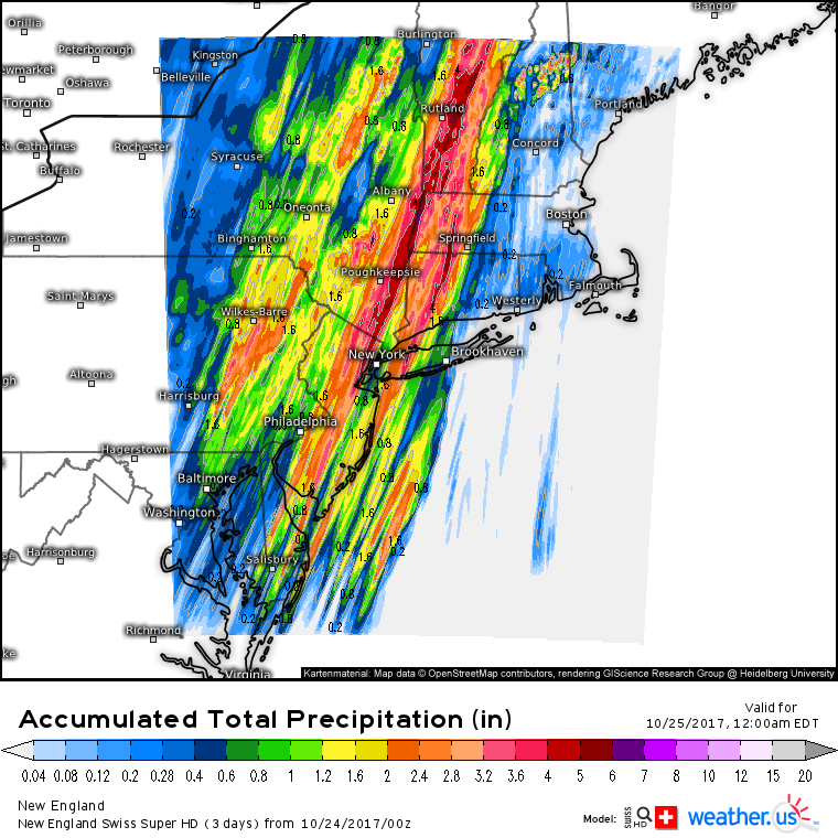
This Swiss Super HD model image shows what happens when a plume of tropical moisture is co-located with strong rising motion in the right entrance region of a jet streak. Heavy rain will break out this afternoon across the Mid Atlantic as daytime heating provides just enough fuel for thunderstorms. Heavy rain will continue as the storms move east and weaken tonight.
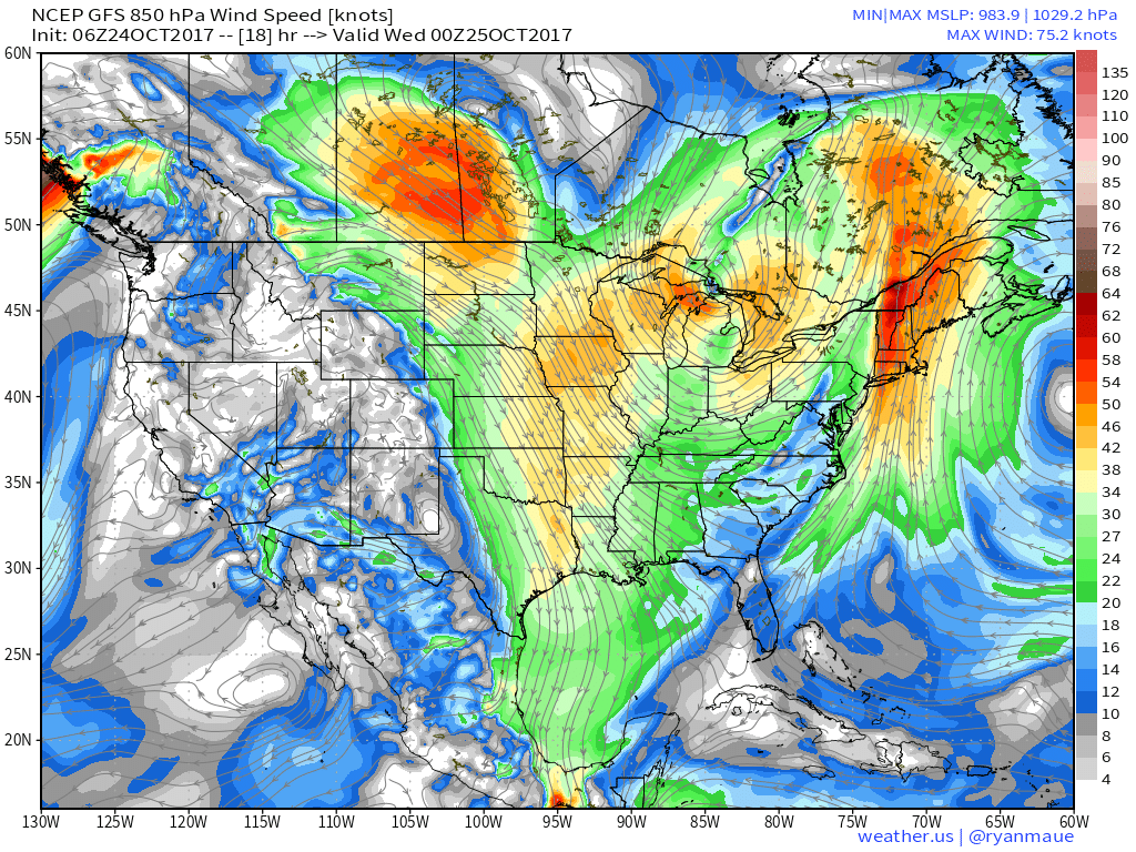
These thunderstorms will be able to mix down strong winds from aloft to the surface, resulting in wind gusts that may be strong enough to cause damage. The map above shows winds at about 5,000 feet (850mb). Notice the area of 50+ kt (60+ mph) winds located across New England. Thunderstorms, which extend well above 5,000 feet, will be able to tap into these winds and bring some of them down to the surface in the form of gusts, which could be strong enough to cause some damage.
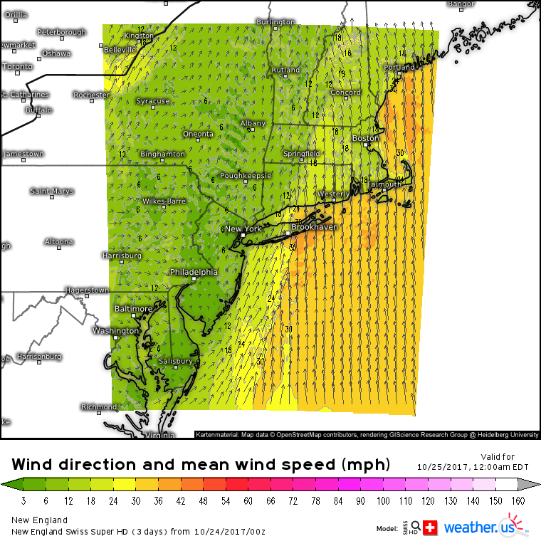
High winds won’t be limited to just thunderstorms. The strong nature of this front means that gusty winds will extend east ahead of the line of storms. Wind gusts over 40 mph are expected along the MA, NH, and ME coastlines tonight as southerly winds ramp up. While not strong enough to cause widespread problems, scattered power outages are definitely a possibility as we head into tomorrow morning.
In addition to the severe weather threat, thunderstorms will also bring torrential rains as they tap into the deep tropical moisture plume I discussed above. Through midnight, several inches of rain are possible from NYC up through Vermont. More rain will fall tomorrow along the New England coast. While dry conditions over the past few months will limit large scale flooding concerns, small scale poor drainage flooding will be a concern with the high rainfall rates.
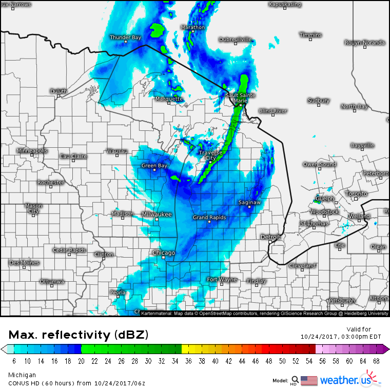
Farther west, steady rain associated with the center of low pressure itself over Michigan will gradually taper to showers this afternoon as drier air works into the area, and the low is cut off from the tropical moisture plume over New England.
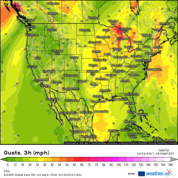
High winds won’t be confined to areas ahead of the front. Northwesterly winds will be breezy behind the front as well, and parts of the Great Lakes could see wind gusts solidly over 50 mph this evening. It will be in these areas that scattered wind damage is possible, 30-40 mph gusts over the Plains shouldn’t cause many problems.
Elsewhere across the country, generally quiet weather is expected as high pressure dominates the West Coast.
For more information on your local forecast: https://weather.us/
For more information on the local forecast for ME/NH: https://forecasterjack.com/2017/10/24/turning-stormier-today/
-Jack
