Storms Weaken As They Move East Today
Hello everyone!
The cold front that brought widespread severe weather to the Plains yesterday will be moving east today, however today’s storms will be much weaker than yesterday’s. 
This simulated radar image for tomorrow shows some strong to possibly severe storms across Mississippi, but as the front moves away from the upper level energy that helped to fuel storms today, the severe weather threat will be decreasing. Still, some gusty winds and a brief spinup tornado can’t be ruled out. Farther north along the front, low-impact showers are forecast in the northern part of the Mississippi valley.
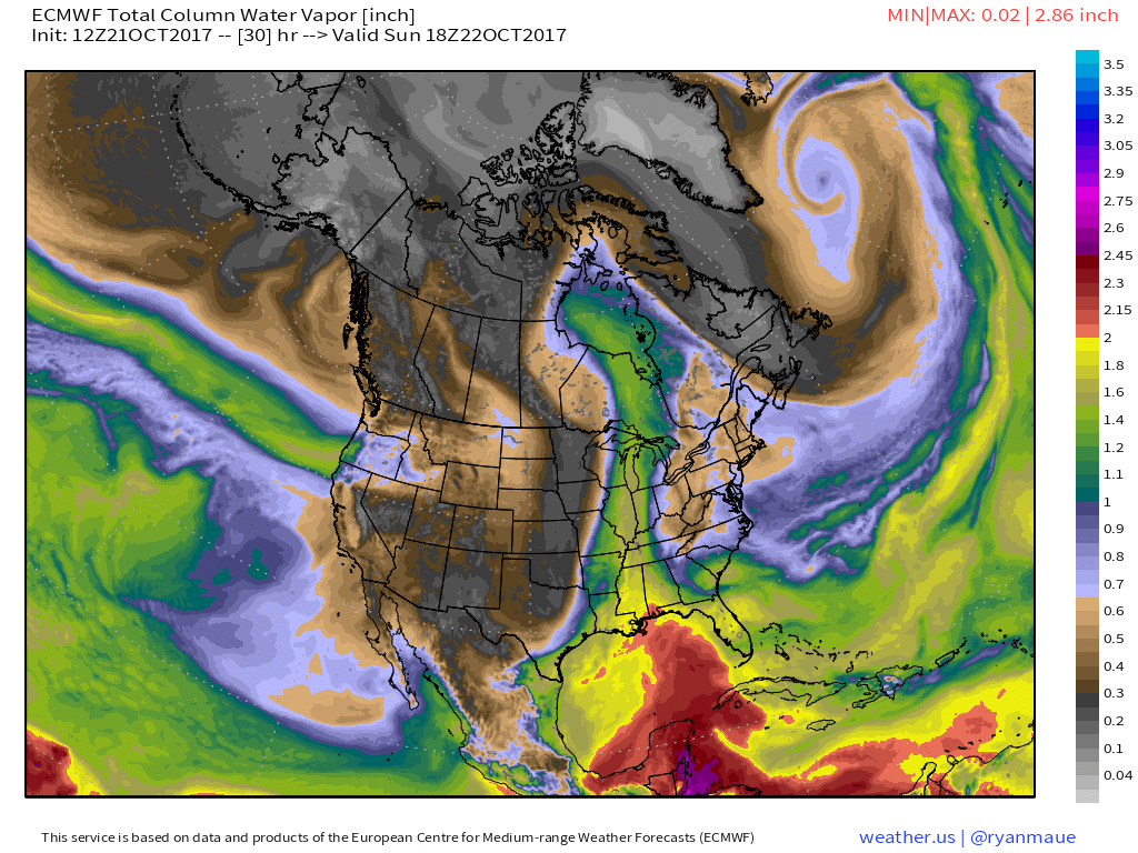
To the west, unsettled weather will continue in the Pacific Northwest as a pipeline of moisture and upper level energy continues to be pointed towards that region.
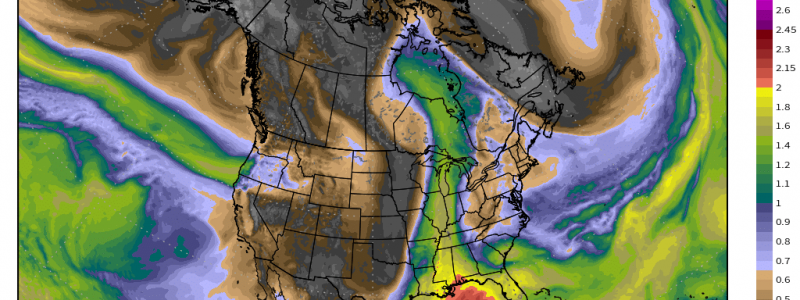
This image from the ECMWF model shows a long plume of moisture moving towards the Pacific Northwest from the tropics. Heavy rain, gusty winds, and mountain snow will all continue today but no unusually severe impacts are expected.
All the air that rises up and over the Cascades due to that atmospheric river has to go somewhere, and that somewhere is the Great Plains. In order to get to the Plains, the air must travel over the Rocky Mountains where it will be compressed due to the terrain influences. This compression will help to accelerate the air parcels, resulting in very gusty winds. The gustiest winds will be found across parts of Montana and Wyoming where hurricane force wind gusts in excess of 75 mph are possible in the higher elevations. Even the lower elevations of Central and Eastern Montana will see wind gusts in the 50-60 mph range. These strong winds will cause power outage and tree damage concerns through the day tomorrow before the die down early in the upcoming week.
Elsewhere across the country, generally quiet weather is expected.
For more details on what to expect in your town: https://weather.us/
For my writeup of today’s weather in Maine and New Hampshire: https://forecasterjack.com/
-Jack


