Storms Bring Unsettled Weather To Both The Northeast And Northwest Today
Hello everyone!
Today’s weather will be dominated by two storm systems, one in the Northeastern states and one in the Pacific Northwest. Each system will bring mostly rain, though ice is expected in interior parts of Northern New England and snow is expected in the high mountains of Washington and Oregon, both areas that will see travel disruptions due to the wintry weather. Farther south, the tail end of the Northeastern storm will bring some showers and thunderstorms to parts of the Mid Atlantic, though no widespread issues are expected there. Meanwhile, the center of the country will enjoy a day of quiet weather after a strong storm brought blizzard conditions, severe weather, and dust storms Sunday and Monday.
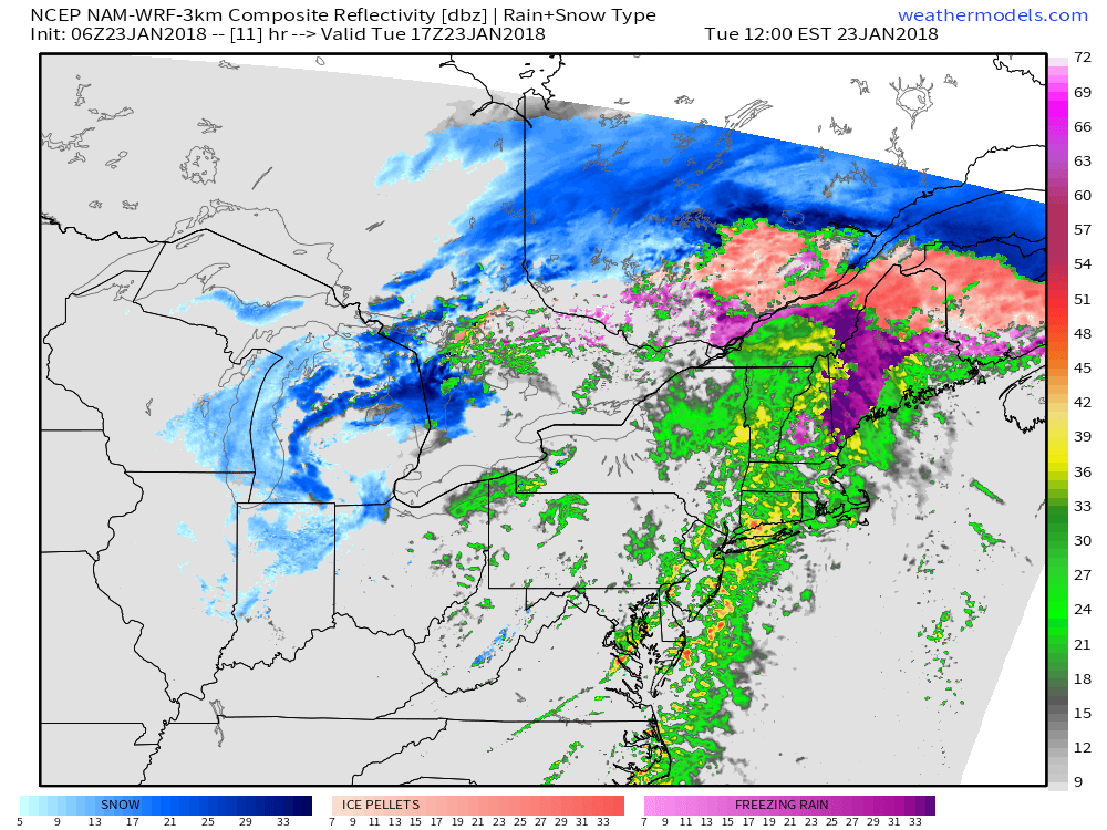
Here’s a simulated radar look at the Northeastern storm from weathermodels.com valid at noon. This map gives a pretty good idea of what to expect from this storm as warm air surges north east of the Appalachians. The only region where cold air will hold out against the incoming warmth will be parts of Maine and New Hampshire between the mountains and the immediate coast. Even there, a change to rain is expected this afternoon, but not before appreciable ice accumulation potentially reaching 1/4″. Farther south, bands of heavy rain are expected in advance of an approaching cold front. Heavy rain will cause some flooding concerns, primarily of the urban/small stream variety though rivers like the Housatonic and Connecticut that remain impacted by ice jams could see larger scale flooding issues.
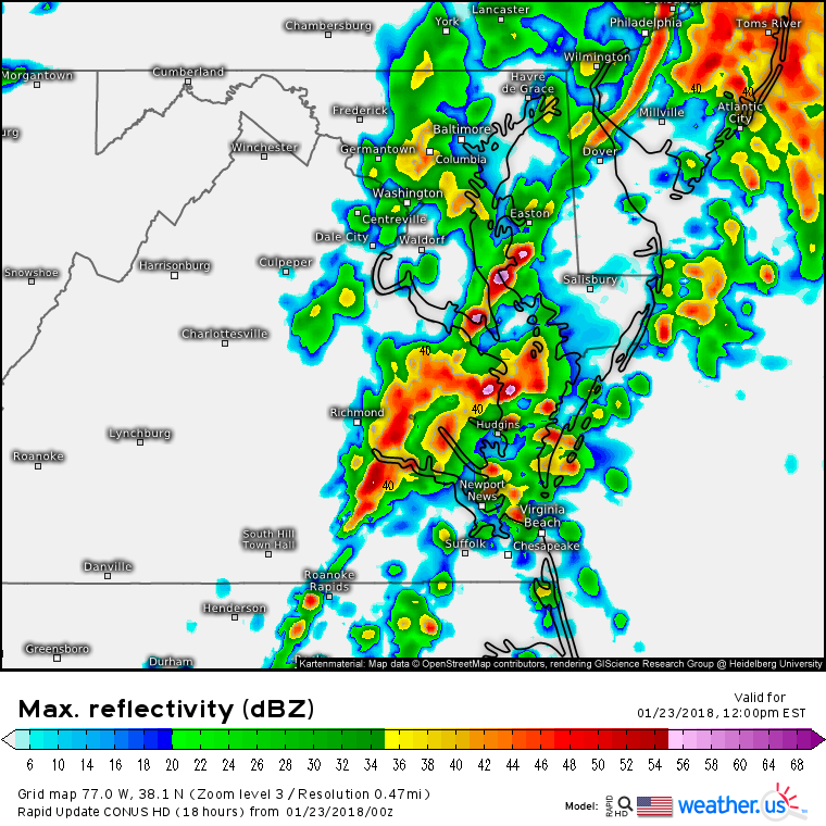
The tail end of this system will move through parts of SE VA and Eastern NC today in the form of a cold front, with showers and thunderstorms developing ahead of it. This simulated radar image shows an area of strong but poorly organized thunderstorms in the Chesapeake Bay area around noon. Most of these storms should remain below severe limits, but a few damaging wind gusts can’t be ruled out. Storms will move offshore this afternoon.
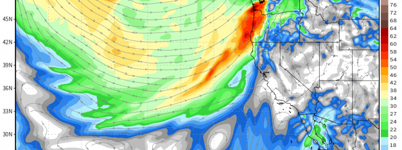
Out west, Water Vapor satellite imagery (what’s that?) shows a strong storm moving into the northernmost part of Vancouver Island this morning. Tropical moisture surging north on the south side of this system will move into parts of Washington and Oregon during the day today. This moisture will get wrung out by the Cascades as well as an approaching cold front, and the result will be a steady rain for the valleys and a steady snow for the higher elevations. The other important feature to note is the speckled pattern in the imagery west of this storm. This indicates lots of cold, Arctic energy. As that energy gets swept into the storm system, it will provide a supply of colder air that will be enough to lower snow levels a bit, down below the passes though still well above sea level.
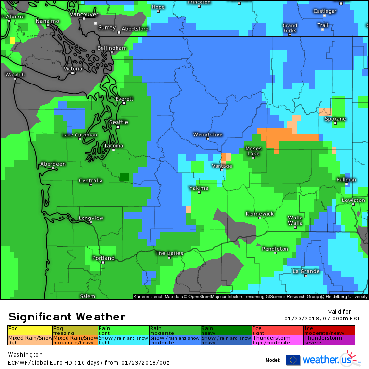
Here’s the ECMWF’s take on the results of this interaction between the colder Arctic energy and the plume of tropical moisture. Notice the indications of heavy precipitation, as well as the relatively wide expanse of snow stretching from the Cascades all the way east to Idaho.
As far as accumulations go, this map shows how much QPF is expected to fall as snow through tomorrow morning (for more on QPF and why it’s useful for snow forecasting). The jackpot area will be the Olympic mountains, which will see 2-3 feet of snow. 1-2 feet is expected in the higher elevations of the Cascades, with lighter amounts at lower elevations east of the mountain range.
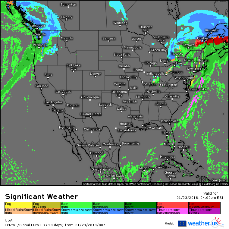
Elsewhere across the country, the ECMWF’s overview map shows that a relatively quiet weather day is expected.
For more information on your local forecast: https://weather.us/
For more information on the local forecast for ME/NH: https://forecasterjack.com/2018/01/23/freezing-rain-transitions-to-rain-today-as-cold-air-damming-slowly-erodes/
-Jack
