Snow Levels Fall Across The Pacific Northwest While The Rest Of The Nation Continues To See Quiet Weather
Hello everyone!
Today will feature the lowering of snowfall levels across the Pacific Northwest as a cooler airmass moves into the area. As a result, the passes will see a return to winter driving conditions after several days of warmth and rain.
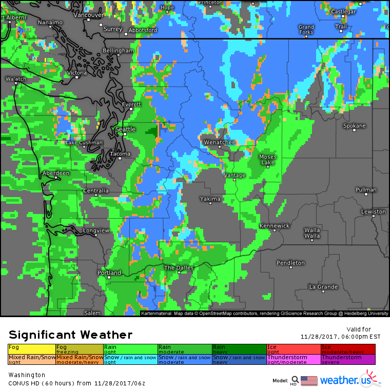
This significant weather map shows the expected rain and snow today as another Pacific storm moves onshore. Notice the much wider expanse of snowfall in today’s forecast compared to yesterday and Sunday. This is due to the cooler source region of the storm system (Alaska as opposed to Hawaii).
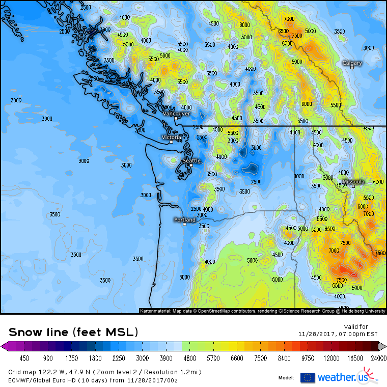
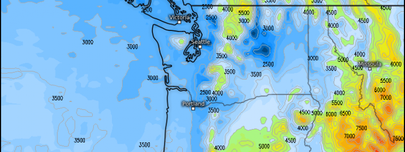
ECMWF snow level forecasts show flakes making it as far down as 2,500-3,500 feet in parts of Washington today. This will be low enough for the passes and other parts of the foothills/mountains to see snow. Seattle and the lowlands will remain warm and rainy today, however as there’s no Arctic air nearby to allow snow to fall into the lowest part of the atmosphere without melting.
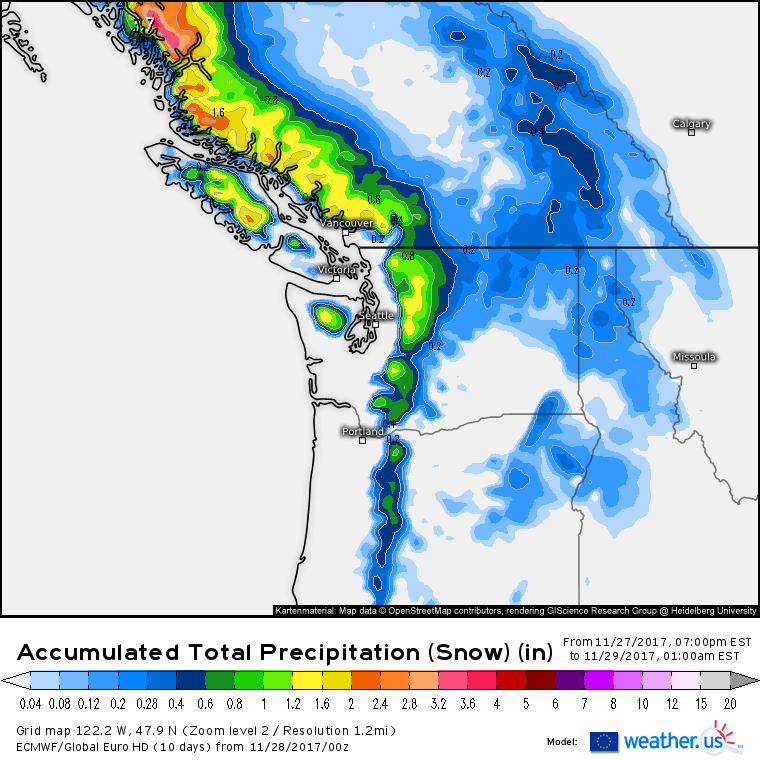
About 1″ of liquid equivalent precipitation (what’s that?) is expected to fall as snow on the summits today, which will produce 10-14″ of snow. Amounts will drop off as you head into the lower elevations, though a good part of NE Washington could see an inch or two as moisture spills over the Cascades.
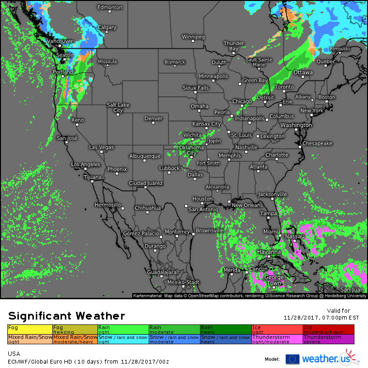
Elswehere across the country today, quiet weather is expected. A cold front will bring showers to the Great Lakes, while an Upper Level low will provide the same service to parts of Oklahoma. Afternoon showers and thunderstorms are possible in parts of Southern Florida, but otherwise look for clear skies across the majority of the nation today.
For more information about your local forecast: https://weather.us/
For more information about the local forecast for Maine/New Hampshire: https://forecasterjack.com/2017/11/28/cool-and-calm-today-3/
-Jack
