Showers Expected On The West Coast As The Pacific Storm Train Resumes Today
Hello everyone!
Showers will return to the West Coast today as the Pacific storm train resumes. While impacts won’t be major, rain and mountain snow will create nuisance issues for travelers today as moisture moves onshore. Elsewhere across the country, quiet weather is expected with just a few showers forecast across the Southern tier as a cold front stalls over the region.
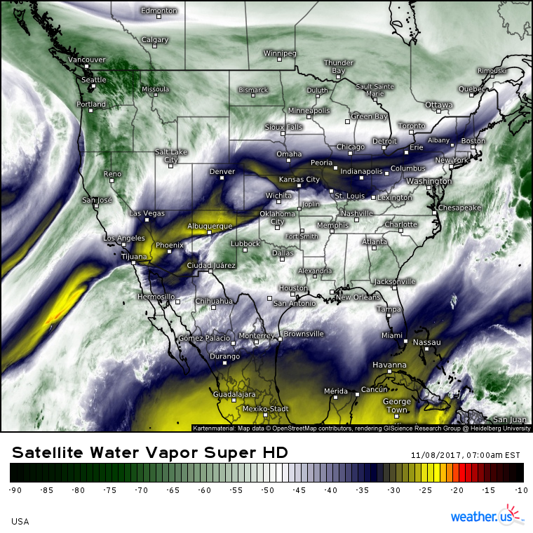
GOES-16 Water Vapor satellite imagery (what’s that?) shows the storm impacting the West Coast this morning. Notice the atmospheric river of moisture extending from the tropical East Pacific to Central California and eventually to British Columbia. Elsewhere across the US, a remarkably quiet pattern is on display as the west-east oriented jet stream precludes any significant storm systems.
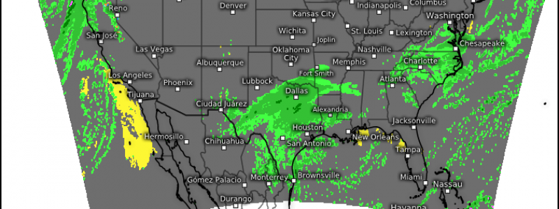
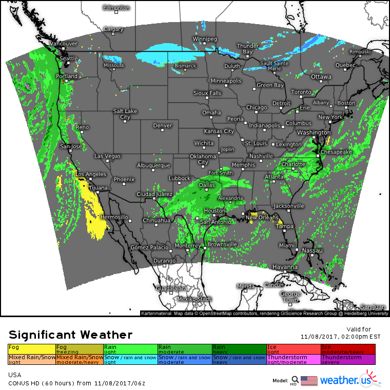
High resolution model guidance does a good job highlighting the short term forecast for this afternoon. Rain and some high elevation snow will impact parts of the West, while rain will also impact parts of Texas and the Mid Atlantic. These areas of rain are associated with weak waves of low pressure forming along a stalled frontal boundary. No major flooding or severe weather impacts are expected with these systems. Most of the rest of the nation will enjoy quiet weather and some flurries are expected in the Northern Plains as an Arctic cold front begins its journey southeast. For more on that front and the impacts it’s expected to bring, check out last evening’s blog post.
For more details on your local forecast: https://weather.us/
For more details on the local forecast for Maine and New Hampshire: https://forecasterjack.com/2017/11/08/a-cool-and-calm-day-today-2/
-Jack


