Severe Threat Diminishes Today
Hello everyone!
Yesterday’s severe storms have weakened into a line of showers spanning the length of the country from the Great Lakes to Southern Texas. These showers will continue east today, but the severe weather threat will be much compared to yesterday.
Water vapor satellite imagery (what’s that?) is, as always, a great place to start getting a sense of our weather for the day. An upper level trough is located over the eastern Rockies, with cool and dry air underneath it, behind the cold front which is now marching into the Ohio Valley. To the East, high pressure between Florida and Bermuda will bring warm and quiet weather to the East Coast.
The jet stream looks fairly similar to yesterday, with an intense jet streak located to the west of the cold front. Upward motion underneath this jet streak will keep showers and thunderstorms going throughout the day today as the front moves east. How do jet streaks generate upward motion and why are they important to severe weather forecasting? I discussed that in yesterday afternoon’s blog post! The jet streak will also strengthen the circulation associated with the front, and strong winds are expected both ahead of, and behind the front, even without thunderstorm activity.
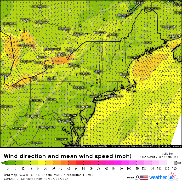
This wind speed and direction forecast shows both the strong nature of the winds and the sharp wind shift associated with the front. This will be one of those fronts that you can feel the moment it moves through. Ahead of the front, the strongest winds will be felt along S/SW facing coastlines such as southern Long Island, southern Cape Cod, and the coast of Maine NE of Portland. Behind the front, the SE shores of the Great Lakes will see the strongest gusts as winds pick up steam over relatively frictionless water.
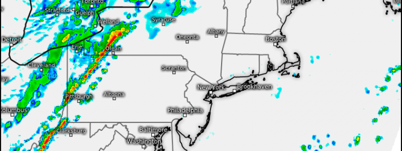
In terms of shower and thunderstorm activity, this simulated radar image gives a good approximation of what to expect this afternoon. A line of storms is likely to form along the cold front as it moves into Western Pennsylvania and New York. This line of storms will pose a damaging wind threat, as the turbulence associated with thunderstorms helps to mix down wind gusts from aloft. The storms will sweep quickly east with the front, weakening as the sun goes down.
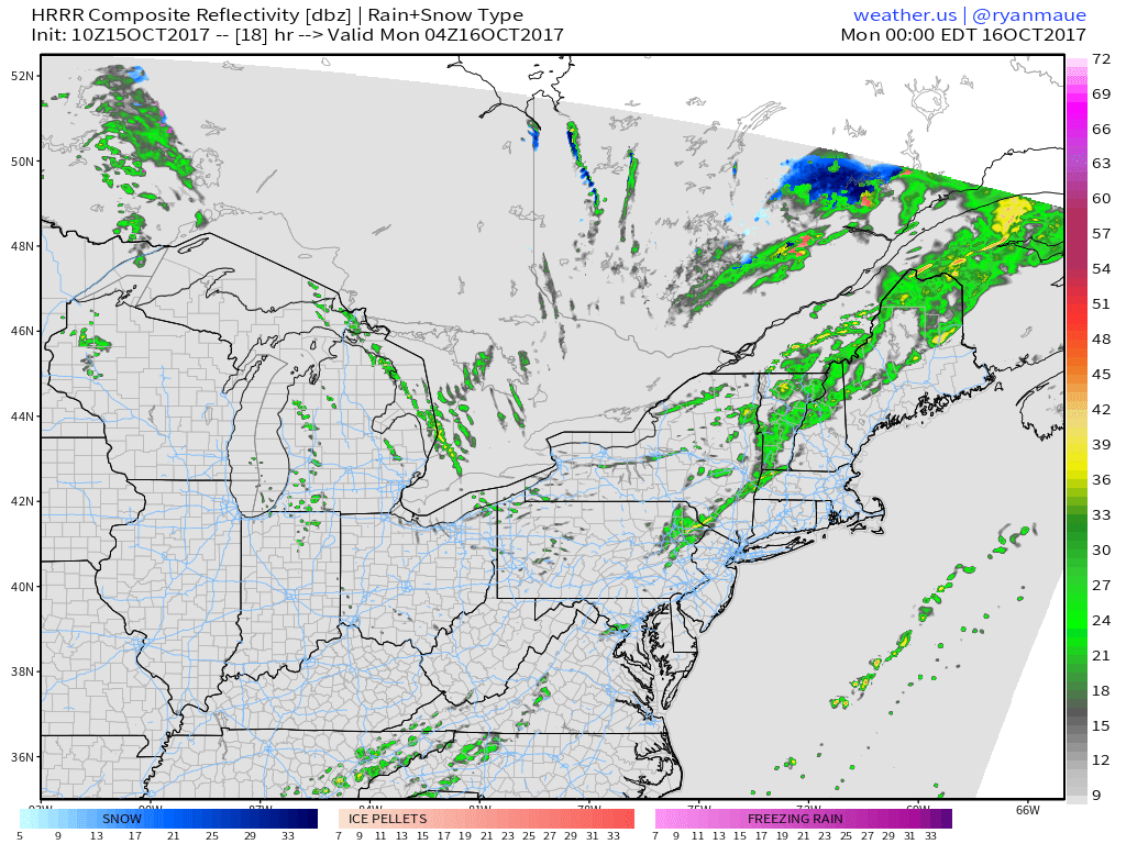
This simulated radar image for later in the evening shows lake effect rain showers developing on the SE side of Lake Huron, Lake Erie, and Lake Michigan. While temps will be a bit too warm for snow, it’s a good reminder that winter isn’t too far away!
Elsewhere across the country today, generally quiet weather is expected.
For more details on your local forecast: https://weather.us/
For more details on the local forecast for Maine and New Hampshire: https://forecasterjack.com/2017/10/15/warm-and-breezy-today-2/
-Jack


