Severe Storms To Erupt In Texas And Louisiana Today
Hello everyone!
A cold front separating warmer than usual temps in the east and cooler than usual temps in the west will be on the move today. As it travels towards the Atlantic, it will spark some strong to severe storms in Texas which will remain fairly powerful as they move into Louisiana tonight. This post will provide a quick rundown of what to expect from these storms, and a little bit of the science behind why.
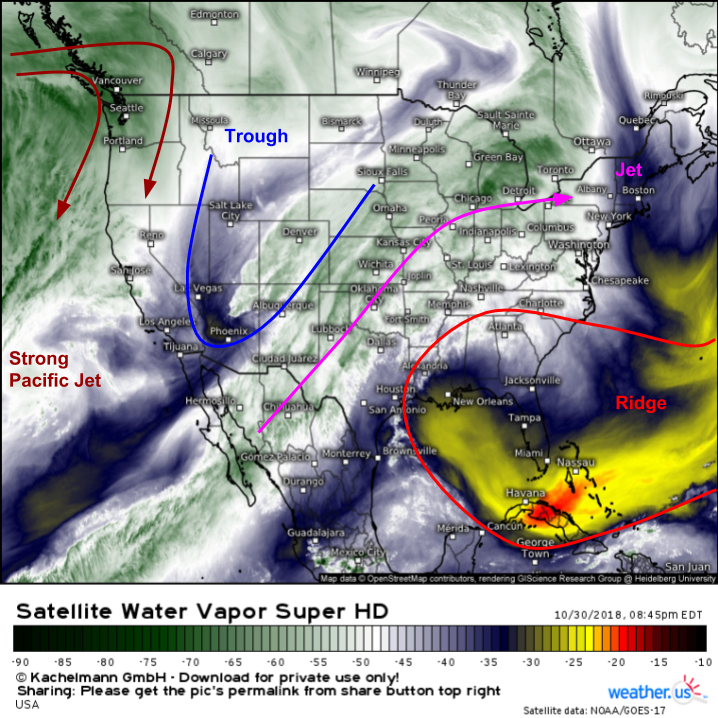
As always, I’ll start with GOES-East WV satellite imagery (what’s that?) which provides a good overview of the large scale pattern from coast to coast. The main features to note are a strong ridge over Florida, and a trough over the Desert Southwest. The strong Jet entering the Pacific Northwest will be pushing the Southwestern trough out to the east, where it will encounter warm moist air sent north from the Gulf of Mexico by the ridge. Combine that with the fact that there’s a strong jet aloft between the ridge and the trough, and you have a good recipe for storms.
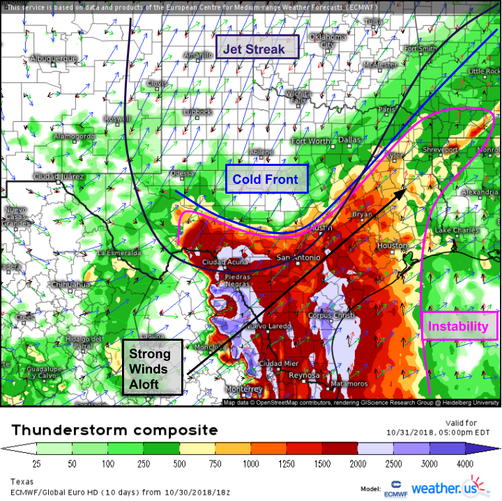
If we want to be a little more precise with our interrogation of the severe storm environment, our next step is the ECMWF’s Thunderstorm Composite map, shown above (what’s that?). This map displays instability and various wind vectors spanning from the surface to 300mb all on one map. This enables us to see surface features (lifting/trigger mechanisms), instability, wind shear, and rotational energy all on the same map! Starting with the most straightforward parameter, there’s a decent amount of instability forecast across Southern Texas, but as is almost always the case, the area of best lifting/shear doesn’t quite line up with the area of best instability. That said, from San Antonio north and east through Houston, Baton Rouge, Vicksburg Mississippi, and Shreveport, which is the area to watch for the most severe weather, there will be enough overlap of dynamics and instability.
If you look closely on the map above, you’ll see winds turning strongly with height across the aforementioned area. Winds are out of the SSE at the surface, SSW at 850mb (red arrow), and SW at 500 and 300mb (blue arrows). This rotational energy will be available for storms to tap into today, leading to rotation!
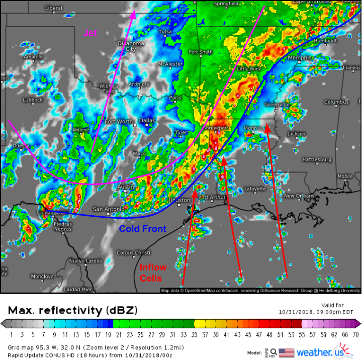
Here’s a look at the simulated radar forecast for this evening showing one depiction of the net result of the dynamics above. There will be two separate storm modes existing simultaneously tonight: a line of storms along the front itself, and discrete cells embedded in the inflow towards that line. The line will be the overall more powerful system, with the potential for damaging winds across a fairly wide area. However, it will be those discrete cells that have the best shot at tapping into the rotational energy discussed above. As a result, we’ll have to watch for potential tornadoes in the cells ahead of the line, and possibly associated with the line itself where we see those inflow cells actually collide with the line itself.
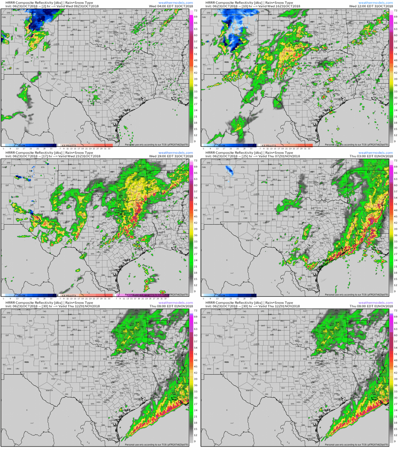
Here’s a quick animation of what the HRRR model thinks the radar will look like over the course of the next day or so. Note the storms developing out ahead of the line earlier in the day, eventually getting caught up by the line as it advances east. As always, don’t use this as a precision tool, but instead as a general guide of roughly what to expect things to look like over a given timeframe. GIF via weathermodels.com.
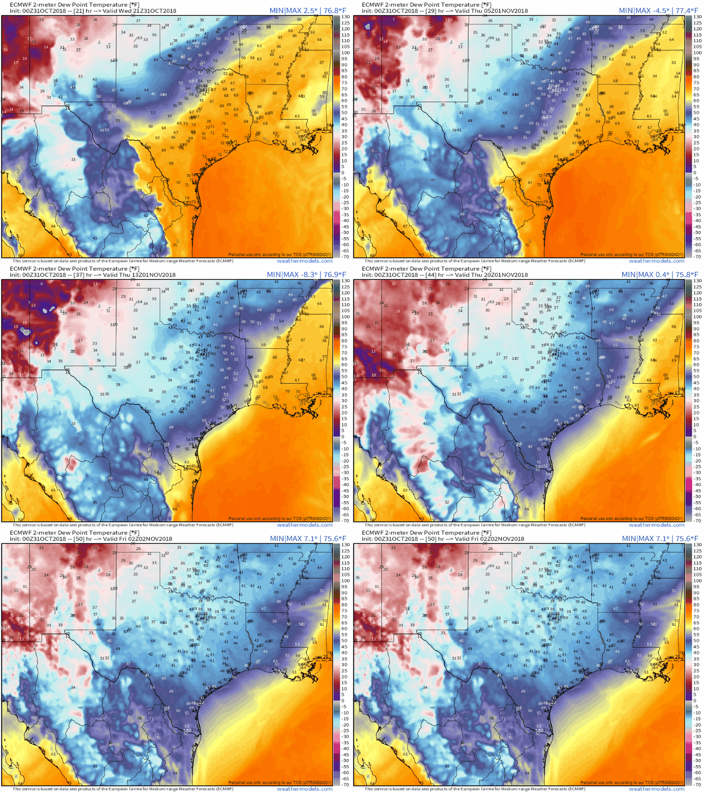
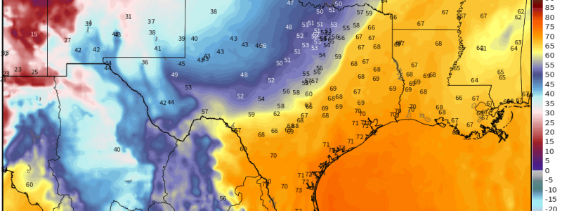
ECMWF one hourly dew point forecasts via weathermodels.com show much cooler and drier air sweeping into the region tonight and tomorrow. You can find all the new ECMWF data, including hourly forecasts and 6z/18z forecast updates both at weather.us and weathermodels.com. This includes maps on both sites, as well as the town-specific forecast info at weather.us (accessible by selecting “Rapid ECMWF” from the dropdown menu, forecast for anywhere in the world via the search box).
Have a great day, and stay safe if you’re in the path of the storms!
-Jack
