Severe Storms Target The Northern Plains, Flash Flooding Near Vegas
Hello everyone!
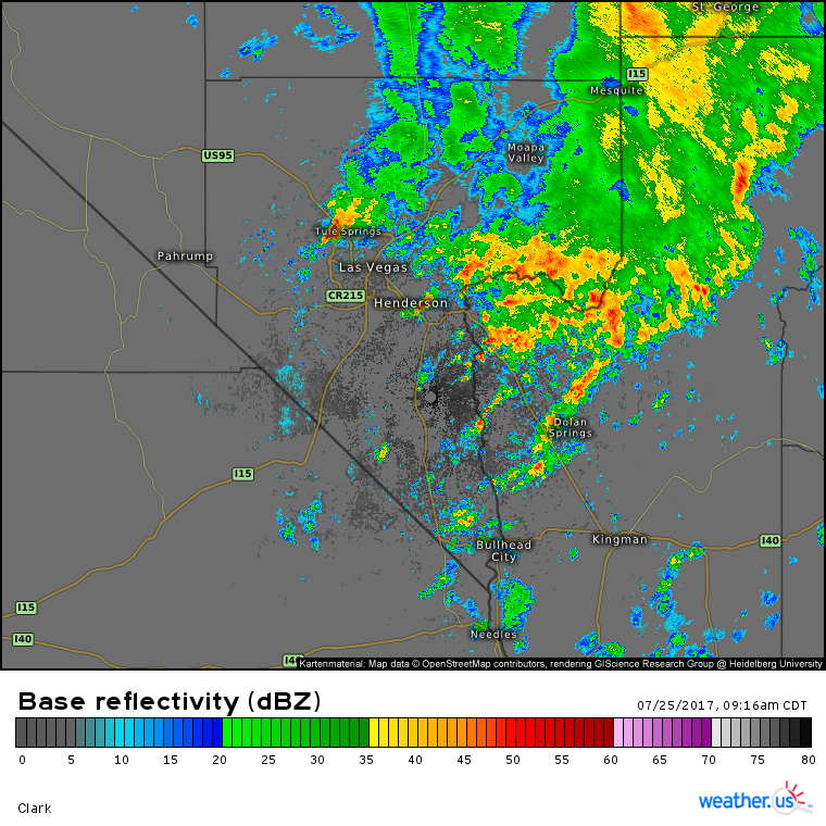
There’s rarely if ever a dull moment in the weather across the US and today is no exception. Flash flooding is impacting the Las Vegas area this morning, and by the time we get to this evening, powerful severe storms will be erupting across the Northern Plains. Meanwhile in the Northeast, unusually cool weather will continue as dueling low pressure systems continue to exert their influence.
This thunderstorm complex is remaining more or less stationary over the same areas and as a result, the same areas continue to receive very heavy rains. This so called “training” of thunderstorms is causing flash flooding just wast of the city. What’s causing the thunderstorms in the middle of the desert? An upper level low just NW of San Francisco is funneling tropical moisture north from the Eastern Pacific. This is providing the moisture while energy associated with the upper level low is responsible for triggering the storms. The storms should slowly dissipate this afternoon as they move east.
While dangerous flash flooding will dominate this morning’s weather, significant severe storms will dominate this afternoon and evening’s weather.
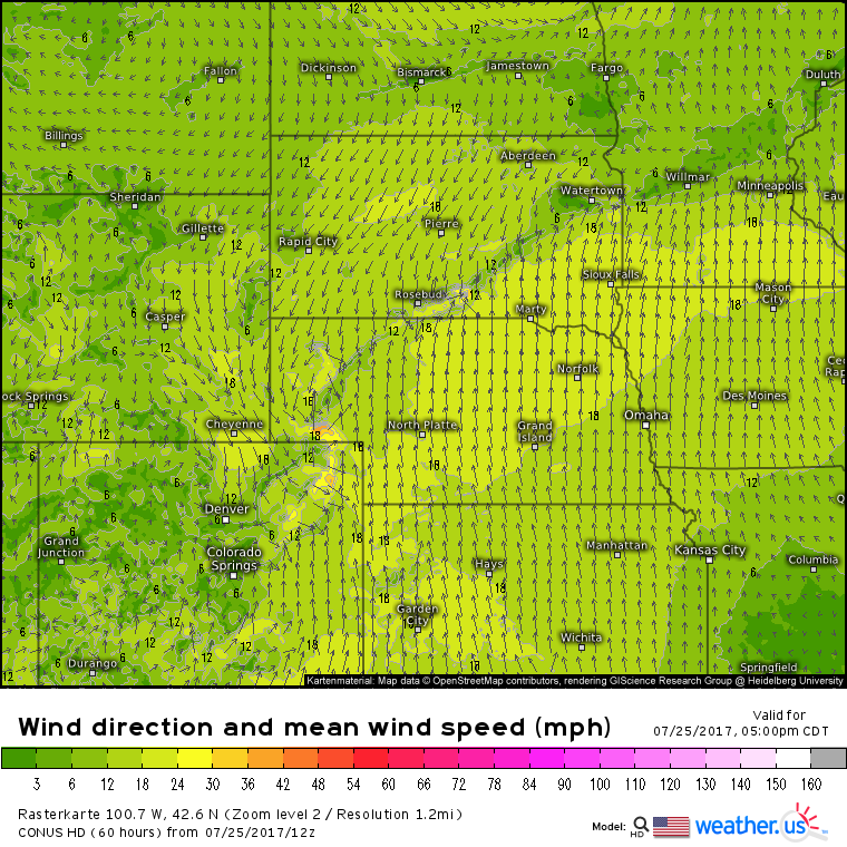
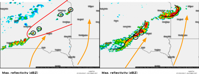
A sharp and well defined warm front is located from the Panhandle of Nebraska up through South Dakota and into Southern Minnesota. Intense heating due to sunny skies in the area will result in an area of very unstable air. CAPE values are forecast to increase to between 3,000 and 4,000 J/kg across Eastern South Dakota and values above 4,000 J/kg are forecast over southern Minnesota. This powder keg of instability will be ignited by the warm front and very strong storms are forecast to develop by the time we get to 6:00 PM, CDT. The storm mode is an important determiner of what type of weather a storm will bring. Linear storm modes (lines of storms) typically favor damaging winds and isolated large hail while discrete storm modes (individual, widely scattered storms) favor large hail and tornadoes in addition to damaging winds. So what storm mode is expected today? Depends on the area.
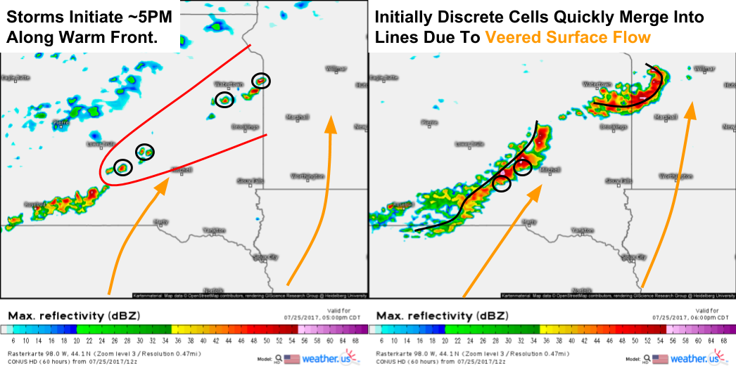
Over Eastern South Dakota, winds are veered meaning that they are out of the south-west (as opposed to backed flow which has an easterly component). The veered winds will favor a linear storm mode to quickly emerge as storms initiate and develop this evening. The NAM model shows this well with initially discrete cells quickly developing into lines within an hour of initiation. Watch for the leading edge of the lines as occasionally a few brief tornadoes can spin up. However, with veered flow and a linear storm mode, I expect to see more damaging wind reports than anything else over Eastern SD. What about Southern MN?
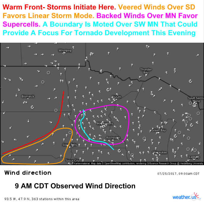
All the pieces are in place at the moment. Current (9 AM CDT) wind direction observations show the warm front and veered winds over Eastern SD. Over S MN, however, backed surface winds are noted with many stations near Minneapolis reporting SE winds. A boundary is noted across parts of SW MN that separates the veered flow from the backed flow. Convergence along this boundary could help to initiate storms this afternoon and any storms that do form could take advantage of the backed winds which is likely to result in rotation. Therefore, supercells will be the initially favored storm mode over S MN before the E SD lines move into the area. During the supercell phase, all modes of severe weather are very possible, including damaging winds, large hail, as well as tornadoes. The threat will evolve to become more in favor of damaging winds as the evening rolls on and the storm mode shifts towards linear. A few lines of storms could persist through the overnight hours and scattered damaging winds are possible all the way through parts of NW Wisconsin as storms move ENE.
Cool weather is set to continue today across the northeast as NE surface winds and a trough in the upper levels combine to limit temps to the 60’s and 70’s. A few scattered showers are possible as weak low pressure drifts through New England but otherwise dry weather is expected.
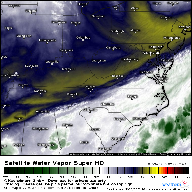
Over the southeast, more disorganized showers and storms are in the forecast today as a weak frontal boundary meanders over the area. Notice the drier air over and to the west of the Appalachian mountains. This will likely slide east before it can sink much farther south, but the boundary between this dry air and the tropical moisture currently in place will result in more showers and storms this afternoon. Due to weak winds aloft, little to no severe weather is expected though flash flooding will continue to be a concern through this evening.
That’s an overview of the active weather forecast for the US today. For more information on your forecast, check out the tools we have available over at weather.us!
-Jack Sillin
