Severe Storms Possible In Oklahoma And Adjacent Parts Of The Southern Plains Today
Hello everyone!
The nor’easter we’ve been following for the past few days is now departing off the East Coast and no longer poses a threat to the US. It will, however, continue to cause problems in parts of Atlantic Canada, so if you have interests in that region, you should keep following along with GOES-East satellite imagery and current observations. If you missed last night’s post on that storm, it took a deeper dive into some of the dynamics of the system’s unique inner core. If you’re curious about that stuff and have a few moments, check it out! Today’s post will return to the forecast realm, discussing the possibility for severe thunderstorms in parts of Oklahoma this afternoon/evening.
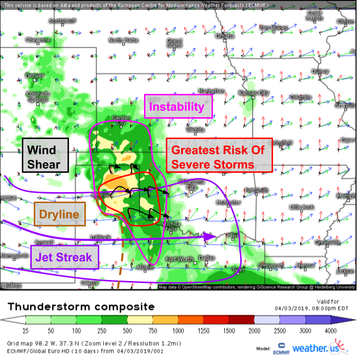
Here’s the overall setup visualized by the ECMWF’s thunderstorm composite map. A narrow corridor of instability will be present to the east of a dryline located in the Texas panhandle. The southern part of that area of unstable air will exist under strong westerly winds at the jet stream level (about 30,000 feet). Those winds will be both stronger than surface winds, and from a different direction, meaning there will be strong wind shear. Farther north, weaker upper level winds will limit shear values. The dryline will act as a forcing mechanism to get air rising to the point where it is warmer and less dense than its surroundings, where it’s free to rise all the way up to the tropopause. The greatest risk for severe weather will exist where those storms have access to the wind shear, which will support rotating updrafts known as mesocyclones.
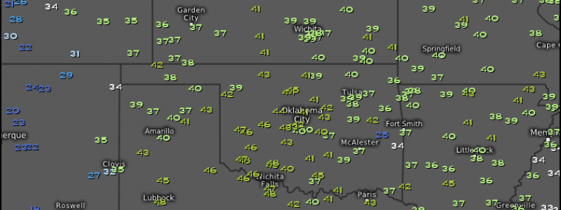
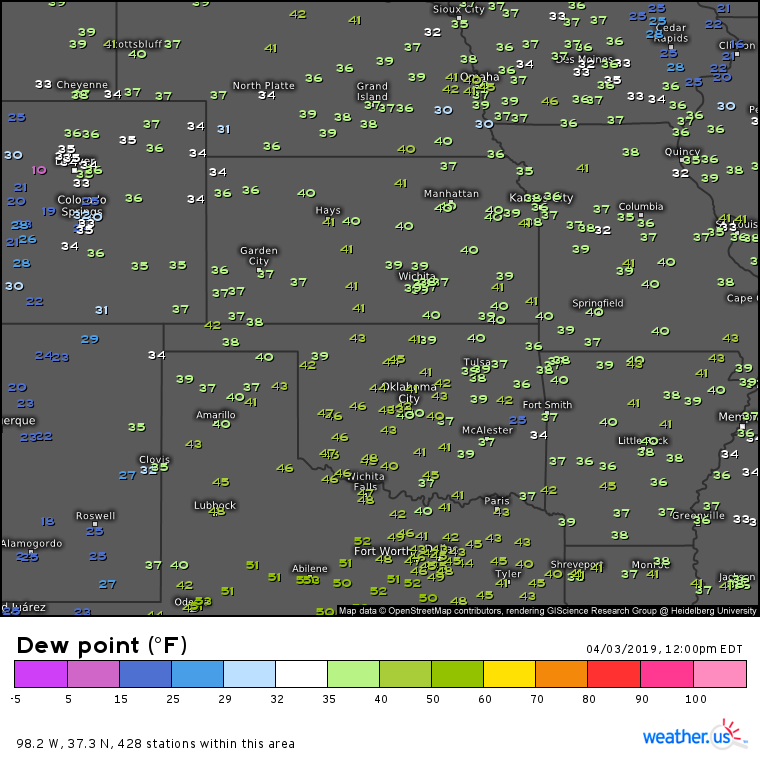
One source of forecast uncertainty that immediately comes to mind with a look at current observations is the question of moisture availability. Of course moisture is one of the key ingredients for thunderstorms. Air can rise and cool all it wants, but if there’s little to no moisture to condense, you won’t get any clouds, let alone powerful storms. Dew points are one way to gauge moisture content, and at the moment values aren’t all that impressive. Generally dew points in the 50’s will support some thunderstorms, while the stronger cells prefer dew points above 60. Of course these are only rough estimates, and given sufficient dynamics even a relatively low moisture environment can and will produce severe weather. Dew points in the area the ECMWF highlighted above are currently in the low to mid 40’s. However, moister air is lurking off to the southeast, and with a few more hours to go before thunderstorms get going, some of that moisture will make its way into the OK/TX panhandle area.
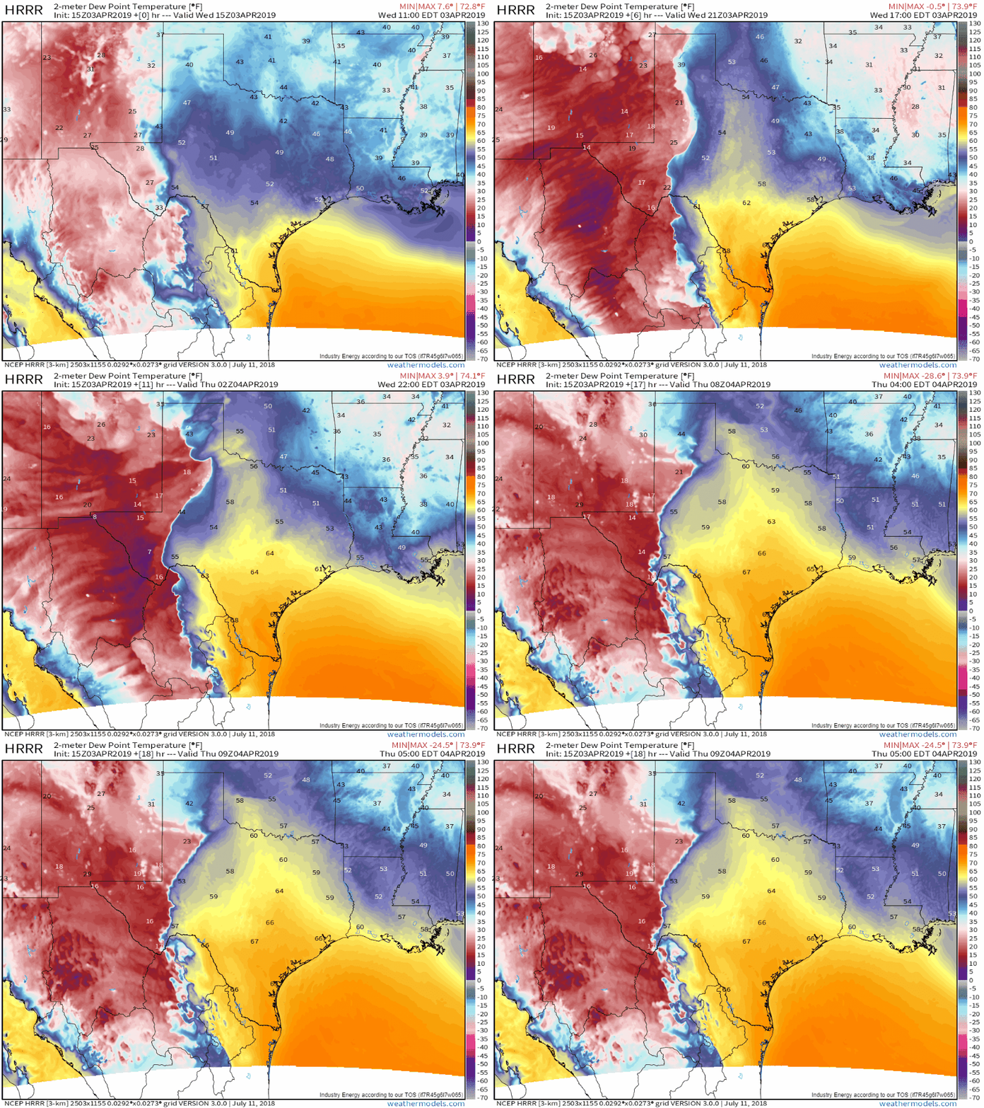
Here’s a forecast simulation from the HRRR that shows that moisture advection process over the next few hours. You can see how dew points rise from the mid 40’s into the low 50’s across the area we’re interested in before thunderstorms develop (storms are visible as pulses of much higher dew points that move towards the NE near the end of the loop). However, if the model is too optimistic about the moisture return and the air stays drier, the severe threat would lessen somewhat. GIF via weathermodels.com.
Here’s a look at the smaller scale implications of the pattern highlighted back at the beginning of the post by the ECMWF’s thunderstorm composite map. This simulated radar image from the HRRR will not be any good at giving you specific storm forecast locations, but it does show the difference between storms that form farther north in that unstable area, and those that form farther south. The southern storms will encounter enough shear to develop rotating mesocyclones, which will enhance their severe potential. Given that storms will be rotating aloft, does that mean there will be a big tornado threat? The answer is no. While there is enough wind shear (rotation) for tornadoes, the relative lack of moisture (remember those dew points in the 40’s) will mean that cloud bases are too high for that rotation to make it all the way to the ground in the form of a tornado. Perhaps local moisture enhancements will enable one or two tornadoes, but they should be short lived and on the weaker side. The primary threats today are large hail, damaging winds, and frequent lightning. Map via weathermodels.com.
Storms will weaken later tonight as they move towards cooler and more stable air in central/eastern OK.
-Jack


