Severe Storms Expected In The Plains Today
Hello everyone!
Today’s main weather story will be severe thunderstorms developing in the center of the country as a cold front moves east. While the strongest storms will be located in Oklahoma and N Texas, severe weather is possible all the way up towards Minneapolis.
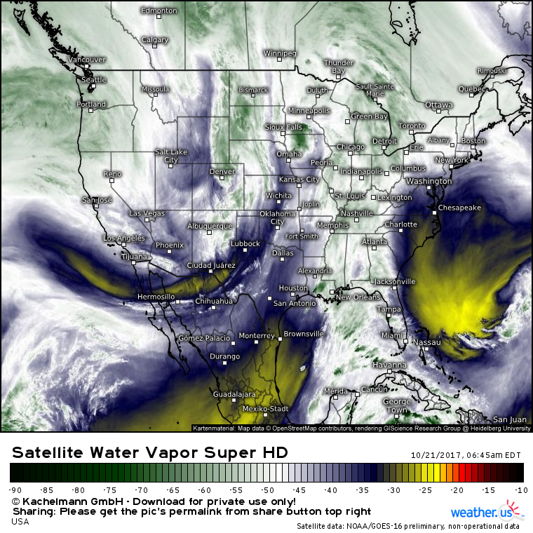
Water vapor satellite imagery from GOES-16 shows the primary feature responsible for this severe weather quite well. This is the dip in the jet stream shown from Southern California up towards Denver and Bismarck, ND. This trough will set the stage favorably for severe thunderstorm development. The trough’s associated cold front will help to focus lifting so that storms can actually get going this evening.
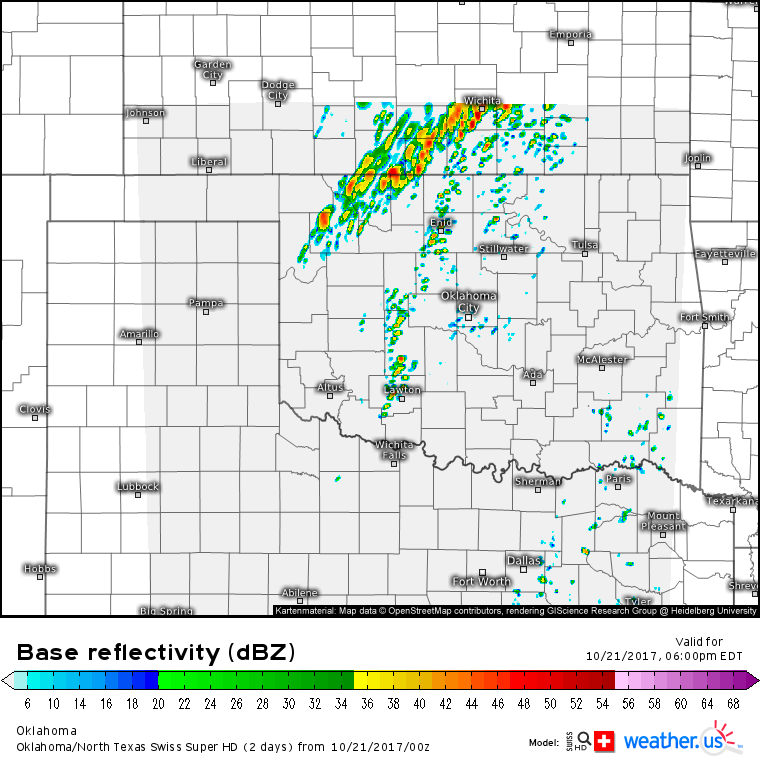
This Swiss Super HD model forecast shows thunderstorms beginning to develop around 5 PM CDT this evening in parts of Kansas and Oklahoma.
The type, or mode, of severe storms is an important factor in determining what type of severe weather is most likely. Discrete supercellular storm modes can produce strong tornadoes and very large hail in addition to damaging winds, while linear storm modes can produce very strong non-tornadic winds but are less likely to produce very large hail and strong tornadoes (weak spinups can still occur).
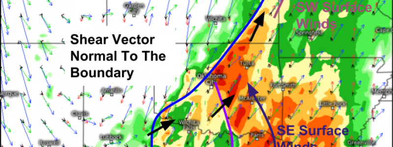
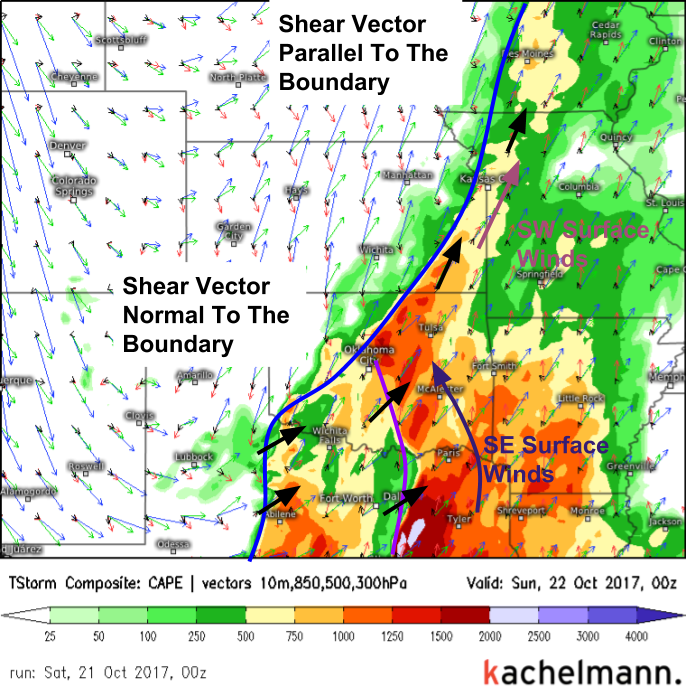
So how do we forecast storm mode? This map, an analysis of wind vectors at different levels, is very important. First we need to figure out our surface boundaries. We have a dryline forecast from Oklahoma City down towards Dallas this evening. A cold front is located farther north and west. Boundaries can be spotted in surface wind forecasts. Next, we add up the vectors through the rest of the atmosphere to figure out the deep layer shear vector.
If the shear vector is pointed parallel to one of the boundaries, a linear storm mode can be expected. This is due to the fact that the shear vector is what steers storms. If a storm goes up on the cold front and the shear vector is pointed parallel to the cold front, that storm will continue to move along the front, where it will encounter and merge with other storms, eventually creating a line. The opposite is true for when shear vectors are oriented perpendicular (or normal) to the boundary. When this happens, storms can move off the boundary into the unstable warm sector environment. Supercells are more likely in these cases. The vector analysis above shows that we have both types of environments forecast this evening.
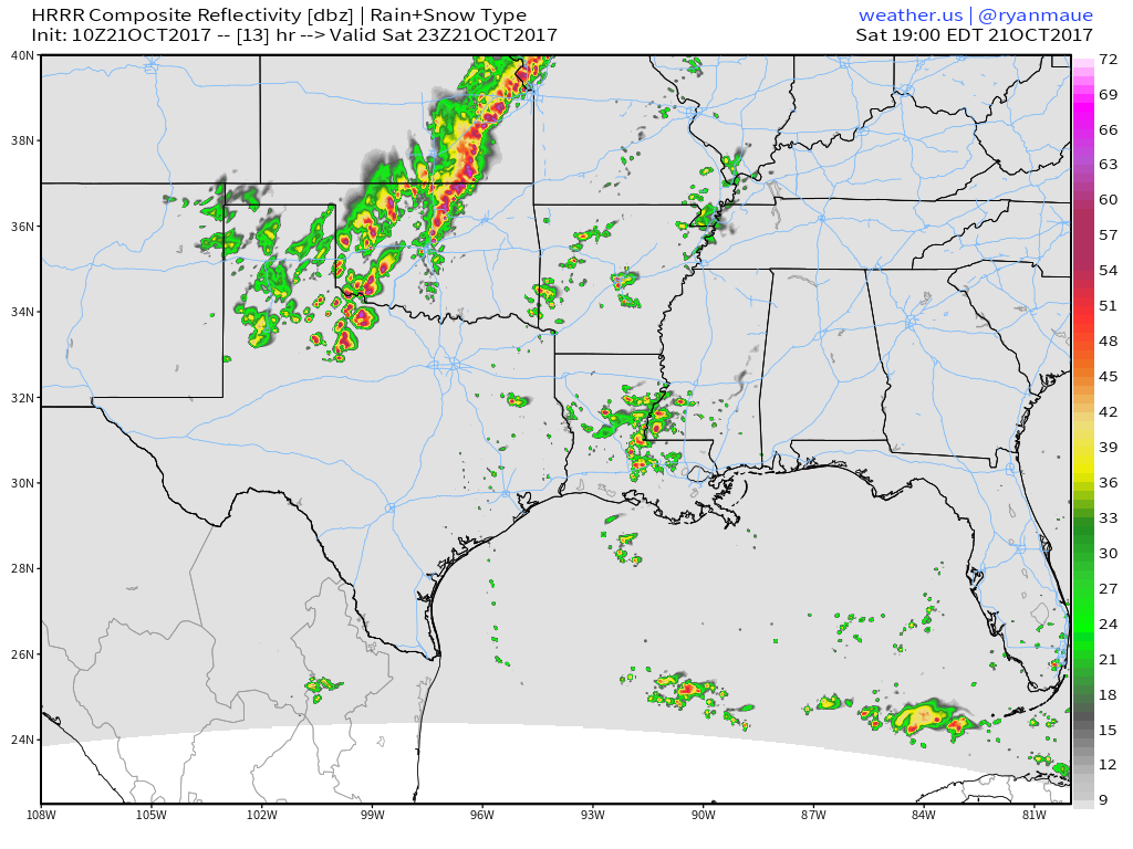
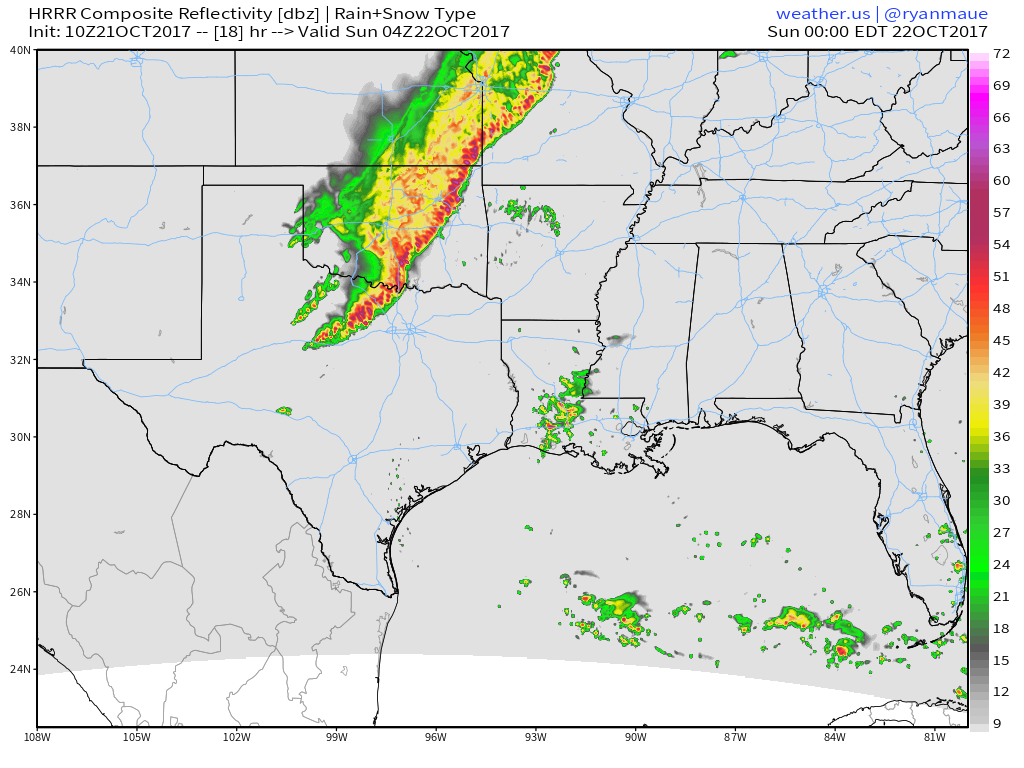
This simulated radar image from the HRRR highlights the difference in storm mode across the Southern Plains this evening. Notice the discrete supercell type structures in N Texas and SW Oklahoma, with a linear storm structure up in NE Oklahoma and SE Kansas. Thanks to the vector analysis, we know the reason for these differences!
By later in the night tonight, the supercells will have produced too much rain cooled outflow to stay discrete, and even they will congeal into a line of storms that will move SE with heavy rain, lightning, and gusty winds.
Follow the storms with the tools available at weather.us!
GOES-16 satellite imagery (use menus to zoom in and select other satellite views, such as visible when the sun comes up so that you can see every cloud!)
HD radar imagery (zoom into your desired area either by clicking the map or via the menus to see the HD imagery instead of the SD overview)
High resolution model forecasts (see short term predictions for severe storm movement with high resolution weather models such as the 1x1km Swiss Super HD model!)
I’ll have more info this evening both here and on Twitter @weatherdotus!
Generally quiet weather is expected elsewhere across the US today. For more details on your local forecast, head on over to weather.us.
-Jack


Hello jack, your weather prediction was absolutely correct. I live in southern California, the thunderstorm was stuck whole day. I am a big fan of yours and your weather prediction, always following you and your predictions. Keep updating!!