Severe Storms Expected In The Dakotas Today
Hello everyone!
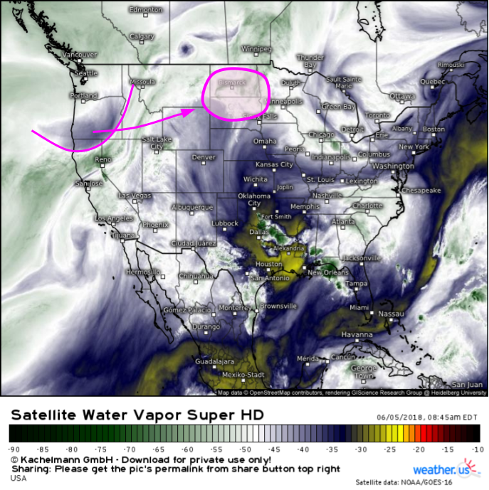
A strong upper level disturbance currently moving through the Northern Rockies will emerge out onto the Northern Plains tonight, helping to spark thunderstorm development in the Dakotas. With strong winds aloft, and warm temperatures near the surface, storms are likely to be severe with damaging winds, large hail, and tornadoes all possible.
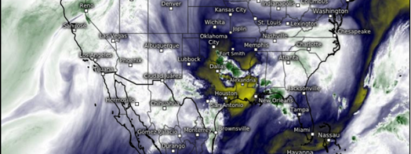
The disturbance is clearly evident on GOES-East WV satellite imagery over Oregon. The disturbance will be a fast mover, reaching the Dakotas by tonight. Elsewhere across the country, a disturbance over Oklahoma will continue dropping southward, bringing some severe storm activity to parts of Texas and Louisiana, and a disturbance over the Great Lakes will touch off a few showers and storms across parts of the Northeast. Aside from those two areas, however, today’s weather will be fairly quiet as the jet stream begins to assume its summertime position north of the Canadian border.
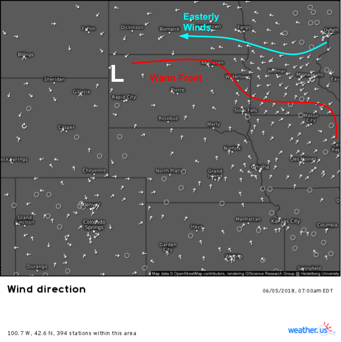
At the surface, a warm front is draped across Northern South Dakota and Southern Minnesota. This front will be the focal point for storm development once the disturbance arrives tonight. North of the front, winds are out of the East, which will provide the wind shear (change in wind speed/direction with height) needed for rotating updrafts. Remember that rotating storms are more likely to produce stronger damaging winds and larger hail compared to non-rotating storms, in addition to posing a threat for tornadoes.
A look at the ECMWF’s thunderstorm composite forecast for tonight shows all the ingredients needed for severe weather coming together. Unstable air will be in place across the Dakotas due to strong daytime heating today. Upper level winds will strengthen as the disturbance approaches, and a warm frontal boundary will provide the focused lift needed for storms to get going. We can also get clues about storm mode from the vertical wind profiles shown on the composite map. Upper level winds can approximate what’s known as the shear vector, which is an important part of many of the processes that drive thunderstorm behavior. The shear vector is nearly parallel to the boundary over south-central ND and NW SD. This will result in a more linear storm mode over these areas. Farther east, the shear vector crosses the boundary at a roughly 90 degree angle, which is a more favorable orientation for discrete cells.
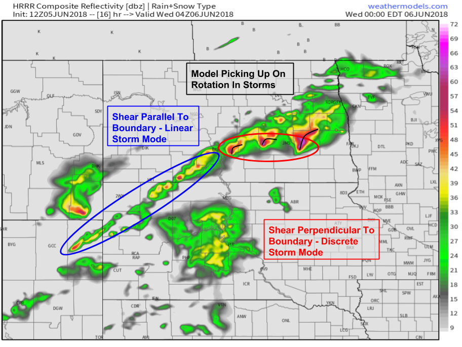
The HRRR’s simulated radar map shown here provides a good illustration of the different storm modes expected today. Linear structures farther west will pose primarily a damaging wind threat, while the discrete cells farther east will threaten all modes of severe weather. All storms will be dangerous due to heavy rains and frequent lightning. Notice that this map is valid at 11 PM CDT. Because the disturbance still has a long way to travel from the West Coast, storms won’t initiate until late this evening, and will maintain their strength into the first part of tonight, before weakening as they move southeast early tomorrow morning. Map via weathermodels.com.
Other disturbances across the Great Lakes and Southern Plains will touch off some scattered showers and storms this afternoon as well, but limits on upper level winds (shear) in the Southern Plains and instability in the Northeast will preclude any widespread severe thunderstorm activity.
For more information on your local forecast, type your town into the search box at weather.us.
For more information on the local forecast for ME/NH, check out this morning’s local blog post.
-Jack


