Severe Storms Expected In Parts Of The Ohio Valley Today
Hello everyone!
Today’s main weather story will be severe storms that are forecast to develop in parts of the Ohio Valley. Showers that are in progress across the region currently will give way to large storms this afternoon/evening. All severe threats are possible!
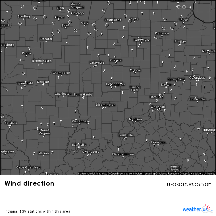
Current observations this morning show a well defined front stretching from Springfield to Chicago in Illinois. This front will move east today, forcing air in front of it to rise, cool, and condense into thunderstorms. Showers are already ongoing along and ahead of the front, and storm development is expected to be gradual today as daytime heating slowly adds energy to the atmosphere.
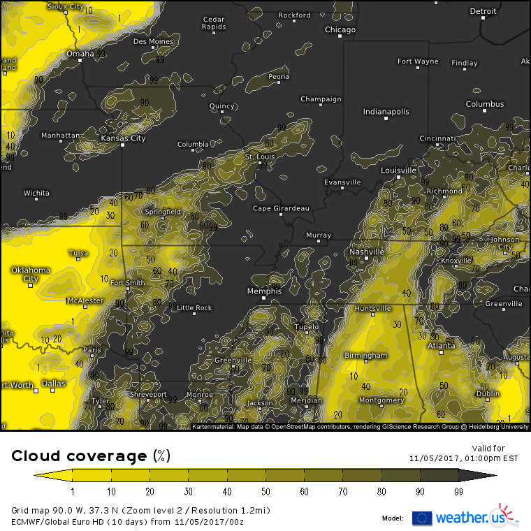
The amount of energy added to the atmosphere via daytime heating will depend largely on how much of the sun’s energy can make it to the surface through breaks in cloud cover. The map above shows the forecast cloud cover early this afternoon. Notice that there are limited sunny breaks in the Indiana/Illinois area. An area of dry air working into the area from the southwest across Missouri may be able to bring sunshine to our area of interest, but it also could get washed out with clouds from the developing and ongoing storms. How much sunshine is able to develop in the Ohio Valley this morning and early this afternoon will have a significant impact on the extent and intensity of severe weather this evening.
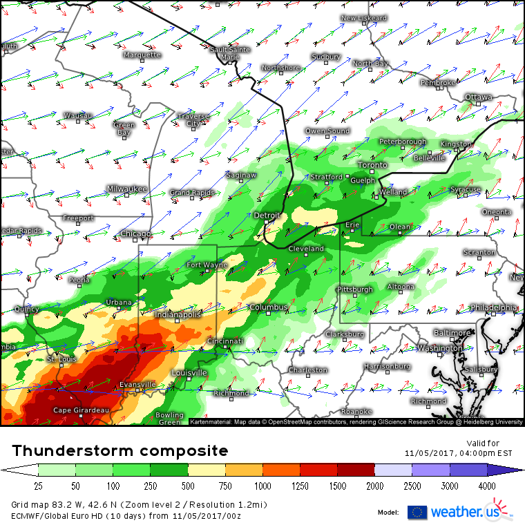
The thunderstorm composite from the ECMWF model shows wind vectors at different levels of the atmosphere, and how much instability is forecast (more on the composite and how to use it). The first thing to look at is the instability. Generally speaking, you need more than 1,000 J/kg of CAPE (more on CAPE) to fuel intense thunderstorms. That’s not to say that you can’t get severe weather with less, but the best chance of the most intense storms will be south of I-70 from Indianapolis to Campaign/Urbana. You can see this is where instability is maximized above. Also notice the wind vectors. Fairly weak southerly/southwesterly winds become strong southwesterly winds in the mid levels (green/red) and very strong west/northwesterly winds in the upper levels (blue). This change in wind speed and direction with height is known as wind shear, and is a very important ingredient for severe weather. There’s plenty of shear forecast today!
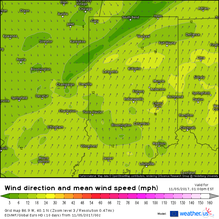
This surface wind forecast for early in the afternoon highlights a few important things. First, we can see the front stretching from South Bend Indiana to Champaign Illinois. NW winds will bring in cooler and drier air behind the front, while ahead of the front, SW winds will carry in warm, humid, and unstable air from the Gulf of Mexico. This boundary is oriented NE to SW, which is important. The final thing I want to draw your attention to is the localized area of S/SE winds embedded within the larger scale SW flow ahead of the front. This pocket of winds is located southwest of Indianapolis, and if it materializes, will enhance rotation in the atmosphere by providing an even more drastic change in wind direction with height. It also provides another boundary, oriented north-south as opposed to southwest-northeast. Why does the orientation of these boundaries matter? For that we have to turn to the shear vector.
This is the wind shear forecast for this afternoon. Remember when I mentioned that the boundary was oriented SW to NE? The shear vector (shown above in wind barb format) is pointed in the same direction. This “boundary parallel shear vector” setup is important because it favors the development of a line of storms over discrete supercells along the front itself. Remember in the last section I discussed that smaller boundary that may form SW of Indianapolis? It is forecast to be oriented north-south. Notice how the shear vector SW of Indianapolis is pointed west-east, perpendicular to the boundary. If the boundary forms, and is strong enough to trigger storm development, the shear vector is oriented in such a way that supercells would be expected. These supercells would have the capacity to bring very large hail and strong tornadoes in addition to damaging winds, lightning, and torrential rains.
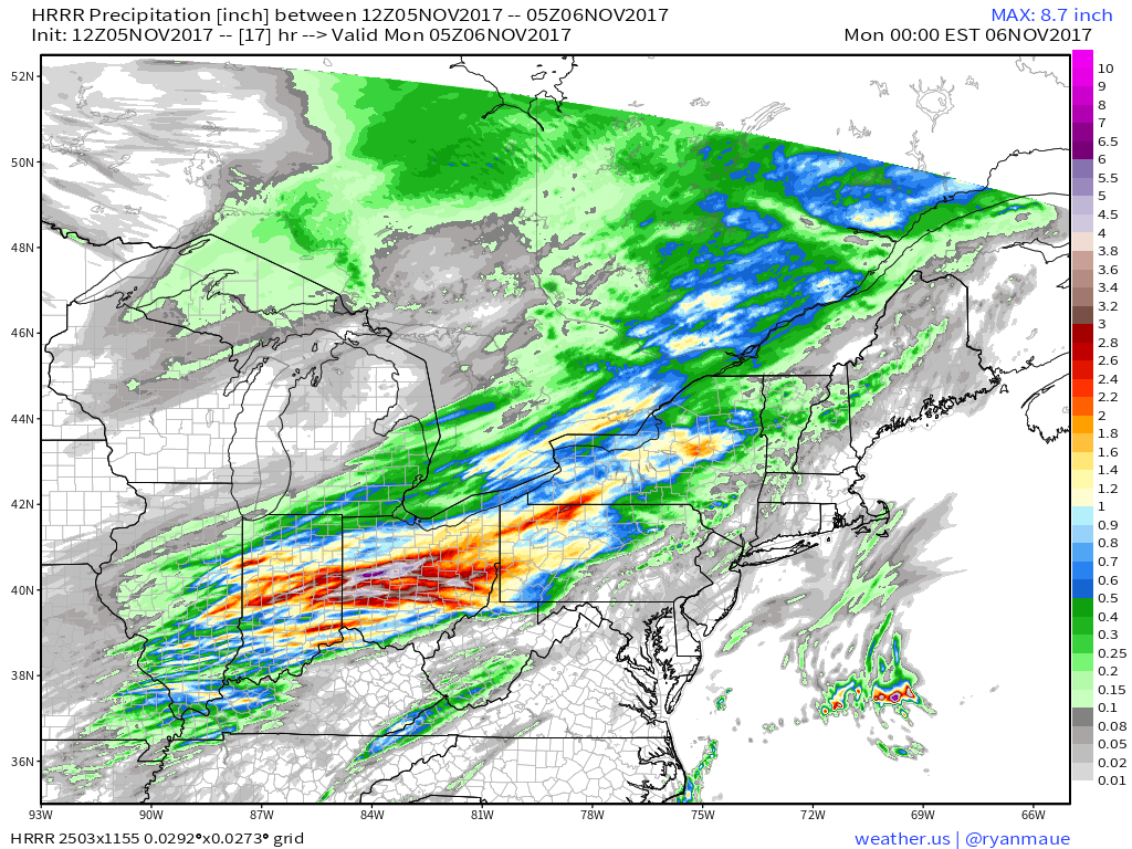
Even if the second boundary SW of Indianapolis doesn’t form, the relationship between the shear vector and the cold front is still important, because it will set up another threat as heavy thunderstorm activity moves over the same locations repeatedly. While training thunderstorms oriented in a line along the front won’t support tornadoes, they will support flash flooding. There’s plenty of moisture in the area thanks to strong moisture transport from SW winds. Thunderstorms are a great mechanism to squeeze that moisture out of the atmosphere. High resolution model forecasts indicate the potential for several inches of rain wherever the heaviest thunderstorm cores set up. The threat for this is greatest along I-70 from Champaign to Indianapolis to Columbus Ohio.
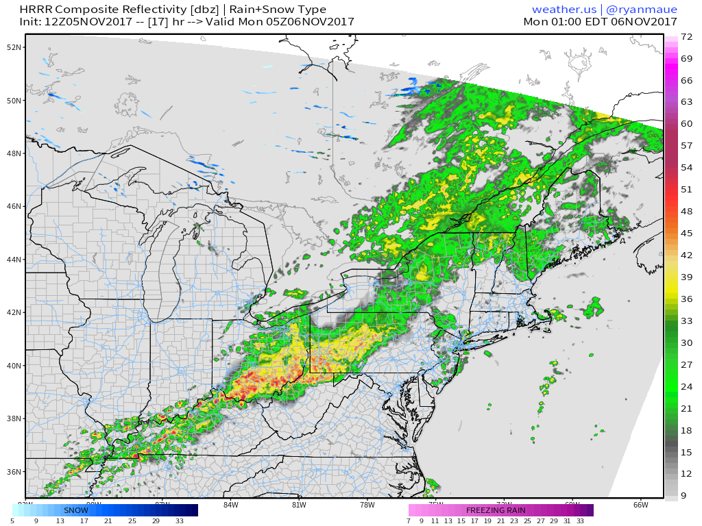
Storms will organize into a cluster tonight and move southeast towards the Appalachian mountains. The storms will be weakening as they lose their source of energy. It’s much harder for storms to maintain through the night in the summertime when low temperatures struggle to get below 70. In November, when temps drop into the 40’s and 50’s, thunderstorms have a much harder time continuing on through the night.
Elsewhere across the country today, generally quiet weather is expected as the Pacific Northwest storm train takes a quick break.
For more information on your local forecast: https://weather.us/
For more information on the local forecast for Maine and New Hampshire: https://forecasterjack.com/2017/11/05/cool-and-cloudy-today-3/
I’ll have more updates through the day today on twitter @weatherdotus
-Jack
