Sea Breezes: What Are They, How Do They Form, And Why Are They Important?
Hello everyone!
Sea breezes are features that you could practically set your watch to in places like Florida, and they make regular appearances all the way up the East Coast through the spring and summer months. Simply put, sea breezes are circulations that develop in response to the differential heating of a landmass and nearby bodies of water by the sun. Most sea breezes produce nothing more than a cool breeze for those impacted, but depending on the surrounding environment, they can either create or destroy thunderstorms. This makes the sea breeze a key feature to understand if you’re trying to predict thunderstorm activity near the coast.
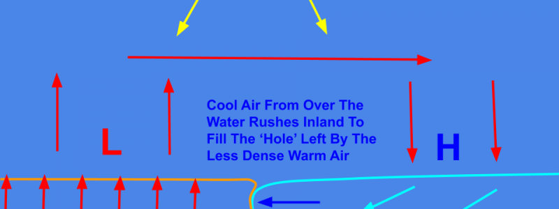
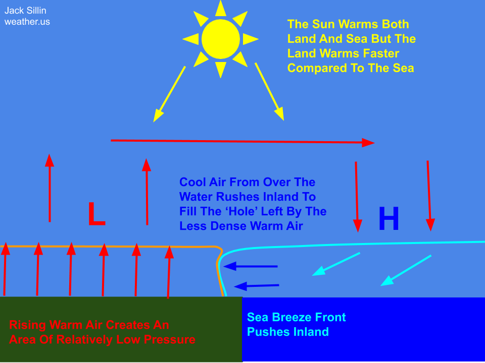
Here’s a schematic showing the basic process behind the formation of sea breezes. Water has a higher specific heat capacity than land, meaning it takes much more energy to raise its temperature. A day of solar heating might raise the temperature of the land by 20 or 30 degrees, while the water might only warm by a degree or two at best. As a result, the air over the land becomes quite warm relative to the air over the water. Warm air is less dense than cold air, so it rises and an area of locally low pressure is created. Cold dense air over the ocean then rushes inland to fill that gap, and the sea breeze is born.
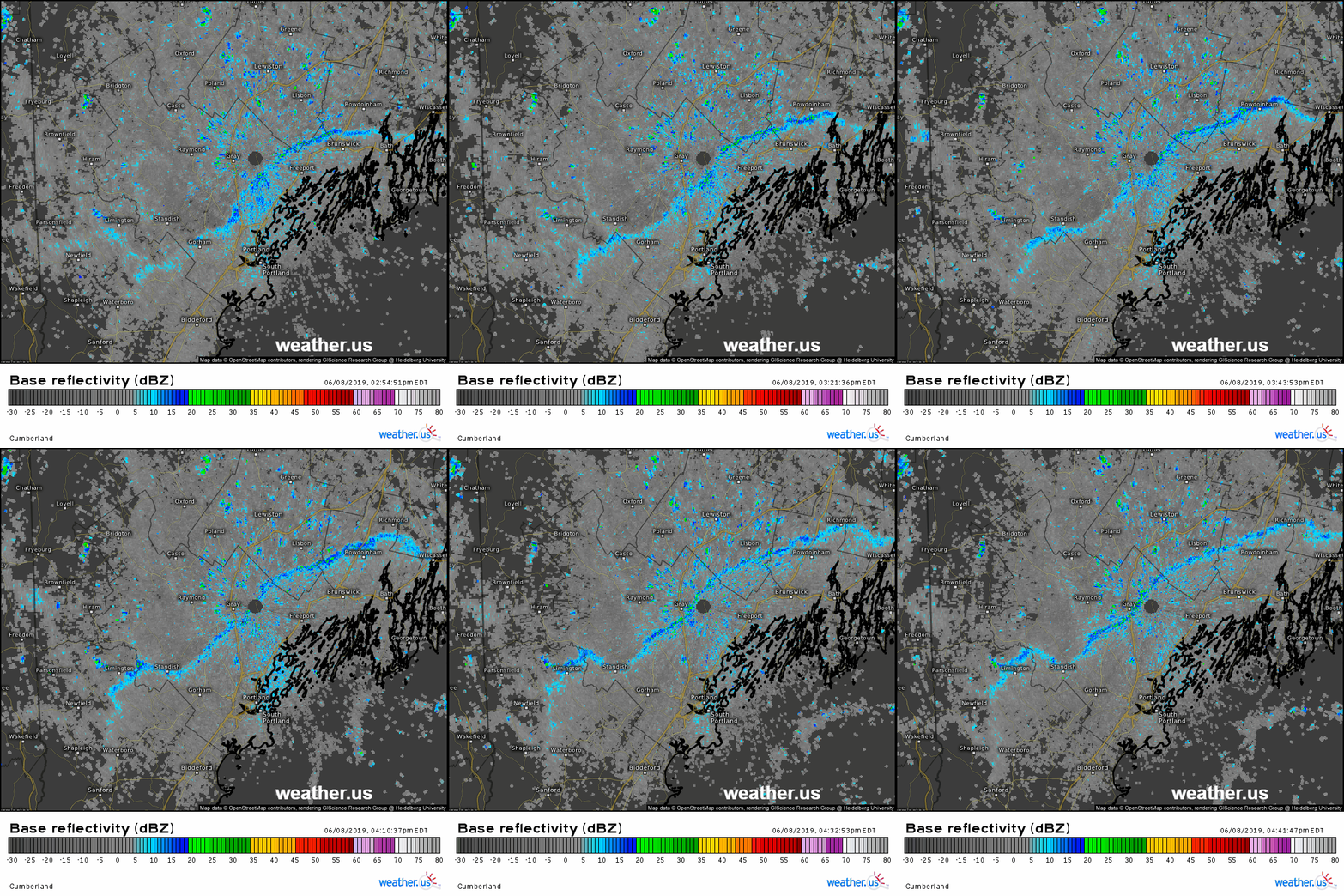
As the cool dense air moves inland, it picks up pollen, dust, small bugs, and other small particles along the way. This means that even if there’s no precipitation present, the front is often visible close to radar sites where the radar beam is close to the ground. Here’s one example from coastal Maine in June of 2019. The sea breeze front is visible as the thin blue line moving slowly away from the coast.
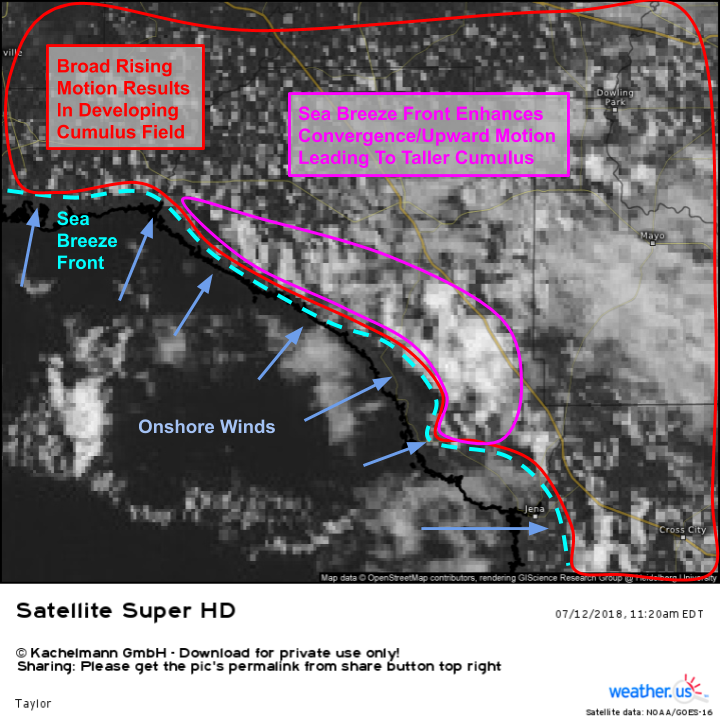
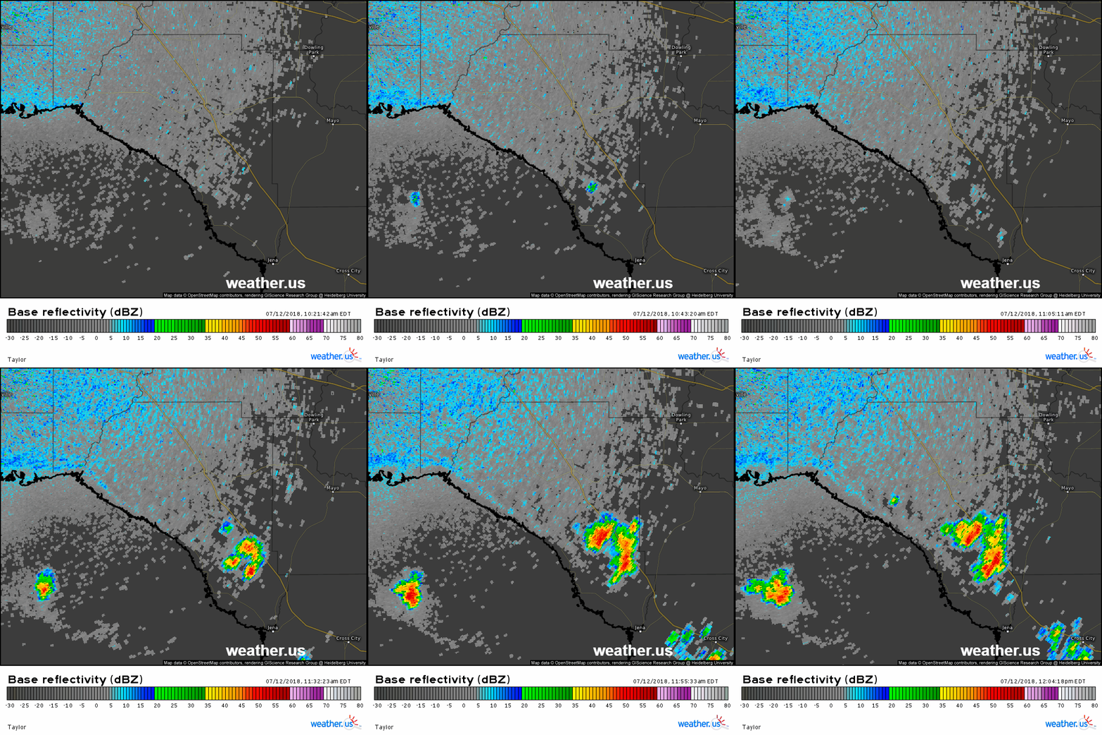
Here’s an example from Florida in July of 2018 showing how the sea breeze can produce thunderstorms. The Gulf of Mexico is always warm, but it’s not nearly as warm as the landmass being heated by the intense Florida sunshine. The broad rising motion inland is producing the fair weather cumulus clouds you’ll recognize from any Florida tourism ad. Closer to the Gulf however, the sea breeze is pushing inland and cooler marine air is displacing the warm inland air upward. The result is a narrow band of much taller cumulus along and just inland of the sea breeze front.
After the sea breeze develops and begins lifting the air just away from the coastline, it doesn’t take long for those cumulus to turn into cumulonimbus and begin producing heavy rain and lightning. This process occurs nearly every day in the summer months over Florida, and is responsible for providing the majority of the region’s precipitation.
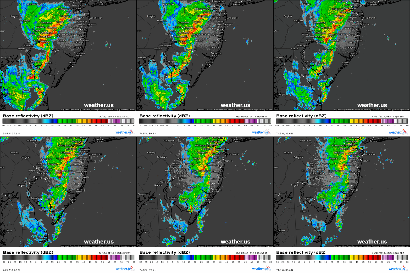
Because the air behind the sea breeze is cool and dense, the sea breeze can often act to kill off already-established storms by shutting off their source of fuel. If a storm moves over the sea breeze front. Anyone living along the East Coast north of the Chesapeake Bay will be quite familiar with this process. The above loop shows just one of many examples of thunderstorms rapidly weakening as they approach the coastline and ingest cool air from the marine layer.
-Jack



often wondered how we can track progression of the sea breeze daily here in Florida? One day it is a west coast breeze that dominates, the next it could be the east coast breeze. Sometimes they are early-day, sometimes late. Sometimes they are simple, other days deadly (lightening). Would be nice to have a method – other than simple cloud development lines – to know where, when, and how bad. Great article!
Hi there,
Many thanks for your comment (and my apologies for the delayed response). As the post outlines, you can follow along with the sea breeze via cloud lines or with radar imagery. As for anticipating exactly how the sea breeze will play out, there are many factors to consider including large scale wind flow patterns (if you have some easterly gradient flow, it will be much harder for west coast sea breeze to get off the ground, but if it does, there will be more convergence along its front to generate rising motion), large scale cloud cover (which affects how much solar radiation makes it to the ground and thus how much land-based heating occurs), and how much moisture/instability is available for potential thunderstorms. If you take the time to understand how each of these factors might be working on a given day, you can indeed outperform more simplistic analyses and more accurately anticipate where storms might pop up.
Hopefully this is helpful,
Jack