Remnants Of Hurricane Bud To Bring Increased Rain Chances To The Desert Southwest This Weekend
Hello everyone!
As severe thunderstorms continue to occasionally rumble through the Great Plains, two tropical disturbances will bring periods of enhanced rainfall to parts of Texas and the Desert Southwest this weekend. Rainfall will be the primary impact from both of these disturbances, and no wind/storm surge issues are anticipated due to the storms’ weak and disorganized nature.
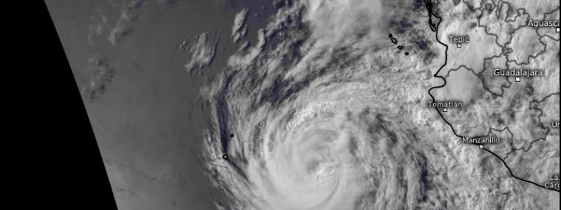
GOES-East satellite imagery shows both systems clearly this evening as they spin in the Caribbean and Eastern Pacific. The Caribbean disturbance, known as “91L”, is the more disorganized of the two, and is not an actual tropical cyclone. Instead, it’s a disorganized area of shower and thunderstorm activity. The Eastern Pacific disturbance is a tropical cyclone, Hurricane Bud. Formerly a powerful hurricane, Bud is weakening rapidly this evening, and will continue to do so as it moves north. This update will focus on Bud, given that its impacts are expected to occur earlier this coming weekend. I’ll have a post out later this week discussing 91L and its impacts, which aren’t slated to arrive until the latter half of the weekend into early next week.
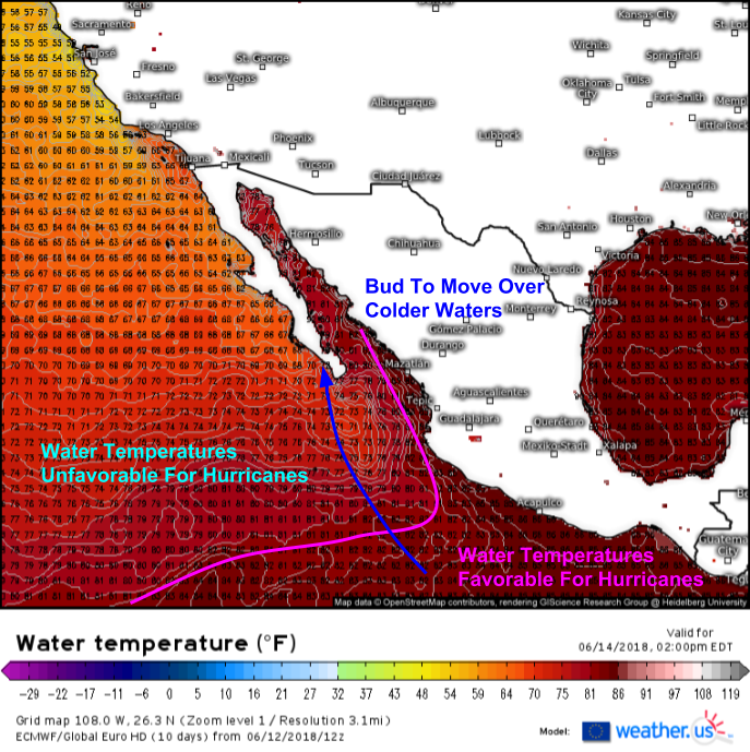
Why is Bud weakening? The answer lies in this map of water temperatures from the ECMWF model. Hurricanes can thrive when water temperatures are at or above 80 degrees. While the hurricane has been fueled by these warm waters over the past few days, water temperatures are only in the mid 70’s south of the Baja peninsula. As Bud encounters these waters over the next couple of days, it will weaken, arriving in Cabo San Lucas as a low-end tropical storm.
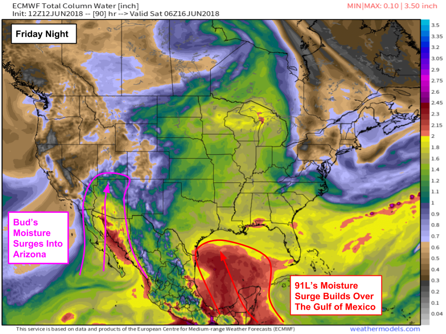
While Bud will weaken and eventually dissipate as it approaches Baja California and later the Southwestern US, its pool of moisture laden air will last much longer than its surface circulation. This precipitable water (moisture) map from weathermodels.com shows Bud’s moisture streaming north into Arizona on Friday night. This moisture will result in widespread showers and thunderstorms, some of which could drop a fair bit of rain in a short time. Given the desert climate of this area, it doesn’t take much rain to cause flash flooding concerns, so keep an eye out for the possibility of rapidly rising waters.
A look at our Forecast Ensemble product for Phoenix Arizona shows the impacts from Bud’s moisture well. Rain is expected both Friday and Saturday in Phoenix (as well as the rest of Arizona), but how much actually falls will depend on the placement of individual showers and thunderstorms. As a result, the forecast for the total precipitation in any one area remains uncertain. Notice the wide range of possible outcomes in the ensemble forecast.
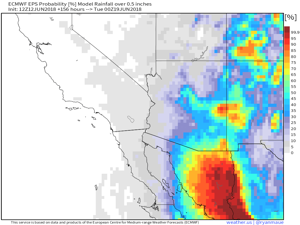
This EPS probability map from weathermodels.com is a way of making sense of the forecast given such large uncertainties, highlighted in the ensemble plot above. This map uses the same dataset, the 51 member ECMWF Ensemble Prediction System (EPS) and displays the probability of total precipitation exceeding .5″ in a given timeframe, in this case between now and Monday afternoon. The greatest probability for rains totaling over .5″ is in SE AZ, but as the ensemble graph above showed, the potential for locally heavy rains exists just about anywhere in the state, outside perhaps of westernmost regions.
Rain chances will decrease again as we move into the beginning of next week and Bud’s moisture gets swept northeast.
-Jack


