Remnants Of Gordon To Bring Flash Flooding To Parts Of The Ohio Valley Today
Hello everyone!
We tracked Tropical Storm Gordon through the Gulf of Mexico last week, and following its landfall in Alabama, we’ve largely ignored it as its remnant low spun northwest towards the Mississippi Valley. However, that remnant low is interacting with the jet stream this morning, and that interaction is fueling some very heavy rains, which will be falling on areas that really don’t need rain. The result will be a fairly high end flash flood setup across parts of Southern Illinois and Indiana, extending east into Ohio.
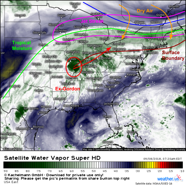
A look at GOES-East water vapor satellite imagery (what’s that?) shows a setup ripe for flash flooding in the Ohio Valley. A deep plume of tropical moisture occupies the entirety of the Eastern US, except for parts of the Northeast where drier air has moved in behind a cold front. That cold front has settled in the Mid Atlantic, and extends west into the Ohio Valley. This boundary will be the boundary of focus for today, wringing out the water in the sponge that is this saturated airmass.
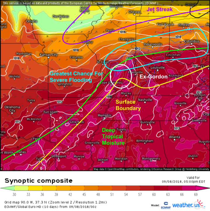
The ECMWF’s synoptic composite map (what’s that?) does a great job of highlighting some of these features this evening as Gordon slowly moves off to the northeast. The jet streak north of the system is anticyclonically curved (turns clockwise as you head east) which means we look to its right entrance region for rising motion. Of course, that happens to be located just north of the boundary discussed above, and right around the moisture/instability gradient. Gordon’s remnants will be riding up that boundary, under that right entrance region. The remnant circulation will provide additional lift, further assisting the boundary and the jet streak in wringing out moisture in the atmosphere. Speaking of moisture, there’s tons of it available as tropical air flows north from the Gulf of Mexico. Remember, Gordon was originally a tropical cyclone, it has plenty of moisture already tied up in its circulation!
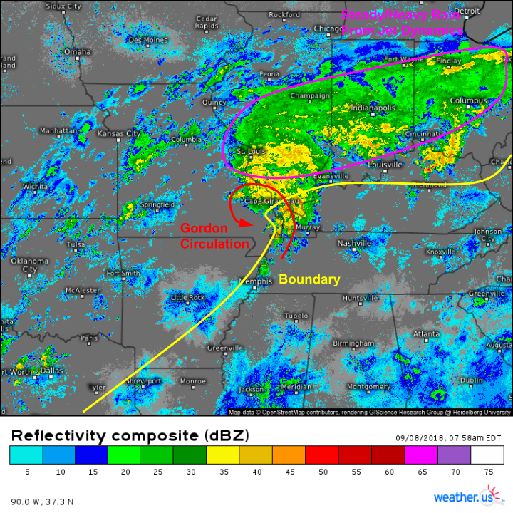
The results of these dynamics are already apparent in observations this morning. Radar imagery (regional composite, HD available by zooming in/selecting individual site) shows Gordon’s circulation in SE MO, with a large area of steady/heavy rain extending to its northeast across Illinois, Indiana, and Ohio. Most of that rain is of the stratiform (steady) variety, as opposed to convective (thunderstorms) and that will continue to be the general trend for this event. Thunderstorms are possible farther south in TN and KY, and they could produce some marginally severe weather, but the flooding threat is the primary concern with this system, and that will be driven by large scale (jet stream) dynamics as opposed to small scale (thunderstorm) dynamics.
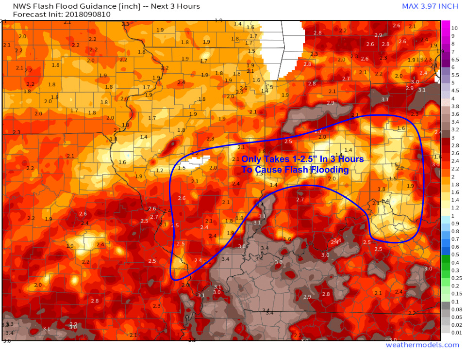
For a little bit of context, here’s three hour flash flood guidance for the Ohio Valley this morning. Note that the area we’re watching for flooding only needs 1-2.5″ to fall over the course of three hours to see flash flooding. This isn’t a whole lot given the moisture and dynamics we’ve discussed above!
Map via weathermodels.com.
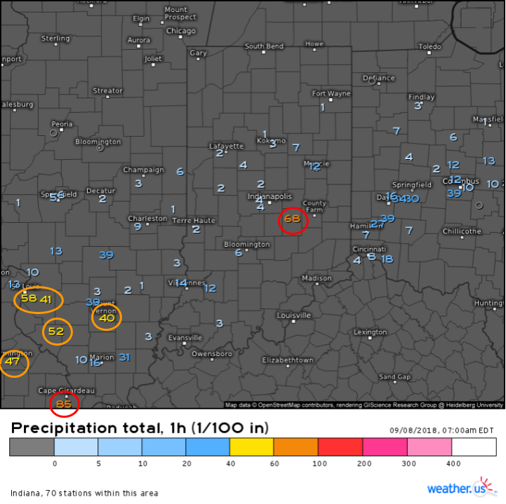
Observed precipitation totals this morning show one hour rain rates between .5″ and 1″ in the area we’ve been watching. Many stations have reported much less than that, which is expected given localized variations in banding, similar to snowfall. However, the model map I showed above was valid for 5 PM this evening, we’ve got a long way to go before drier conditions return tonight.
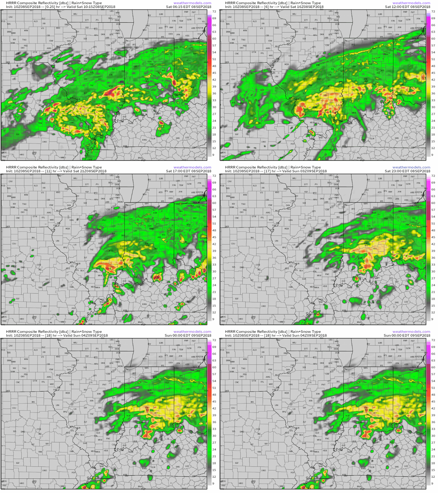
For a general overview on what to expect today, here’s a loop of the HRRR model’s simulated radar imagery. While the model won’t pinpoint individual shower/storm locations, you can see how steady/heavy rainfall will continue through much of today across parts of Southern Illinois and Indiana, while also expanding east into Ohio. To the south, you can see some thunderstorms popping up this afternoon as some instability develops south of that boundary we discussed earlier.
GIF via weathermodels.com.
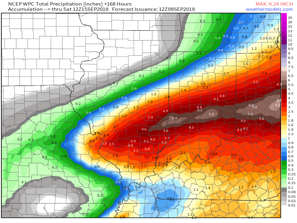
So how much rain is expected anyways? Forecasts from the National Weather Service’s Weather Prediction Center (responsible for extratropical/precipitation forecasts, among other things) show a wide swath of 3-6″ totals in the area we’ve been highlighting from Southern IL through South-Central IN and into Southern OH. There will of course be some localized variations, the actual map won’t be nearly this smooth, but that’s the general idea.
Map via weathermodels.com.
Remember to never drive or walk through flood waters, it doesn’t take much to move even the heaviest cars. Have a way of receiving alerts from local NWS offices, including flash flood warnings, and be ready to seek higher ground if flood waters begin to rise in your area. Rain will taper off from west to east across this area tonight as Gordon moves NE.
Track the rain with HD radar and station-observed precipitation totals at weather.us (click maps to zoom in, latest data via refresh button at the top left of the map). High resolution weather models will update with the latest forecast ideas through the day, though don’t expect too much in the way of significant changes. As this event is ongoing in the 0-12 hour period, forecast confidence is very high.
-Jack
