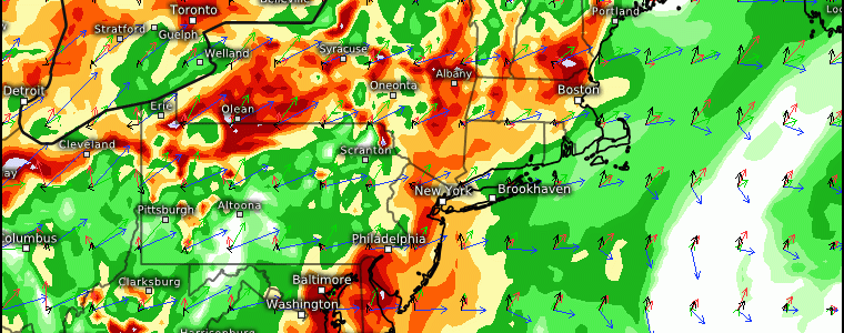
Relentless Rain Continues This Weekend Across The Northeast
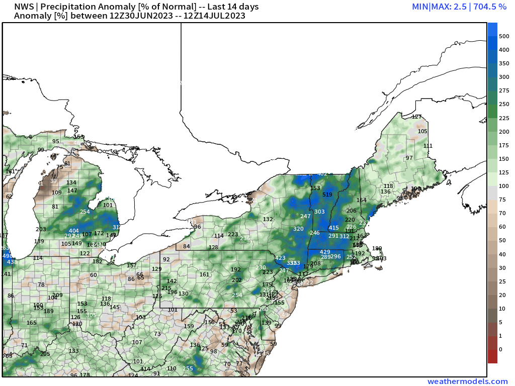
Over the past two weeks alone, we’ve seen in excess of anywhere between 100 – 450% of normal relative to climatological averages across the Northeast. It has been remarkably active and persistent across this region since June, with almost no sign of letting up. We have another potent threat in the making for this weekend, in particular Sunday from CT to MA, NH, and ME within the “bullseye” at this juncture.
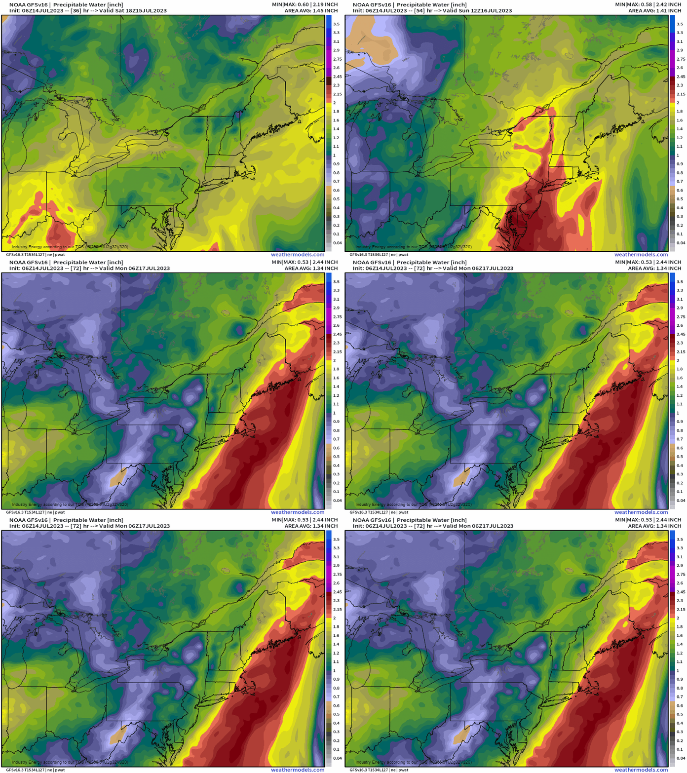
What is most notable with this setup this weekend will be the moisture advection. The source region that the moisture is being “pulled” from is the Gulf, which is right now “boiling” with well above normal sea surface temperatures. Below, we see a relatively wide swath of 2.2” – 2.5” of PWAT values, which is above to well above the climatological average across New England. There’s no shortage of water vapor that’ll be immediately ready to be condensed. Notice how this surges overnight Saturday into Sunday. This moisture surges because a warm front will approach from the south through Saturday into Sunday.
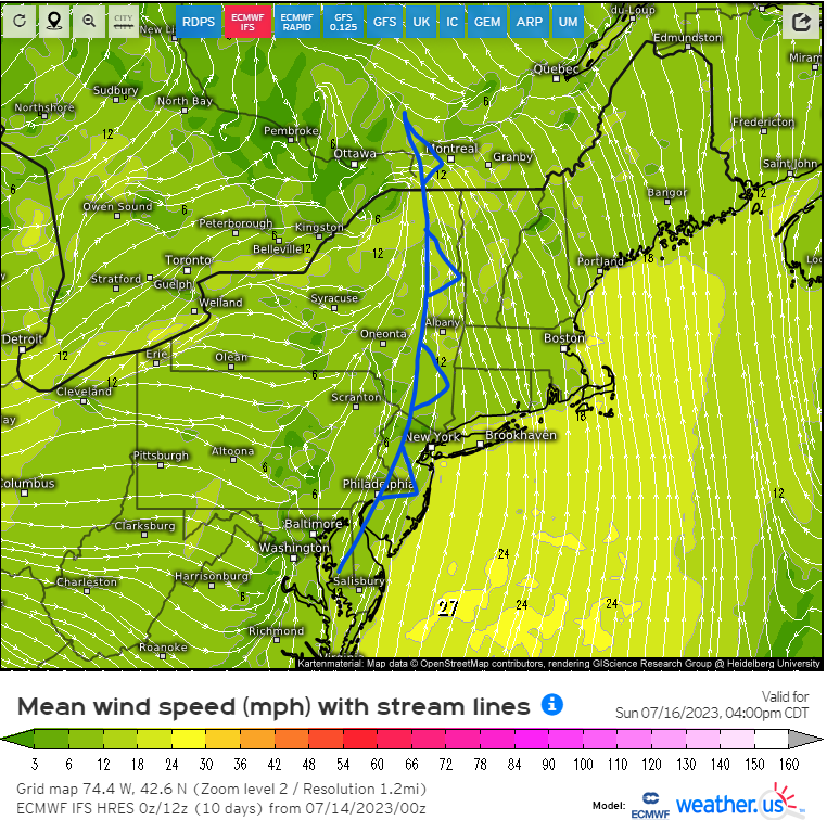
On Sunday, the synoptic setup will feature another shortwave trough that’ll swing through the Northeast. Out ahead of it, this at the surface is delineated as a cold front, which will be the main forcing mechanism. Sunday afternoon, this front slowly pushes eastward and will force the warm buoyant air out ahead of it, upwards that coincides with peak heating. Now, what makes this another potent flood-maker is due to the aligning of the low-mid level winds and the front. When you have your low level winds advecting in moisture that becomes parallel to a front, this manifests an extremely favorable environment for back-building and training of rain.
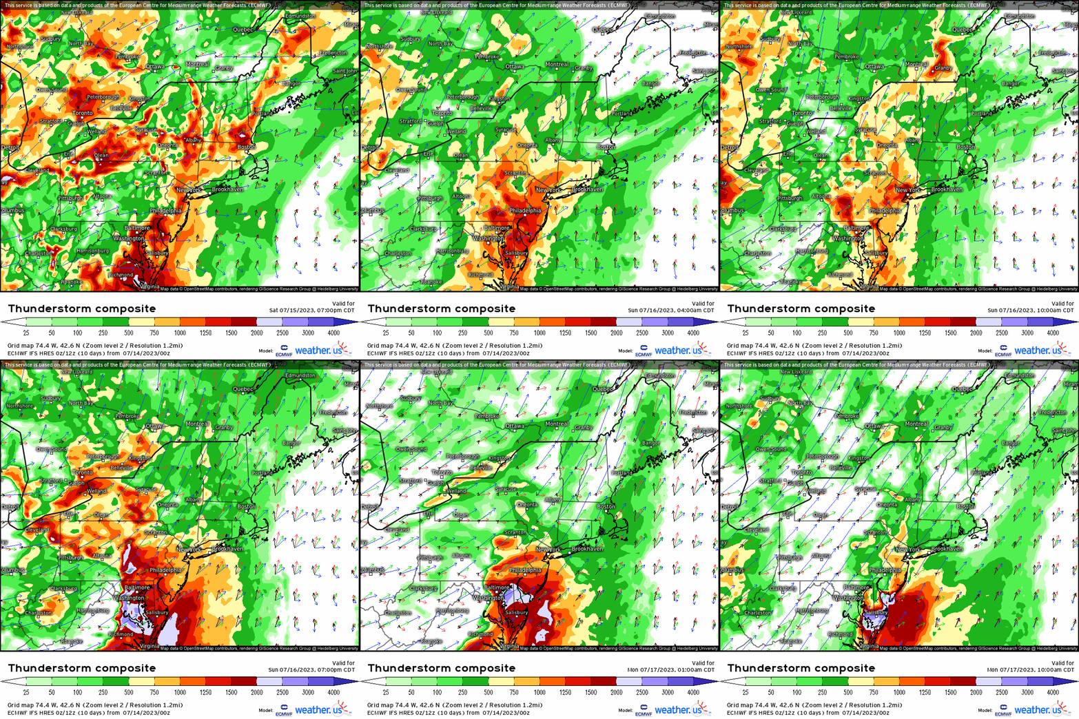
Compare the snapshot image above to the animation of the “thunderstorm composite” below where it combines CAPE and wind vectors at each respective level: 10m, 850mb (~5,000 ft), 500mb(~18,000 ft), and 300mb (~30,000 ft). What we see here verbatim is a surge of CAPE (likely being under-modeled at this point and will certainly jump once we get sunshine) into New England from PA toward ME through Sunday. However, what’s most important here is the direction of our wind vectors. Notice that if you were to take an average by just eyeballing the vectors at the different levels, you’d get a mean wind direction out of the south/southwest. This aligns with our surface cold front that’ll also be lifting the unstable air out ahead. We combine these ingredients to get back-building convection, heavy rainfall, and the potential for severe thunderstorms as well given our wind shear and instability profile for Sunday.
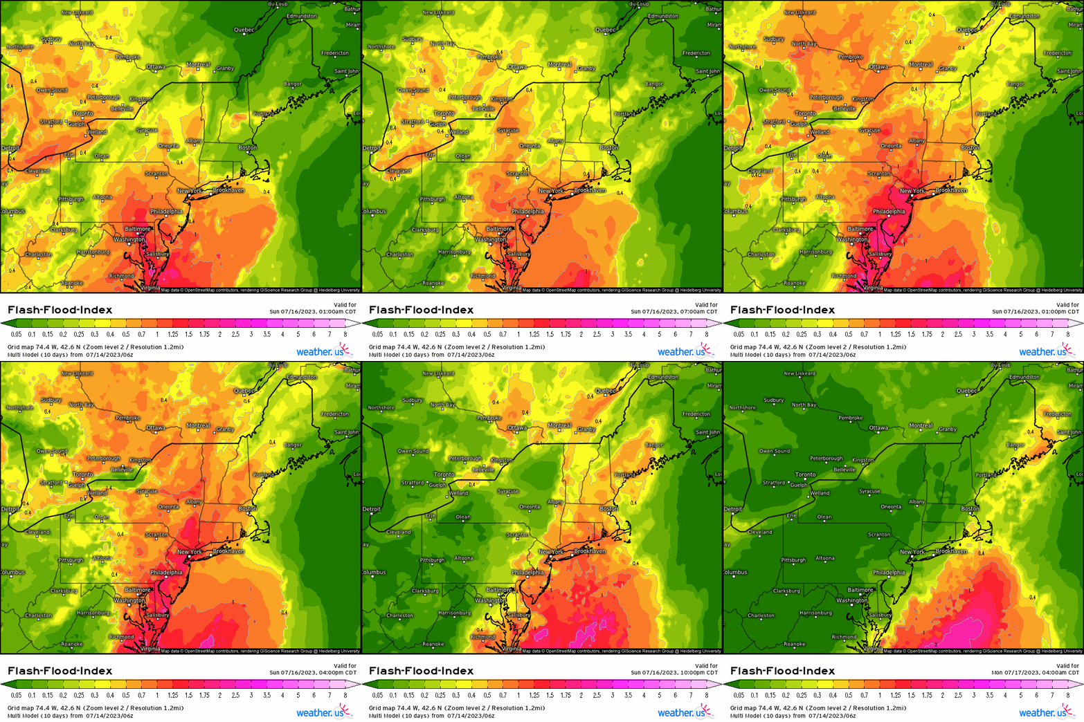
With the aforementioned discussion regarding the antecedent rain around this general region, flash flood guidance will be particularly low meaning it will take very little for certain areas to see flooding from rainfall this weekend. Utilizing the flash-flood-index, we see that values round out to near 1.0 and higher indicating the formidable saturated environment soon to happen as the warm front lifts northward.
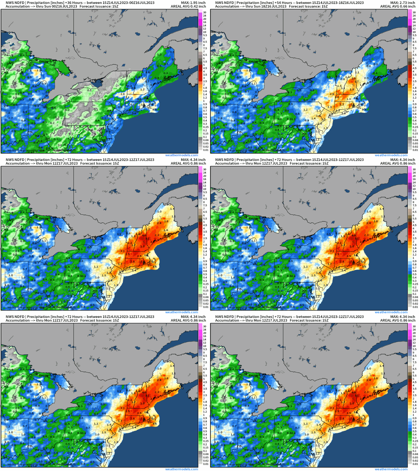
All together, we’re right now looking at anywhere between 2 – 4”+, with likely localized higher amounts especially with terrain and orographic lifting that enhances rainfall from the Catskills to the Berkshire mountains. Despite VT not necessarily being targeted as the main “bullseye”, it’s awfully close to the axis of the forecasted heaviest rain swath and there can be adjustments leading up to the event.
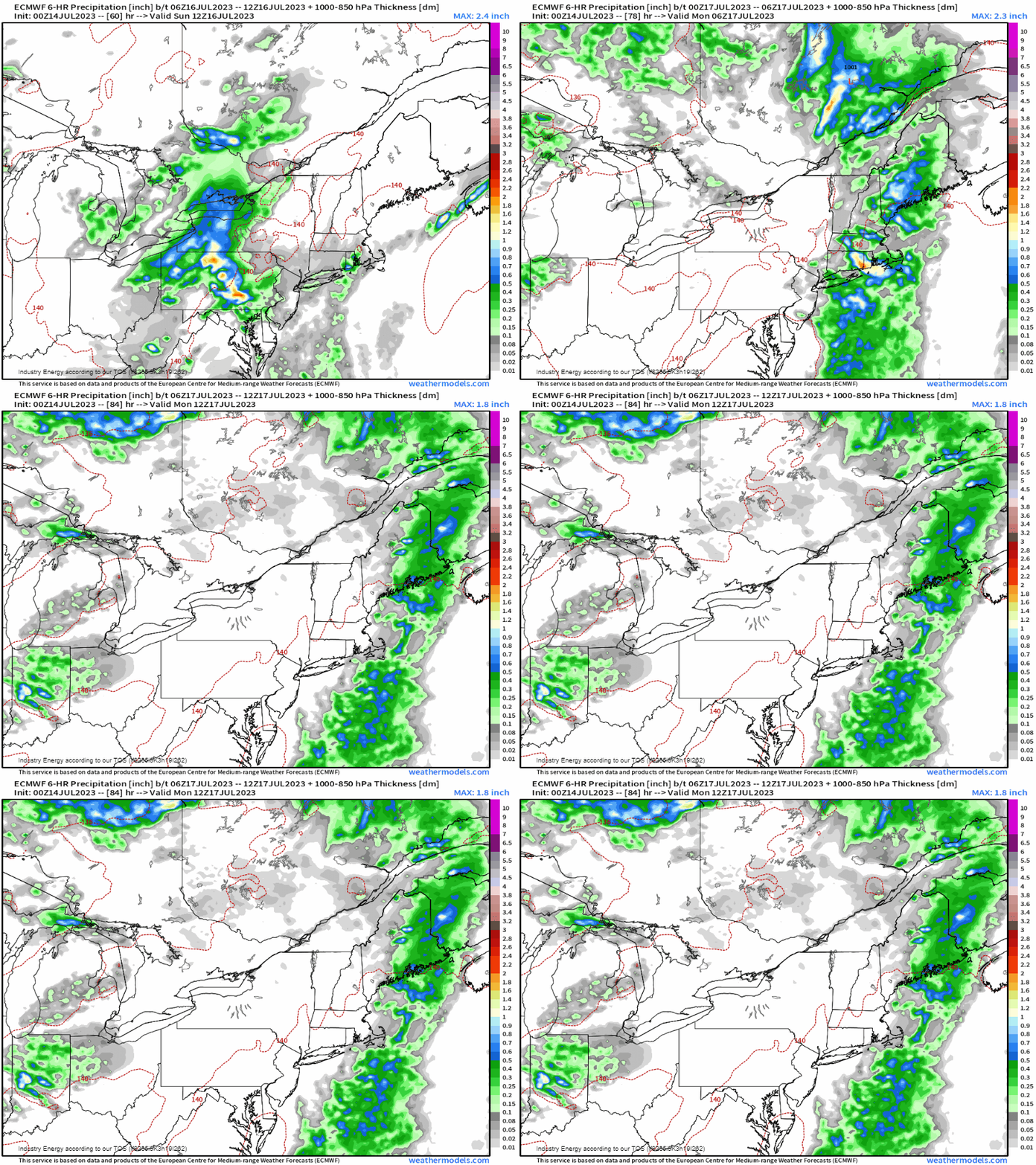
Regarding timing, this looks to mainly occur later Sunday morning as showers and sub-severe storms begin and then intensify as the front draws closer toward the coast, and exacerbate during the afternoon Sunday. The front then clears New England later Sunday night into Monday before drying out as we begin next week.
If you live in this region, and are in flood sensitive areas, please have preparations in place for flooding. More importantly if on the road, you know how it goes – Turn Around, Don’t Drown! It takes 6” of water to stall a vehicle, and a foot to mobilize it.


