Rapidly Intensifying Storm To Bring A Major Blizzard To The Northern Plains Tomorrow
Hello everyone!
A remarkable display of atmospheric dynamics is just getting underway across the Central part of the US this evening as two powerful upper level disturbances join forces to produce an intense cyclone that will be centered over Kansas by tomorrow. This cyclone will produce many impacts, including severe weather (Tuesday’s severe threat is explained here), strong winds, and flooding, but this particular update will focus on the system’s wintry aspect, which will take the form of a blizzard with 1-2 feet of snow and wind gusts over 50 mph across parts of the Northern Plains from Colorado NE to the Dakotas.
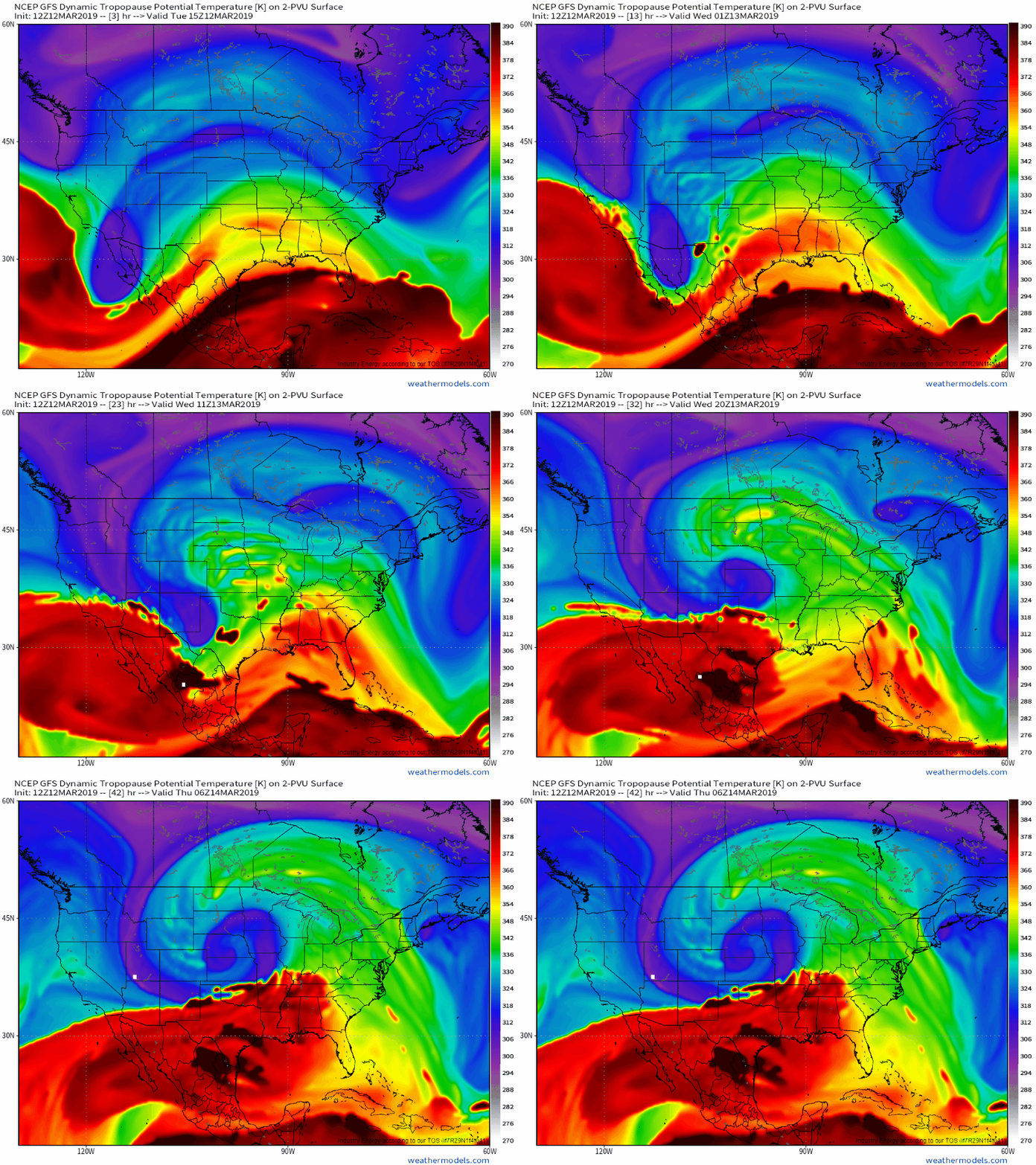
The dynamic evolution of this system from a meteorology perspective is fascinating and worthy of discussion on its own, but I will save that for another post. You can see lots of those dynamics unfold here, but this animation also is a good way to intuitively grasp what’s going on even if each feature isn’t readily apparent. The two purple blobs over the Western US at the beginning of the loop represent strong upper level disturbances. Note how these disturbances join forces over the Southern Plains late tonight/early tomorrow morning, producing an intense swirling cyclone over Kansas by tomorrow afternoon/evening. This is the cyclone responsible for the blizzard over the Plains. GIF via weathermodels.com.
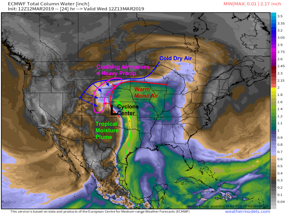
Here’s a look at some of the large scale features responsible for the forecast heavy snow. A deep plume of tropical moisture can be seen moving north out of the Gulf of Mexico and into the Plains. The dry airmass is a bit less pronounced, but it’s located in the Northern Rockies and will be moving SE towards the center of the low, which will be located over Kansas. Where the two airmasses clash, from Colorado through SE WY/W NE/C SD, is where we’ll find the heaviest precipitation. Map via weathermodels.com.
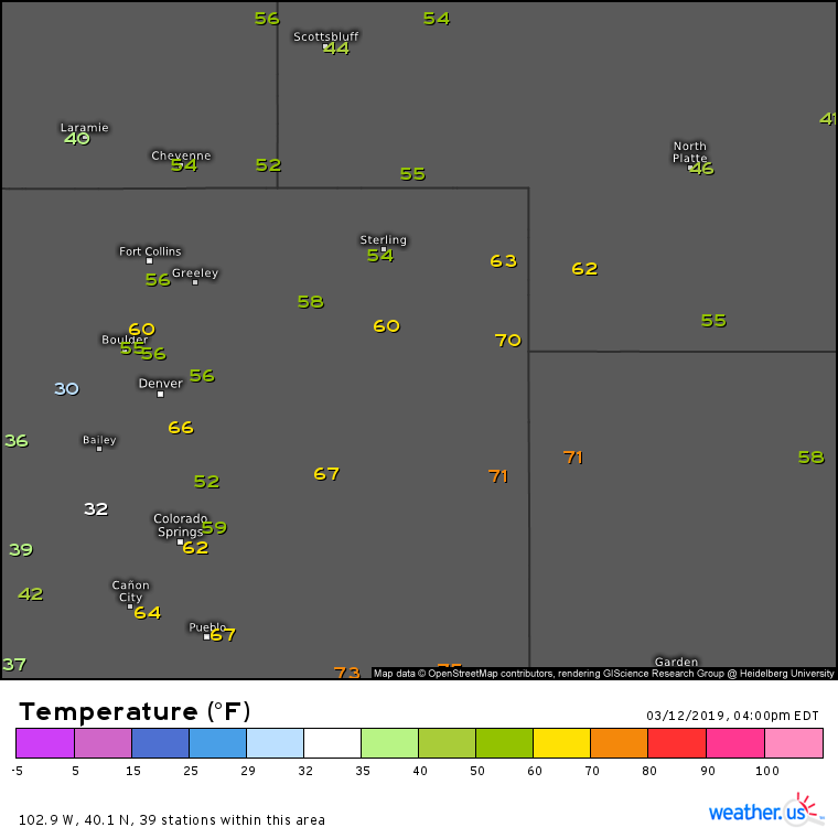
Here’s a look at current observations across Colorado, where blizzard conditions are expected in less than 24 hours. Note the readings in the upper 50’s to low 60’s! Temps will fall tonight, but when precip arrives early tomorrow morning, it will begin in the form of rain. As the storm intensifies, cold air will be drawn in towards the center, which will result in a changeover to snow. Road conditions will turn from wet to snow-packed in less than an hour, so be extremely careful if you need to be out and about! Snow will pile up at rates of 1-2″ per hour in the heaviest bands, which will contribute to the high-impact nature of the storm.
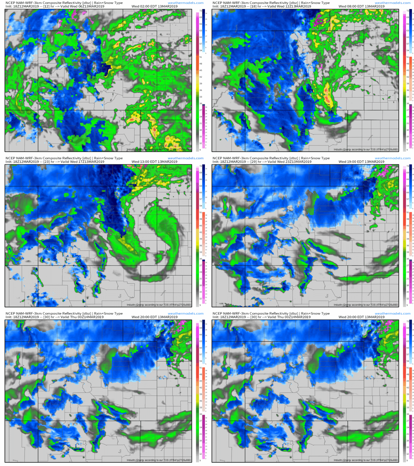
Here’s a simulated radar loop from the HRRRR to highlight just how rapid the changeover will be across E CO/W NE/SE WY. At 8 AM MDT in those areas, it will be raining, with heavy snow arriving just an hour or two later. Stay inside if you don’t absolutely need to travel! GIF via weathermodels.com.
During this time, the intensification of the storm will result in increasing winds across the impacted areas. Here’s the patchwork of NWS forecast wind gusts over the course of the storm. Notice winds over 60 mph in the Denver-Boulder corridor, with even higher gusts off to the east in the flatter terrain. Remember for a blizzard you need heavy snow and low visibility due to 35 mph wind gusts. Some parts of NE CO could see wind gusts double that criteria! With winds this strong, power outages will be a concern especially in areas where snow is heavy and wet, and thus more prone to sticking to trees/power lines. Map via weathermodels.com.
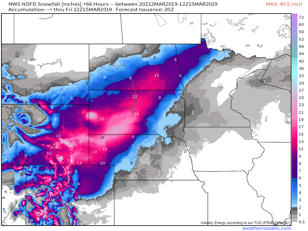
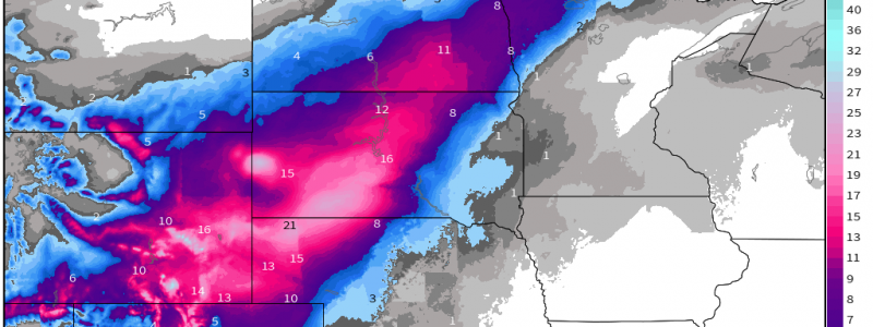
Here’s a look at how much snow the NWS expects to accumulate as a result of this system. The highest totals will range from Central ND through W NE and SE WY, where the best dynamics will collide with the coldest air. Colorado will see blizzard conditions but less total accumulation due to warmer air closer to the low. Farther NE, it will be plenty cold enough for snow across NW MN and SE ND, but the system will be weaker by the time it arrives in that area, so less snow is expected. Map via weathermodels.com.
While this map displays snowfall accumulations, remember that this rarely ends up reflecting the total amount of snow on the ground in any given spot. With winds gusting over 50mph for much of this area, blowing and drifting snow will be a major concern even after the storm passes. One part of your yard might be scoured bare, while the other side of the house has a six foot drift.
Snow will wind down on Thursday, but gusty winds will continue to cause blowing and drifting snow that will make travel difficult.
-Jack
