Rain, Snow, And Storms Today As Low Pressure Intensifies In The Midwest
Hello everyone!
Today’s most active weather will be found across the Midwest as low pressure intensifies and moves northeast. Rain, snow, severe storms, and gusty winds are all expected with this system today before it moves towards New England tomorrow.
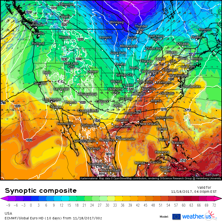
The ECMWF synoptic composite (what’s that and how do I use it?) gives a good overview of what’s happening in our atmosphere today. The black lines indicate 500mb heights (the height at which the pressure is 500mb). The higher the heights, the nicer the weather and vice versa. Notice the large ridge over the West Coast. This will allow quieter weather to return to that part of the country today while heights drop in the Midwest. There’s a sharp trough moving east this morning that is forecast to extend from Thunder Bay down to Missouri and Oklahoma by this afternoon as shown above. This trough axis is oriented northeast to southwest, which is important because that orientation won’t allow for explosive intensification, as was forecast a few days ago.
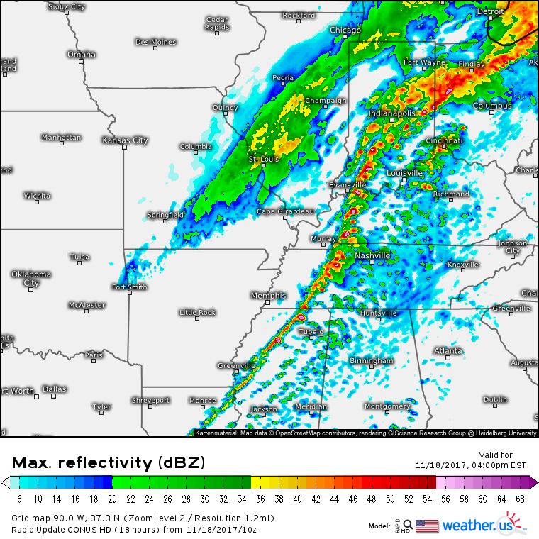
Nevertheless, impacts are still expected. Rain is already ongoing across parts of Iowa and Kansas behind the system, while warm air moving north over a retreating cold airmass is producing precipitation farther east from Indiana over into Pennsylvania. This will be a theme of today’s weather- watching the two areas of precipitation and how they behave. Also, as the day goes on, a new area to watch will emerge to the south of the system where showers and storms will develop, potentially becoming severe.
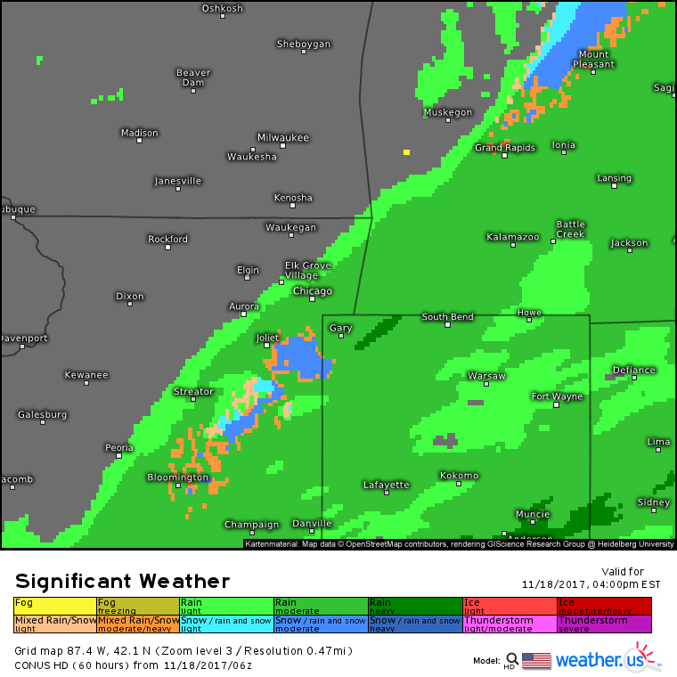
The first area of precipitation to watch will be the one occurring west and north of the surface low. This area will remain relatively low impact (think rainy day) until this afternoon/evening when temperatures begin to fall. The dynamics associated with the backside of the storm will combine with cold northerly winds, and the downward temperature trend that comes with the sun setting to change rain over to snow for parts of Illinois, Indiana, and Michigan.
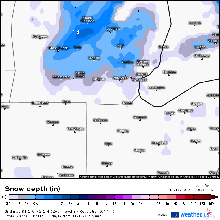
Accumulations won’t amount to much. This ECMWF forecast calling for a coating-2″ across Michigan is reasonable. Lighter amounts will fall to the south, across Northern Indiana and Ohio. Even with minimal accumulations, snow will fall heavily for a time this evening resulting in low visibilities and slick roads for travelers in these areas.
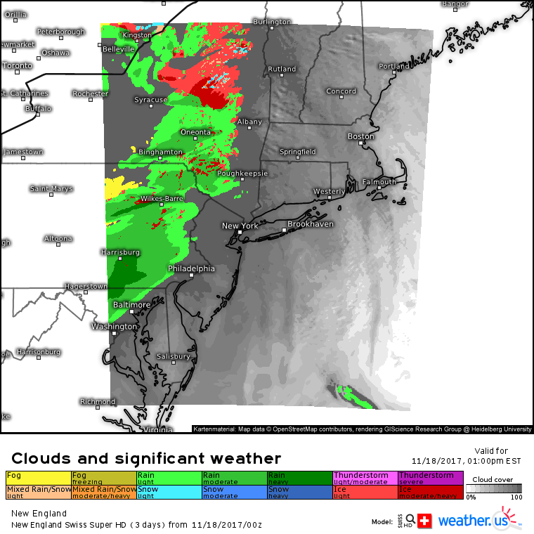
Farther east, it’s the cold air that will be on borrowed time as warmth surges north east of the Appalachians. Most of the second batch of precipitation, currently falling from Indiana to Pennsylvania, will fall as rain, but cold air will be able to hang on in the valleys of the Poconos, Catskills, Adirondacks, and the mountains of New England. Just above the surface, these mountains will have a much weaker influence, so warm air will be able to rush in much more easily. As a result, freezing rain is expected for the valleys of the mountain ranges discussed above. Icing won’t accumulate to much, but it only takes a very thin glaze to make roads, steps, and sidewalks extremely slippery.
The two areas of frozen precip discussed above will serve as bookends for the severe weather threat today. Storms are already ongoing along the warm front this morning, and will develop along the cold front this afternoon. Gusty winds will be the main threat with these storms, though the cells that develop along and near the warm front could produce hail or even a brief tornado.
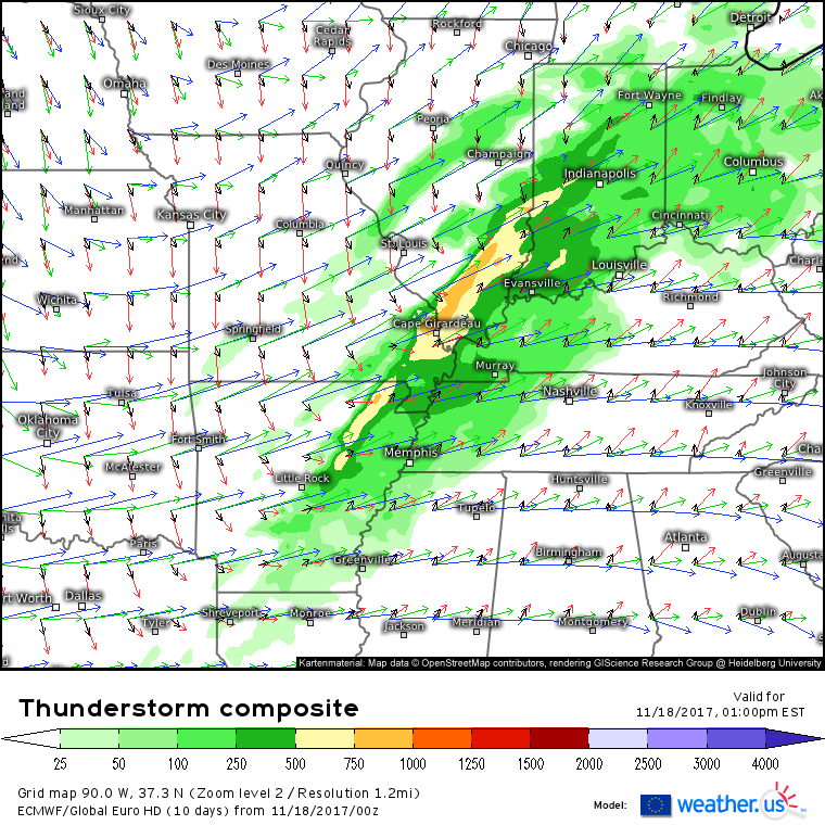
The ECMWF thunderstorm composite (what’s this and how do I use it?) shows the axis of best instability right along the northern portion of the cold front, from NE Arkansas through SE Illinois. Wind profiles here are more or less unidirectional, meaning that winds both aloft and near the surface are blowing in the same direction. Southwesterly winds also happen to be parallel to the front, meaning that we can expect a line of storms capable of damaging winds, and perhaps a brief spinup tornado, to form and move east this afternoon. Farther north, near the warm front, wind profiles veer much more with height. Southerly winds near the surface (black) give way to southwesterly winds aloft. This directional wind shear will help support discrete storms that are capable of large hail and potentially a tornado or two, in addition to the damaging wind threat.
The entire system will progress east overnight, with cold air flooding in behind the strong cold front. Lake effect and upslops snows are expected to develop Sunday and continue into Monday in the northwest flow regime. I’ll have more details on the storm’s Northeast impacts tomorrow morning.
Elsewhere across the country today, quiet weather is expected.
For more details on your local forecast: https://weather.us/
For more details on the local forecast for Maine and New Hampshire: https://forecasterjack.com/2017/11/18/warmer-today-as-our-next-storm-approaches/
-Jack
