Rain And Snow Picks Up Out West While Flurries Exit New England Today
Hello everyone!
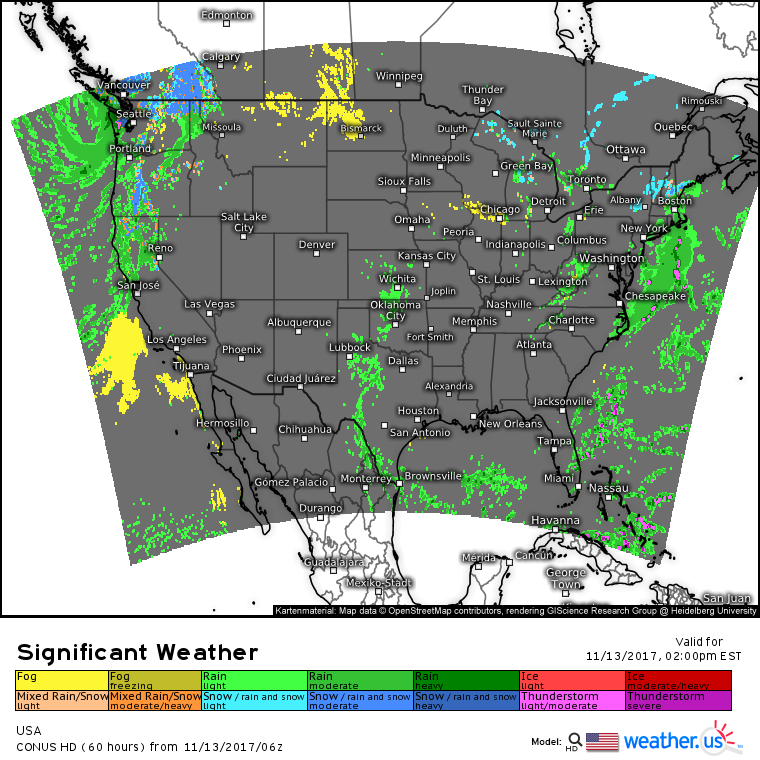
Our large scale pattern remains quite similar today as there have been no major events to shift the pattern. What does this mean for us? Quiet weather will continue for the most part across the US. A Pacific storm will drift a bit closer to the Seattle area today meaning the rain and mountain snow showers of recent days will increase in coverage and intensity. However, no major impacts are expected from this system. If you’re headed through the passes, be ready for winter driving conditions, but otherwise, it’s just another rainy day in the Pacific Northwest.
Elsewhere across the country, a weak disturbance will bring some light rain and snow to parts of New England today. Accumulations in parts of Upstate New York, Vermont, New Hampshire, and southwest Maine will range between coatings and 1″ while areas closer to the coast will see non-accumulating flakes. Some of the untreated rural roads in Southern New England could get a bit slippery, but otherwise this will be another low impact system.
Quiet weather is expected elsewhere across the country today, with just a few minor showers in parts of the Plains.
For more information regarding your local forecast: https://weather.us/
For more information regarding the local forecast for ME/NH: https://forecasterjack.com/2017/11/13/light-snow-for-some-today/
-Jack


