Rain And Snow Expands South Across California Today
Hello everyone!
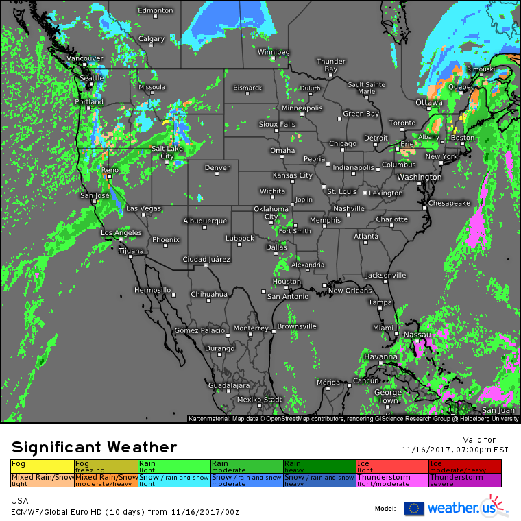
Today’s active weather will be focused on the West Coast as Pacific storms continue to move onshore with copious tropical moisture. Rain and high mountain snow will expand south today, with showers possibly reaching the Los Angeles area by this evening.
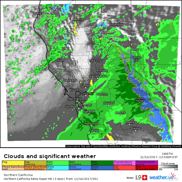
Here’s the Swiss Super HD model’s forecast for 9 AM PST showing the core of heavy rain and snow moving south of San Francisco today. Snow levels will once again be fairly high as the source region for these storms continues to be in the tropics, as opposed to the Alaska area. That being said, the passes will continue to see treacherous travel conditions with heavy snow falling through much of the day today.
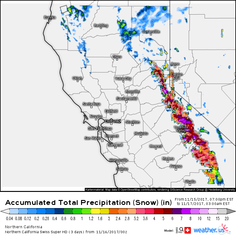
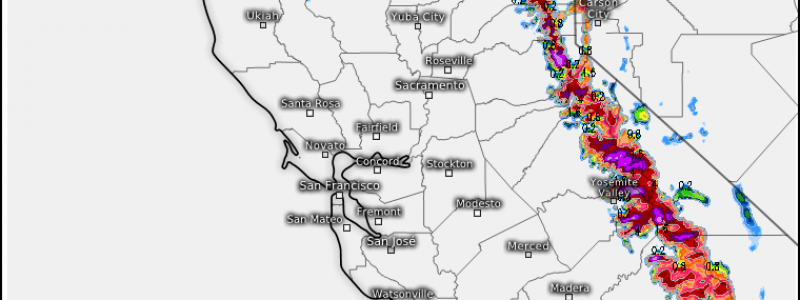
This map shows how much liquid equivalent precipitation is forecast to fall as snow through midnight tonight. The reds and pinks indicate 3-6″ of liquid equivalent, which corresponds to several feet of snow. For more on forecasting snow amounts using liquid equivalent precipitation, check out this video.
Why so much snow? The Sierras are unique in that they are 10,000 foot+ tall peaks that rise straight up from the relatively flat land in the Central Valley, which sits just to the east of the Pacific Ocean. While hills and some small mountains do exist near the coast, none come close to the height of the Sierras. When a stream of tropical moisture enters the region, it must suddenly rise 10,000+ feet as it hits the Sierras, cooling and condensing into clouds and precipitation. Another factor that makes the Sierras such effective precipitation producers is the fact that the passes separating the high peaks sit at very high elevations. There’s no option for air to travel around the mountains, so it must rise up and over them.
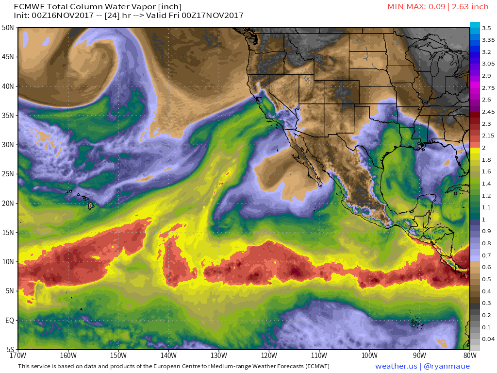
Speaking of tropical moisture plumes, the atmospheric moisture forecast from the ECMWF shows a stream of moisture extending from the tropics south of Hawaii straight to California. This will be the fuel for today’s heavy precipitation. Notice the drier air to the north of this moisture plume. The lack of moisture in the Seattle region will prevent heavy precipitation today, though rain and mountain snow showers are expected under the upper level low located near the region.
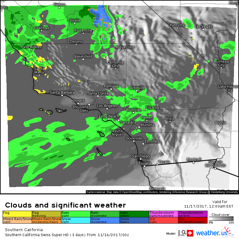
By this evening, moisture will make it as far south as the Los Angeles area where showers are forecast to develop. These showers won’t be super heavy, but it won’t take too much rain falling on the burn scars from last month’s wildfires to cause some flash flooding problems.
Elsewhere across the country today, some of the Pacific moisture that has been impacting the West Coast will spill into the Rockies. Look for rain and snow to develop in parts of Utah, Idaho, and Wyoming as this moisture moves east. Quiet weather will dominate the Central and Southern parts of the country today, while a coastal low brings rain and snow to Maine.
For more details on the Maine storm: https://blog.weather.us/strong-upper-level-low-to-bring-rain-and-snow-to-new-england-thursday/
For more details on your local forecast: https://weather.us/
For more details on the local forecast for Maine/New Hampshire: https://forecasterjack.com/2017/11/16/a-mixed-bag-of-precipitation-today/
-Jack
