Quiet Weather Continues Across The US Today As Blizzard Warnings Are Posted For Parts Of Montana
Hello everyone!
Today will feature the continuation of yesterday’s generally quiet weather pattern as we sit and wait for the atmosphere to reshuffle back into a configuration supportive for regionally impactful storm systems. There are a few areas of precipitation expected today, but none are forecast to bring regionally significant impacts.
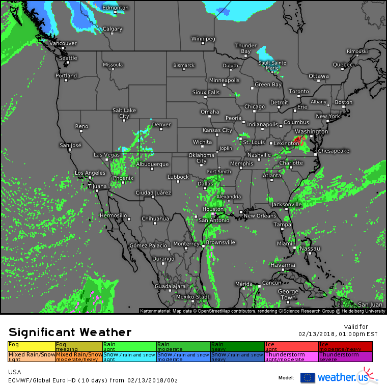
Here’s the ECMWF’s overview map highlighting the generally quiet weather, and few areas of light precipitation across parts of Arizona, Texas, and Virginia. Arizona’s rains are forecast ahead of an elongated upper level low, and while a couple inches of rain are expected, it will fall over a long enough time to preclude any significant flooding concerns. In Texas, Gulf of Mexico moisture will begin to move northward again today, with showers and thunderstorms developing in the Eastern part of the state. No severe weather is expected, and overall impacts from this system will be low. In Virginia, some moisture is being forced to rise over an impressive low level cold airmass, which is resulting in some light precipitation this morning. As this precip moves north farther into that cold airmass, some light freezing rain is expected across mountainous parts of NW VA and SE WV. While no major ice accretion is expected, it doesn’t take any more than a glaze to cause very slick conditions out on the roads.
Elsewhere across the country, most areas will see generally tranquil weather.
Despite the generally quiet pattern, probably the most impactful weather today doesn’t actually show up on the overview map above, as it involves no precipitation falling from the sky. Blizzard warnings are up for parts of Montana today and whiteout conditions could make travel occasionally impossible in some mountainous parts of the state.
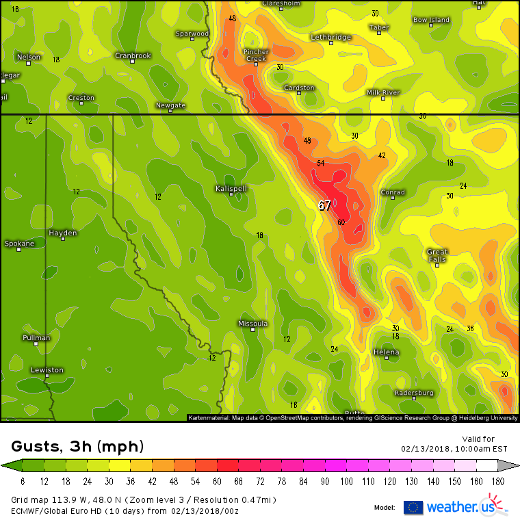
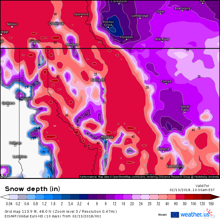
Here’s the ECMWF’s wind gust forecast for this morning across Western Montana. Notice the area of 50-60+ mph gusts NW of the state capital Helena. These winds will blow around any snow that may be on the ground in these areas, and the ECMWF’s snow depth analysis shows no shortage of that available.
Snow depths in the area with the max winds fall between 60 and 80 inches, the result of a persistent train of snow producing storms over the past few months. This deep snowpack will be whipped into a frenzy by the strong winds, and blowing/drifting snow with very dangerous travel conditions can be expected as a result. Because the winds are generated in part by terrain influences, these impacts will be limited to areas along and near the high terrain that stretches from Glacier National Park down to just NW of the city of Helena. If you’re headed through this area today, use plenty of caution, and if not, this is unlikely to impact you much.
For more information on your local forecast: https://weather.us/
For more information on the local forecast for ME/NH: https://forecasterjack.com/2018/02/13/cool-and-calm-today-6/
-Jack
Header photo by Lukasz Szmigiel


